Tuesday, July 16, 2024

JEEPING IT UP AND ENJOYING IT (DROVE THROUGH ALMONT; TIN CUP -- STORE, FRENCHY'S CAFE & TOWN HALL; REFLECTIVE MIRROR LAKE; CUMBERLAND PASS WITH LOTS OF SNOW; PITKIN MINING CAMP; BIKE RIDE OUT TO CLOSED BRIDGE; AND CHICKEN FAJITAS FEAST) - Tuesday, June 18 - Wednesday, June 19, 2024

We have planned to do several jeep off-roading trips while our friends, Mike & Judy Pluto, are with us here at the Blue Mesa Recreational Ranch Thousand Trails in Gunnison, Colorado. Gunnison is only about 13 miles from the campground, so I am sure we will be making several trips into Gunnison as well.

Tuesday, June 18, 2024

Today was a beautiful, sunny day -- just perfect for a jeep adventure. We left the campground at around 9:00 a.m. with our sandwiches packed in our cooler and drove along Hwy 50 into Gunnison. 

(Shirley in the front, with Mike and Judy Pluto in the back seat of the jeep.)


From there, we followed Hwy 135 until we reached Almont, Colorado (a town where many people begin their rafting journey from). 

The first permanent settlers to Almont were the aptly named Fishers, because the town was platted in 1881 on the Fisher Ranch. Samual Fisher allegedly named the town for Almont of Kentucky -- the horse that sired his favorite stallion. The Almont Post Office opened on March 6, 1882. In the late 19th century, miners in the area brought their ore to Almont, where it was transported by train to Gunnison. As the mines closed down and the railroad moved out, Almont went back to its fishing heritage. Many of the old mining settlements still exist today.


From Almont, we drove along Hwy 742 -- which followed the Taylor River for a ways. Then just after the Taylor Park Reservior Dam at the Taylor Park Trading Post, we turned onto Forest Road 765, which was a dirt road in very good condition.


It was now just six more miles along the gravel road and then we were to Tin Cup.


It took us about 1 hour and 20 minutes to reach Tin Cup. At Tin Cup, we walked around a bit -- giving Pedro, Mike and Judy's dog, a chance to get in a good walk and for us to use the restrooms.

Tincup was originally named Virginia City. The community was once a prominent mining town, but is now a community of summer homes with a few year-round residents. Many historic buildings are still standing today.


The post office that was named Virginia, Colorado opened on July 22, 1879. The name was later changed to Tin Cup on February 28, 1880, and finally changed to Tincup on May 7, 1895. The Tincup post office closed on January 31, 1918.

In October 1859, prospector Jim Taylor panned some gold from Willow Creek, and carried it back to camp in a tin cup; and he named the valley “Tin Cup Gulch.” For years the area was the site of seasonal placer mining, but no year-round communities were established, partly because of the danger of Native American hostilities.


In 1878, lode deposits were discovered in the area, and the town of Virginia City was laid out in March 1879. By the 1880 census, the town had a population of 1,495. As Virginia City, it was incorporated in August 1880, but confusion with Virginia City, Nevada, and Virginia City, Montana, caused the residents to change the name. The town was reincorporated in July 1882 as Tin Cup.

Early Tin Cup was a violent place. Town marshal Harry Rivers died in a gunfight in 1882, and marshal Andy Jameson was shot to death in 1883. The town population declined when the mines were exhausted. The Boothill Cemetery is located just south of the town. The Great Divide passes through Tincup and creates Tincup Pass. Tincup is at an elevation of 10,157 feet.


Shown above is the Tin Cup Store. It is an essential stop if you make it up to Tincup. This building dates back to the 1800s and now operates as a small souvenir shop.


Shown above, Mel is airing down the tires in preparation for our journey to Tin Cup Pass, while shown below is Mike, Judy and Mel in front of the Tin Cup Store.


Shown above is Mike, Shirley and Mel in front of the Tin Cup Store.


Shown above is Frenchy’s Cafe on the Pond. Frenchy’s Cafe sits on a small fishing pond in town and is a great gathering place for visitors. It is seasonally open from June to September. 


Driving through town, we went past the Tin Cup Town Hall that was built in 1903. It also serves as the church (see pictures below).


We're now heading for the Tincup Pass trail. We will see how far we can go before hitting snow (see map below). 


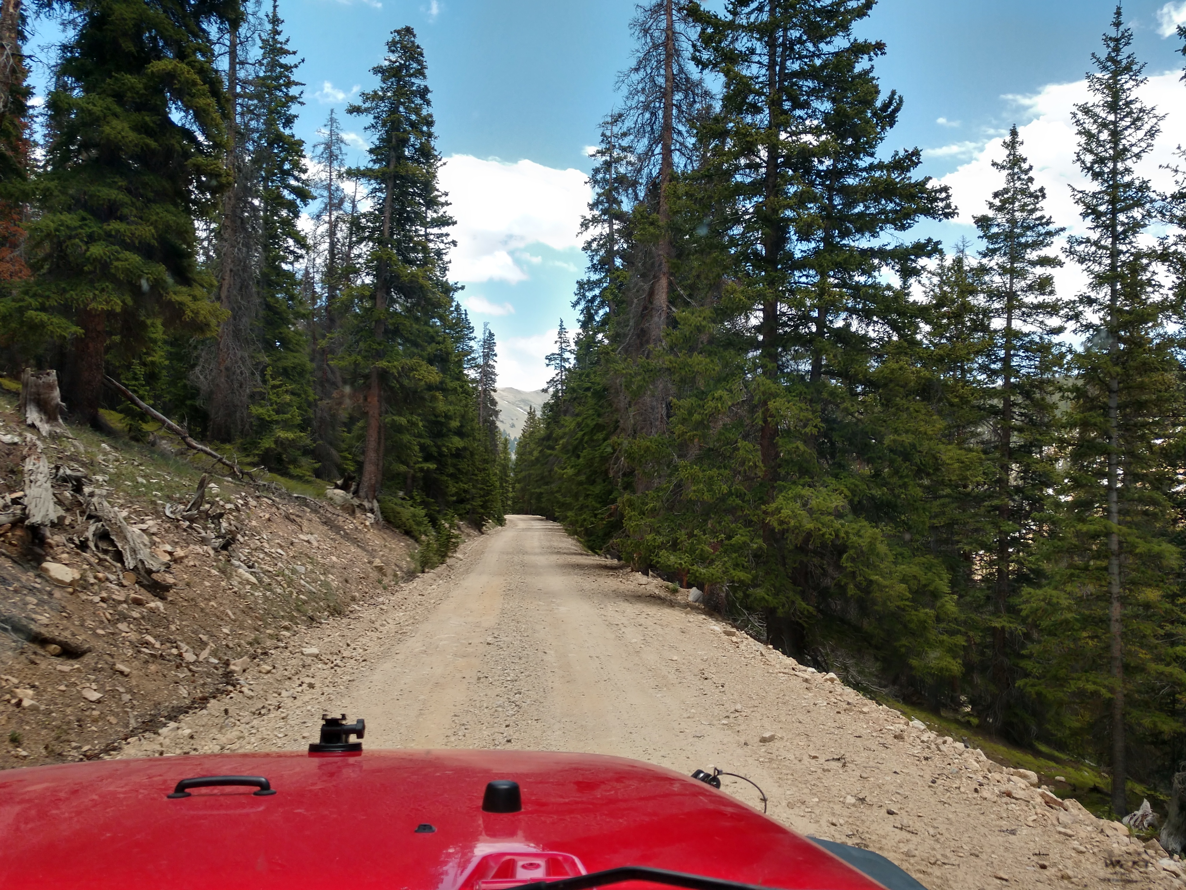
We followed Mirror Lake Road, which was a gravel and pretty rocky road.


It is now 3 miles to Mirror Lake and 7 miles to Tincup Pass.


 As you can see in the above picture, the road is getting rougher with several bigger rocks and boulders that Mel has to watch out for and miss as he drives along.


We are now at the entrance to the Gunnison National Forest campground right before we come to Mirror Lake.


We can now see Mirror Lake in the distance (see pictures below).


At Mirror Lake, the 13,000 foot peaks of the Sawatch Range provide a dramatic backdrop for this site (see pictures above and below).


At the base of Tincup Pass, nestled amidst the grandeur of the Sawatch Mountains is the serene Mirror Lake. This natural oasis offers an unforgettable panorama, where the rugged mountain peaks meet the calm, reflective waters of the lake. Named for its mirror-like surface, the lake provides a picture-perfect reflection of the surrounding landscapes.


Shirley and Judy are standing in front of Mirror Lake. What a spectacular and beautiful lake it is!!!


This is another chance for Pedro to explore the surroundings. Pedro is resting in the grass (see below).


Shown below are Mike, Judy and Mel in front of Mirror Lake.


Today on the jeep trail, we could only go as far as Mirror Lake because of the high level of the water -- and therefore we were unable to drive around it and continue on. Instead, we decided to turn around and go back along Hwy 765 over Cumberland Pass to Pitkin.


Cumberland Pass is 9 miles away, while Pitkin is 20 miles away.


We're beginning to see some snow along the road to Cumberland Pass.


Actually there is quite a lot of snow!


We have now arrived at Cumberland Pass. Cumberland Pass has an elevation of 12,015 and is a high mountain pass in the Sawatch Range of the Rocky Mountains of Colorado. It is located in Gunnison County within the Gunnison National Forest. The pass divides the watersheds of West Willow Creek to the north and Quartz Creek to the south.

The pass is traversed by Forest Road 765 and can be accessed from the towns of Tin Cup to the north and Pitkin to the south. The road is gravel and is closed seasonally due to heavy snowfall, typically from November until May.


The Cumberland Pass road was built in 1882, connecting the mining towns of Tin Cup to the north and Pitkin to the south. The wagon road allowed ore from Tincup-area mines to be shipped to the Quartz Station of the Denver and South Park Railroad. The ore was then shipped by rail east through the Alpine Tunnel. The road was later improved by the Civilian Conservation Corps in 1935 and improved again in the 1950s.


Since there was quite a lot of snow up here at Cumberland Pass, Mel decided to drive the jeep into a snow bank just for the fun of it and because he could (see below).


Both Mel and Mike got out of the jeep to stomp around on the snow drift.


Mike found a beer bottle and picked it up, while he was enjoying the nice view!!!


After stretching our legs and taking what pictures we wanted, we began our descent down from Cumberland Pass toward Pitkin.


The road wasn't too bad, but the views were spectacular!!!


We saw many running creeks and waterfalls along the way.


We drove into the turnoff for the Alpine Tunnel, but found it was closed so we continued on.


The sign shown above indicated we are now 3 miles from Pitkin.


Welcome to Pitkin! Pitkin has a population of 72 and was founded in 1879. It is said to be Colorado's first mining camp west of the Continental Divide. Originally named Quartzville, it was renamed to honor Governor Frederick Walker Pitkin. Pitkin is at an elevation of 9,242 feet, and located about 28 miles northeast of Gunnison, Colorado.


Shown above is the community of Pitkin. Surrounded by the Gunnison National Forest, Pitkin is a quiet mountain town. There’s a main street and many historic buildings around town. It’s a semi-ghost town, with not much open except during the warmer months of the year.


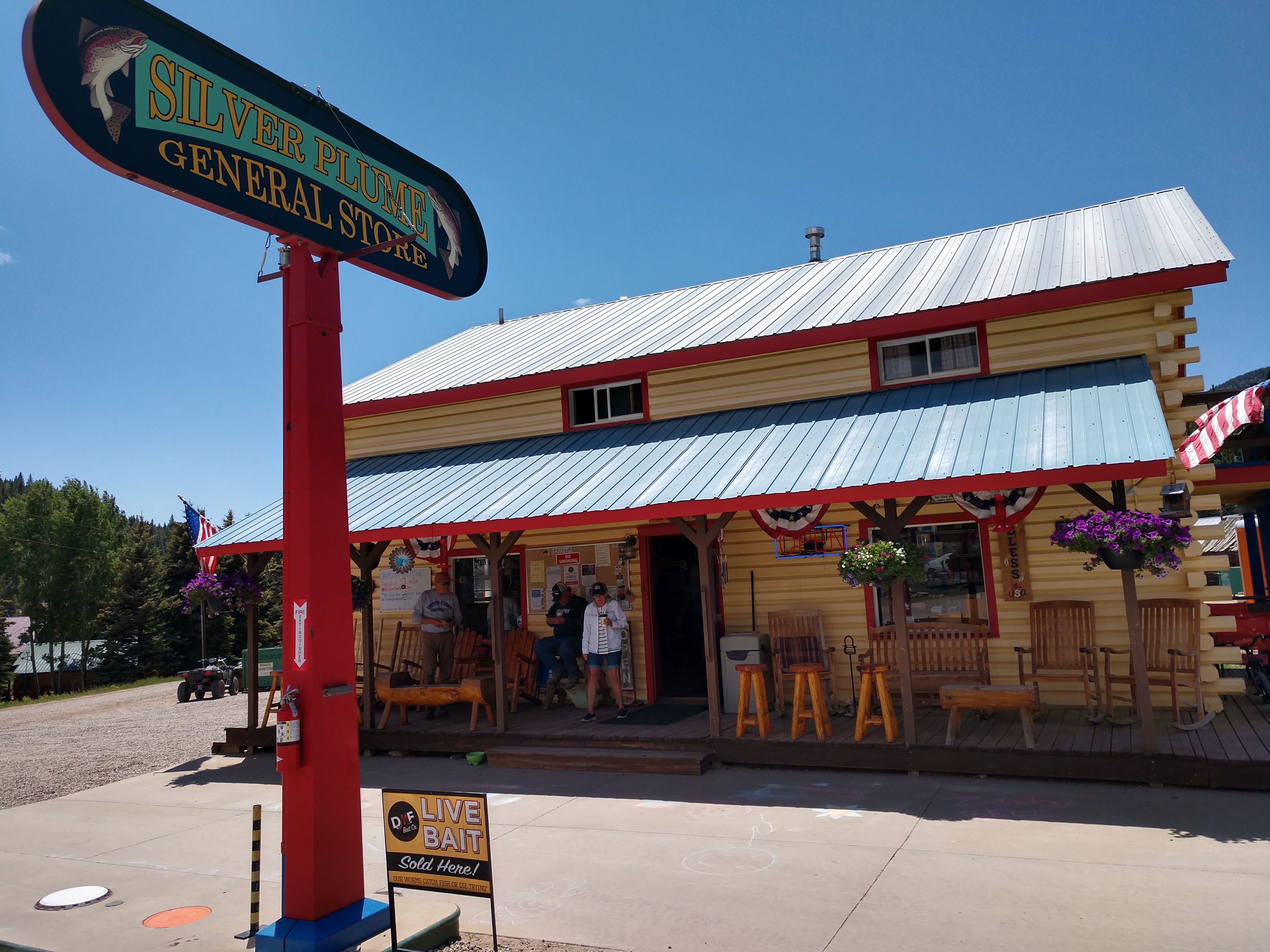
The Silver Plume General Store (shown above) is located in the town of Pitkin, Colorado. We stopped there for a restroom break and another opportunity to walk Pedro.


Mike, Judy and Mel poise in front of the Silver Plume General Store alongside the wooden-carved bear. Note that the bear's mug says, "Pitkin and a-grinnin."


And then just as we were leaving Pitkin, we saw this beautiful stagecoach with horses.

Wednesday, June 19, 2024

It's another beautiful day here at the campground.


As shown above and below, these are the fabulous views we have looking out our RV door from our campsite!


Around mid-morning, Mel, Mike and Judy rode their bikes out to the bridge closing at milepost 138.


Shown above is Mel on his bike in front of the Blue Mesa Reservoir.


Shown above is Mel and Mike riding to where the road is closed, while below is Judy stopped on the road.


For dinner tonight, Judy fixed a fantastic spread of chicken fajitas with all the trimmings (see below). They were simply delicious!!!


So far, we have enjoyed every minute of our time in the mountains!

Shirley & Mel

Friday, July 12, 2024

TAKING A BREAK TO HEAD TO THE MOUNTAINS (HAPPY FATHER'S DAY & OUR TRIP TO BLUE MESA RECREATIONAL RANCH THOUSAND TRAILS IN GUNNISON, CO) - Sunday, June 16 - Monday, June 17, 2024

 Sunday, June 16, 2024

Happy Father's Day! 

Today at church, we celebrated all the fathers. And each one received a bundle of six chocolate chip cookies. Yum!!!


Monday, June 17, 2024

We're now on our way to Blue Mesa Recreational Ranch Thousand Trails in Gunnison, Colorado. It is surrounded by some the most spectacular Rocky Mountain beauty to be found anywhere as well as the beautiful Blue Mesa Lake, which was formed by the Gunnison River beginning a few miles west of the city of Gunnison. It parallels Highway 50 for more than 20 miles to Blue Mesa Dam. 

No matter what direction we go from the Blue Mesa Recreational Ranch Thousand Trails, we find plenty of incredible mountain country to explore and we're not disappointed!

We were made aware before we left to go to Blue Mesa Recreational Ranch Thousand Trails that the bridge that crosses the Blue Mesa Reservoir at Dillon Pinnacles between
Montrose and Gunnison is closed for structural repairs.


We left Matheson, Colorado at around 7:30 a.m. and headed toward Gunnison, Colorado to meet up with our dear friends -- Mike and Judy Pluto -- at the Blue Mesa Recreational Ranch Thousand Trails.


Leaving Colorado Springs, we drive by the Cheyenne Mountain State Park entrance.


We are now 8 miles from Cañon City and  67 miles from Salida.


Welcome to Cañon City. It is the county seat and the most populous municipality of Fremont County,  with a city population of 17,141. Cañon City straddles the easterly flowing Arkansas River and is a popular tourist destination for sightseeing, whitewater rafting, and rock climbing. The city is known for its many public parks, fossil discoveries, Skyline Drive, The Royal Gorge railroad, the Royal Gorge bridge (see below), and extensive natural hiking paths.


Cañon City was laid out on January 17, 1858, during the Pike's Peak Gold Rush, but then the land was left idle. A new company "jumped the claim" to the town's site in late 1859, and it put up the first building in February 1860. 


In 1861, the town raised two companies of volunteers to serve with the Second Colorado Infantry during the American Civil War. This regiment fought in skirmishes in nearby New Mexico and as far east as the Indian Territory (Oklahoma) and Missouri before ending its organization in 1865.

In 1862, A. M. Cassaday drilled for petroleum 6 miles north of Cañon City, close to a known oil seep. Cassaday struck oil at the depth of 50 feet, and he completed the first commercial oil well west of the Mississippi River. He drilled five or six more wells nearby, and he refined kerosene and fuel oil from the petroleum. Cassaday sold the products in Denver. A number of metal ore smelters were built in Cañon City following the discovery of gold at Cripple Creek in 1891.


Continuing on, we are now 24 miles from Cotopaxi and 47 miles from Salida.


On our way into Salida, the Arkansas River winds closely along the highway (see pictures above and below).


We are now 7 miles from Cotopaxi and 30 miles from Salida.


As we continue, we are now 4 miles from Cotopaxi and 23 miles from Salida. We can also begin to see the peaks within the San Isabel National Forest.


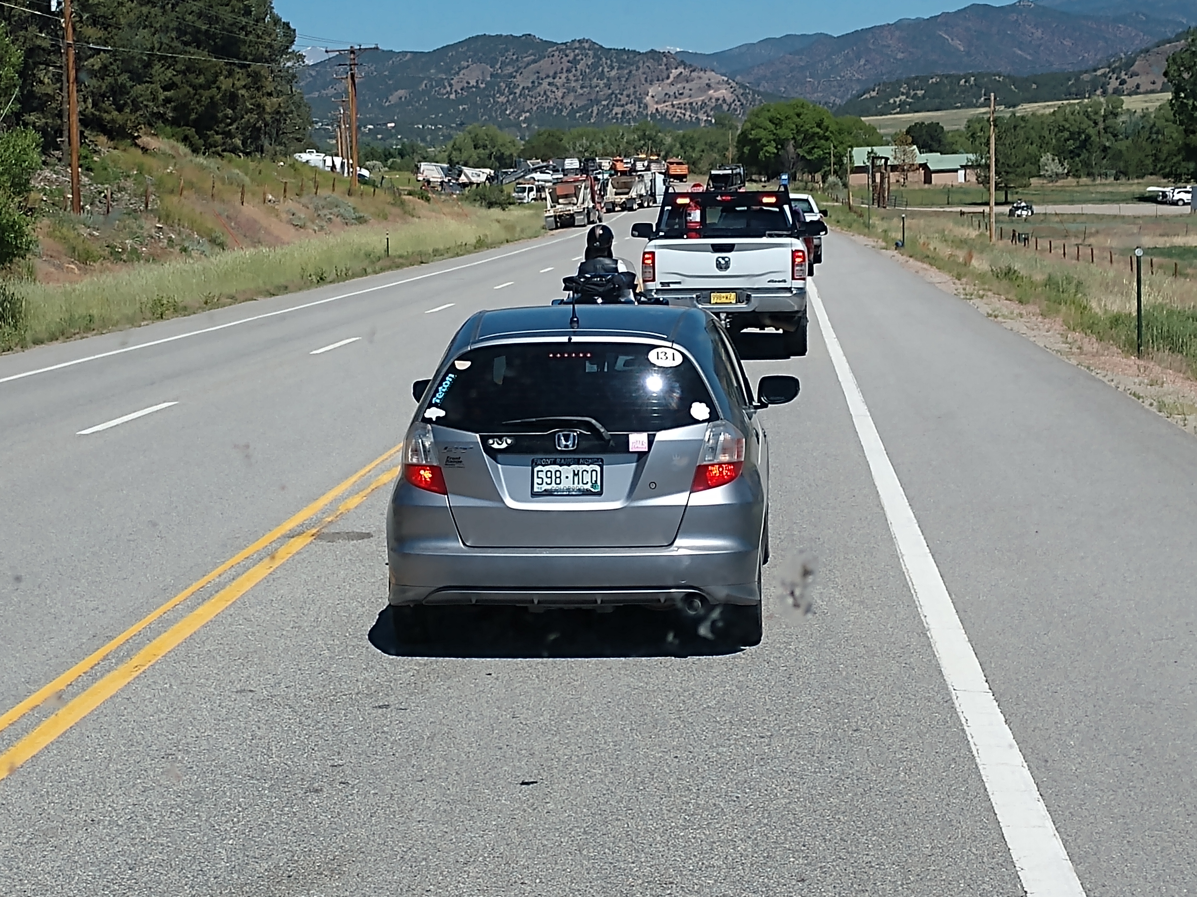
We just ran into some road construction that held us up for about 30 minutes.


We have just arrived at Salida, which has a population of 5,666. A post office has been in operation at Salida since 1881. Salida, meaning "exit" in Spanish, was named on account of its location near the point where the Arkansas River flows out of the valley and into Bighorn Sheep Canyon, upstream from the Royal Gorge.


The Sawatch Range runs north and south and is located roughly 10 miles west of Salida. The Mosquito Range parallels the Sawatch Range to the east, forming the Upper Arkansas Valley, and the southern terminus of the range, just east of Salida, is known locally as the Arkansas Hills. Methodist Mountain, which is a major feature on Salida's southern horizon, is the northernmost mountain in the Sangre de Cristo Mountains. To the north of Salida is the Upper Arkansas Valley and the town of Buena Vista.


And then we ran into some more road construction. We are now 60 miles from Gunnison, Colorado.


As we continued along Hwy 50, we came to the turnoff to the left (the Lake City Bridge that crosses the Gunnison River and continues on to Lake City). However, we continued on Hwy 50 toward the campground.


We have arrived at the Blue Mesa Recreational Ranch Thousand Trails.


We were on site 406 and Mike & Judy Pluto were on site 407 along Lake Fork Drive in the campground. We had a beautiful view of the Blue Mesa Reservoir.


Shown above and below are the campsites we occupied from the back.


Our campsite is shown above and below.


Mike & Judy Pluto's site is right next to our (as shown in the picture above and below).


What more could we ask for? Beauty is all around us and we enjoy the peaceful surroundings and friendship of our friends, Mike and Judy for the next couple of weeks!

Shirley & Mel

TRAVEL FROM ROSEBUD TO CONROE, TEXAS (WE WILL SPEND 4 WEEKS AT LAKE CONROE THOUSAND TRAILS; KID'S CRAFT - WREATH & ORNAMENT; LADIES CRAFT - BEARDED GNOME OR SANTA; WOODEN 2X4 CHRISTMAS TREES TO MAKE) - Sunday, December 1 - Friday, December 6, 2024

Sunday, December 1, 2024 Good morning! Today is December 1st and we are leaving the BK Burk Little Pond Creek Ranch of our friends, Brian an...