We have only a short distance to travel today, and even though it it is raining and only 53 degrees out, we are excited about arriving at Denali National Park. This destination was our first reservation that we made and everything we arranged after that led up to this stopping point. So at 8:55 a.m., we are on our way.


Leaving the pull out just outside of Healy, we once again crossed the Nenana River that we having been crossing numerous times the past few days.

We then crossed the Dragonfly Creek again.


We then crossed the Iceworm Gulch again.

We then drove back through the canyon again.


We passed Canyon Drive on our way.


And then we went over Kingfisher Creek (another stream located 8 miles from Healy.)


And now Denali Park Road is only 1/2 mile away.

We then turned right onto Denali Park Road.

And see many beautiful wildflowers on the drive.


Knowing that we have to go to the Riley Creek Campground Mercantile to register, we followed the signs. Also there, Mel planned to dump the gray and black tanks and fill with fresh water before we drove out to the Teklanika River Campground for four days. Out at Teklanika River Campground as we would have no hookups.


While Mel dumped the black and gray tanks, I walked over to the Riley Creek Campground Mercantile to get us registered for the next four days at Teklanika River Campground.


I spotted this neat map of Denali National Park on the wall in the Riley Creek Mercantile (see below).

And I also received the map of the Teklanika River Campground and our registration tag for our stay (see below).


We will be staying in Teklanika River Campground for the next four days from July 1st through July 5th. We are hoping to get a glimpse at the "Great One" during our stay there.

Located on the Teklanika River at mile 29.1 on the park road in Denali National Park, the Teklanika River Campground is one of six campgrounds inside the park. But it is the only one that campers can drive their personal vehicle past mile 15 to get to, which makes it a unique experience!
Teklanika River Campground is only open from May 20 until mid-September and has a total of 53 sites, which accommodate both tent campers and RVers, but do not offer any hookups. Once you get to the Teklanika River Campground, your vehicle cannot move until after your stay is over (there is a minimum three night requirement.) They do this to keep a lot of traffic off the park road.
We felt that staying at the Teklanika River Campground was the perfect way to have a more wilderness-like experience inside of the national park. While staying at the Teklanika River Campground, we were only able to go to the end of the road at mile 43, due to the Pretty Rocks Landslide.

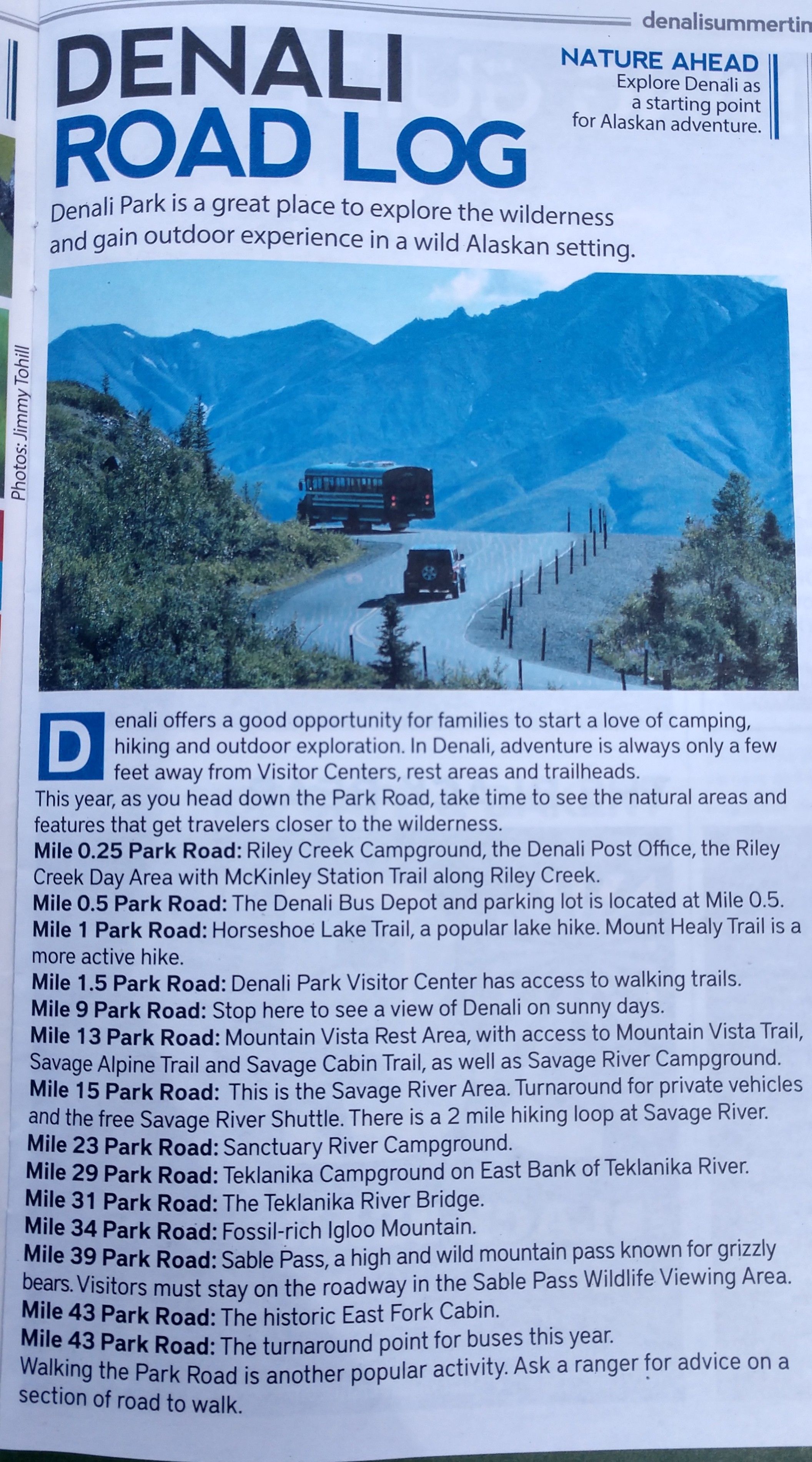
Leaving Riley Creek Mercantile on the way to the Savage River checkpoint, we found the mountain views were awesome!


After passing the Denali Bus Depot turnoff, we continued on.


We then passed the Denali Railroad Depot.

And then we passed the turnoff for Murie Science and Learning Center.


We also passed the Visitor Center turnoff.


We met one of the tan buses (the Tundra Wilderness Tour bus) that requires a ticket to ride. The Tundra Wilderness Tour is a 5-1/2 hour excursion into the park with a certified driver-naturalist. This tour will guide you along the spectacular road corridor, promising different experiences every day, as Denali's wildlife moves at its own pace and according to the seasons. Travel to the Murie Cabin near the East Fort River (mile 43) to experience where Adolf Murie lived while conducting his famous research inside what was then known as Mount McKinley National Park.


We drove past the Rock Creek area. Rock Creek, at an elevation of 2,030 feet, is the first of many waterways that the Denali Park Road crosses. In contrast to many glacial fed rivers, Rock Creek is contained in a defined channel at this point.

Next we met a green park bus, which is the free "Savage River Shuttle." This bus route is perfect for visitors wishing to experience a short bus ride into the park. Departing from the Denali Visitor Center bus stop and the Denali Bus Depot every 30 minutes, this shuttle travels to trailheads at Mountain Vista and Savage River, where parking is extremely limited. Visitors can use the shuttle to access hiking trails, picnic beside the river, or just enjoy the two-hour round trip ride.

We then passed the Denali Park Headquarters and the historic district. It is located at mile 3.4 on the Denali Park Road. The Headquarters District was established on park land specifically set aside in 1924 for an administration area and now occupies 11.91 acres. The construction of the Headquarters Historic District was largely achieved through the efforts of the Civilian Conservation Corps (CCC) and park labor.


We then passed another green bus.


In a little while we came to the Mountain Vista Trailhead turnoff. This short but stunning 0.6 mile loop begins and ends at the Mountain Vista Rest area at mile 13 on the Denali Park Road. It offers panoramic views of the Savage River Valley to the south, Mount Healy to the north, and Denali on sunny days to the southwest. Interpretive signs along the trail illustrate how vegetation and development in the area have changed over time.

And then we passed the Savage River Campground. Savage River Campground is located at mile 13 on the Denali Park Road. It sits a few hundred feet below the tree line (about 3,000 feet above sea level) in a spruce forest, with moderate screening between sites. An old gravel road leads through the campground towards Savage River itself, where the trees are less dense and beautiful. On clear days, Denali can be seen from a short walk below the campground. Only two campgrounds in Denali can boast such a view - Savage River and Wonder Lake (which cannot be accessed now due to the Pretty Rock Landslide).

Next we passed by the Savage Cabin Interpretive Trailhead. This trail directs visitors on a gravel loop past a historic ranger cabin that is still active today (particularly used by the rangers to patrol the park in the winter by dogsled.) Located in a taiga forest near the Savage River Campground, it's a worthwhile short hike on level terrain with interpretive signage along the trail sharing the story of early rangers and their dog sled teams.
Built by road crews in 1925-1926, Savage Cabin was actually two cabins built facing each other, connected by a common roof. It was originally built about a mile southwest of here and served as a cookhouse for road workers in the summer, and as a ranger patrol station in the winter. In 1940, the park separated the two cabins and moved them to a more protected location with the right side being reassembled and the other side used for firewood.


We were now nearing the check in point before we headed to Teklanika River Campground.

Crossing over the bridge over the Savage River, we're finally at the checkpoint.

Once we passed through the checkpoint at Savage River with our permit, the traffic on the well-graded gravel road to Teklanika River Campground slacked up a bit -- with most of the traffic being park buses.

Nearly all park visitors have to turn around at mile 15 (Savage River checkpoint). However, we were among those that could continue on to our campsite at Teklanika River Campground. From the checkpoint, it was another 14.1 miles to the Teklanika River Campground located at mile 29.1.
At "Checkpoint Charlie" as we came to call it, we were instructed about the rules for riding bikes in Denali (see below) and provided with our safety bike passes.

We were also told about the "sheep gap spacing" which was a ten-minute pause in traffic every hour (the first 10 minutes of the hour) at certain mileposts. Below is one of the signs we saw on our way to Teklanika River Campground.


The drive to Teklanika River Campground took approximately 1-1/2 hours as you are not allowed to drive fast on this road due to the gravel. The scenery was beautiful the entire way and we just wanted to soak it in!


Besides the gravel road and the mountain views, the fireweed was in bloom in some areas which added a vibrant pink color in the foreground of the mountain vistas. We were told that fireweed gets its name not from it brilliant color, but rather because it is one of the first flowers to bloom in post-fire burn areas.


We drove by the Sanctuary River Campground at mile 22 on the Denali Park Road. It had an elevation of 2,468 feet, and offers 7 campsites making it one of the smallest in Denali.

And then we crossed the Sanctuary River Bridge.


And then met another green park bus.


Then with one final stretch of gravel, we were almost to Teklanika River Campground.


We camped on site #31, which was very convenient because it was only a few steps from a nice outhouse in the loop.


Below is a picture of the outhouse. The also had potable water there as well and a place for people in tents to lock up their food.

After we got all set up, we decided to go for a 14-mile bike ride from about 1 p.m. until 2:30 p.m.

We rode our bikes out to the Teklanika River, which has an elevation of 2,650 feet.


And then we rode on to the Igloo Creek Campground at mile 33.6 and an elevation of 2,940 feet. Igloo is nestled between Cathedral Mountain and Igloo Mountain, alongside the Igloo Creek. Igloo Creek Campground is a small, tent-only campground (7 sites) accessible by the Camper Transit Bus, bike or on foot.


And then we road across the Igloo Creek, with an elevation of 2,940. Igloo Creek is a prominent creek that runs near the Teklanika campground in Denali National Park. The creek lines the Forest of Drunken Trees, so named for their tilted stance. The areas of Igloo Creek and the Forest of Drunken Trees are prime moose habitat because the moose can find an unlimited food source among the willow thickets and spruce trees.


I have include the maps and information below about Denali as a resource to help you understand where we are in the park.


We relaxed at our campsite in Teklanika. And then for dinner, we had chicken pizza.
We truly have had quite a marvelous day -- traveling on the gravel road to the Teklanika River Campground, and then riding our e-bikes out exploring the vast wilderness.
We look forward to many more awesome adventures in the days ahead!
Shirley & Mel


No comments:
Post a Comment