Friday, October 27, 2023
Today was a sunny day with the temperature starting at 45 degrees and reaching 65 degree in the afternoon. Mel walked around the campground in the morning, while I worked on my blog. At 3:00 p.m. I went up to the lodge to play bingo and I ended up winning two Klondike Heath Ice Cream Bars -- I then walked back to the campsite and shared one with Mel. Ice cream, you scream, who doesn't like ice cream!
Later on we had pizza for dinner.
Saturday, October 28, 2023
Just another beautiful sunny day (temps ranged from 50 to 60 degrees) with no place to go and not much to do. We pretty much hung around the campsite. For dinner tonight, we had salmon and angel hair salad.
Sunday, October 29, 2023
Another non-eventful day, but at least the sun was in its full glory. The temperature started out at 41 degrees and reached 68 degrees by the afternoon. I went for a bike ride around the campground (see the Garmin GPS screenshot below).
Monday, October 30, 2023
Today was once again nice and sunny with a temperature starting at 50 degrees and reaching 78 degrees by the afternoon. Around 10:00 a.m., we rode into the Safeway store in Hollister, California with our next-door neighbors at the campground, Randall and Beth Townsend to get groceries. They had earlier told us if we needed anything while our truck was in the repair shop to just ask. That was so nice of them!
Wednesday, November 1, 2023
Another sunny day with the temperature starting at 48 degrees and reaching 83 degrees in the afternoon. At around 10:00 a.m., because we still don't have our truck back, our neighbors, Randall and Beth Townsend, again asked if we wanted to ride along with them into the Safeway store in Hollister, California. After we were done grocery shopping, they joined us for lunch at Taco Bell. Then we all came back to the campground.
This afternoon, I once again rode my bike around the campground -- today riding 4.46 miles in 32 minutes.
While on my bike ride, I saw a couple deer. There are quite a few in the campground and they don't seem to mind the people.
Shown below is the Garmin GPS screenshot of my bike ride.
Friday, November 3, 2023
We have had so many sunny days, and today is one of those too. The temperature started at 48 degrees and reached a high of 85 degrees in the afternoon.
We left the campground at 9:00 a.m. This morning our truck is to be ready for us to pick it up after having a new engine put in it, so our neighbors, Randall and Beth Townsend, are once again taking us into Hollister, California.
They dropped us off at the SpeeDee-Midas auto shop so we could get the truck. We then took the truck out for a test drive to Los Banos, California, as Mel wanted to get quite a few miles on the new engine to make sure everything is working right.
So we headed out of Hollister on CA Hwy 156 East.
Then we followed CA Hwy 152 East toward Los Banos, California.
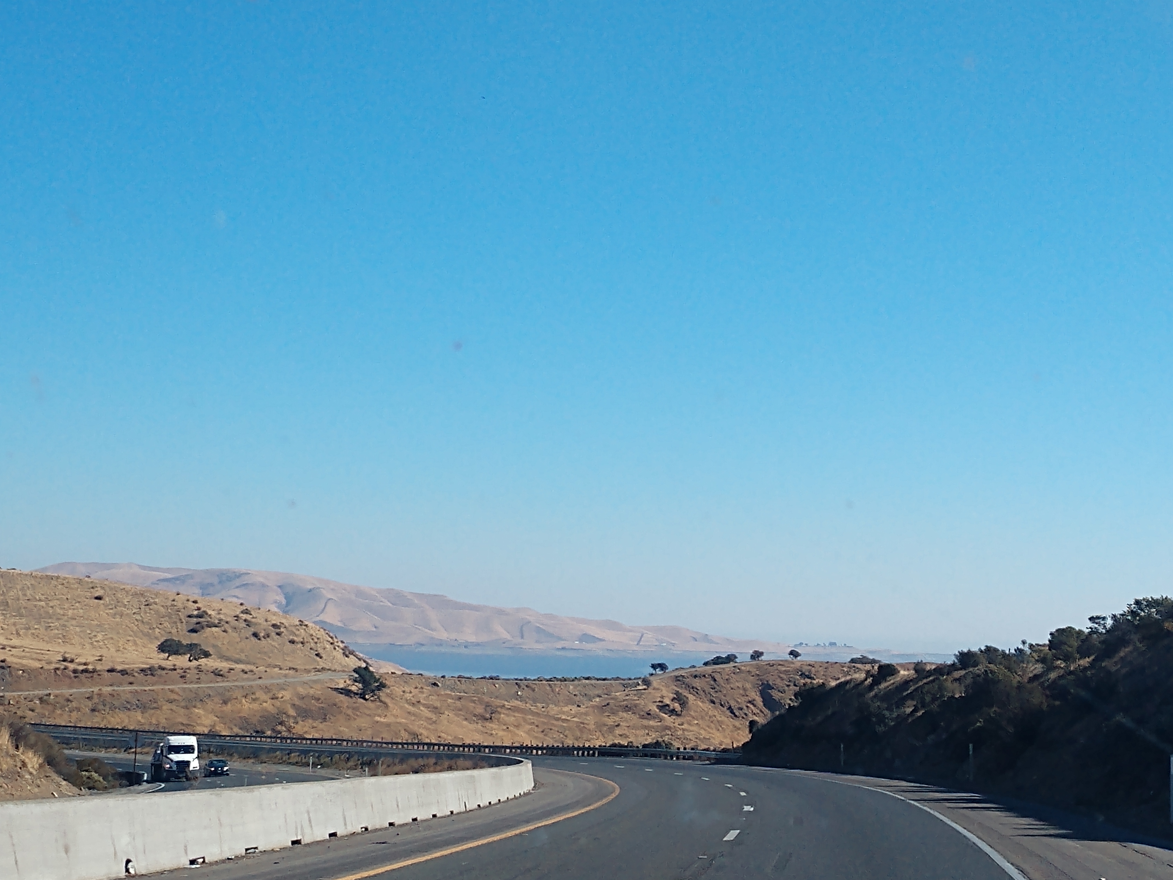
We drove by the San Luis Reservoir Recreation Area. The San Luis Reservoir is an artificial lake on San Luis Creek in the eastern slopes of the Diablo Range of Merced County, California, approximately 12 miles west of Los Banos on State Route 152, which crosses Pacheco Pass and runs along its north shore. It is the fifth largest reservoir in California. The reservoir stores water taken from the San Joaquin-Sacramento River Delta. Water is pumped uphill into the reservoir from the O'Neill Forebay which is fed by the California Aqueduct and is released back into the forebay to continue downstream along the aqueduct as needed for farm irrigation and other uses.

Depending on water levels, the reservoir is approximately nine miles long from north to south at its longest point, and five miles wide. At the eastern end of the reservoir is the San Luis Dam, the fourth largest embankment dam in the United States, which allows for a total capacity of 2,041,000 acre-feet.
Completed in 1967 on land formerly part of Rancho San Luis Gonzaga, the 12,700 acres reservoir is a joint use facility, being a part of both the California State Water Project and federal Central Valley Project, which together form a network of reservoirs, dams, pumping stations, and 550 miles of canals and major conduits to move water across California.
We continued to follow CA Hwy 152 toward Los Banos and Fresno, California.
Los Banos is now 6 miles away.
We are now in Los Banos, which is a city in Merced County, located in the San Joaquin Valley in central California, near the junction of State Route 152 and Interstate 5. Its population is 45,532. The town's Spanish name Los Baños means "the baths"; it is named after a spring that feeds natural wetlands in the western San Joaquín Valley. Its official spelling, reflected in the name of its post office, omits the tilde of the ñ, though some signs in town show its name as Los Baños. Los Banos is located on the west side of the San Joaquin Valley, 26 miles southwest of Merced, at about 118 feet elevation.
While we were in Los Banos, we stopped at the Panda Exresss and had lunch (a two-entree plate). We also stopped to get gas at the Petro gas station in Los Banos.
We then headed home toward Gilroy, then Hollister.
We got back to the campground around 2:00 p.m. The test drive of the truck went well!
Saturday, November 4, 2023
Today we headed to the Monterey, California. We left at 9:00 a.m. to sunny skies and a temperature of 52 degrees, which would once again reach a high of 85 degrees.
We headed out on US 101 West toward Monterey, California.
We then turned onto CA Hwy 156 West toward the Monterey Peninsula.
We drove by Castroville, an unincorporated town and census-designated place in Monterey County, California, with a population of 7,515. Castroville is known for its artichoke crop and for the annual Castroville Artichoke Festival, leading to its nickname as the "Artichoke Center of the World".
The community's origins lie in Rancho Bolsa Nueva y Moro Cojo, a Mexican-era rancho granted to the Castro family of Californio rancheros. Following the American Conquest of California, Juan Bautista Castro founded Castroville in 1863.
(Shown above is Juan Bautista Castro, the founder of Castroville.)
Rancho Bolsa Nueva y Moro Cojo was a 30,901-acre Mexican land grant given in 1844 by Governor Manuel Micheltorena to Maria Antonia Pico de Castro, Juan Bautista Castro's mother. Rancho Bolsa Nueva y Moro Cojo is a combination of three land grants: Rancho Bolsa Nueva y Moro Cojo, given in 1844 by Governor Micheltorena to María Antonia Pico de Castro; Rancho Bolsa del Potrero y Moro Cojo, in 1822 by Governor Pablo Vicente de Solá to Joaquín de la Torre; and the land between the other two, granted by Governor Juan Alvarado to Simeon Castro (Juan Bautista Castro's father) in 1837.
Marina is now 6 miles away, while Monterey is now 14 miles away.

Marina Dunes Preserve has coastal dunes along the south Monterey Bay, which form a narrow edge between former dunes and the bay. This strip of land is steadily changing from wind and wave forces. The reason for this is the native plant cover has evolved with and adapted to these “shifting” sands. This living blanket insulates the dunes from the constant erosional force of wind.
These dunes are like a living fabric -- interwoven with a diversity of the strands of life. If one of these strands is allowed to deteriorate, then others weaken and soon the fabric can begin to unravel. Like a fabric, these dunes can be mended, but only if everyone helps out.
Though no evidence exists to say that the Marina Dunes Preserve area near Monterey Bay was explicitly used by the Ohlone people prior to European contact, it is safe to say that these dunes were used extensively by them. What impacts may have occurred would have most likely been limited to foot paths. It wasn’t until after WWII that the dunes began to see heavy use.


Seaside, California is now 5 miles away.
We followed Exit 401 A into Monterey, California.
Shown below is one of the many El Camino Real bells we have seen along US Hwy 101 in California.
(Map showing El Camino Real locations from south to north.)
El Camino Real or the Kings Highway stretches for roughly 600 miles (some sources say 700 miles) through the Golden State. It's also known as the Mission Trail, referring to the many missions founded initially by Father Junipero Serra. We saw many signs along the historic route (US Hwy 101) in the shape of bells with the words "El Camino Real" on them. We wondered how they came to dot California's north/south artery?
Here's the story I was able to find . . .
In 1892, Anna Pitcher, an enterprising and civic-minded woman, was looking for a way to promote what she felt were treasures in California. She especially wanted to preserve its Hispanic heritage. She decided El Camino Real was the perfect venue to advance her vision, as it was the link to the missions, which she saw as connecting points.
She put a plan together and presented it to the General Federation of Women's Clubs and the Native Daughter of the Golden West. It was well received. However, in 1902 she became ill. She discussed her vision with a friend named Harrye Rebecca Piper Forbes, who was happy to run with the project. Forbes spent the ensuing years marking specific locations along El Camino Real.
These women's clubs became the driving force to promote "El Camino Real" as the route's name. Before this effort, it was known as Route 2. By the end of 1920, you could drive from San Diego all the way to Sonoma. Route 2 later became formally known as US Highway 101.

The El Camino Real Bell storyboard above told us in verbatim that El Camino Real is Spanish for "The Royal Road” or "The Kings Highway". Originally the El Camino Real was the 700 mile road that connected the 21 California Missions. They stretch from San Diego to Sonoma. Each mission was one day's journey by horseback. In 1892, Anna Pitcher who resided in Pasadena began a campaign to preserve El Camino Real along with Tessa Kelso. Her efforts were adopted by the California Federation of Women's Clubs in 1902.
Mrs. A.S.C. Forbes (Harrye Rebecca Piper Smith) and Mrs. Caroline Olney spearheaded the idea. She founded the California Bell Company in 1906 and designed the 90 pound bells and cast the first 450. The first one was unveiled at the Plaza Church on Olvera Street on August 15, 1906. The poles were 11 feet tall and were in the shape of a Shepherd's hook.
By 1926, the bells had fallen into a state of disrepair. From 1926-1931 the California Automobile Association and the Automobile Club of Southern California maintained the bells. In 1974, the California Legislature appointed Caltrans to be responsible for repairing or replacing the bells. The bells were originally cast in iron but are now cast in concrete.


We are now in Monterey, California, a city located in Monterey County on the southern edge of Monterey Bay on California's central coast. Founded on June 3, 1770, it functioned as the capital of Alta California under both Spain (1804–1821) and Mexico (1822–1846). It was originally the only port of entry for all taxable goods in California. In 1846, during the Mexican–American War of 1846–1848, the United States Flag was raised over the Customs House. After Mexico ceded California to the U.S. at the end of the war, Monterey hosted California's first constitutional convention in 1849. Monterey has a population of 30,218.
Long before the arrival of Spanish explorers, the Rumsen Ohlone tribe, one of seven linguistically distinct Ohlone groups in California, inhabited the area now known as Monterey. They subsisted by hunting, fishing and gathering food on and around the biologically rich Monterey Peninsula.
The city is named after Monterey Bay. The current bay's name was given by Sebastián Vizcaíno in 1602 (see above). He anchored in what is now the Monterey harbor on December 16, and named it Puerto de Monterrey, in honor of the Conde de Monterrey, who was then the viceroy of New Spain. Despite the explorations of Cabrillo and Vizcaino, and despite Spain's frequent trading voyages between Asia and Mexico, the Spanish did not make Monterey Bay into a settled permanent harbor before the eighteenth century because it was too exposed to rough ocean currents and winds.
In Monterey, we first drove out to the Fisherman's Wharf. Fisherman's Wharf is a historic wharf in Monterey, California that was used as an active wholesale fish market into the 1960s, however the wharf eventually became a tourist attraction as commercial fishing tapered off in the area.


Fisherman's Wharf is technically known as The Old Fisherman's Wharf -- to distinguish it from the current commercial wharf, known as Municipal Wharf #2. Fisherman's Wharf was built by the Pacific Coast Steamship Company in 1870 for the loading and unloading of passengers and goods. The wharf was also used by other commercial operations, and the city of Monterey took ownership in 1913. The wharf was expanded through 1920.
The above sign told us that Old Fisherman's Wharf -- Monterey's earliest pier of stone built in 1846 gave way to a commercial fishing wharf in the early 1900's when Monterey's multi-million dollar fishing industry was born. Despite many changes the wharf today retains the tone and flavor of the past -- a monument to the fishing industry and the fisherman who braved the wind and sea.
(Shown above and below is the Fisherman's Wharf and Monterey Marina.)
In 1923, while an unusually large shipment of sardines was being loaded onto the S.S. San Antonio, bad weather caused the ship to lean on the wharf, and 132 feet of the wharf collapsed. When the wharf was reconstructed, it was extended by 750 feet. Municipal Wharf #2 was constructed in 1926. After World War II, the sardine population in Monterey Bay collapsed. With the contraction of the fishing industry, Old Fisherman's Wharf reoriented its business focus toward tourism. Today, Fisherman's Wharf is lined with seafood restaurants.


After leaving the Fisherman's Wharf area, we then drove through a tunnel in Monterey, California. Opened in 1968, the tunnel remains in use today. Monterey mayor Minnie Coyle dedicated the one and only tunnel in Monterey on April 5, 1968.The $2.5 million urban renewal traffic tunnel, then known as the Custom House Tunnel or Minnie's Ditch, took over two-years to complete. The tunnel connects downtown Monterey with New Monterey and Cannery Row runs beneath the Custom House Plaza.
(Shown above is what the tunnel looked like in 1968 when it opened.)
Shown above is entering the tunnel, while shown below is going through the tunnel.
Shown above is more of the Monterey harbor.
We are now passing Cannery Row Inn as we make our way to Cannery Row.

With its picturesque charm and colorful history, Cannery Row captivates visitors from all over the world. The unique appeal of this fabled street is what makes Cannery Row the most popular destination on California’s Central Coast.
The first cannery company was opened on Valentine's Day in 1908. The cannery industries skyrocketed in profits during World War I and during World War II but quickly became fruitless when Monterey experienced a sardine scarcity, which led to the economic disaster of cannery companies.
Cannery Row is a historic industrial district west of downtown Monterey and the waterfront street bordering the city of Pacific Grove. It is officially in the New Monterey section of Monterey, California. Several companies operated large sardine canneries and packing houses from the 1920s until the 1950s when the sardines were overfished and the industry collapsed.
Cannery Row is the site of a number of now-defunct sardine canning factories. The last cannery closed in 1973. The street name, formerly a nickname for Ocean View Avenue, became official in January 1958 to honor John Steinbeck and his novel Cannery Row. In the novel's opening sentence, Steinbeck described the street as "a poem, a stink, a grating noise, a quality of light, a tone, a habit, a nostalgia, and a dream."
The canneries failed after the collapse of the fishing industry in Monterey Bay in the mid-1950s, which resulted from a combination of factors, including unfavorable oceanic conditions, overfishing, and competition from other species. In his investigation of where the sardines had gone, Ed Ricketts finally concluded "They're in cans." Before the collapse, the fishery was one of the most productive in the world due to the upwelling of cold yet nutrient-rich water along the California coastline.
Once the sardine companies were destroyed, two restaurant managers resurrected Cannery Row. They promised, “It would forever remain a place that paid tribute to the many cultures who had made it world famous”.


Immediately north of Steinbeck Plaza near McAbee Beach is the Monterey Canning Company complex. Founded by banker George Harper and built in 1917–1918, the complex was erected on the former site of the Monterey Fish Canning Company, owned and operated by Chinese immigrants from 1910 to 1916.
The complex comprises two buildings: the large, rectilinear cannery on the east (bay) side of Cannery Row and the smaller, rectangular warehouse on the west (inland) side. The two are connected by an elevated, enclosed conveyor belt that spans the street. Both buildings’ signature architectural feature is a false espadaña parapet on the facades. While the cannery burned in 1978 and was rebuilt, the warehouse and overcrossing are original; furthermore, the warehouse is significant as one of the few remaining examples of corrugated iron industrial architecture on the row.


Shown above are Worker Houses on Cannery Row. The three tiny cabins standing here are a small reminder of the hundred or so that once dotted Monterey's waterfront from Cannery Row to Fisherman's Wharf. They are located along what was once called the old "Chicken Walk," where a series of planks were set in the embankment as steps. People walking up the steps reminded at least one witty observer of chickens climbing slat ladders into an old chicken coop. Residents were usually single men who worked in the canneries or fished sardines during the season. Even though rent was cheap, sometimes as many as four men lived in one cabin.
The little homes were a multi-cultural stew made up of men from Mexico, Spain, Japan, the Philippines, Sicily and other parts of the world. They may not have spoken each others' languages, but they shared an understanding of the work to be done. The three one-room shacks represent three of the ethnic groups who worked at the canneries during the heyday of Cannery Row. Filipinos from the island of Luzon, north of Manila, came during the 1920s through the 1940s. Japanese fishermen and cannery workers were prevalent from the 1920s through the 1930s. Spanish workers also resided here in the 1920s.
Because the arrival of sardines was seasonal, so were many of the men who fished and canned them. When the season ended in mid-February, many workers moved on to the San Joaquin and Santa Clara valleys to pick fruit and vegetables. Others traveled to Alaska to harvest red salmon. However, they always returned to Monterey when the bay once again flashed silver with schools of sardines.
We drove by the Monterey Bay Aquarium.
Here we turned right to go to Pacific Grove, California.
We are now in Pacific Grove, which is known for its stunning coastal beauty. Pacific Grove was officially incorporated as a city in 1902. Pacific Grove is a coastal city in Monterey County, California, with a population of 15,090. Pacific Grove is located between Point Pinos and Monterey.
Harbor Seals often hang out and sun themselves in Pacific Grove (see below).
Pacific Grove is affectionately known as “America’s Last Hometown.” It played a unique role in the history of the Monterey Peninsula. In the late 19th century, it became a popular destination for religious retreats and gatherings. The serene natural surroundings combined with the town’s tranquil atmosphere, made it an ideal setting for reflection and spiritual renewal. This period saw the establishment of numerous retreat centers and churches, turning Pacific Grove into a haven for those seeking solace and spiritual rejuvenation.
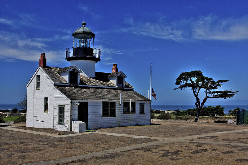
Pacific Grove is the location of the Point Pinos Lighthouse. Novelist Robert Louis Stevenson frequented Pacific Grove and wrote of visiting lighthouse-keeper Allen Luce in 1879. Author John Steinbeck resided in Pacific Grove for a number of years.
(Shown above is the Point Pinos Lighthouse in Monterey, California.)
The Point Pinos Lighthouse was lit on February 1, 1855 to guide ships on the Pacific Coast of California. It is the oldest continuously operating lighthouse on the West Coast of the United States and even the lens is original.


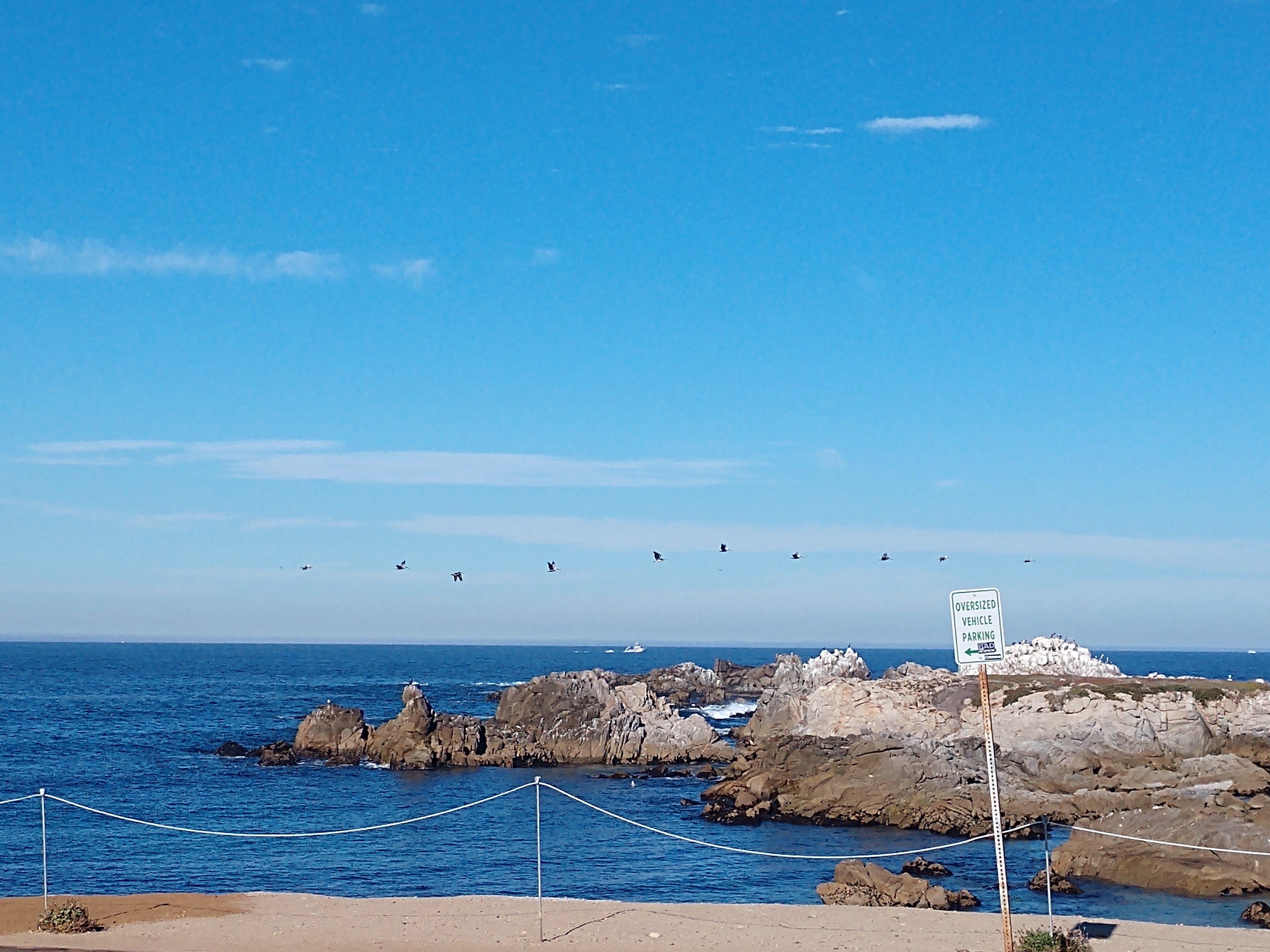
We are now driving along the coast of Pacific Grove.
It's a beautiful coastline.
Above is a flock of seagulls flying along the coast.
Above are some surfers getting ready to head out to surf.
Next we turned right, to head toward the Pebble Beach 17 Mile Drive. 17 Mile Drive was merely a description that highlighted the length of the road. Its primary purpose was to take the guests of the esteemed Hotel Del Monte on a journey through the scenic coastline of Pacific Grove, Pebble Beach, and Carmel-by-the-Sea. It’s been around 140 years since the first carriage embarked on the enthralling journey.
The 17 mile loop drive encompasses a stunning stretch of roadway that circles the coastline from Pacific Grove to Pebble Beach. We took our time on this private drive, that you typically have to pay to enter, but somehow they just waved us in. We were immersed in numerous mesmerizing views.
(The above map shows the 17 Mile loop drive from Pacific Grove to Carmel-by-the-Sea.)
(Shown above is a beach near the Pacific Grove entrance of the 17 Mile Drive.)
Most people usually begin the 17 mile loop drive from Del Monte in Pacific Grove and end at Carmel-by-the-Sea on the Monterey Peninsula. It’s interesting to note that the coastline that makes up a significant part of the drive resides behind the gates of the Pebble Beach private community.

The 17-Mile scenic road through Pebble Beach and Pacific Grove on the Monterey Peninsula in California hugged much of the Pacific coastline and passed by the famous golf course -- Pebble Beach.
History of the 17 Mile Road
In 1602, the Monterey Peninsula was mapped by Spanish explorers. By 1840, the area now called Pebble Beach was a rancho left to widow Carmen Garcia Barreto Maderiaga Maria by her husband. She sold the 4,000 acre property for $500 in 1846. Ownership passed several times until 1862 when the property was purchased at an auction for 12 cents an acre by David Jacks. At the time, the area was called "Stillwater Cove". Jacks leased the land to the "China Man Hop Company", a small village with a population of about 30 Chinese fishermen living in shacks built upon the rocky shoreline.
In 1880, Jacks sold the land to the Pacific Improvement Company, a consortium of The Big Four railroad barons: Charles Crocker, Mark Hopkins, Collis Huntington and Leland Stanford. By 1892, the Pacific Improvement Company laid out a scenic road that they called the 17-Mile Drive, meandering along the beaches and among the forested areas between Monterey and Carmel. Within short order, the area became a tourist destination with the building of the Hotel Del Monte.
The Hotel Del Monte was a large resort hotel in Monterey, California, from its opening in 1880 until 1942. It was one of the finest luxury hotels in North America. During World War II, it closed and the building was leased to the United States Navy. It first was used by the Navy as a school where enlisted men spent the second, third, and fourth months of an 11-month course being trained as electronic technicians. Later the Hotel Del Monte became the Naval Postgraduate School. Today, the building is named Herrmann Hall. It contains school administrative offices and the Navy Gateway Inns and Suites, a hotel.
(Shown above is the original hotel, ca 1883.)
(Shown above is the Hotel Del Monte in 1915.)
The hotel was the starting and finishing point for 17-Mile Drive. The drive was offered as a pleasure excursion to hotel guests, and was intended to attract wealthy buyers of large and scenic residential plots on Pacific Improvement Company land. Sightseers riding horses or carriages along the 17-Mile Drive sometimes stopped at Pebble Beach to pick up agate and other stones polished smooth by the waves, and they commented on a few unusual tree formations known as the Witch Tree and the Ostrich Tree—the latter formed by two trees leaning on each other.
At that time, the Chinese fishing community continued in existence despite mounting anti-Chinese sentiment among Monterey residents of European heritage. At roadside stands, Chinese-American girls sold shells and polished pebbles to tourists. In the 1900s, the automobile began replacing horses on 17-Mile Drive, and by 1907 there were only automobiles.

We have just arrived at Carmel-by-the-Sea, a city in Monterey County, California, founded in 1902 and incorporated on October 31, 1916. Carmel-by-the-Sea is located on the Pacific coast, about 300 miles north of Los Angeles and 100 miles south of San Francisco, and has a population of 3,220.
Situated on the Monterey Peninsula, Carmel-by-the-Sea is known for its natural scenery and rich artistic history. In 1906, the San Francisco Call devoted a full page to the artists, writers and poets at Carmel-by-the-Sea, and in 1910 it reported that 60 percent of Carmel-by-the-Sea's houses were built by citizens who were "devoting their lives to work connected to the aesthetic arts."
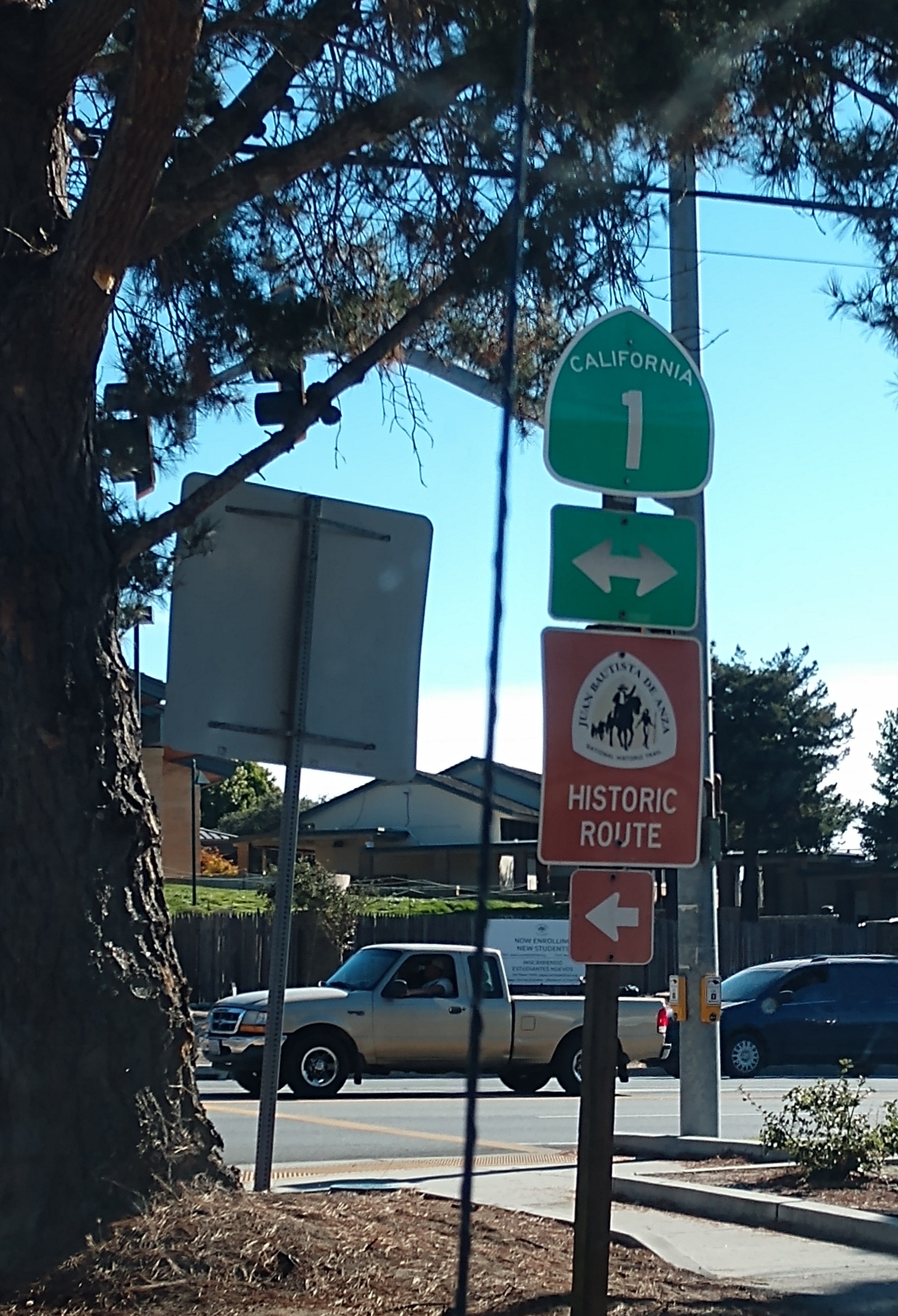
Leaving Carmel-by-the-Sea, we traveled the historic route, CA Hwy 1.
We drove by Point Lobos State Reserve. Point Lobos and the Point Lobos State Natural Reserve is a state park in California. Adjoining Point Lobos is "one of the richest marine habitats in California." The ocean habitat is protected by two marine protected areas, the Point Lobos State Marine Reserve and Point Lobos State Marine Conservation Area. The sea near Point Lobos is considered one of the best locations for scuba diving on the Monterey Peninsula and along the California coast. Point Lobos is just south of Carmel-by-the-Sea, California, and at the north end of the Big Sur coast of the Pacific Ocean. Point Lobos features a number of hiking trails, many alongside the ocean, and a smaller number of beaches.
We continued on along the coastal highway.
Above and below, we are now beginning to see the Point Sur lighthouse. It’s nearly impossible to miss the dark, jutting volcanic outcrop along the coast when traveling south to Big Sur. It is the windswept point atop which the Point Sur lighthouse sits.

The area has a legacy of notable shipwrecks — including three divers whose boat was swept from Point Lobos and ran aground as recently as 2000 — but it was the sinking of the mailship SS Ventura in 1875 that prompted the building of a lighthouse to guide boats away from shore.
They began construction on the lighthouse in 1887, and it was finished in 1889. The lighthouse is 38 feet tall and stands 270 feet above the sea. The beacon was lit in August of 1889, and it has been lit since then. The lighthouse is remote and was managed by a few families until Highway 1 was built in 1935, which made the area more accessible. Even so, they still didn’t have electricity until 1948.
One of the reasons why the lighthouse was so important here is because this is where the bend is along the California coast and so boats must reroute at this bend to make sure they get to their destination. Prior to the lighthouse, there were many wrecks along this part of the coast.


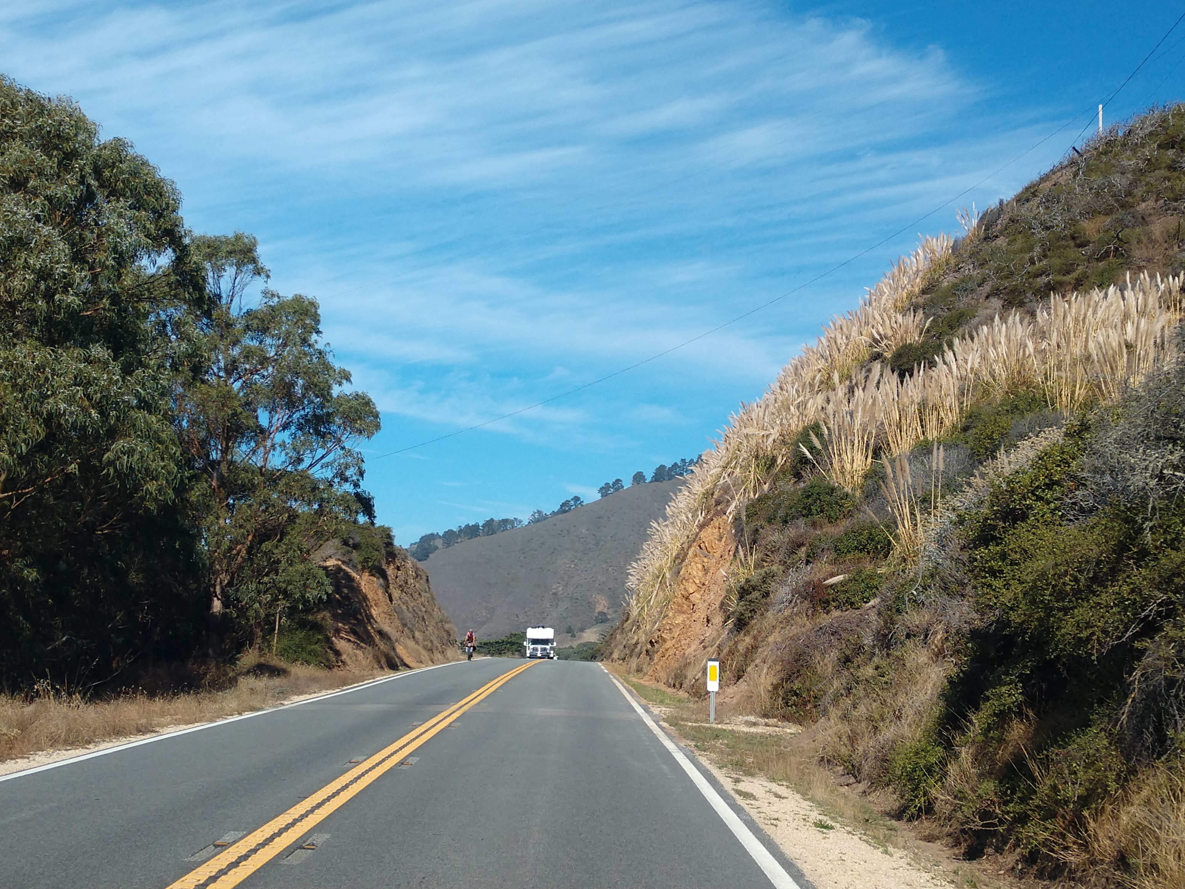
We then drove by Big Sur campground, and ran into some more road construction.
Our next stop was at the Big Sur Ranger Station. This station houses personnel representing the California State Park System and Los Padres National Forest of the U.S. Forest Service -- each of which is responsible for much of the land in the Big Sur Valley and the overall Big Sur region. Big Sur Ranger Station is probably as close to a "visitor center" as Big Sur has.
We then drove by the Pfeiffer Big Sur State Park. Pfeiffer Big Sur State Park is a state park in Monterey County, California near the area of Big Sur on the state's Central Coast. It covers approximately 1,006 acres of land. The park is centered on the Big Sur River. It has been nicknamed a "mini Yosemite." A Redwood tree in the park nicknamed the Colonial Tree is estimated to be between 1,100 and 1,200 years old.

The Esselen people were the first known residents of the Big Sur area. They lived in the area from about Point Sur south to Big Creek, and inland including the upper tributaries of the Carmel River and Arroyo Seco watersheds. Archaeological evidence shows that the Esselen lived in Big Sur as early as 3500 BC, leading a nomadic, hunter-gatherer existence. The aboriginal people inhabited fixed village locations, and followed food sources seasonally, living near the coast in winter to harvest rich stocks of otter, mussels, abalone, and other sea life. In the summer and fall, they traveled inland to gather acorns and hunt deer.
(Shown above is an Esselen Native American of the Monterey, California area, circa 1791.)
The native people hollowed mortar holes into large exposed rocks or boulders which they used to grind the acorns into flour. These can be found throughout the region. Arrows were of made of cane and pointed with hardwood foreshafts. The tribes also used controlled burning techniques to increase tree growth and food production.

After leaving the Big Sur area, we drove back toward Monterey, and then on to Salinas, California.
We drove back past the Point Sur Lighthouse (see pictures above and below).
The coastal scenery has been magnificent all day!
The highway curved back and forth hugging the spectacular coastline.
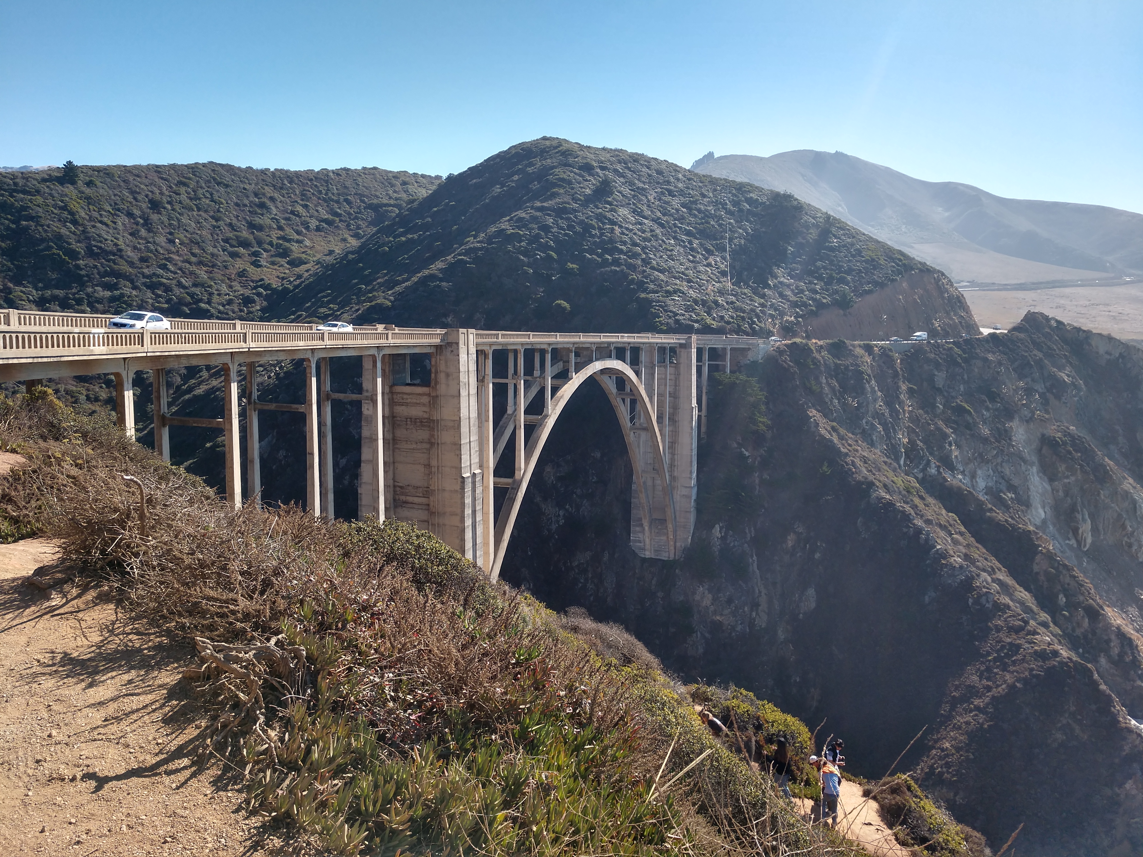
We are now beginning to get a glimpse of the Bixby Bridge (see in the middle of the above picture).
Bixby Bridge, located on the Big Sur coast of California, is one of the most photographed bridges in California due to its aesthetic design -- graceful architecture and magnificent setting. It is a reinforced concrete open-spandrel arch bridge. The bridge is 120 miles south of San Francisco and 13 miles south of Carmel-by-the-Sea in Monterey County on State Route 1.
Before the opening of the bridge in 1932, residents of the Big Sur area were virtually cut off during winter due to blockages on the often impassable Old Coast Road, which led 11 miles inland. The bridge was built under budget for $199,861 (equivalent to $3.51 million in 2022 dollars) and at 360 feet was the longest concrete arch span in the California State Highway System. When it was completed, it was the highest single-span arch bridge in the world, and it remains one of the tallest.


The land north and south of the bridge was privately owned until 1988 and 2001. A logging company obtained approval to harvest redwood on the former Bixby Ranch to the north in 1986, and in 2000 a developer obtained approval to subdivide the former Brazil Ranch to the south. Local residents and conservationists fought their plans, and both pieces of land were eventually acquired by local and federal government agencies. A $20 million seismic retrofit was completed in 1996, although its 24-foot width does not meet modern standards requiring bridges to be 32 feet wide.

The Bixby Bridge is 714 feet in total length and 24 feet wide, with 260 feet of clearance below, and has a main span of 360 feet, which places 50 percent of the total roadbed above the arch. The arch ribs are five feet thick at the deck and nine feet thick at the springing line, where they join the towers at their base. The arches are four and one-half feet wide. The bridge was designed to support more than six times its intended load.
The above stone marker was dedicated by Mrs. Lyndon B. Johnson, and told us about California's first official Highway Route One in Monterey County from the Carmel River south to the county border. This roadway and its scenic corridor has been preserved for the people of the nation by action of the county of Monterey and the state of California.
Views of the awesome coastline from the Bixby Bridge.
We crossed over the Rocky Creek Bridge, which is very similar to the Bixby Bridge. Rocky Creek Bridge is a reinforced concrete open-spandrel arch bridge on the Big Sur coast of California, built in 1927. It is about a mile north of the more famous Bixby Creek Bridge. Rocky Creek Bridge is one of seven similar bridges along State Route 1 known as the Big Sur Arches.
We continued on our northbound route toward Salinas, California.
We drove back past the 17 Mile Drive.
We then drove back through Monterey.
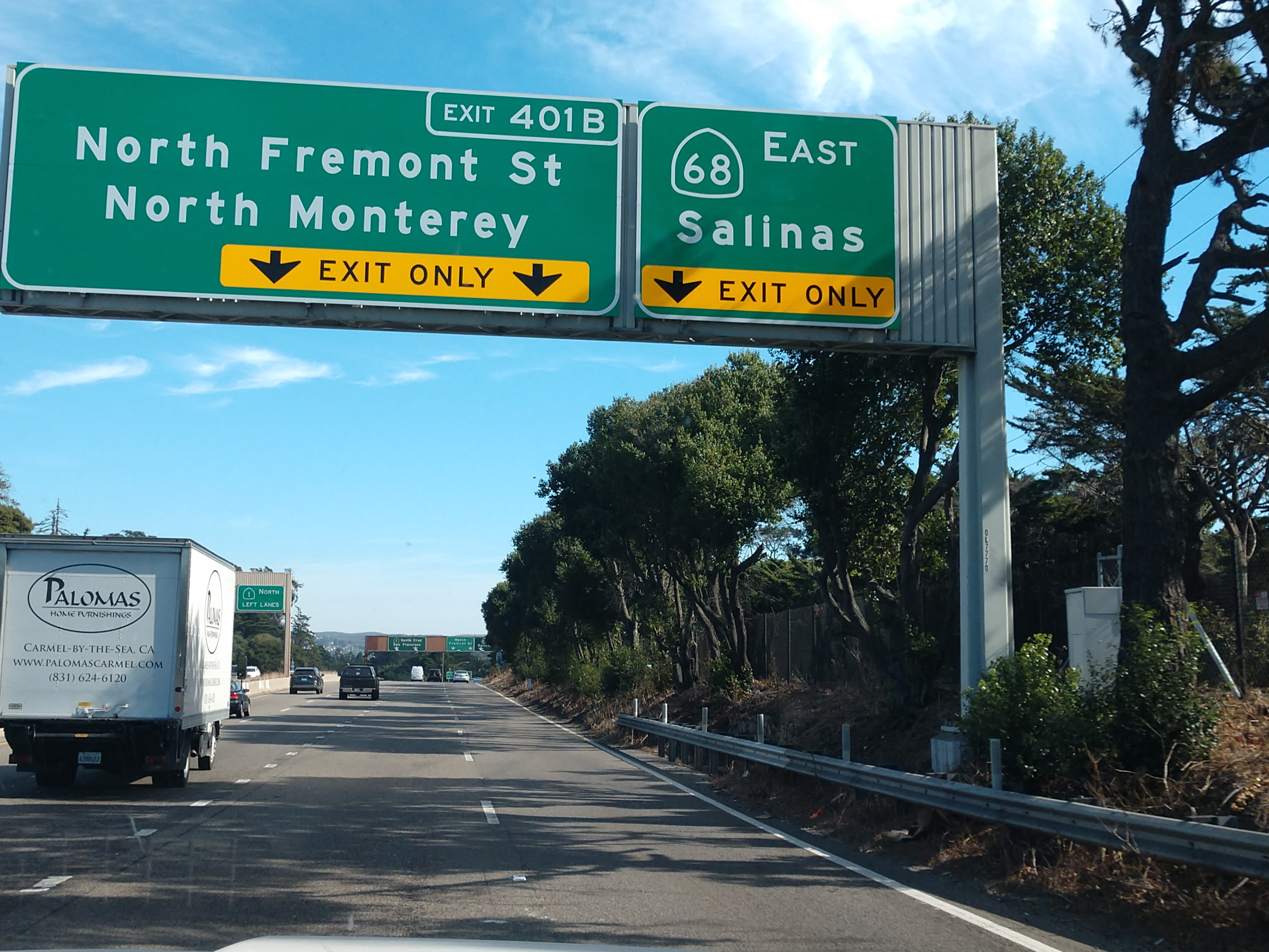
We then took Exit 401B to Salinas, California.
Salinas has a population of 163,542, and is the most populous city in Monterey County. Salinas is an urban area located along the eastern limits of the Monterey Bay Area, lying just south of the San Francisco Bay Area and 10 miles southeast of the mouth of the Salinas River. The city is located at the mouth of the Salinas Valley, about eight miles from the Pacific Ocean, and it has a climate more influenced by the ocean than the interior.
We stopped in Salinas to lunch at Taco Bell. Also while in Salinas, we stopped at Walmart to get groceries, and then at the Valero to get gas.
We got back to the campground around 3:45 p.m. Our road trip today ended up being a 209 miles long through lots of spectacular scenery.
I decided to go on a bike ride around the San Benito Thousand Trails Campground. As I was riding around, I saw some deer around the campground (see above and below).
Shown below is the Garmin GPS screenshot from my 4.30 mile half hour bike ride.
Sunday, November 5 and Monday, November 6, we just stayed around the campsite. Both days were beautiful sunny days, with temperatures ranging from a low of 56 degrees to a high of 76 degrees.
We have taken in so many beautiful sights the past few days. So, I felt like writing a little poem to end this blog -- here goes:
* * * * * * * * * *
It is said that California has 840 miles of beautiful coastline,
And the glistening sun off the Pacific Ocean suggests a gold mine.
While sunsets produce streaks of yellows, pinks and other hues galore,
So much to see and experience -- how could we ask for anything more!
Our awesome journey will continue on with God daily by our side,
Through my blog, I'm so glad you can come along and enjoy the ride!
* * * * * * * * * *
Shirley & Mel


.jpg)


_(14762391891).jpg)


.jpg)
.jpg)


.jpg)


.jpg)


.jpg)


.jpg)


No comments:
Post a Comment