Happy 43rd Anniversary to Mel & Shirley!!!
Today, we are driving back to LaConner Thousand Trails in LaConner, Washington for a five night stay. The day started out cloudy at 57 degrees but it soon turned a sunny 66 degrees.


We arrived at the LaConner Thousand Trails at 10:50 a.m., but had to wait for the ranger to come up and check us in at around 11:45 a.m.

We got set up on site #284 with full-hookups for five nights (September 13 - 17, 2023). It was another beautiful and shady site.


Then around 12:30 p.m., we took off to drive into Burlington, Washington to the Four Seasons Buffet.

Since today was our 43rd wedding anniversary, we decided to get Chinese food. The Four Seasons Buffet is an all-you-can-eat buffet with over 150 items to choose from including: sushi, stir-fry, grill, pepper salt shrimp, cajun seafood (crab legs, crawfish, lobster, mussels), lo mein, fried rice, orange chicken, dim sum, bbq ribs, walnut shrimp, chicken wings, cheese mushroom, baked oysters/mussels, various soup, salads, fresh fruits, various desserts, ice cream and more. The variety of food is amazing!


Shown above and below are some pictures from the inside of the Four Seasons Buffet and a few of the buffet lines.

.jpg)
Shown below is Mel with his plate of food, with my plate closest to the front of the picture. Bon appétit and yummy for sure!

The buffet wasn't cheap, but we didn't think $30 was too bad for both of us.

After lunch, we drove to the Fred Meyer in Burlington to get groceries and then on to the Swinomish Casino in Anacortes to get gas before arriving back at the campground around 3:30 p.m.

Tonight, around 7:15 p.m., there was a beautiful sunset at the LaConner Thousand Trails Campground. This 111-acre campground has a 1/2 mile of saltwater beach front on the Puget Sound. From our campsite, it was just a short walk over to the water's edge to watch for the sunset.


In the above picture, you can see a silhouette of Mel down by the water's edge.

What a beautiful sunset and a splendid ending to a day of celebrating our anniversary!
Thursday, September 14, 2023
We left to drive to Whidbey Island this morning at 9:55 a.m. and the skies were sunny with a temperature of 52 degrees.

Whidbey Island is in the Puget Sound, located north of Seattle, Washington. The island’s rugged terrain spans beaches, hills and farmland. On its northwest tip, Deception Pass State Park offers clifftop views, forest trails and freshwater lakes. To the south, Fort Casey Historical State Park is home to a lighthouse and gun battery. The coastal towns of Oak Harbor, Coupeville and Langley have boutiques, cafes and galleries.

HISTORY OF WHIDBEY ISLAND
Whidbey Island was inhabited by various Native American tribes (the Lower Skagit, Swinomish, Suquamish, and Snohomish) until the first European explorers arrived in the area in the late 1700’s. The Salishan name for the island was Tscha-kole-chy. These were peaceful groups who lived off the sea and land, with fishing, harvesting nuts, berries and roots, which they preserved over the winter. The first known European sighting of Whidbey Island was during the 1790 Spanish expedition of Manuel Quimper and Gonzalo López de Haro on the Princesa Real.
In 1792, British sea captain George Vancouver, of the HMS Discovery, came upon the island. In May of that year, Royal Navy officers and members of Vancouver's expedition, Joseph Whidbey (master of HMS Discovery) and Peter Puget (a lieutenant on the ship), began to map and explore the areas of what would later be named Puget Sound. After Whidbey circumnavigated the island in June 1792, Vancouver named the island in his honor. By that time, Vancouver had claimed the area for Britain. Colonel Isaac N. Ebey permanently settled in western Coupeville, which is present day Ebey’s Landing and Fort Ebey. Oak Harbor was named after the Garry Oak trees that poulated northern Whidbey Island.
Whidbey Island is home to 69,480 residents, with 59% of those living in North Whidbey, 20% living in Central Whidbey, and 21% living in South Whidbey. Whidbey Island is the largest of the islands in Washington state. The island forms the northern boundary of Puget Sound. It is home to Naval Air Station Whidbey Island. The state parks and natural forests are home to numerous old growth trees.
Whidbey Island is approximately 37 miles from north to south, and 1-1/2 to 10 miles wide, with a total land area of 168.67 square miles, making it the 40th largest island in the United States. It is ranked as the fourth longest and fourth largest island in the contiguous United States, behind Long Island, New York; Padre Island, Texas (the world's longest barrier island); and Isle Royale, Michigan. In the state of Washington, it is the largest island, followed by Orcas Island.
Thomas W. Glasgow filed the first land claim on Whidbey Island in 1848, attempting to become the first settler. He built a small cabin near Penn Cove, planted some crops and married a local lady, Julia Pat-Ke-Nim. Glasgow left in August of that year however, having been forced out by the local inhabitants. Colonel Isaac N. Ebey arrived from Columbus, Ohio, in 1850 and became the first permanent white settler, claiming a square mile of prairie with a southern shoreline on Admiralty Inlet. He took advantage of the 640 acres offered free of charge to each married couple, the first to do so, on October 15, 1850. In the fall of 1851, his children, his wife, three of her brothers and the Samuel Crockett family arrived to join Ebey. In addition to farming potatoes and wheat, Ebey was also the postmaster for Port Townsend, Washington and rowed a boat daily across the inlet in order to work at the post office there.
On August 11, 1857, at age 39, Colonel Ebey was murdered and beheaded by Native Americans, said to be Haida who had traveled to this area from Haida Gwaii. Some sources however, refer to his killers as "Russian Indians called Kakes or Kikans from Kufrinoff Island, near the head of Prince Frederick's Sound." Ebey was slain in proxy-retaliation for the killing of a Haida chief or Tyee and 27 other indigenous people at Port Gamble. Fort Ebey, named for the Colonel, was established in 1942 on the west side of the central part of the island, just northwest of Coupeville.

(Map of Whidbey Island — in Island County, Washington.)

(Carved sign welcoming visitors to Whidbey Island.)

We took WA Hwy 20 West to the left toward Oak Harbor and the Coupeville-Port Townsend Ferry.

Oak Harbor is now 15 miles away, Coupeville is 25 miles away, and the Port Townsend Ferry is 34 miles away.


We drove by Pass Lake (shown below). Pass Lake is on Fidalgo Island, located just north of Deception Pass and the north end of Whidbey Island, and just south of Anacortes. It’s right along Highway 20 near Deception Pass State Park. Pass Lake’s rich fishing history legend grew substantially in 1939, when it became the first lake in Washington to be strictly limited to fly fishing. It’s also strictly catch-and-release for trout, which enables more of its trout to reach trophy proportions.

Soon we are at Deception Pass State Park.

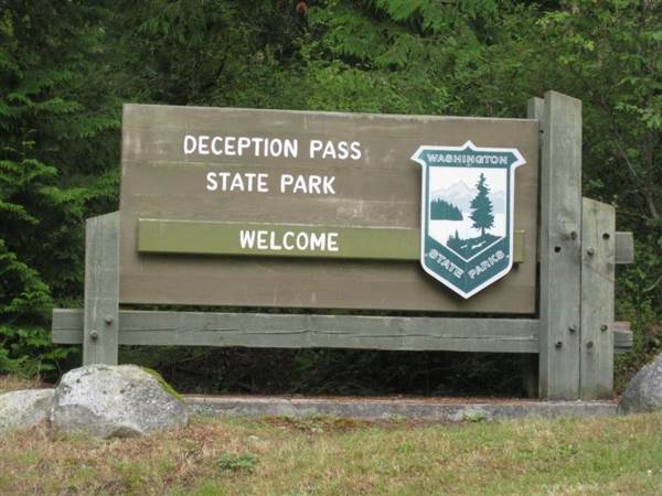
Deception Pass State Park is a 4,134-acre marine and camping park with 77,000 feet of saltwater shoreline, and 33,900 feet of freshwater shoreline on three lakes. Rugged cliffs drop to meet the turbulent waters of Deception Pass. The park is outstanding for breath-taking views, old-growth forests and abundant wildlife. The human history of the Deception Pass State Park dates back thousands of years, when the first people settled in the areas now known as Cornet Bay, Bowman Bay and Rosario. Eventually, the land was settled by the Samish and the Swinomish. They lived on the land until the early 1900s.
During his Northwest coastal explorations, Captain George Vancouver became the first European to identify the area near Whidbey Island as a passage, which he named "Deception Pass." The name "Deception Pass" derived from Captain Vancouver's realization that what he had mistaken for a peninsula was actually an island. A 1925 act of Congress designated the property for public recreation purposes. In the 1930s, the Civilian Conservation Corps built roads, trails, buildings and bridges to develop the park.


On the Whidbey Scenic Isle Way Byway, the rush of life subsides, and stress vanishes. As we crossed Deception Pass Bridge, we caught our breath and went on “island time” for one of the region’s most spectacular drives that is a 54-mile island route from end to end. The locals dub the island “The Shortest Distance to Far Away” because of its mellow pace, natural beauty and easy proximity to Seattle.
Driving along the Whidbey Scenic Isle Way, we came to the island’s largest town, Oak Harbor, that is home to the top-rated U.S. Naval Air Station in the country. Coupeville was the next community we encountered (the second-oldest town in Washington state). We then visited Fort Casey State Park, an immaculately preserved military installation that once protected the entrance to Puget Sound and the Admiralty Head Lighthouse.
I will provide more detail about each stop we made along Whidbey Island further down in this blog.

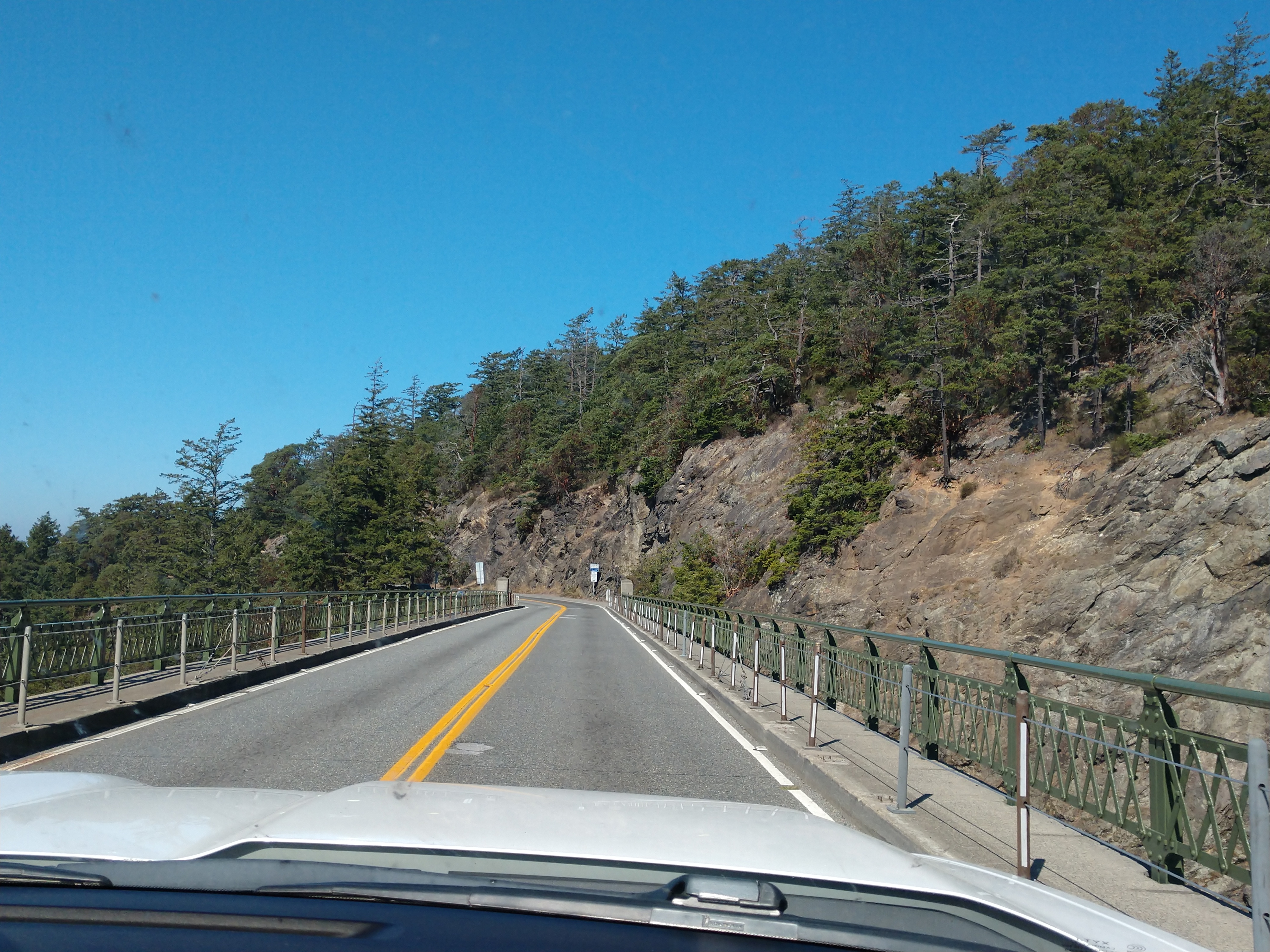
As we continued on our drive we soon came to Deception Pass Bridge (shown below) that was built on July 31, 1935 connecting Whidbey Island to Fidalgo Island.

Deception Pass Bridge connects Whidbey Island in Island County to Fidalgo Island in Skagit County in the state of Washington. The bridge, one of the scenic wonders of the Pacific Northwest, is actually two spans, one over Canoe Pass to the north, and another over Deception Pass to the south. Pass Island lies between the two bridges. Construction began in August 1934, and the completed bridge was dedicated at noon on July 31, 1935. The Wallace Bridge and Structural Company of Seattle, Washington provided 460 tons of steel for the 511-foot Canoe Pass arch and 1,130 tons for the 976-foot Deception Pass span. The cost of the New Deal-era construction was $482,000.
Completion of the bridge was a factor in the decision to build Naval Air Station Whidbey Island and helped Oak Harbor flourish. The bridge is a very commonly photographed landmark of the Puget Sound region.

(Shown above is a portrait of Joseph Whidbey, a member of the Royal Navy who served on the Vancouver Expedition 1791–1795, and later achieved renown as a naval engineer.)
In the spring of 1792, Joseph Whidbey, master of HMS Discovery and Captain Vancouver's chief navigator proved that it was not really a small bay as charted by the Spaniards, but a deep and turbulent channel that connects the Strait of Juan de Fuca with the Saratoga Passage, which separates the mainland from what they believed was a peninsula (actually Fidalgo Island and Whidbey Island). Thomas Coupe, a sea captain and founder of Coupeville, was the only man ever to sail a full-rigged ship through the strait discovered by Whidbey.

(Shown above is a photograph of Captain Thomas Coupe — founder of Coupeville on Whidbey Island in Island County, Washington.)

(Shown above is Deception Pass in 1912, before the bridge was built.)
In the early years of the 20th century, travelers of the horse-and-buggy era used an unscheduled ferry to cross from Fidalgo Island to Whidbey Island. To call the ferry, they banged a saw with a mallet and then sat back to wait.

We continued our drive over Deception Pass Bridge.


An informational marker at the entrance to the bridge tells some of the history of Deception Pass and its location:
"To the north of this narrow passage is Fidalgo Island, so named for the for the Spanish explorer Lieutenant Salvador Fidalgo. To the south is Whidbey Island, second largest island in the contiguous 48 states, which Captain George Vancouver while exploring this region in 1792, at first sight thought to be a peninsula. Further exploration conducted by him, disclosed the existence of this intricate channel. Upon the realization that he had been deceived as to the character of the large island, Vancouver gave to this channel the name of Deception Passage, and in naming the island, he honored his trusted officer, Joseph Whidbey."


The Whidbey Island Naval Air Station is on the north end of the island in Oak Harbor. Oak Harbor is the largest city on Whidbey Island. The main portion of the base, Ault Field, is about three miles north of Oak Harbor. The other section, called the Seaplane base for the PBY Catalina flying boats once based there, holds most of the island's Navy housing as well as the air station's main Navy Exchange and DeCA Commissary.


(Location of Naval Air Station on Whidbey Island in relationship to Oak Harbor.)


On September 21, 1942, Naval Air Station Whidbey Island was built for the U.S. military. Because of this, the area experienced a surge in population growth, with numerous military personnel and their families being stationed in the region.

Oak Harbor is now 2 miles away, Coupeville is 12 miles away, and the Port Townsend Ferry is 21 miles away.


We are now in the city of Oak Harbor, Washington. Oak Harbor has a population of 22,075, and was incorporated on May 14, 1915 (with a population of 401). The Lower Skagit people have inhabited Oak Harbor and the nearby Crescent Harbor since time immemorial. There were several villages in the vicinity, and the modern settlement of Oak Harbor was built over one such village. In the early 1850s, two settlers staked claims where the city now stands—Zakarias Martin Toftezen, a shoemaker from Norway and C.W. Sumner from New England. Irish and Dutch immigrants also arrived and settled in the area.
Oak Harbor was named for the area's Garry Oak trees. Houses and businesses sprouted up along the shores of Oak Harbor as pioneers relied entirely on water transportation until the 1900s. For the next 30 years, steamers and freighters carried passengers and freight from the Island to the mainland and back as well as Fidalgo Island to the north. The city grew following the completion of Deception Pass Bridge on July 31, 1935, and Naval Air Station Whidbey Island on September 21, 1942.

We continued on through Oak Harbor. Now Coupeville is 8 miles away, Port Townsend Ferry is 17 miles away, while the Mukilteo Ferry is 35 miles away.

Shown above and below are views of Skagit Bay as we drove south along WA Hwy 20 toward Ebey's Landing. Skagit Bay, a bay and strait, is part of the Whidbey Island Basin of Puget Sound. The Skagit River empties into Skagit Bay. To the south, Skagit Bay connects with the rest of Puget Sound via Saratoga Passage and Possession Sound. The boundary between Saratoga Passage and Skagit Bay is between Polnell Point on Whidbey Island and Rocky Point on Camano Island. To the northwest, Skagit Bay connects to the Strait of Juan de Fuca via the narrow strait of Deception Pass. A third waterway, the Swinomish Channel, connects Skagit Bay with Padilla Bay to the north.


We are now in Coupeville, Washington. Coupeville, located on Penn Cove is a historic waterfront town on Whidbey Island with a gorgeous pier that extends out into the water.

Coupeville is the county seat of Island County and has a population of 1,831. Prior to European settlement, Coupeville and the bay in which it is located, Penn Cove, was inhabited by the Lower Skagit, a Lushootseed-speaking Coast Salish people. There was an abundance of salmon, clams, and other resources, as well as offering easy access to the water, making it an excellent village site. When Europeans arrived to explore the Puget Sound, it was Joseph Whidbey who first visited the bay, naming it Penn Cove.


We drove by the sign for the historic waterfront of Coupeville. We plan to stop at the historic downdown of Coupeville on our return trip.


Next, we drove by the Rhododendron Park, located south of Coupeville. Rhododendron Park is a 32-acre, largely forested, mixed-use Island County park in central Whidbey Island. The main draw, as the park name suggests, is the brilliant show of blooming native rhododendrons in late spring. The Washington State flower is the Pacific Rhododendron and the park delivers with thousands of individual plants with hundreds of thousands of blooms in this relatively small area.

Even though we didn't stop to see the rhododendrons, shown below is what they would have looked like.


We turned right on WA Hwy 20 East toward the Port Townsend Ferry, and then continued on toward Fort Casey.

We drove by Crockett Lake. Crockett Lake is a lake at an elevation of 0 feet. The Crockett family homesteaded the site in the 1850s and gave the lake their name.

Crockett Lake is an open, shallow, estuarine lake on the south shore of Whidbey Island. The lake is a mixture of fresh and salt water separated by a narrow gravel bar and a tidegate from Admiralty Inlet. The open water of the lake is surrounded by marsh and grassland. Fed by runoff from the surrounding area and by inflow through the tidegate, the water levels can fluctuate greatly. When water levels are low, extensive mud flats are exposed. This mixture of marsh, open water, grasslands, and mudflats is rich with the kinds of small invertebrates that are eagerly fed upon by a variety of birdlife. As a result, Crockett Lake attracts many birds throughout the year and is one of the most productive birding areas in the Puget Sound lowland.


(Crockett Lake reflection on Whidbey Island.)
We continued on toward Keystone Harbor which is near the Coupeville-Port Townsend Ferry terminal.

Shown above and below is the Coupeville-Port Townsend Ferry.


(Shown above is the route that the Coupeville-Port Townsend Ferry takes from the Fort Casey State Park area to Port Townsend.)


From here, we drove on to Fort Casey and Fort Casey State Park.


(Shown above is a map of Fort Casey and Crockett Lagoon.)

We turned right to go to the state park and lighthouse.
.jpg)
Fort Casey State Park, a 999 acre marine camping park is a historic district within the U.S. Ebey's Landing National Historical Reserve. Admiralty Inlet was considered so strategic to the defense of Puget Sound in the 1890s that three forts—Fort Casey on Whidbey Island, Fort Flagler on Marrowstone Island, and Fort Worden at Port Townsend—were built with the intention to create a "triangle of fire" against invading ships. This military strategy was based on the theory that the three fortresses would thwart any invasion attempt by sea.

(Brigadier General Thomas Lincoln Casey in uniform.)
Fort Casey was named for Brigadier General Thomas Lincoln Casey, U.S. Army Chief of Engineers. Designed as part of the massive modernization program of U.S. seacoast fortifications initiated by the Endicott Board, construction on Fort Casey began in 1897. In 1901, the big guns on disappearing carriages, which could be raised out of their protective emplacements so that the guns were exposed only long enough to fire, became active. However, the fort's batteries became obsolete almost as soon as their construction was completed.
The invention of the airplane in 1903, and the subsequent development of military aircraft made the fort vulnerable to air attack. In addition, the development of battleships designed with increasingly accurate weaponry transformed the static strategies of the nineteenth century into the more mobile attack systems of the twentieth century. Most of Fort Casey's guns and mortars were removed during World War I, when they were mounted on railcars to serve as mobile heavy artillery. Some of these weapons were returned to the fort after the war, and were scrapped during World War II as 16-inch guns and other weapons at other forts superseded them.

We first drove by the entrance into Fort Casey and then turned around. We then back tracked to the entrance and then ventured inside the fort area.


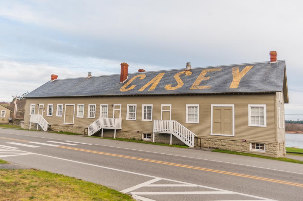
Shown above is a photo of Fort Casey Inn, circa 1909 -- which was the former Non-Commissioned Officers’ Quarters. It was built for the active defensive installation of Fort Casey. The inn is located adjacent to Fort Casey State Park with its gun bunkers, lighthouse, 10-inch disappearing guns, public beaches and trails.

Shown above and below is Fort Casey Inn, with its ten cottages originally built for officers stationed during World War I at Fort Casey.


Fort Casey State Park has a lighthouse and several military structures.

The Admiralty Head Lighthouse was beautiful in all it's splendor on the hill.

In 1858, the U.S. government purchased ten acres of land costing $400 for the construction of Admiralty Head Lighthouse. In 1890, the army took over the premises. The first Admiralty Head Lighthouse that was built in 1859, was removed from the bluff when the United States War Department decided to fortify Admiralty Inlet and the fort was constructed. A new lighthouse was built on the present site in 1903. By 1922 the lighthouse was out of use as other nearby lighthouses at Point Wilson and Marrowstone Point were more useful. Today the Admiralty Head Lighthouse at Fort Casey serves as a historic landmark and interpretive center.

Admiralty Head Lighthouse was designed by architect Carl Leick in 1898 and opened in 1903. The original lantern was removed after the lighthouse ceased operation in the 1920s. It is now in place at a lighthouse 40 miles away at Dungeness. The lighthouse was built to guide ships into Puget Sound. The Admiralty Head Lighthouse structures include a 30-foot-tall tower, a two-story lighthouse keeper’s home, and a shed where oil for the lamp was stored.

(A sketch from the architect Carl Leick’s original plans.)

(Original Admiralty Head Lighthouse in 1893.)

We drove around looking at some of the buildings in Fort Casey. The main structures at Fort Casey consist of gun batteries (9 in total) and support buildings (1 observation station, 1 power house and 1 lighthouse) scattered across the grounds. From the furthest parking lot, you will have 5 batteries and the observation tower overlooking Admiralty Inlet closely accessible via paved trails.

Shown above and below are pictures of some of the gun batteries at Fort Casey.


Battery Worth (shown above) was named for Brigadier General William S. Worth, who served with distinction during the U.S. Civil War and the Spanish-American War. He was wounded during the attack on San Juan Hill. He died in October 1904.

Battery Trevor (shown above) was named for 1st Lt. John Trevor of the 5th U.S. Calvary. He died from wounds received during the Battle of Winchester, Virginia in 1864.


The Quartermaster’s Building (shown above and below) is located on the Crockett Lake side of Fort Casey’s south entrance. Built in the early 1900s, it was used as a military storehouse.

After leaving Fort Casey, we got another brief look at the Coupeville-Port Townsend Ferry terminal to Port Townsend (shown above).

We did not go to the Mukilteo Ferry, but instead headed back on WA Hwy 20 East toward Coupeville.


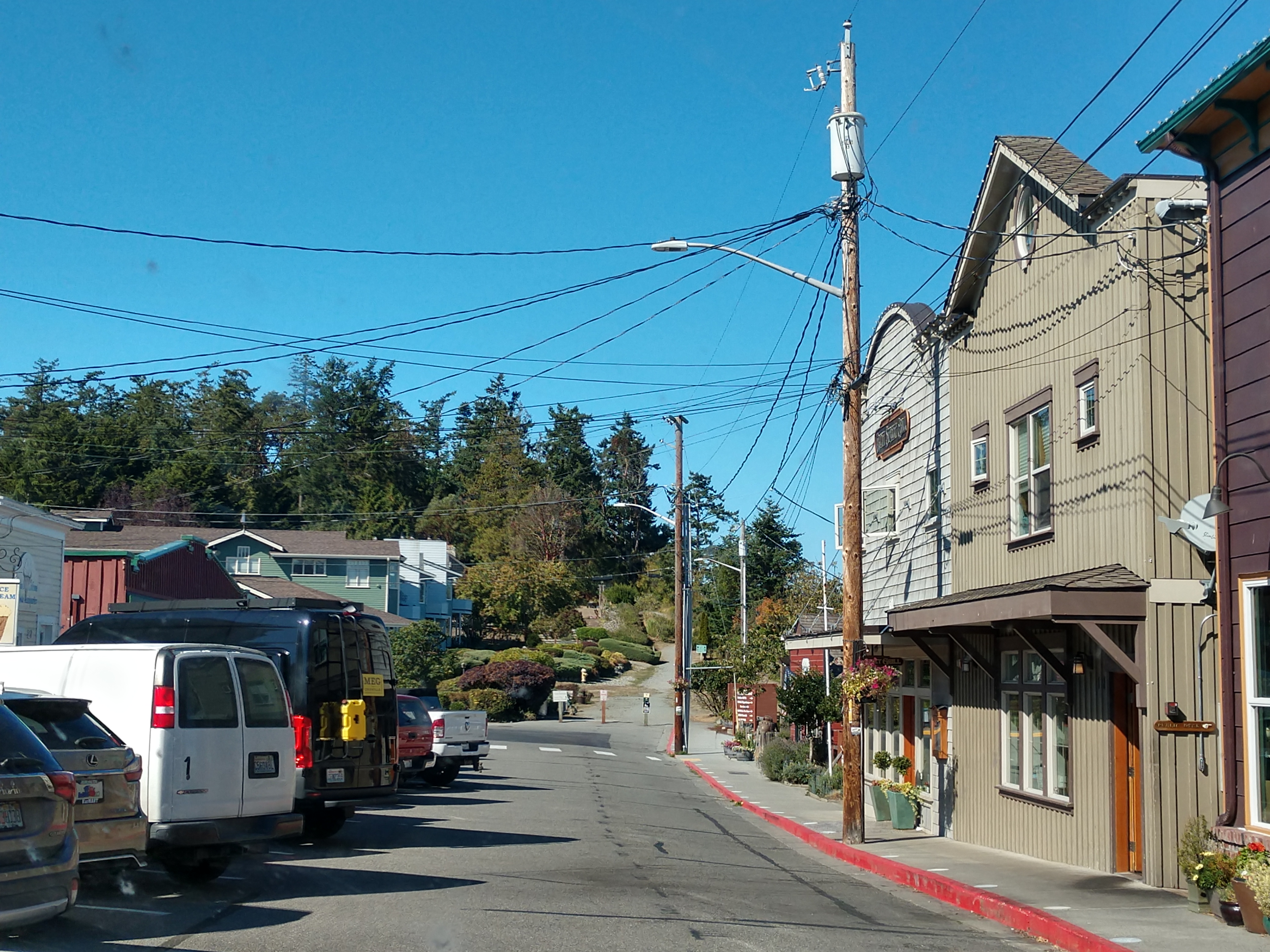
We were welcomed to Historic Coupeville's waterfront. Coupeville was incorporated as a town in 1910, with 321 people.

We drove by Anchorage Inn on the right side of the road as we drove into Coupeville.

The Anchorage Inn Bed and Breakfast was built in the 1860s and is a Victorian-style Inn in the historic town of Coupeville overlooking picturesque Penn Cove. The bed and breakfast boasts seven rooms and nine bathrooms and is more than 4,300 square feet.

We drove through the historic waterfront of Coupeville.


We then drove to the historic pier in Coupeville.


The pier and waterfront in Coupeville were simply gorgeous.

We're now are on way back, with Oak Harbor 10 miles away and Deception Pass 19 miles away.

We drove by Fort Ebey State Park.

And then we drove by Oak Harbor.

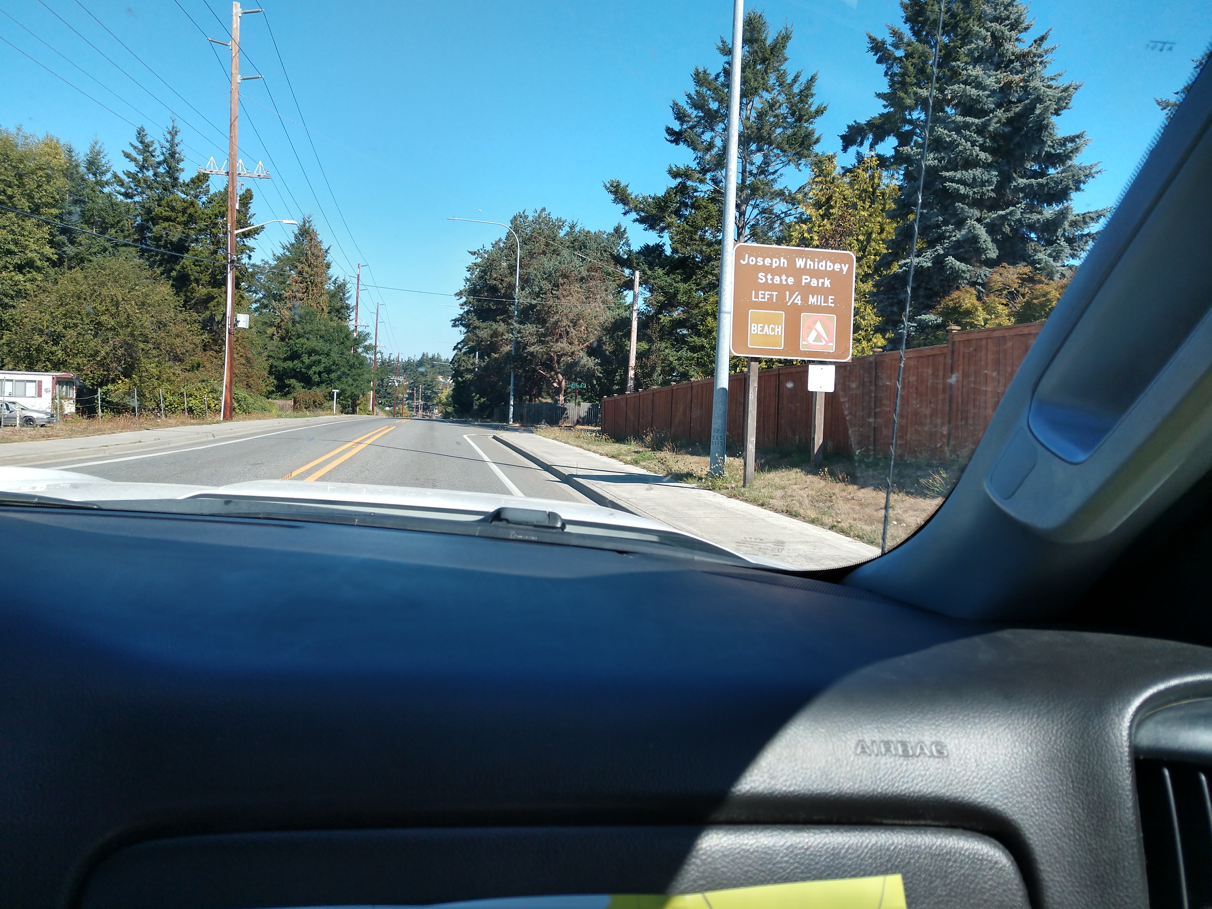
We then drove by Joseph Whidbey State Park.

We're now 9 miles from Deception Pass and 19 miles from Anacortes.

We again passed by the Whidbey Island Naval Air Station.


We drove into Deception Pass State Park. Deception Pass State Park spreads over 3,854 acres, a marine and camping park with 77,000 feet of saltwater shoreline and 33,900 feet of freshwater shoreline on three lakes. The park is actually located on two islands — Fidalgo to the north and Whidbey to the south. The Canoe Pass and Deception Pass bridges connect the two islands, creating a gateway for exploration.


We turned off the main highway and followed the Deception Pass State Park road down to the beach.


We drove by Cranberry Lake on our way down to West Beach. While the average depth of Cranberry Lake is only six feet deep, large areas are past the 20 and 30 feet marks. Cranberry Lake is separated from the saltwater of the Pacific Ocean by unusual northwest sand dunes.


Deception Pass State Park has numerous beaches, but none is more accessible than West Beach. Access to the beach is via the Deception Pass State Park road that intersects Cranberry Lake and Deception Pass State Park Campground. Upon arriving at the beach area, we saw a long stretch of a pebbly beach. The main draws to West Beach are the amazing views as the Olympic Mountains, San Juan Islands, and sometimes even Victoria can be seen along the shore.

West Beach runs for miles and miles down the island. It faces the Salish Sea, then goes straight down to the Pacific Ocean.


Cranberry Lake is shown above and below. Deception Pass State Park is primarily known for its beaches, but Cranberry Lake is an important addition to the park. It's much warmer than the adjacent West Beach (on the Pacific Ocean), which makes it ideal for a dip in summer. The western shore of the lake has a designated swim area that is sectioned off with ropes and floating buoys.

At one point, Cranberry Lake was a saltwater inlet. The retreating Cordilleran Ice Sheet created a basin about 15,000 years ago, which filled with ocean water. Over time, sand dunes built up a divide between the lake and West Beach. Some saltwater still exists in the depths of the lake. Cranberry Lake got its name from its history as a cranberry bog used by settlers.

We drove back out on the Deception Pass State Park road and then crossed over the Deception Pass Bridge again on our way back home.


We then drove by the low tidal areas by the Fidalgo Bay Road.


Soon we were back to Anacortes, Washington.

We stopped to eat lunch at the Taco Bell in Anacortes, Washington. We each had a couple of Chipotle Ranch Grilled Chicken Burritos (see picture below).

We then drove by the harbor area in Anaacortes.


Our next stop was at the Rockfish Grill & Anacortes Brewery in Anacortes, Washington.

The Anacortes Brewery was established in 1994 and is the 9th oldest continuously operating brewery in the state of Washington. They brew over thirty styles annually, focusing on high quality ingredients, a carefully controlled process and delicate handling to provide the best craft beers. The Anacortes Brewery operates a seven barrel brewery designed and installed by Sound Brewing Systems of Seattle with vessels fabricated by Ripley Stainless in British Columbia.


Mel gives a "thumbs up" before we go inside the Anacortes Brewery.


The chart above shows the brewing process from the grain and hops through the numerous processes and kettles until it is kegged.

The chart above shows many of the different types of craft beer that have been brewed and labels over the years at Anacortes Brewery.


Inside Anacortes Brewery, Mel enjoys a craft beer or two.


Then as we left the Anacortes Brewery, we drove back by the harbor area and saw the MV Yakima, a super-class ferry operated by Washington State Ferries. It is a ferry that is 382-feet in length.
The Yakima was built in 1967 for the Seattle–Bremerton run and remained there until the early 1980s when she was moved to the Edmonds–Kingston run where she was a better match for ridership levels. In 1999, she was extensively rebuilt, and then she was moved to the Anacortes–San Juan Islands route. She was removed from service in the spring of 2014 to have her drive motors rebuilt, and returned to service in Fall 2014. In March 2016, there was a fire on the vessel while running in the San Juan Islands. The vessel clogged passage to and from Friday harbor for several hours and the ship was out of service for some time. The Yakima has since returned to service in the Anacortes–San Juan Islands.


As we left the historic area of Anacortes, Washington, we then went to the Bastion Brewing Company in Anacortes, Washington.


Mel gives a "thumbs up" before we go inside the Bastion Brewing Company in Anacortes, Washington.


Mel enjoys a craft beer or two at the Bastion Brewing Company in Anacortes, Washington.

We arrived back to our campsite around 3:10 p.m. in the afternoon. Later, for dinner we had pizza.
Friday, September 15, 2023
Today was another sunny day with a temperature of 52 degrees. Mel went for a walk in the morning, while I worked on my blog. We enjoyed a relaxing down day at the camper.
Later for dinner, we had hamburgers on the grill and potato wedges.
Saturday, September 16, 2023
Another sunny day with a temperature of 54 degrees that would reach 76 degrees in the afternoon. We left the campsite at 10:00 a.m. and headed out toward Arlington, Washington (which was about 28 miles away).

Our plan today was to visit a couple of casinos starting with the Angel of the Winds Casino Resort in Arlington, Washington.


Angel Of The Winds Casino Resort is owned by the Stillaguamish Tribe, which opened the casino on October 28, 2004 on its tribal land, and was expanded to include a 125-room hotel in 2015.

We signed up for the new player card at the Angel of the Winds Casino Resort and each got $10 in free play. We were only there for about an hour.
We then drove to Tulalip, Washington to the Tulalip Casino (located about 20 miles away). Tulalip Resort Casino is an Indian casino, owned and operated by the Tulalip Tribes of Washington. It opened in June 2003 at a cost of $78 million and includes 192,000 square feet of gaming space, seven restaurants, a spa, and meeting rooms.

As a new ONE club member will received $15 in Free Play credits and a 10% dining discount!


Before leaving the Tulalip Casino, we ate at the Blazing Paddles Restaurant in the casino, and got a 10% discount.

I had the 'Ultimate Meat Treat' pizza shown below. Its ingredients included the House Red Sauce, Spicy Italian Sausage, Pepperoni, Romano Meatballs, Mozzarella/Provolone Cheeses,Shaved Parmesan, and Hand-Picked Oregano. Mel had the 'Blazing BBQ Chicken Ranch' pizza, with the following ingredients Hennessy BBQ Sauce, BBQ Ranch Dressing,
BBQ Chicken, Hot Italian Ham, Mozzarella/Provolone Cheeses, Spinach, Onion, Roasted Garlic, and Shaved Parmesan.

Before returning home, we stopped at the Swinomish Casino to get gas. We got back to our campsite at around 3:40 p.m.
Sunday, September 17, 2023
Today was another stay at the campground day. It was sunny and 61 degrees, so Mel did a couple loads of laundry while I worked on my blog. For dinner, we had halibut and home-made macaroni and cheese.
We've had wonderful memories the last few day her in the LaConner area -- with awesome sunsets, sandy beaches, forts and a magnificent lighthouse. In closing, I will share a verse from a poem by Henry Wadsworth Longfellow called, "The Lighthouse" :
The rocky ledge runs far into the sea,
And on its outer point, some miles away,
The Lighthouse lifts its massive masonry,
A pillar of fire by night, of cloud by day.
Shirley & Mel


What a great last few days yall have had. I love all the ponds and lakes and campgrounds. Keeping my fingers crossed one of you will hit at one of the casinos. Will you continue traveling or stop for a few weeks to rest? I know driving is allot of work. Love all your travels. Merry Christmas to yall from Texas.
ReplyDelete