Today we are traveling toward British Columbia making our way as we head to Stewart, BC and Hyder, Alaska in the next few days. The day started out sunny with a temperature of 52 degrees as we headed out on the Alaska Highway.


We drove by the Watson Lake Campground sign and then by the Upper Liard area.


We cross the Liard River Bridge. The Indigenous name for the river is Nêtʼił Tué', which means Hanging Down River in the Kaska language. The name comes from a particularly narrow spot near the river's headwaters, where Kaska people used to set goat snares. The "hanging down" - "Nêtʼił" part of the name refers to the snares. The origin of the river's name in use today is derived from the French word for "Eastern Cottonwood" (a kind of poplar) which grow in abundance along sections of the river.

Among the early fur traders, who traveled the river corridor the Liard above the Fort Nelson River was referred to as the "West Branch," while the Fort Nelson River was the "East Branch." The first European to traverse most of the river was John McLeod of the Hudson's Bay Company (HBC). Leaving Fort Simpson on June 28, 1831, McLeod and eight others ascended the river, reaching and naming the Dease River in just over six weeks. Four days later, they reached the Frances River, and mistakenly ascended it, thinking it was the Liard's main branch.

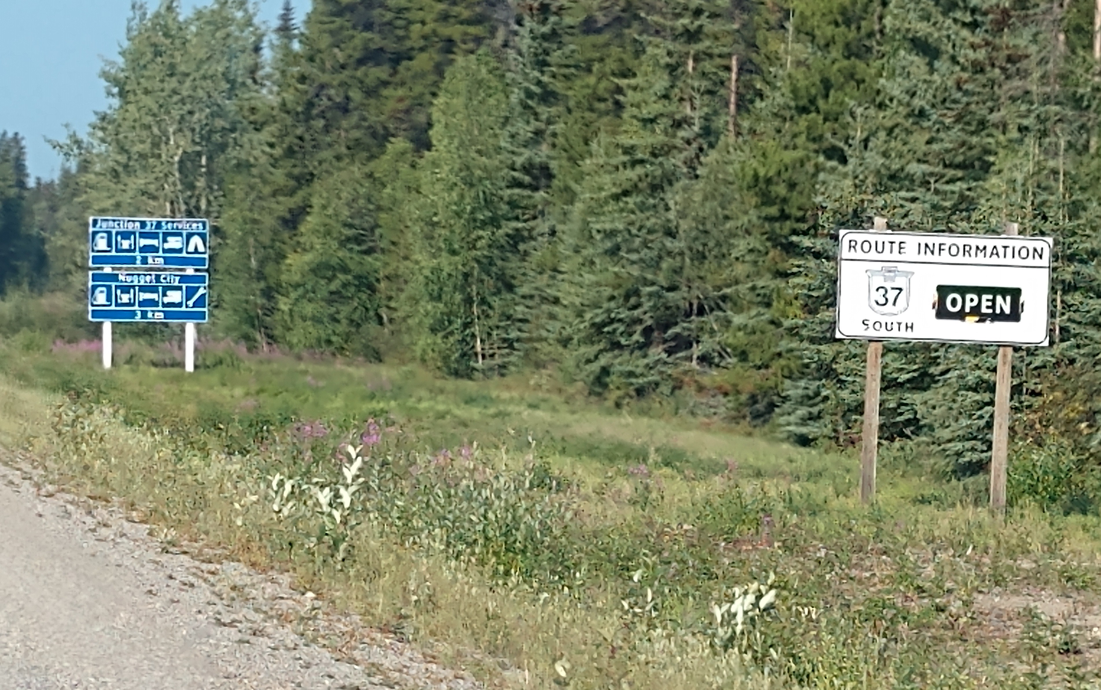
We came to a sign that says the Cassiar Highway (Hwy 37) is open today, which was good since that was the way we're traveling. It has been closed some days just recently due to fires in the area.

As we continue on down the highway, there are patches of the beautiful lavender fireweed (see above).

We take the Cassiar Highway (Hwy 37) toward Dease Lake and Stewart.


We passed the Junction 37 area and continued on.


It is 634 km (or about 394 miles) to Stewart, which is tomorrow's destination.

We have now left Yukon Territory and entered into British Columbia. Cassiar Highway appears to be mostly gravel (which surprised us).
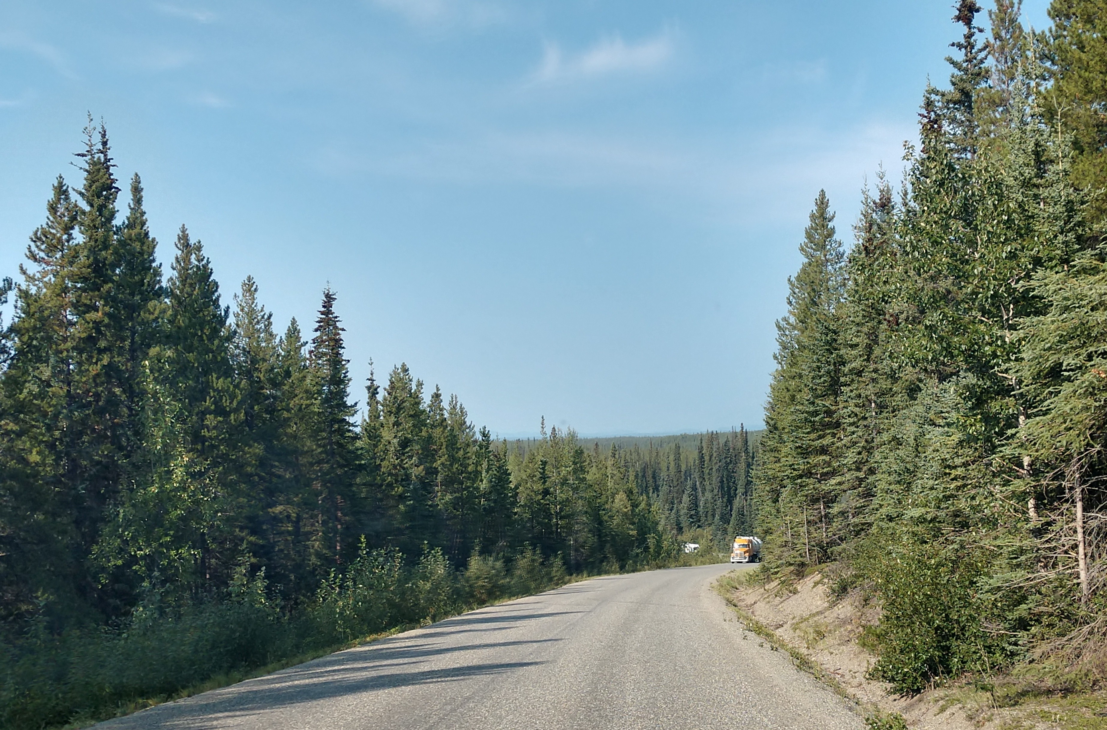
We do notice that there are a lot of fir trees along the highway and the road continually goes up and down.


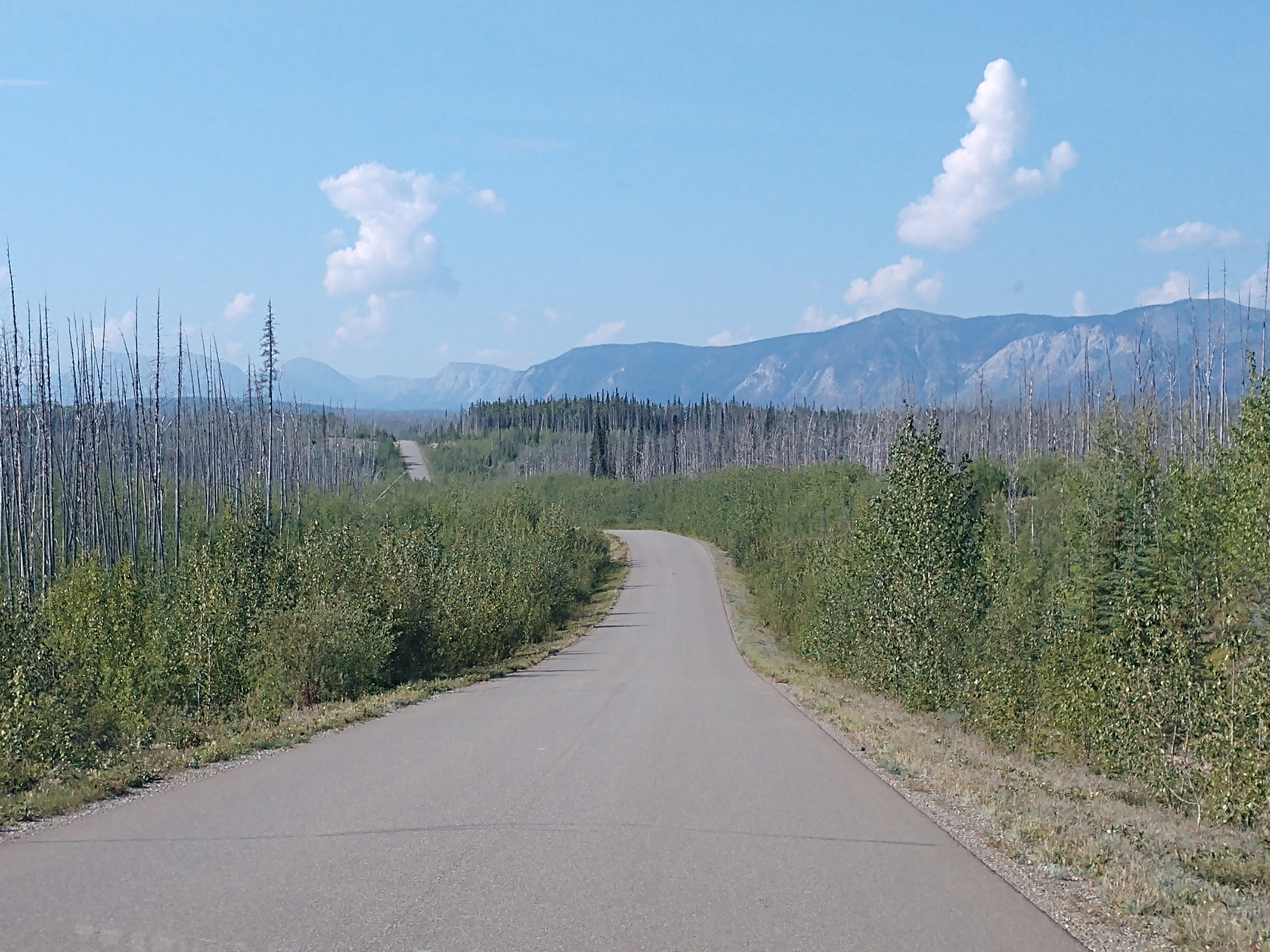
Along the way, we encountered small towns, beautiful lakes, and endless mountain views.


There were also some areas where there has been forest fires -- as you can see above and below.


What gorgeous views even though you can see the burned areas!


We're now at the Boya Lake turnoff. The Tā Ch’ilā Park offers scenic camping and a wide variety of water recreation opportunities with Boya Lake’s superb water clarity and color, beckoning the traveler to explore its many islands and bays.

Tā Ch’ilā is situated on the Liard Plain, an area carved out by glaciers 20,000 years ago. The area is characterized by long ridges, or eskers, and elongated hills, or drumlins. Boya Lake is also one of the few lakes in the north that is warm enough for swimming. The lake is noted for its color and clarity. The bottom is composed of marl, a mixture of silt and shell fragments. The crystal clear waters and aquamarine lake color are a result of the light reflecting from the marl bottom.

It is really early on our journey today (11:15 a.m.), but we decided to drive down to the Boya Lake Campground and check it out.

There are several campsites that are situated right along the Boya Lake (see above and below) that are simply spectacular. But we feel like it is too early to set up camp today, as it would make tomorrow's journey too long.


We drive back out to the Cassiar Highway and continue on.


Dease Lake is now 137 km (85 miles) away.


We keep rolling along, and are now less than a mile from Jade City.


We decided to stop briefly at the world famous Jade City. Jade City has a population of 50 and is located 71 miles north of Dease Lake on the Cassiar Highway. Jade City is not a city but a highway community made up of one jade business that specializes in jade products. Jade City earned its name as a commercial outlet for jade mined from the nearby mountains. There are several major jade mines in the Cassiar region. The mines in the Cassiar Mountain Range have produced about 1 million pounds of jade each year, and half of that is exported.


Jade City -- named for the extensive jade deposits found to the east of the community -- offers a glimpse into mining this lovely stone. With a population of approximately 20 people, the family-run jade mining operation is a stop of particular interest on the Stewart Cassiar Highway. With 40 years of history mining in the area, the owners of the Cassiar Mountain Jade Store are experts in everything from prospecting to carving it.
The huge jade boulders that visitors can see being cut here are from the Princess Jade Mine, one of the largest jade claims in the world. An extensive selection of raw jade, jade jewelry, and jade carvings crafted from local Cassiar jade can be viewed at two Jade stores. The Cassiar Mountain Jade Store and Mine sells jade direct from their mine to the public, by the pound or by the ton. They offer custom-cut jade, semi-precious stones, gold nugget jewelry, and an interactive museum.


We walked around Jade City taking it all in. I even found a few little pieces of jade to take with me.


We got to see some of the equipment that they use in cutting the jade.


We also got to see large boulders of jade (see above and below).


Shown above is a Canadian Mountie carved wooden moose just on the outside of the Jade Store. We then went inside the Jade Store to look at all the pretty jade figurines and polished stones!


Can't imagine what one of these jade bears would cost (see above and below).


Above is a totem pole and other wood carvings at Jade City.

We then walked around looking at more of the jade carving tools, and carved jade pieces.


Above is the jade carving studio.

There was lots and lots of jade, everywhere we looked there was jade.


We're now only 84 km (52 miles) to Dease Lake, and up ahead is Dease River.


The Dease River flows through northwestern British Columbia and is a tributary of the Liard River. The river descends from Dease Lake, though its ultimate origin is in the headwaters of Little Dease Creek at Snow Peak, approximately 31 miles west of the lake. The river flows 165 miles generally north-eastward, draining into the Liard River near Lower Post, British Columbia. Large sections of the river parallel the Cassiar Highway, helping to make it a popular destination for canoeists, kayakers, and rafters.

The area has a rich history. It is important to the history of Tahltan and Kaska First Nations, who continue to reside along the river. The first European known to have visited the river was John McLeod, a Hudson's Bay Company fur trader and explorer, in August 1831. He named the river for Peter Warren Dease, at the time Chief factor of the Mackenzie River District of the Hudson's Bay Company. In 1837, Robert Campbell established a Hudson's Bay Company fur trading post at Dease Lake. The community of Dease Lake has a population of approximately 650, and is the major center in the river's watershed.
In fiction, Jack London's short story, "Love of Life," has the protagonist trying to make his way to "the River Dease," where he has a cache of food and supplies hidden.


We came upon another sign indicating that Highway 37 & Highway 37A are both open.

And now we are 399 km (248 miles) to Stewart, British Columbia.


We are now crossing the Stikine River, a major river in northern British Columbia and southeastern Alaska. It drains a large, remote upland area known as the Stikine Country east of the Coast Mountains. Flowing west and south for 379 miles, it empties into various straits of the Inside Passage near Wrangell, Alaska. About 90 percent of the river's length and 95 percent of its drainage basin are in Canada. Considered one of the last truly wild large rivers in British Columbia, the Stikine flows through a variety of landscapes including boreal forest, steep canyons and wide glacial valleys.

Known as the "fastest-flowing navigable river in North America," the Stikine forms a natural waterway from northern interior British Columbia to the Pacific coast. The river has been used for millennia by indigenous peoples including the Tlingit and Tahltan for fishing, hunting and trade. It provided access for fur traders and prospectors during the 1800s and remained an important transportation route until the 1970s, when roads were finally opened to the northern interior. However, most of the Stikine basin remains wilderness, with only a few small settlements; only two bridges cross the river along its entire length. The river's salmon run supports large commercial and subsistence fisheries, and its extensive estuary and delta provide habitat for numerous fish and migratory bird species.


We have now entered the unincorporated Iskut, which has a population of 295. Iskut is a small Tahltan Native (indigenous community) on the Cassiar Highway. Iskut is the home of Iskut First Nation, a group of the Tahltan people, which also includes the communities of Dease Lake and Telegraph Creek. Two bands comprise the Tahltan Nation, the Iskut First Nation and the Tahltan First Nation or Tahltan Indian Band.


We finally see the sign for Red Goat Lodge (where we will be staying at the campground).


Red Goat Lodge's Campground is located just south of Iskut, British Columbia on the Cassiar highway, in the heart of the lakes district. Situated alongside Eddontenajon Lake in a valley of mountains, Red Goat Lodge is truly a unique resort and campground with a stunning view.


We found a spectacular back-in site right beside the Eddontenajon Lake. We get set up on site #10 for one night at $34 CA per night ($24.65 US).


What beautiful views right from our campsite.


Above and below are views of the Eddontenajon Lake from our camper window.


Mel gets his lawn chair and finds a spot to enjoy the lake (see above and below).

Tonight we were lulled to sleep by the gentle lapping of the water against the lake's shore.
Shirley & Mel


No comments:
Post a Comment