Thursday, August 3, 2023
Today we're leaving Skagway and heading back to the Yukon Territory. It's cloudy and 56 degrees when we leave around 8:30 a.m.

The United States Customs Checkpoint is located 7 miles up the road from Skagway.

Above is the Skagway Checkpoint and because we are leaving the United States, we do not have to stop -- instead we drive on by the backside of it. However, we will be stopping at the Fraser BC/Canada Checkpoint a few miles down the Klondike Highway.

The Klondike Highway provides a unique perspective of glacial lakes, rugged mountains, and cascading waterfalls. We are hoping to see these on our drive today.


Before reaching the Canadian border, there were several waterfall sightings along the way. To the right and across the valley, Pitchfork Falls (see above) flows from Goat Lake, and the cascade is one of the most photographed spots in the area. Even though it is a bit cloudy today, we caught a glimpse of Pitchfork Falls as we drove by. Pitchfork Falls was named after the pitchfork wielded by the infamous Devil Man that lived in a hut beneath the falls during the Klondike Gold Rush.

Pitchfork Falls is a 2,000-foot cascade into the Skagway River, viewable from the Klondike Highway between Skagway, Alaska and the border with British Columbia. The falls tumble down the mountain from Goat Lake, going underneath a railroad bridge of the White Pass and Yukon Railway and down to the Skagway River gorge.

The above storyboard told us about White Pass City. What today looks like a pristine valley 12 miles up the South Klondike Highway was actually the site of a tent city during the gold rush. It was the last major stopping point before the ascent to the summit of the White Pass. The valley provided one of the first flat sections of trail where a stampeder could spread out and pitch a tent before heading up the Dead Horse Gulch.

(Photo of White Pass City.)
The town existed for a total of two years. It consisted mostly of tents and offered 17 saloons, one for each building. One hotel in the valley called the White Pass Hotel could sleep up to 50 men at a rate of $1 per night. Many stampeders were glad to pay the fee as to not sleep outside for a night. White Pass City was also chosen as a construction crew quarters for the railway workers. When the train reached the summit in February of 1899 the city was deserted almost as quickly as it was created in 1897.

The storyboard above told us about Deadhorse Trail. When the trail was opened by Captain William Moore it was designed for lightly loaded horses and experienced horsemen. It was not designed for the hordes of gold seekers who were bombarding the trail.

(Prospectors loading supplies on pack animals as they head north up the trail.)
Within one year of the discovery of gold in the Klondike thousands of people had attempted to cross the trail. Animals were brought up to Skagway on the same steamships that carried people and freight. Ship conditions were very harsh for everyone. Some animals were forced to stand for two weeks straight and did not get the luxury of food and water. If they did not die on their way to the Skagway they were killed in accidents, shipwrecks, or on the trails.

(A procession of men with their horses carrying bales of hay up the trail.)

(3,000 animals died along the White Pass Trail giving it the nickname, "the Dead Horse Trail.")
Horses, mules, oxen, sheep, and dogs were loaded down, forced to wait in long lines, and exhausted by the trail leading over the pass. It was not uncommon for the trail to be blocked by a fallen horse.There were often long periods of waiting in lines on the trail. Stampeders refused to unload their horses that were weighed down with hundreds of goods as to not waste time reloading them.

A short distance up the road, Bridal Veil Falls cascades next to the highway on the left (see falls above and below). The misty Bridal Veil Falls along Klondike Highway in Skagway is one of the area’s top roadside attractions and best waterfalls in Alaska, fueled by a tributary of the Skagway River. From the pulloff on the highway, it’s possible to see a portion of the falls that drop approximately 50 feet into a rocky pool.

On the other side of the highway the water flows through a tube and on down the mountainside.


You can see that the heavy fog is setting in as we near the Captain Moore Historic Bridge that we saw on our way into Skagway as well.


We continue on along the Klondike Highway going North. We are now crossing the William Moore Creek.

And then at around mile 14, we reached the summit (see above). But the foggy conditions kept us from seeing any sign of it today. (Below is what the summit elevation marker would have looked like if we could have seen it.)


(The summit of the White Pass Trail in the spring 1899.)
At the Summit, the highway tops out at 3,290 feet. The conditions at the summit were very harsh for gold seekers passing over the border into Canada. During the summer months millions of mosquitoes used these lakes as breeding grounds. In the winter it could snow up to 200 feet on the pass with wind chills at -80 degrees F. These weather conditions made the summit uninhabitable by most people. The North West Mounted Police stationed at the summit of the White Pass lived in very rough conditions. Expecting trouble from stampeders, they came equipped with machine guns. Their job was to collect duties and customs to be paid to the Queen of England. At the time, Canada was a colony of the British Empire.


The Tormented Valley is an exceptional landscape that consists of wind-battered rocks, a sparse forest of 300 year old trees, and sparkling blue lakes. Despite the name, the Tormented Valley is beautiful. This sub-arctic alpine tundra is one of the most unique ecosystems in North America.

About 19 mile north of Skayway, we begin to see Summit Lake (see above and below). It is a tranquil high-mountain lake surrounded by forests, mountains, and wildlife that runs along the Klondike Highway.
.JPG)
Fortunately, enough clouds lifted and shifted around at the right time to provide some unforgettable sights of Summit Lake.
.JPG)
Just before we leave Alaska and go through the international border area at Fraser, we saw the "Welcome to Alaska" sign (see below). The scenery would have been majestic to see behind this shroud of fog, but that wasn't going to happen today.
.JPG)
.JPG)
Also at this stop, there was the Klondike Highway commemorative marker (see above). The State of Alaska's Transportation and Public Facilities departments erected a stone and plaque structure on the Klondike Highway for the 100th anniversary of the 1898 Gold Rush. The marker lies between Skagway, Alaska and the Canadian border town of Fraser, British Columbia. Also here is a cairn set up by the Kiwanis Club (see below).
.JPG)
The storyboard below told us information about the international border.


The sign above reminded us to change our clocks as we left Alaska (we lost an hour).

We are arriving at the Fraser, BC Canada Customs.


Easy customs crossing -- we arrived at 9:25 a.m. and were through the crossing by 9:40 a.m. The questions asked were easy, there was just a lot of traffic going through customs including several buses.

Fraser is also where buses bring passengers to get aboard the White Pass & Yukon Railroad for a popular sightseeing train tour that runs between Skagway, Alaska and the White Pass Summit, and vice versa.


We are now heading to Carcross, which is about 41 miles away.

The clouds and fog have cleared and we can see the beautiful scenery.

We are now 23 miles from Carcross.


We crossed Dall Creek.

The Southern Lakes region is a gem of the Yukon. Mountains crested with glaciers meet clear blue lakes, and endless boreal forests sit in between. The network of lakes, rivers, and glacier streams form the headwaters of the mighty Yukon River, and the area’s network of waterways and trails form a backcountry playground for adventurers.
Several small communities, rich with history, make this scenic area home. During the fur trade, the Southern Lakes region was an important region for trade between the coastal Tlingit people and the inland Kaska and Tutchone peoples. The Tagish people, whose traditional territory lies in the Southern Lakes region, became the middlemen in this trade relationship, and adopted many customs of the Tlingit. During the Gold Rush, the Southern Lakes region was a transportation center for goods and people moving north into the Klondike.


Another glimpse of the Venus Mine which is located in the southern part of the Yukon on the west side of Windy Arm which is a part of the Tagish Lake system and Tutshi Lake. We had seen this on our way into Skagway a couple of days ago.


Continuing on, we pass the turnoff for Conrad Campground.


We're almost to Carcross.


We cross the Natasaheeni Village road, and then see the Carcross sign (see below).


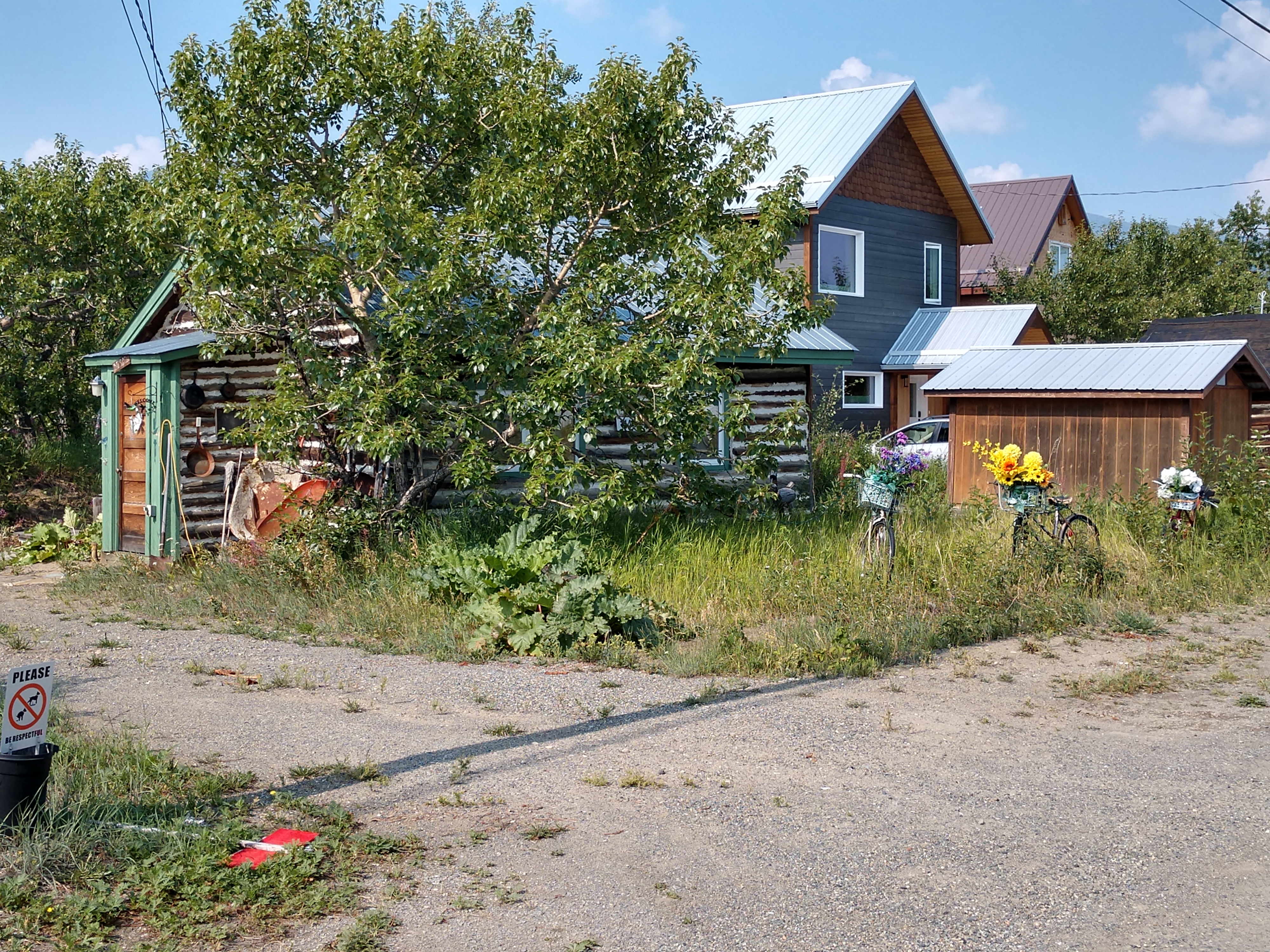
We are now driving into Carcross. Carcross has a population of 504, and an elevation 2,175 feet. The name Carcross is a shortened from Caribou Crossing. The town is located at a point long used by Indians for caribou hunting. During the gold rush, especially after the railroad was built, the town grew. It became a supply center for riverboat accessible destinations on the surrounding lakes. A fleet of sternwheelers serviced these lakes for many years. Several totems located downtown were carved by Native carver Keith Smarch, who also runs the carving studio in Carcross.

Historic Carcross was formerly known as Caribou Crossing because of the large numbers of caribou that traversed the narrows here between Bennett and Nares Lakes. In 1904, Bishop Bompas – who had established a school here for Native children in 1901 – portioned the government to change the name of the community to Carcross because of confusion in mail services due to duplicate names in Alaska, British Columbia and the Klondike.
Carcross became a stopping place for gold stampeders on their way to the Klondike goldfields. It was a major stop on the White Pass and Yukon Route railroad from 1900 until 1982, when the railroad ceased through train service. In the early days, passengers and freight transferred from rail to sternwheelers at Carcross.
The vast majority of the 300 or so people that live in Carcross are members of the Carcross/Tagish First Nations tribe. They had recently built a trading post/tourist area a few years ago and had painted the buildings in beautiful native motifs. There were also huge totem poles built depicting area animals.

We begin our Carcross walking tour in the Carcross Commons area by looking at all the beautiful totem poles.


The storyboard below told us about the Carcross/Tagish First Nations tribe and their totem poles. Skookum Jim Mason (Keish) had this house built in 1899, just after he discovered gold near Dawson City, an event which sparked the Klondike Gold Rush. He imported the lumber and furniture, and had them shipped from Skagway to Lake Bennett by White Pass & Yukon Route and then by raft to Carcross.

Skookum Jim (Keish) died in 1916 and Johnnie Johns bought the house in 1920. Johns did not live in the house, but held it in trust for the Wolf (Dakl’aweidí) Clan. When the original Skookum Jim House collapsed during renovations around 1987, Joe Schinkel built a replica to honor the memory of Skookum Jim Mason (Keish) in the same year. The house remains the property of the Daḵl’aweidí Clan within the Carcross/Tagish First Nation. The building has been renovated and moved to downtown Carcross, where it is the cornerstone of the Carcross Commons development. The exterior mural was designed in the coastal tradition by Tlingit artist Keith Wolfe Smarch and painted by Bill Oster.


According to historical documents, men were already prospecting for gold in Alaska and Yukon before Skookum Jim's find, but none of their finds were as large as Skookum Jim's. It is one of the biggest gold strikes in history to date, and was the strike that sparked the famous Klondike Gold Rush of 1898. His discovery was made close to what is now called Bonanza Creek.
Skookum Jim was born in 1856 to Tagish Chief Kaachgaawa and his wife Gus'duteen. He was born with the name of Keish, which was given to him by his clan, the Wolf Clan. Keish was influenced to change his name to Jim Mason by a man named George Carmack, whom he met while working as a Chilcoot carrier. The carriers would transport food and other supplies from Skagway, Alaska, to Dawson City, Yukon for a prospector named William Ogilvie, and were named after a treacherous pass in one of the highest mountain ranges in Alaska. Skookum was added to Jim's name, because of his physical strength. The word Skookum in his Tagish language means strong or husky. George Carmack later married Skookum Jim's sister Kate, and became a partner in Jim's find.

(Photo above is Keish, aka Skookum Jim Mason in 1898. Keish is today credited with making the gold discovery that led to the Klondike Gold Rush.)
Jim's fortunes changed when Carmack and his wife left Whitehorse to travel down river to trap and search for gold. They were gone for quite awhile, so the family sent Skookum Jim and his nephew, Charlie, to search for them. Since there are many conflicting stories about Jim's gold discovery, the film is based on the account of two people, Patsy Henderson and William Ogilvie, whose records of the event are similar.
Before Skookum Jim found his sister and brother-in-law, he and his nephew ran out of supplies and food, so they decided to get some good timber to float down river to sell to a sawmill at Forty Mile, Yukon, a small establishment along the Yukon River. They located George and Kate close to where they were gathering the logs.

They all decided to search for gold in the area of Rabbit Creek - the name was later changed to Bonanza Creek. In the beginning all that the group found were small amounts of gold deposits, too small to record. So they continued to search for trees to cut down and get ready to sell to the sawmill.
To provide for the group, Skookum Jim set off to hunt; he shot and killed a moose. While waiting for the others to get to the dead moose, Jim went down to the creek for water and his eyes fell upon huge quantities of gold. Because Jim was an Indian he did not have the right to record the claim, so he worked out a deal with his brother-in law, Carmack, to split the find. His nephew, Charlie, also claimed part of the stake.
George and Charlie put a piece of gold in a rifle shell cartridge and headed to the sawmill at Forty Mile while Jim stayed behind to guard the find. News of the discovery traveled fast and the three men were treated like royalty. Jim became wealthy and for a time he enjoyed the benefits. He traveled great distances as a prospector and to market with the gold he'd discovered, and for a time Jim even found his way to Seattle, Washington.
Skookum Jim was generous to everyone and while living in Seattle, Jim sat in a hotel room and threw bank notes and gold pieces out of his window to passers-by below. He then sat back and laughed as people scrambled to pick the gold and money from the ground.
After moving back to Yukon, Jim built an expensive house with some logs he had shipped from Alaska. In 1912, he hostedthe last big potlatch in Carcross, Yukon. People came from many miles to enjoy the two-week-long celebration. More than $2,000 and other gifts were given out to the guests.
Skookum Jim continued to prospect for gold; his success depended on the fact that he was able to leave for his search with nothing but a rifle, a hatchet and a gold pan. He travelled lightly, so he was able to travel great distances on foot. Jim, who married briefly, had a daughter called Daisy, with whom he maintained a close relationship. In 1900, Carmack sold his portion of the gold claim to Skookum Jim who had by this time bought out his nephew's claim. In August of 1904, Jim sold all three claims to the Lewes River Mining and Dredging Company. A year later Jim established a trust fund for his daughter.
Skookum Jim died of a kidney ailment in 1916. While he left money to his daughter, his sister Kate, and his brother-in-law George, Jim's will outlined that the needs of the Indian people of Yukon be looked after, so the Skookum Jim Indian Fund was formed.

Above is the SS Tutshi Memorial – the partially rebuilt hull of the old sternwheeler remains as a memorial after the SS Tutshi burned down in July 1990.
The sternwheeler Tutshi was built in 1917 to accommodate the increasing number of tourists visiting Yukon’s Southern Lakes. When tourism waned, the S.S. Tutshi was kept busy carrying mail and freight to mines and small communities. The completion of all-weather roads in the 1940s ended the era of the sternwheeler and the S.S. Tutshi was decommissioned in 1955.

The above storyboard told us about the S.S. Tutshi. She’s a burned out hulk now, and her ruins lie in Carcross where she was built. In her day, the steamer Tutshi was a class-act of the Yukon riverboat fleet. The S.S. Tutshi was one of the largest riverboats in the Yukon. Weighing in at just over 1,102 tons, she was built in Carcross in 1918 by the White Pass Company, for the run between here and Graham Inlet on Tagish Lake. The Tutshi had a crew of 29, and could carry 135 passengers. She started out as a wood-burning vessel, but was converted to oil power when she began carrying tourists to Ben-My-Chree, beginning in the 1920s.
Ben-My-Chree at the southern tip of Taku Arm was the garden site of the North. Tourists flocked there onboard the Tutshi to see the incredible gardens created by Mr. and Mrs. Otto Partridge. They imported plants and trees form around the world, and were hailed as the North’s most creative botanists.
Carcross, where the Tutshi was built, was first known as Caribou Crossing because of the large herds of caribou to cross the narrows here. In 1903, Bishop Bompas asked the Canadian Government to rename the community Carcross because of the confusion in mail service between the Yukon town and those with similar names in both Alaska and British Columbia. The Government made the change in 1904, but the White Pass Company continued to use the name Caribou Crossing until 1916.
The Tutshi was beached on the shores of Carcross in 1972, and restoration by Parks Canada began in 1977. The work was carried on over the years, but there was never enough money to install a proper sprinkler system on the boat. In 1991 she went up in flames in what was considered an act of arson, though no one was ever charged with the offense.


The display is quite nice with a lot of storyboards. We walked around looking at various displays for awhile.


The storyboard above told us about adapting to changing times. The Carcross and Tagish people gathered at Tagish and the mouth of the McClintock River to trade and fish, and camped by the Natasaheen River when the Woodland Caribou migrated across the river. The Klondike Gold Rush brought tremendous change to the area as trees were cut for boat building and later railway ties and barges. The sternwheelers needed wood for fuel and camps were set up around the lakes to supply fuel for the boats. Increasing population and development affected the local caribou herd which moved out of the area.
The Natasaheen River and Nares Lake remained a good place to fish and hunt for birds, and the local people were attracted by new opportunities for employment. Johnnie Johns became famous as a world-renowned outfitter and employed many First Nation guides in his business. The sternwheelers hired local deckhands, and wood camps employed seasonal workers who could still spend most of their year on the land. The sternwheelers stopped at camps around the lake to obtain fresh fish for their elegant menus. One woman made between $300 and $400 in the summer of 1931 supplying fish to the Tutshi.

The above storyboard told us about the crew of the S.S. Tutshi. “Scotia Mac” John McDonald joined the BYN Co. after working on a number of steamers for numerous organizations starting in 1896, mostly on Kootenay Lake in British Columbia. In 1902, MacDonald worked on the sternwheeler Scotia on Atlin Lake as a mate. He eventually earned the position of captain of the Tutshi, as well as a reputation as a jokester and a storyteller.
While at Ben-My-Chree, he was rumored to have told some tourists that red cabbages had been “struck by the northern lights.” His love of pranks resulted in embarrassment for the captain once when he decided to nudge a sandbar in order to frighten the passengers and ended up getting stuck. The passengers danced though the night as the crew worked to get the Tutshi off the bar.
The deckhands were hired locally. They handled the lines, kept the deck clean, filled the water barrels on the deck, manned the life boats and fire hoses and occasionally helped the waiters clean the tourist cabins. The deckhands and the firemen lived in the engine room cabins. The rooms off the freight deck were occupied by the waiters and cooks. Many of the waiters on the WP&YR steamers came north from the lower mainland of British Columbia. The work was attractive to university students who could earn enough money to pay tuition and live in comfort for the rest of the year. Due to the intensity of the Tutshi’s schedule, a crewmember only had three hours in Carcross between runs to Ben-My-Chree.


We continued to walk around looking at the S.S. Tutshi.


The above storyboard told us about Tutshi Mechanics. The first steamboat, tested in 1807, was heralded as “the wonder of the age”. The technology was developed and refined until a powerful steam engine, mounted on the light frame construction of a shallow hull, drove a side or stern wheel vessel. This became the pioneer form of river transportation in many parts of the world. Steamboats convert water into steam in the boiler and it travels through pipes to the engine where the heat is converted into mechanical energy. A closed cylinder contains a large piston which moves back and forth depending on changes in pressure on each side of it. A crank and connecting rod (or pitman) attached to the paddlewheel converts the reciprocal motion of the piston into rotary motion to power the paddlewheel.
Paddlewheelers had little room in the hull for mechanical systems so almost everything was mounted on the deck. The boilers and cylinders were placed in a horizontal position to accommodate the space. The machinery and firewood on a large boat took up enough space that another deck was needed to accommodate the crew and passengers. The boat was navigated from the wheelhouse where the pilot could see to negotiate shallows and snags.


We continued looking around. Below we saw where the fire had burned destroying the ship.


The above storyboard told us of the Boats of the Southern Lakes. The Yukon steamers were all sternwheelers rather than sidewheelers. The paddlewheel at the rear of the boat allowed grounded steamers to wash sand away from the hull by reversing their engines. Sternwheelers had a narrower beam enabling them to negotiate smaller channels and they did not require special docking facilities. The Bennett Lake and Klondike Navigation Company sternwheelers were called the “mosquito fleet”.
Two of these little boats were sent through Miles Canyon and White Horse Rapids and were the first to offer scheduled trips between Dawson and Whitehorse. The John Irving Navigation Company operated the Gleaner on Bennett and Tagish lakes and the Scotia on Atlin Lake. The boats offered a through transportation route to the Atlin goldfields and on July 30, 1899 the Gleaner arrived in Bennett with $240,000 in gold dust. John Irving’s company was taken over by the BYN in 1901. The BYN Co. sternwheelers were modeled after the “swift water” vessels that operated on the Snake, Williamette, and Upper Columbia rivers. The Yukon River boats had flat bottoms and used rudders while lake boats, like the Tutshi, had narrower and deeper hulls and a keel. The Tutshi had rudders attached behind the stern wheel (“monkey rudders”) in 1952.

The above storyboard told us about the freighters on the Southern Lakes. The first southern lakes sternwheelers were constructed on the shores of Lake Bennett during the Klondike Gold Rush. They carried freight and passengers from Bennett City to Canyon City at the head of Miles Canyon just upstream from presentday Whitehorse. Before the railway was completed around Lake Bennett, the lakes steamers Bailey, Gleaner, Clifford Sifton and Reaper were on constant duty transporting rail for the construction crews. The end of steel in Whitehorse connected to the Yukon River sternwheelers. Dissatisfied with the efficiency of the system, WP&YR set up the British Yukon Navigation Company (BYN). It purchased the Canadian Development Company sternwheelers on the Yukon River and the assets of the John Irving Navigation Company which operated boats on Lake Bennett, Taku Arm and Atlin Lake. As the stampede waned, many sternwheelers were taken through Miles Canyon and White Horse Rapids to run between Whitehorse and Dawson. The remaining boats worked out of Carcross to supply the growing mining communities in the southern lakes.


The above storyboard told us about the WP&YR and Carcross. Construction of the WP&YR railway began on May 28, 1898 at Skagway and took 26 months to complete from tidewater Alaska to Whitehorse, Yukon. The rail line reached Bennett City, on the south end of Lake Bennett, on July 6, 1899. Land was surveyed at Carcross for railway yards, a depot and a good sternwheeler landing. The lake steamers hauled passengers and freight from Bennett to Carcross where the stream of traffic continued on to the Dawson or Atlin goldfields. A construction camp of tents grew up at Carcross and the Red Line Company was established here in anticipation of rail construction between Carcross and Whitehorse.
Shippers were relying on the railway even before it was completed. A 492 feet by 39 feet corrugated iron warehouse was built at Carcross and WP&YR built barges to transport heavy commercial and construction freight across the lake. Locomotives made their first official stop in Whitehorse on June 8, 1900. The formal celebration was held in Carcross when the last spike connecting the rail lines from Bennett City and Whitehorse was driven in on July 29, 1900. Following the gold rush, Carcross thrived as an important center, supplying the mining communities of Tagish and Atlin lakes, and WP&YR promoted the tourist industry on the southern lakes.

The above storyboard told us about safe harbors. Tagish Lake contains a number of reefs and sand bars especially at Golden Gate where Taku Arm and Taku Inlet meet. Tagish and Bennett lakes are prone to fierce winds and in the fall of 1933 a heavy wind blew the Tutshi broadside against the ice, damaging the hull. The Natasaheen River, connecting the two lakes, provided a protected harbor where the Carcross-based boats could wait out the winter.
The Tutshi was often left sitting in the water for the winter as the narrows by the railway bridge does not freeze. The boats were taken out of the water for repairs and could sit on the “ways” for the winter. Ways are the dry-dock assemblage of sliding boards and timbers used to haul big boats out of the water. Four steel cables were wrapped around the steamers with wooden pads protecting the hull. The cables were attached to four horsepowered capstans which moved in unison to winch the boats evenly up the ways. The boats sat on “butter boards” which slid over the timbers, greased with tallow.


Above is a plaque erected in 2000 to Skookum Jim. It says: “Skookum” Jim, a Tagish of the Dakhtawedi clan and the Wolf moiety, found a nugget on Rabbit (Bonanza) Creek in August 1898 that began the Klondike Gold Rush and changed the history of the Yukon Territory. He made the discovery while on a journey down the Yukon River to find his sister Kate and her husband George Carmack. Renowned for his legendary exploits and physical abilities, “Skookum” (strong) Jim believed his Frog Spirit had guided him to the gold. He became very rich, but remained a generous man who never forgot his obligations to his community.

Above is the White Pass & Yukon Route - Golden Spike Centennial marker. The inscription says: The golden spike was driven to mark the completion of the White Pass & Yukon Route Railway on July 29, 1900. It was the beginning of a fully integrated rail transportation system – which grew to include lakes & river steamboats, stage lines, aircraft, bus lines, trucks and container ships. One hundred years later – on July 29, 2000 a new ceremonial spike was driven to honor the courage and dedication that built the first northern railway and to pledge a commitment to a second century of service.


Above are two pictures of the Duchess locomotive built in 1878.

Above is a storyboard that told us about the Duchess: "The little engine known as the Duchess was once part of a matched set. She and her partner, the Duke, were built in September 1878 for the Dunsmuir & Diggie Company. For a time the two little locos hauled coal for the Wellington Colliery Railway. The Duchess also burned coal at that time, although she was converted later to wood & later still to oil. White Pass bought the little engine in 1899 and put her to work on the Taku Tramway the following year.
On July 18, 1900 the Duchess pulled the first load across the portage. Appropriately enough, the Taku Tram was a miniature version of a railway, only two miles long, which connected Tagish Lake with Atlin Lake. At $2 for 2 miles, it was the most expensive trip in the world. Passengers rode amidst packages and cargo, stamping out cinders and sometimes asked to help push the train the last part over the hill where the grade was 7%. And, since there was no turntable at the eastern end, the return trip was made going backwards.
The Duchess was taken out of service in 1919 when she was replaced by Engine No. 51 (one of the two original Baldwin engines built for White Pass.) In 1932 the other engine, No. 52 was brought there.

The plaque above, White Pass & Yukon Route - The Golden Spike had an inscription that told us: Construction of the White Pass & Yukon Railway began on May 27, 1898 at Skagway, Alaska during the height of the great Klondike Gold Rush. Undaunted by those who said the railway could not be built a small group of devoted White Passers composed of contractor Michael J. Heney, chief engineer “F.C.” Hawkins, assistant chief engineer John Hislop and the railway’s first president Samuel H. Graves pushed the work to completion. After overcoming almost insurmountable construction problems the last rail was laid at this spot on July 29th, 1900. On that day “The Golden Spike” was set in place and with a cheering boisterous crowd of Alaskans and Yukoners in attendance, Samuel H. Graves drove it home. The job was done. To the thousand’s of men who gave their strength, and talents to the construction of the White Pass & Yukon Railway this plaque is respectfully dedicated on the 65th anniversary of the White Pass & Yukon’s “Golden Spike” - July 29th, 1965 Carcross, Yukon.

The Caribou Hotel (shown above and below) dates to 1910 and is one of the oldest buildings in the Southern Lakes region. The original building was moved here from Bennett City on a scow by the owner, W. A. Anderson. In 1903, Dawson Charlie (Káa Goox) purchased the hotel from Anderson. Charlie was a member of the Carcross/Tagish First Nation and one of the co-discoverers of gold in the Klondike.

He named it the Caribou Hotel and the business prospered under several different managers. Dawson Charlie died in 1908 and his heir, Annie Auston, leased the hotel to Edwin and Bessie Gideon, until it burnt to the ground on Christmas Eve, 1909. The Gideons rebuilt the hotel using material salvaged from a building in Conrad City. They continued to run the hotel until Mrs. Gideon died in 1933. Her ghost is said to roam the third floor.

Over the years, the hotel has provided accommodation for locals, miners, tourists and visiting dignitaries. Johnnie Johns, a world renowned big game hunter, had a long relationship with the hotel and many of his clients stayed here.

(Inside the Caribou Hotel.)
The hotel was also known for Polly the parrot, who lived here from 1918 to 1972 and entertained the guests with his renditions of “I Love You Truly” and “Springtime in the Rockies”. The Caribou Hotel is a designated Yukon Historic Site. The current owners are undertaking restoration work.

Above is a replica of "Polly the Parrot," while below the sign told us that this saloon was called "The Surly Bird Saloon." The Caribou Hotel has been home to a number of famous characters including Polly the Parrot—who was a yellow-naped green amazon parrot that resided at the hotel from 1918 until his death in 1972, and was known for singing opera, drinking whiskey and cursing in foul language. The Caribou Hotel’s “Surly Bird Saloon” is named in Polly’s honor. Bessie Gideon died in 1933, five years to the day after her husband’s death on October 27th. She is a hospitable spirit who refuses to leave the premises and has been known to look after her guests by knocking on doors and adding bubbles to baths. She has been seen peering out of a third floor window with her beloved parrot, Polly. Canada Post honored Bessie Gideon and the Caribou Hotel with a Haunted Canada Postage Stamp in 2015. The Caribou Hotel is a designated Yukon Historic Site.

The Matthew Watson General Store (shown below,) is one of Yukon’s longest operating businesses. Following the 1909 fire that destroyed much of downtown Carcross, the store was reconstructed using two buildings retrieved from the dwindling mining communities of Conrad and Bennett. Matthew Watson was a prospector who had traveled over the Chilkoot Pass in 1899. He bought the store in 1911 and carried general merchandise and miner’s supplies; he also outfitted hunting parties. Watson and his descendants continued to operate the store until 1982, when it was purchased by Stan and Jean Tooley. When the Tooleys took over, the store still contained elegant top hats in silk-lined boxes and dusty jars of liniment promising cures for everything from
sprains to baldness.

The storyboard below told us that on December 24th, 1909, fire swept through Carcross and destroyed many of the prominent buildings, such as the depot, caribou Hotel, and general store. The Caribou had been an established hotel for some time and was once owned by Dawson Charlie, a local Tagish Indian man and one of the original discovers of Klondike gold.

The hotel and rail depot were both rebuilt the following year, although the new train station, which stands today, is in a slightly different location than its predecessor. It is believed that the Matthew Watson store was originally two small buildings that were made into one composite structure. The original buildings were probably transported from the community of Conrad after it was abandoned. Other buildings here in Carcross were brought from Conrad as well. The original Matthew Watson, as well as being a store owner, was Agent to the Mining Recorder for many years. He bought the store in 1911 and was listed in a 1915 Gazateer as having "General Merchandise, Miner's Supplies, and Guides for hunting parties". Watson's family ran the store for many years and it is still open today, making it one of the longest established businesses in the Yukon.

Above is inside the Matthew Watson General Store, while in the next few pictures below are several books that are available for sale in the store. Many of which I want to get my hands on to read.


The White Pass & Yukon Route Railroad Depot Complex (shown above) was built in 1910, following a fire that destroyed the original depot. The WP&YR ran a passenger and freight railway from 1900 until 1982. The warehouse behind the depot was used for freight storage in later years. The wharf was used for the sternwheelers and gas boats that ran on Windy Arm and Bennett Lake. In 2006, the line between Skagway, Alaska and Carcross reopened as a scenic railway attraction, ending at the WP&YR railroad depot. It is a designated Heritage Railway Station of Canada.

There were several interesting storyboards inside the White Pass & Yukon Route Railroad Depot Complex (as shown above and below).


At over 410 feet, this swinging bridge (shown above and below) is a railway bridge that was built in 1900 by the Puget Sound Bridge and Dredging Company, under contract for the WP&YR. The bridge was designed so that the 151 foot midsection could pivot on a central axis, allowing large boats to pass on either side. Commercial navigation dwindled after the railway began operating and the swing span was opened only a few times before it was permanently closed. In 1969, pilings were set under the bridge to increase its load tolerance. The bridge is still used by the WP&YR.


Shown above is the Bobby Watson House. Jack Pooley, who worked at the Venus Mine, built this house in 1903-1904. He sold it to Matthew Watson in 1914, who lived here with his family. The house remained with the Watson family for many years, although they rented it out for a variety of purposes. In the 1920s, it housed the North West Mounted Police barracks and was fitted with a jail cell.
Between 1939 and 1941, the school principal, Rev. H.C.M. Grant, and his family lived here. Bobby and May Robson ran a tea room and barbershop out of this house from about 1948 to 1950. The RCMP had a barracks here again in the 1950s. Around 1955 it became the year-round home of Bob and Nellie Watson, Matthew Watson’s son and daughter-in-law. It remains a private residence today.

Above is the Simmons House (along with the two next pictures below). This house was moved from Conrad City to its present location by Leo Simmons, a local mink and fox rancher. Simmons owned this house with his wife, Grace. In later years she was affectionately known as “Ma Simmons”. They raised three children here: James Aubrey, George and Gladys. James Aubrey became the member of Parliament in the 1950s, George started Northern Airways in Carcross in the 1930s, and Gladys worked with George. The building of the Atlin road, in the 1950s, shifted George’s business interests from aviation to trucking. George married Emily Hill in 1948 and they lived most of their married life here. When George died in 1985, Emily continued to live here seasonally until she passed away in 1996. Today the Customs Office is closed, but hosts birds shelters that you can see below.


Below is the Post Office. The first post office opened in Carcross in 1902 in a building located at this site. The original building also served as a telegraph office and the North West Mounted Police detachment. The first postmaster was W.J. Scott. The current Carcross post office building has been in use since it was built in 1910. It is the longest, continuously used post office building in Yukon.

Below is Tommy Brooks Cabin. Tommy Brooks, a prospector and poet of some fame, lived in this tiny house from the late 1920s to the early 1960s. Poor health forced him to leave his beloved home for a seniors’ residence in Whitehorse. In 1989, Albert Peterson and his wife, Jennifer Stephens, bought and renovated the house. Albert painted many fine pieces of art in the small living space of this special cabin. It continues to be a private residence.

Below are some old warehouse buildings in Carcross.

Below is the Phelps House. This log structure was built in 1905-1906 for the American entrepreneur Colonel John Howard Conrad, who won and lost many fortunes over his long life. As president of the Conrad Consolidated Mining Company, he invested heavily in the Windy Arm Mining District, mining silver ore in the region. Beginning in the early 1900s, he shipped about 50,000 tons of ore from Conrad City. By 1912, the price of silver was low and Conrad was forced into bankruptcy. Instead of paying his debts in cash to Whitehorse lawyer, Willard Phelps, Conrad deeded his Carcross property. This building once housed Conrad’s office and living quarters, and provided accommodation for workers at the Conrad mines. The property remains within the Phelps family.

Below is the Erlam Cabin. This cabin was built as a residence around 1910. It was owned by lawyer Willard Phelps and rented throughout the 1930s and 1940s. Bob Erlam, owner and editor of the Whitehorse Star newspaper, owned the cabin for over 15 years beginning in the 1980s. It continues to be a private residence.

Below is the Watson Cabin. This single-story log cabin dates to the early 1900s and was one of several properties owned by Matthew Watson. It was available for rent on a seasonal or year-round basis and, over the years, many prominent Carcross residents lived here, including Robert Watson, Millie Jones and Johnny Williams. Other occupants reflect the colourful history of Carcross and it is rumored that is was once used as a brothel. The 1950s Chevy pickup truck parked outside belonged to Jack McMurphy, the owner’s grandfather. The cabin continues to be a private residence.

The next pictures below is the Jones Cabin. This cabin was built in 1938 with logs that came from a circa 1902 home in Conrad City. Alf Dickson constructed the cabin as a guesthouse and rental unit beside his larger, log home. Around 1940, Herman Peterson, a pilot with Northern Airways in Carcross, documented some of the community’s history in a makeshift darkroom in the back of the cabin. Don Jones purchased the cabin in 1952 and since, it has been renovated and is used as a seasonal residence.
Below is Miss Matthews’ Cabin. This home was built by a Mr. Kennedy from Conrad City in 1905. Around 1907, when Conrad mining operations slowed to a halt, Kennedy left the Carcross area. Matthew Watson acquired the cabin in 1910 and used it as a rental property. At one point it became the local teacherage, housing single schoolteachers. In the mid-1950s, an Anglican missionary, Miss Ruth Matthews, rented the cabin. Over the years she became greatly involved in the community and the cabin became known as “Miss Matthews’ cabin”. Around 1980, Bobby Watson sold the little cabin to Helen Williams and Margaret Wilson, two nurses from Whitehorse. It remains privately owned.

Below is the Peterson Store. This building was constructed around 1947. It was initially a store operated by Joyce Richards and Doris Peterson. After Joyce married Gordon Yardley, they built three rental cabins behind the house. One cabin remains, although it has been moved close to the Caribou Hotel. The Yardleys had a lasting connection to Carcross. Gordon Yardley came to Yukon in 1937 and worked on the S.S. Tutshi and for Pan American Airways before becoming a contractor. The Yardleys raised cattle and bought a ranch nearby. They also had a sawmill.

Below is the Herman Peterson House. Herman Peterson built this house using material from a structure at Engineer Mines on Tagish Lake. Peterson was a pilot for Northern Airways in the early 1940s and he was transferred to Atlin before the house was completed. The building was used as a schoolhouse from 1953 until the new school was constructed in the 1970s. It is now a private residence.


Above, we are at Fox Street and Bennett Avenue in Carcross. Below we are at the Arne Ormen Cabin. Arnulf “Arne” Ormen was a woodcutter, of Scandinavian descent, who lived at 12 Mile on the Tagish Road from the 1940s to the 1960s. He would ski into Carcross in the winter and bicycle in the summer to get his supplies and to visit the beer parlor. As Arne grew older he thought he should live in Carcross and so he built a little cabin where he claimed he could do what he always wanted to light his fire without getting out of bed. He was a very tall man and could not stand up straight in his cabin, only in the outhouse. Unfortunately, Arne didn’t live for very long after his diminutive cabin was built.


Mel is standing in front of the Arne Ormen Cabin, so you can see it isn't a very tall cabin.

Bennett Lake (shown above and below) is a lake in the Province of British Columbia and Yukon Territory in northwestern Canada, at an elevation of 2,106 feet. It is just north of the border with the state of Alaska, near the Alaskan port of Skagway. The narrow-gauge White Pass and Yukon Route Railroad connects the community of Bennett at the south end of the lake with Skagway further south and Whitehorse, Yukon on the north. It runs between Skagway and Fraser, British Columbia during the summer months. The abandoned town of Bennett, British Columbia, historically usually referred to as Lake Bennett or Bennett Lake and the town of Carcross, Yukon are on the shores of Bennett Lake. Mount Gray in the background.


Above you can also see some of the sand from the Carcross Desert.

The storyboard above told us about the Klondike Gold Rush, while the storyboard below told us about the Traditional Territory of the Carcross/Tagish First Nation.


As is our tradition at beaches, Mel wrote "Bennett Lake Carcross, YT" in the sand (see above and below).


After spending some time at Bennett Lake and the beach, we continued on with the rest of our walking tour.

I spotted a beautiful mural on the side of the Carcross Community Club building. The large-scale mural was painted in 1987 by Nathalie Parenteau. It depicted fantasy-like scenes of seasonal activities that take place in the Carcross area (see above).

Above and below are pictures of St. John Baptist Church The church was brought from Conrad City to this site in 1939. A local First Nation couple, William and Winnie Atlin, were the first to be married here.


Above and below are pictures of the Old School. The first primary school in Carcross was built in 1909 when the Anglican mission began to accept only First Nations children; it operated until 1914. A second school building burnt down in 1936. This schoolhouse was built in 1939-1940 by William Geddes, the Anglican Bishop of Yukon, for use as a territorial school. It was used as such until 1953 and later became the parish hall for the Anglican Church.


Above and below are pictures of thh Barracks. Johnny Williams, a foreman with the White Pass & Yukon Route, constructed this building in 1921. He used logs from trees burned in a fire beside Lake Bennett. Over the years, the building served as a private residence, a Royal Canadian Mounted Police barracks and a craft shop. In 2011, it reopened as the Klondike Trail Bakery. The building has its original doors and windows, and a unique piece of rounded wood that Williams found as a door header. Ship canvas still covers the walls and ceiling and some of the original oakum forms the chinking between the logs.


Carcross Visitor Information Center (shown above and below) are run by the Carcross/Tagish First Nation. The colorful crests on the fronts of these buildings are representative of First Nation clans. The Center is painted with one of the Crow Clan crests and is operated by Tourism Yukon. The small totem in front of the visitor center depicts “Welcome Man,” who was dedicated to world peace.

Each building in the Commons is uniquely decorated with designs representing the local First Nations’ clans. The Carcross Tagish First Nations people follow a matriarchal lineage and belong to one of two larger groups: the Wolf or the Crow.
The Wolf moiety is further divided into the Whale and Wolf clans, while the Crow moiety is made up of the Beaver, Raven, Frog, and Crow clans. Symbols representing these six clans were painted on the building and carved into the totem poles decorating the Carcross Commons.


Leaving Carcross, we headed toward Tagish to where we are planning to stay tonight.


Tagish is a small community with a population of just under 400 residents and is located at Six Mile River, where the northern tip of Tagish Lake connects to Marsh Lake. Most of the residents commute to Whitehorse for work. It’s the place where Whitehorse residents have weekend cottages to get away from the city hustle.
Tagish also has also played a big role during the Klondike Gold Rush. The waterways around Tagish made it an ideal route for stampeders. The North-West Mounted Police set up a post 1-1/2 miles upriver from the current site of Tagish. During the gold rush, almost 30,000 fortune seekers registered at the post on their way to the goldfields. Two of the post’s five buildings are still standing today.

From Tagish drive over the bridge over the massive Tagish Lake (shown below).


And then we see the sign for the Six Mile River Resort in Tagish. We drive in and get checked in, and start setting up.


And then after moving the camper around several times to get it set up exactly as requested by the lady owner, "Mitch" Dupont of the Six Mile River Resort RV Park, her husband Doug drives up in his truck and tells us we have it all wrong. He then starts yelling at Mel telling him we will need to move it as it is taking up two spots.
We had originally planned to stay four nights on Passport for $24 CA/night. But Doug Dupont, one of the owners continues to be really rude and in Mel's face telling us we need to fix it or move along. Frustrated, we decide it is not worth the grief, and having to put up with a rude Canadian, so we pack everything back up and move on down the road toward Teslin.


We crossed the Teslin River bridge.


We continued on Hwy 1 East toward Watson Lake.


We stopped and got gas at the the Nisutlin Trading Post in Teslin and then continued on.


We are continuing on to Watson Lake which is about another 162 miles to go.


We drove over the bridge crossing the Upper Rancheria River.


The scenery continued to be beautiful.


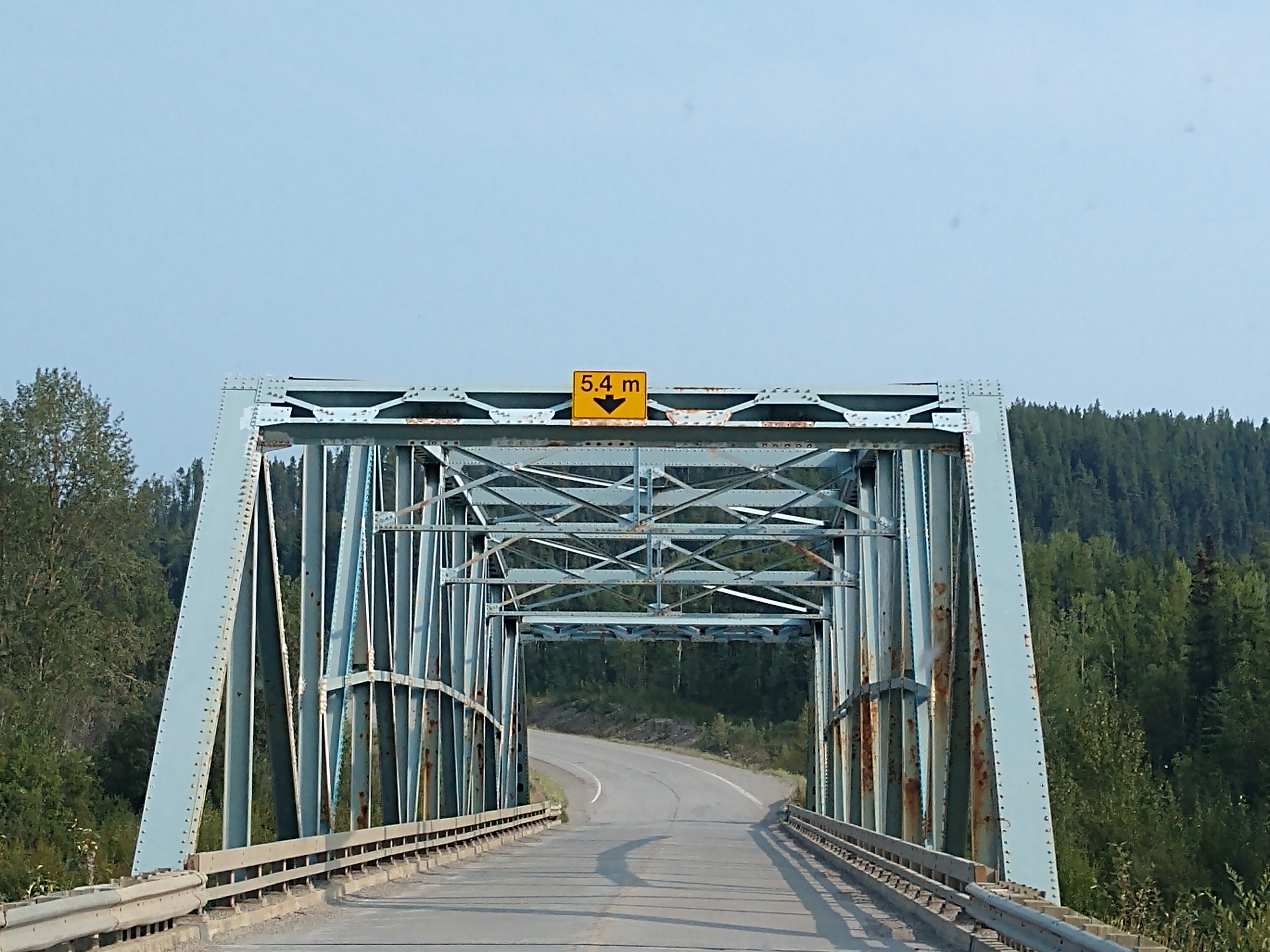
We drove over a couple more bridges.


And then we drove over the Little Rancheria River bridge.


We checked to see if there was availability at Nugget City RV Park, but no luck. So we continued on.

It is now about 14 miles to Watson Lake.


We cross the Liard River bridge.


We finally arrived at Watson Lake and once again drove by the Sign Post Forest.


We arrived at Downtown RV Park in Watson Lake after 324 miles and 9-1/2 hours on the road.


We plan to stay for two nights on site #67 (at a total of $117 CA or $42.75 US per night). We get set up and then have a dinner of pork chops and baked potatoes.
Friday, August 4, 2023
It is a wonderful sunny day with a temperature of 52 degrees which will reach 78 degrees by the afternoon. We're not planning to go anywhere, but instead hang around the campground.

After a delicious breakfast of pancakes and bacon, Mel took off to go get propane gas at the Watson Lake gas station.
Then for lunch, Mel walked over to the Watson Lake Grocery store and got us deli sandwiches and bacon potato soup for lunch. They were both yummy!
In the afternoon, Mel washed the truck and trailer, while I worked on my blog. For dinner tonight, I made homemade macroni & cheese and tuna patties.
Rest and relaxation is warranted and much appreciated!
Shirley & Mel


No comments:
Post a Comment