Wednesday, September 27, 2023
Today started out sunny at 57 degrees, but it would soon rain on our parade. We had an omelet and an English muffin for breakfast and just hung around the campground. It only reached a temperature of 62 degrees by the afternoon.
For dinner, we had salmon and angel hair pasta salad.
Thursday, September 28, 2023
Today started out cloudy at 56 degrees, but soon the sun came out, and then it started to rain again.
We left the campground at 10:00 a.m. and headed into Newport.
Shown above and below are some of the many quilt patterns and kits I have been picking up along our travels.
We headed along US Hwy 101 to Lincoln City as we planned to go to the Chinook Winds Casino.
We arrived at Chinook Winds Casino. Chinook Winds Casino is a Native American casino located in Lincoln City, Oregon. It is operated by the Confederated Tribes of Siletz. The casino's amenities include a 227-room hotel, a 157,000-square-foot gaming floor (between two floors), two restaurants (with a 24-hour food counter), and a 35,000-square-foot convention center.
We walked into the casino and got new player cards -- but no new player perks since we had been there several years ago when we were in this area (so we weren't new players). We just walked around the casino for a little while and then left.
Next, we drove out to Yaquina Head Outstanding Natural Area in Newport, Oregon to a birding hot spot.
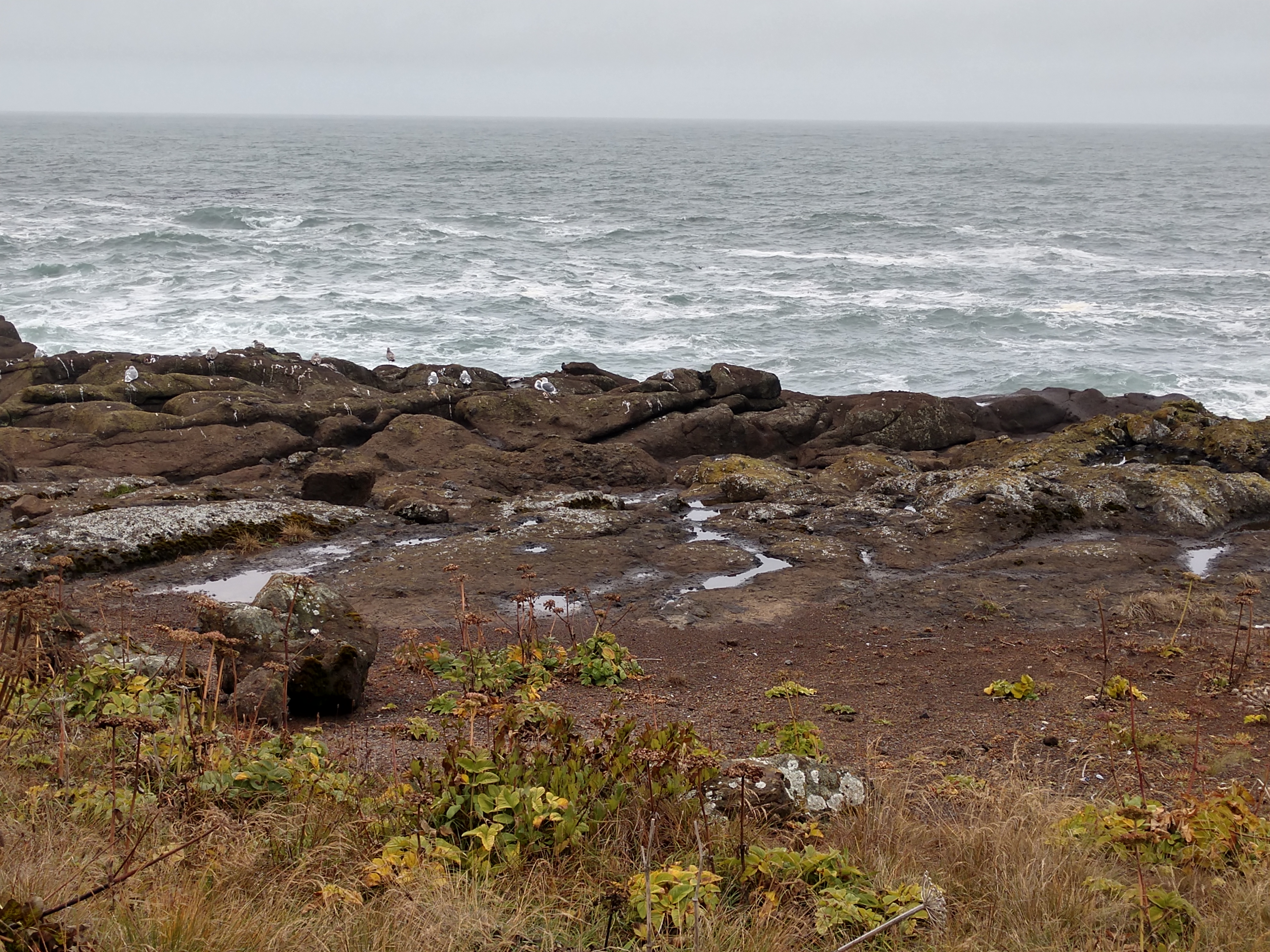
Because it was a little bit foggy today, we didn't drive all the way out to the lighthouse, but instead drove along the coastal area for a little bit. We found a place to pull over, so we got out and walked.
In the picture below, there are some seagulls on the rocks along the coast.
Seagulls also hung around us close to the fenced area.
We then drove back to Depoe Bay, Oregon. Depoe Bay is a city in Lincoln County, Oregon, located on US Hwy 101 on the Pacific Ocean, with a population of 1,398. The bay of the same name, Depoe Bay, is a 6-acre harbor that the city promotes as the world's smallest navigable harbor. Depoe Bay was named for Siletz Indian Charles "Charley" Depot who was originally allotted the land in 1894 as part of the Dawes Act of 1887. There are conflicting accounts of the origin of his name. One says he was given the name "Depot Charley" for working at the military depot near Toledo, Oregon. The family was later known as "DePoe". His original tribal affiliation was Tututni.
On March 11, 2011, Depoe Bay's port was damaged by a tsunami caused by the Tōhoku earthquake off the coast of Japan. On August 21, 2017, Depoe Bay became one of the first places in the United States to witness totality of the North American solar eclipse of that year.
(Shown above is an aerial view of the harbor and center of Depoe Bay.)
(Shown above is the city entrance sign over the harbor.)
Depoe Bay is the world’s smallest natural navigable harbor, currently covering approximately six acres, with a 50-foot wide, 100-foot long rockbound, dog-legged channel connecting to the Pacific Ocean. There are two freshwater creeks that flow into the harbor -- North Depoe Creek enters at the northeasterly corner and South Depoe Creek enters at the southeasterly corner. These creeks are very different in character. North Depoe Creek is rocky-bottomed and fairly fast-flowing, while South Depoe Creek is sandy-bottomed and slow-moving. Originally, the inner bay was shallow with a beach area on the east side surrounded by a cedar forest. Boats would simply anchor in the bay, afloat during high tide and rest on the bottom during low tide.
In 1937, Congress authorized development construction of the inner bay. When the construction was completed in 1939, the harbor was 375 feet long by 125 feet wide by five feet deep. In 1950, the harbor was closed for improvements which were completed by 1952. A cofferdam was constructed across the mouth of the channel to keep ocean waters out of the bay, and flumes rerouted water from North Depoe Bay Creek and South Depoe Bay Creek to the ocean. The water in the bay was pumped out and the harbor was enlarged to 750 feet long by 390 feet wide by eight feet deep, and the retaining seawall along the east side was constructed.
(Shown above is Depoe Bay, the world's smallest harbor.)
Just before the project was completed, rough waters at high tide tore out the south side of the cotterdam, flooding Depoe Bay. However, all construction equipment had been removed from the bay floor, and there was little consequence to this potentially devastating event.
In 1963, the 150-foot long channel was widened from 30 feet to 40 feet and deepened to eight feet at average low tide, by the Army Corps of Engineers. In 1966, the existing breakwater was lengthened, and an additional breakwater was installed on the north side of the channel. In September of that year, Depoe Bay’s harbor was visited (at high tide) by the Omar, the largest vessel ever to enter the harbor. It weighed 33 tons and was 70 feet long with an 18-foot beam and a nine-foot draft.

Next, we drove to Devil's Punchbowl State Natural Area located in Otter Rock, Oregon. Devil's Punchbowl, a dangerous, foaming collapsed sea cave, is just one of the many natural wonders along the 363 miles of the Oregon Coast.
Devil's Punchbowl State Natural Area is a state day use park on the central Oregon Coast. It is centered on a large bowl naturally carved in a rock headland which is partially open to the Pacific Ocean. Waves enter the bowl and often violently churn, swirl, and foam. At one time the Punch Bowl was referred to as "Satan's Cauldron".
Devil's Punchbowl got its name from the swirling churn of the sea as waves fill the rocky bowl like a witch’s brew. The bowl becomes a deadly trap for anyone caught inside when the tide comes up, but when the tide is out, visitors have a chance to walk inside and revel at the geological history still written upon the sandstone walls.
Outside the bowl, ocean conditions are attractive to surfers near a large offshore rock pinnacle named Gull Rock, located about 1⁄2 mile west-northwest of Devil's Punch Bowl, which funnels and concentrates waves easily seen from the park. There are at least seventeen large rocks, part of Oregon Islands National Wildlife Refuge, which provide interesting wave viewing, and attract and provide a home for wildlife.
The Devil's Punch Bowl is located about 5 miles south of Depoe Bay, and about 8 miles north of Newport in the community of Otter Rock, and about 1⁄4 mile west of US Hwy 101. The park encompasses 5.34 acres, which includes a trail for access to the beach and tide pools. The bowl is thought to have been created when two caves carved by the ocean collapsed.
Violent, mesmerizing, and beautiful, the waves of the Pacific Ocean have slowly carved out what is known as the Devil's Punchbowl. It was once a sea cave, but eventually, the roof of the cave collapsed, creating the open punch bowl formation that we see today.
Shown above is catching the waves slam against the rocks - then splash!
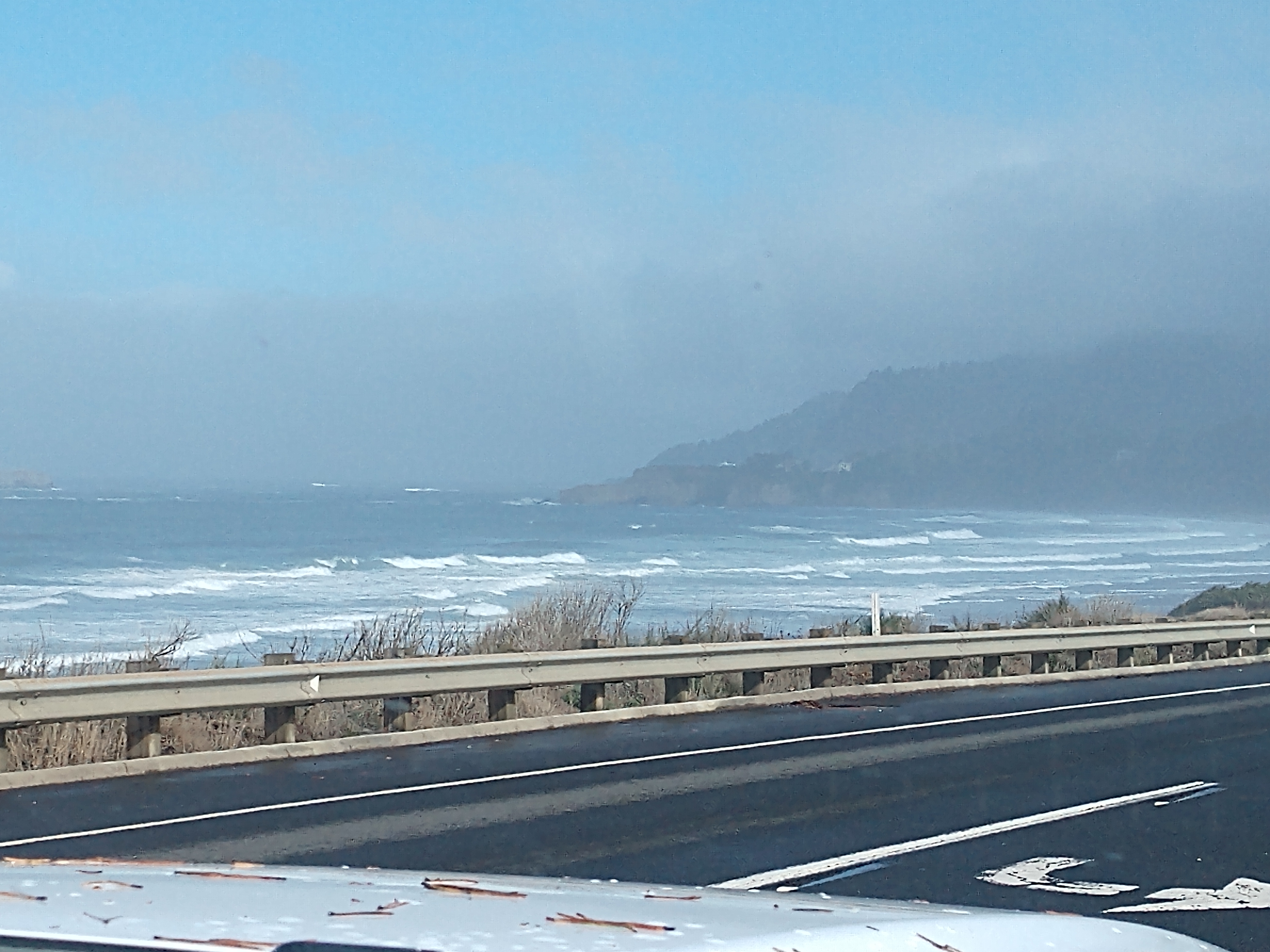
We are now back on US Hwy 101 and the sea mist is getting thicker. (If you look closely, in the distance you can see a lighthouse on the left-hand side of the picture.)
It is probably Yaquina Head Lighthouse, which is where we are going now.
Here they funneled traffic into the parking lot at the Yaquina Head Interpretive Center, before you could drive out toward the Yaquina Head Lighthouse.


The Yaquina Head Outstanding Natural Area extends out from the Oregon coast one mile into the Pacific Ocean. Standing 93 feet tall at the westernmost point of the basalt headland jutting due west nearly 1 mile into the Pacific Ocean north of Newport, the Yakina Head Lighthouse, which is Oregon's tallest lighthouse, is framed by the majesty that is the Central Oregon coast. It has been a bright beacon of the night, guiding ships and their supplies along the west coast. Winds and rain have buffeted this lighthouse since its beginning, and it took approximately one year, and over 370,000 bricks to construct.
The Yaquina Head Lighthouse was also known early in its existence as the Cape Foulweather Lighthouse (though Cape Foul Weather is 4 miles to the north). It was established in 1873, and is located in Lincoln County, near Newport at Yaquina Head. The tower stands 93 feet tall and is the tallest lighthouse in Oregon. Made in Paris in 1868 and shipped to Oregon, Yaquina Head Lighthouse was first lit August 20, 1873.

The light has been active since Head Keeper Fayette Crosby walked up the 114 steps, to light the wicks on the evening of August 20, 1873. At that time the oil burning fixed white light was displayed from sunset to sunrise. Today, the fully automated first order Fresnel lens runs on commercial power and flashes its unique pattern of two seconds on, two seconds off, two seconds on, 14 seconds off, 24 hours a day. The oil burning wicks have been replaced with an LED stack of 36 individual LED bulbs.
A two-story keepers' dwelling was built at the time the lighthouse tower and its adjoining oil house were constructed. In 1923, a one-story keepers' house was added a short distance to the east. In 1938, a one-story building replaced the original two-story dwelling. Both dwellings and all outbuildings were then demolished in 1984.
Yaquina Head typically had three lighthouse keepers under the U.S. Lighthouse Service; a Head Keeper, and First and Second Assistant. The Head Keeper as well as the First Assistant usually stayed in the two-story keepers' dwelling with their families and the Second Assistant was usually a bachelor. In 1939, the U.S. Coast Guard took over the management. During World War II, 17 servicemen were stationed at Yaquina Head to keep a lookout for enemy ships.
The lighthouse still uses its original 1868 French-made, 1st order, Fixed Fresnel lens, visible 19 miles out to sea. In 1993, the lighthouse was listed in the National Register of Historic Places.
Shown above is a historical photograph of Yaquina Head Lighthouse.
(Shown above is a map of the Yaquina Head Outstanding Natural Area.)
We then drove to Taco Bell in Newport and had a late lunch (the cravings box), before driving back to the campground around 2:00 p.m.
Friday, September 29, 2023
Today was a sunny day, even though it rained overnight. It was 53 degrees that would reach 62 degrees in the afternoon. We just spent the day around the campground.
For dinner, we had BBQ ribs and angel hair pasta salad.
Saturday, September 30, 2023
Today started out as a beautiful sunny day at 52 degrees, so at 11:45 a.m. we decided to take off and go see the lighthouses.
We drove across the Yaquina Bay Bridge and then drove down along the Yaquina Bay. Yaquina Bay is a coastal estuarine community found in Newport, Oregon. Yaquina Bay is a semi-enclosed body of water with a free connection to the Pacific Ocean, but also diluted with freshwater from the Yaquina River land drainage.
Yaquina Bay was named after the Yaquina Tribe that occupied the territory along the Yaquina River. With the railroad addition in the late 1880s, many thought Yaquina Bay would be the commerce center for the Pacific Northwest. Wheat, lumber, and other goods were transported to Yaquina Bay as the area began to develop. Oyster companies and other merchandise organizations began to take residence in the Bay.
(Shown above is an aerial photo of Yaquina Bay in Newport, Oregon.)
Indigenous peoples of the region had called Yaquina Bay home for years until the westward expansion. In 1856, the first vessel entered Yaquina Bay carrying supplies for Siletz Block-houses up the Yaquina River. The newfound Bay access promised a great deal of advantages, particularly open transportation and shipping to and from San Francisco Bay. Also in 1856, a doctor from the Willamette Valley was appointed surgeon to an Indian agency in Yaquina Bay. Following Indian trails through the Coast Range, the doctor, along with three other explorers, set out for the coast in quest for his new appointment.
In 1861, Captain Spencer, from the state of Washington, first settled in Yaquina Bay. Spencer, with the assistance of a local Indian guide, discovered valuable oyster beds within the Bay, which would attract future businesses, particularly firms from San Francisco.
(A steamboat leaves Yaquina Bay in 1910.)
In 1866, news spread of the promises and new life Yaquina Bay had to offer and quickly brought a surge of settlers to the area. Newport was quickly formed and oyster companies and other industries began to take resident. The growing oyster business initiated the construction of a wagon road from Corvallis to Yaquina Bay, costing approximately $20,000 and spanning 45 miles. The road was completed in 1873 and promised continued connections between Corvallis and the coast, and even helped settlers reach their new coastal home. With the influx of residents, seasonal visitors to the area, and booming businesses, Yaquina Bay's oyster trade quickly began to decline. In 1869, a group of oystermen formed a task force with the interest of preserving oyster beds.
For a long time, Yaquina Bay was the midpoint between San Francisco and Seattle. With increased ship and navigation traffic into the area, the number of shipwrecks increased rapidly.
We then drove into the Yaquina Bay State Park. Yaquina Bay State Recreation Site was established in 1948, and is a coastal state park in west-central Lincoln County, Oregon, in the city of Newport. It is administered by the Oregon Parks and Recreation Department, and located at the north end of Yaquina Bay near its outlet to the Pacific Ocean. The site includes picnic facilities, beach access, a fisherman's memorial shrine, a forested bluff and the historic Yaquina Bay Lighthouse.
(Looking west over the Pacific Ocean from Yaquina Bay State Recreation Site in Newport -- see pictures above and below.)
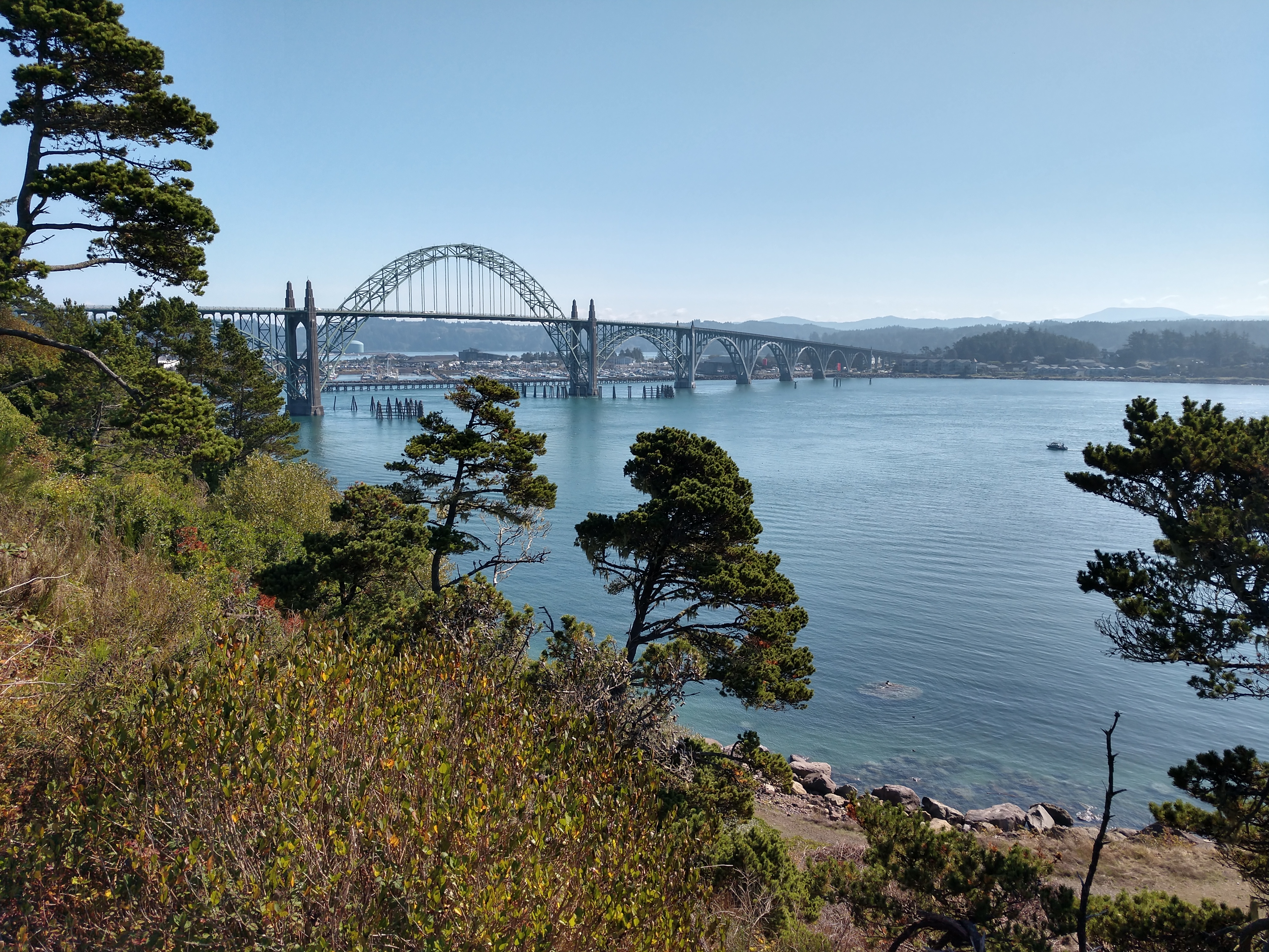
Above is a picture of the Yaquina Bay Bridge from the Yaquina Bay State Recreation Site.
The above storyboard told us about the Oregon Geology and Tsunamis. Devasting waves called "tsunamis" can strike Oregon's coast at any time. These waves are caused by great undersea earthquakes that occur along the Cascadia Subduction Zone, one of the largest active faults in North America. This fault zone lies 32 to 70 miles offshore and roughly parallels the coast.
Tsunamis are dangerous and destructive. They have struck the Oregon coast repeatedly (at 200 to 600 year intervals) and will again in the future. Tsunamis can follow within minutes of an earthquake. They move rapidly but quickly run out of water as they sweep inland and uphill. Flooding can occur several miles inland along rivers and streams. Remember, most tsunamis are not solitary giant waves; instead, many large waves may strike the shore over the course of several hours.
For example, about AD 1700, a tsunami caused by an earthquake on the Cascadia Subduction Zone flooded marches landward of Yaquina Bay and other Oregon bays. Geologists know tsunamis have affected large areas in the past because tsunami-deposited sand has been found here and in other coastal lowlands in Oregon, Washington, British Columbia, and northernmost California.

The above storyboard told us about the Oregon History of Yaquina Bay. The old Yaquina Bay Lighthouse established in 1871 is the earliest aid to navigation, standing within the range of the first recorded landfall made from a ship to the shores of the Pacific Northwest. Captain James Cook made this landfall on March 7, 1778. At noon he named Cape Foulweather. On account of the heavy weather, he was compelled to stand out at sea at night and only approach the land in the afternoon so that he was unable to find any harbor along the Oregon Coast. News of Cook's voyage to the Pacific Northwest stimulated the American interests in this region and aroused in Thomas Jefferson an interest that led to the Louisiana Purchase in 1803 and the dispatch of the Lewis and Clark Expedition.


A piece of Oregon history sits atop a bluff at the mouth of the Yaquina River. It is the Yaquina Bay Lighthouse (see above), that was built in 1871. However, with the establishment of the Yaquina Head lighthouse to the north in 1874, it was decommissioned. It was officially restored as a privately maintained aid to navigation on December 7, 1996.

Yaquina Bay Lighthouse is believed to be the oldest structure in Newport. It is also the only existing Oregon lighthouse with the living quarters attached, and the only historic wooden Oregon lighthouse still standing. The Yaquina Bay Lighthouse is listed in the National Register of Historic Places.
(Shown above is the Yaquina Bay Lighthouse, ca 1890.)
(Shown above is the Yaquina Bay Lighthouse with U.S. Lifesaving surfmen and crew, ca 1911.)
The Yaquina Bay Lighthouse has been restored as a working lighthouse and an aid to navigation by the Oregon Parks and Recreation Department, with the help of many people and agencies, including Friends of Yaquina Lighthouses.
(Shown above is the Yaquina Bay Lighthouse, ca 1915.)
The official relighting ceremony with the US Coast Guard took place on December 7, 1996. The light shines with a steady white light from dusk to dawn (and sometimes on dark days, because it is controlled by a photocell.) The light is 161 feet above sea level. Inside the lighthouse, two flights of stairs lead to the watch room.

The storyboard above told us about the Yaquina Bay Lighthouse. In February 1869, the Oregon legislature sent a memorial to the U.S. Senate petitioning for a lighthouse at the mouth of Yaquina Bay to guide traffic into the harbor at Newport, one of the busiest harbors between San Francisco and Seattle. The U.S. Lighthouse Board agreed that a lighthouse was necessary, but a controversy erupted over whether a lighthouse would be more appropriate on Yaquina Bay, to guide local crafts, or on Yaquina Head, to focus on coast-going maritime traffic. The board’s decision to provide an aid to Newport’s commercial interests settled the matter, despite the advice of Colonel R.S. Stockton, the Lighthouse Service district engineer, who argued that a harbor light on the bay would be less useful than a more powerful first-order light on Yaquina Head.
Congress appropriated funds for the Yaquina Bay Lighthouse, and the Lighthouse Board purchased thirty-six acres on a promontory overlooking the sea on the north side of Yaquina Bay for $500 (about $9,860 in 2019 dollars) from homesteaders Lester and Sophronia Baldwin. Construction began on May 1, 1871. Ben Simpson, who lived in Newport, built the lighthouse tower and the two-story wooden building that was used as a dwelling. Metal expert Joseph Bien of San Francisco built the lantern room.
The lighthouse beacon, an oil lantern inside a fifth-order Fresnel lens, shone for the first time on November 3, 1871, under the care of its first and only keeper, Charles H. Peirce. A former Civil War captain in the Union Army, Peirce lived with his wife and their children at the lighthouse, where their ninth child was born.
(Shown above is a map of Yaquina Bay State Park.)
(Shown above is the back of the Yaquina Bay Lighthouse.)
The lighthouse was decommissioned just three years after it was built. It fell into disrepair and was nearly forgotten until a magazine writer, Finn John gave it new life when he printed the ghastly story about "The Haunted Light."
In 1899, Lischen Miller had published a short story called “The Haunted Light at Newport-by-the-Sea” in Pacific Monthly Magazine, which told the story of a girl who mysteriously died at Yaquina Bay Lighthouse. The young girl was named Muriel Trevenard. She was left at a boarding house by her seafaring father, who planned to pick her up in two weeks. One day, Muriel and a group of kids explored the abandoned lighthouse on the hill where they found a secret door inside leading to a shaft that apparently ran all the way down to the sea.
As the story goes, the kids threw little pieces of paper down the hole, but they couldn’t see the bottom or even figure out if it had a bottom. A chilling fog moved in and the exploring children decided to go, leaving the secret door open behind them.
As she was about to leave, Muriel Trevenard — realized she had left her handkerchief in the lighthouse and went back alone to retrieve it. The mist around the lighthouse began to thicken, and the night was dark and damp. Shortly thereafter, three blood-curdling cries for help were heard coming from inside the lighthouse; her friends frantically raced back to the house and found the secret door closed and locked, and no sign of Muriel but a terrifying pool of “warm red blood.”
Following an exhaustive search, police never found her body or her assumed killer. Muriel's father never returned from his voyage at sea to learn about his daughter either. The article was portrayed as fiction, although no one knows exactly where the author got her inspiration.
(This image of turn-of-the-century beachgoers on the dry sands of the beach at Newport around 1905 shows the lighthouse above, by then abandoned and a little eerie looking.)
(The abandoned Yaquina Bay Lighthouse as it appeared in 1890, a few years before Lischen M. Miller wrote her spooky short story in Pacific Monthly magazine. It's easy to see how the building and the setting would have lent themselves to ghostly storytelling.)
(Shown above is the Yaquina Bay Lighthouse as seen in 1939, with the U.S. Coast Guard tower rising behind it.)
* * * * * * * * * *
DO YOU LOVE EERY, GHOSTLY TALES? IF SO, YOU CAN FIND THE ENTIRE "PUBLIC DOMAIN" SHORT STORY 'THE HAUNTED LIGHTHOUSE AT NEWPORT-BY-THE-SEA' THAT LISCHEN M. MILLER WROTE IN THE PACIFIC MONTHLY IN MY NEXT BLOG POST.
Believe me . . . It is so very spoooooooooooooooooooooky!
We did however go inside the Yaquina Bay Lighthouse to look around.
(Shown above is drapes inside the lighthouse.)
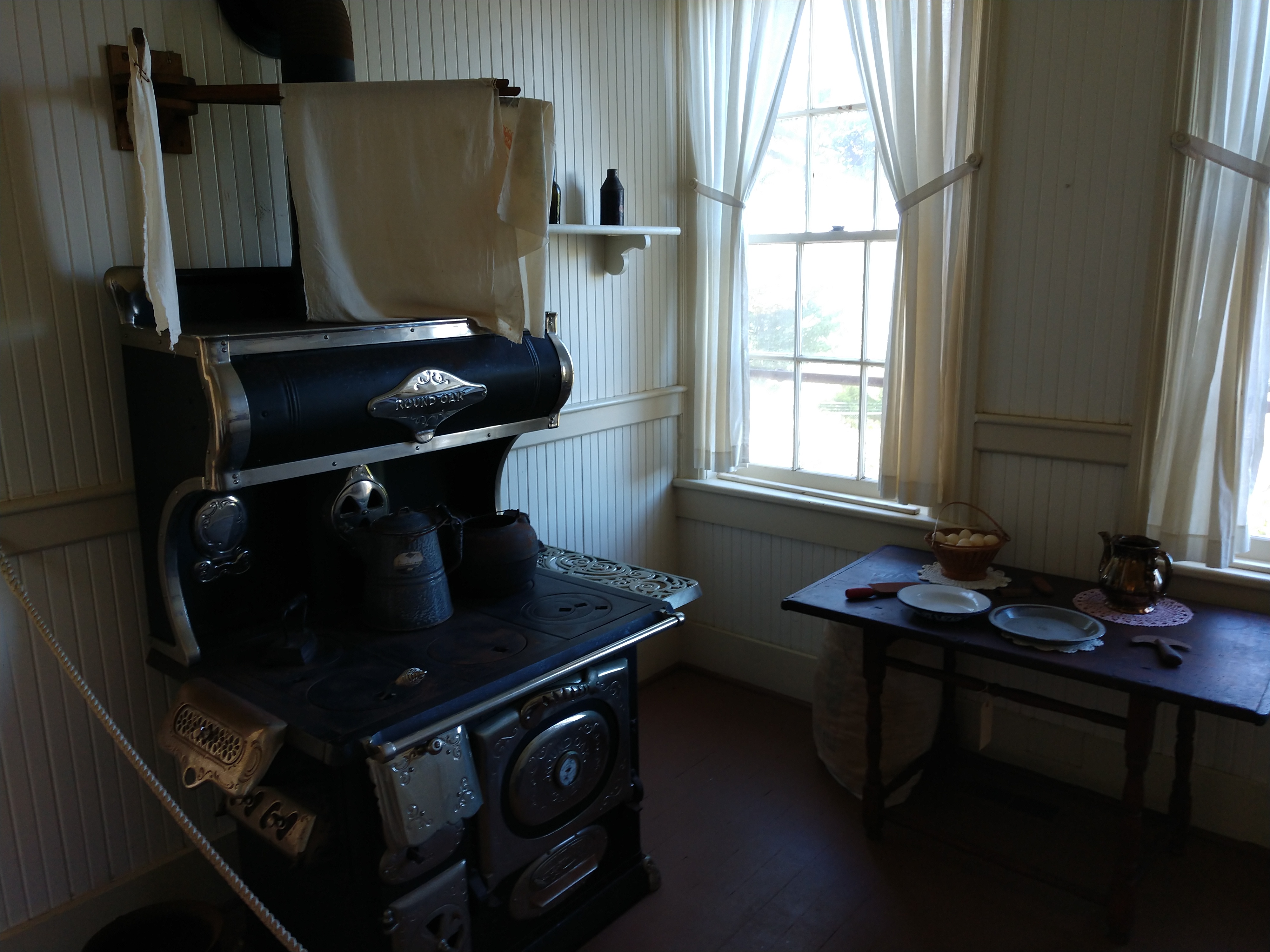
(Shown above is the kitchen.)
The storyboard above told us about the kitchen ... the heart of the lighthouse. A typical meal might include stewing a fattened hen, served with cream gravy, mashed potatoes, and vegetables. Cottage cheese and a fresh fruit pie may have completed the meal. Imagine having to cook breads, meats, pies and cakes on a wood burning stove. The kitchen was also the only room in the lighthouse with running water. The water system gathered rain from the roof and stored in a large cistern outside the kitchen. A pump similar to the one seen here in the kitchen pumped water into the house.
(Shown above the storyboard told us how they made cottage cheese.)
(Shown above is the wood burning stove in the kitchen.)
The storyboard above told us about the pantry that stored the food supplies that the family of the lighthouse needed. The pantry also store additional everyday items such as the wash tub, feather duster, and extra serving dishes. In the 1870s, the Peirce could walk to the bay front to shop. Newport consisted of two stores, two fish packing plants, one meat market, two hotels, two saloons, one restaurant, and one cooper shop. In addition, the lighthouse tender ship Shubrick brought in food staples such as flour, sugar, salt, beans, vinegar and coffee once every three months.
(Shown above is the pantry where you can also see a washtub.)

The storyboard above told us about the parlor which was often used as the room to hold social gatherings. It would have been used for social events where the family and community members would gather around and enjoy tea, or maybe where they would join around the pump organ for a sing along. The parlor, like the other rooms in the lighthouse would have had a fireplace that provided heat and light to the family. One can imagine the Peirce children doing homework stretched out on the floor in front of a large fire. They probably played checkers or cards in this room as well. The tender ship Shubrick carried many supplies and goods to the lighthouse including a traveling library. 50 new books would be brought in for the family in exchange for the books they already had. The library included poetry, scientific works and of course a Bible. The library would have been probably kept in the parlor where the family would read the books at night.

(Shown above and below are pictures of the lighthouse parlor including a pump organ and spinning wheel.)
The storyboard above told us about the bedroom. The "sleep tight, don't let the bedbugs bite," saying came from this era. Note the ropes for holding a feather mattress. The ropes need to be tightened as needed before bed so that the mattress wouldn't sag when it was slept on. There may have also been a trundle bed underneath the bed we see here, so that the room could accomodate more children. Several children could have slept in this room; hope none of them kicked!
(Shown above is a possibly a children's bedroom.)
(Shown above and below is the lighthouse keeper's bedroom.)
(Shown above is another bedroom inside the lighthouse.)
Shown above is another look at the Pacific Ocean from the Yaquina Bay Lighthouse, while below are a couple more pictures of the beautiful Yaquina Bay Lighthouse.
(Shown above is the Yaquina Bay Lighthouse and lookout tower.)
(Shown above is looking at the Yaquina Bay Bridge from the Yaquina Bay Lighthouse.)
The Historic Bayfront District is where fishing boats tie up and sell their catch, and it is one of its most delightful districts. The entire Bayfront area, about one half mile long, is lined with bars, restaurants, and shops. Seafood is the most popular here in the Bayfront District, including the headliner and an Oregon Coast tradition Mo’s Seafood and Chowder. Beginning with a location on the bay front near Yaquina Bay Bridge in Newport and stretching north to Cannon Beach, Mo’s has become known for its clam chowder, which it now packages and ships 500,000 pounds of annually to grocery stores or fresh to its restaurants.
Mo's Seafood & Chowder in the original location opened in 1946 and is the epicenter of Mo's history and legend. Over 70 years in business and Mo's is still family owned and operated.
Next, we stopped at the Yaquina Head Interpretive Center. It featured exhibits on seabirds and marine life as well as human history from the headland. The Yaquina Head Interpretive Center opened in 1997, and there we saw the wheelhouse of a historic ship, checked out a recreated rocky island and its inhabitants, and witnessed a full scale replica of the lighthouse lantern.
Shown above is the replica of the Yaquina Head Light that we saw inside the Interpretation Center.
We then drove out to the Cobble Beach area and parked to take a walk to see the coast area, wildlife at Seal Island, and the Yaquina Head Lighthouse. If the conditions are right at Cobble Beach, you can listen to the water rushing into the shore, tossing and jumbling the cobble stones. It took 14 million years to build this cobble beach -- from boiling hot lava to eroded fragments.
Shown above and below is the view as we were looking down at Cobble Beach.
Shown above and below is the magnificent Yaquina Head Lighthouse -- the tallest lighthouse in Oregon, standing 93 feet tall.
I took a selfie in front of Yaquina Head Lighthouse.
Seal Rock (shown above) is an iconic grouping of seamounts that provide valuable habitat to migrating and nesting sea birds, sea lions, seals, and many other marine and intertidal animals.
Shown above is another rocky area along the Yaquina Head Lighthouse area.
Another look at Cobble Beach.
From there, we drove to the Walmart in Newport for groceries, and then to the Fred Meyers for gas. We then went to the South Beach Fish Market in South Beach for a late lunch. South Beach Fish Market is a seafood lover’s dream! It is partly a fresh seafood market, and partly a seafood restaurant, but all delicious!
Even though the outside of the building looked a little rough, and you have to wait in a line to order, and then wait again for your food -- it did not disappoint.
I had the wild halibut and chips (shown above), while Mel had the Captain's Platter, which included 2 each of halibut, oysters, scallops and prawns (shown below). We also shared a pint of clam chowder.
We got back to the campground around 4:00 p.m.
Sunday, October 1, 2023
Today started out sunny at 48 degrees. We decided to do some laundry, and then go for a walk down to the beach.
We followed the beach trail that ran right beside one of the campsites.
Shown above is Mel on the beach path.
And then we came to the sign shown above saying that we were leaving Whalers Rest.
We continued on the beach path until we could see the highway as shown below.
We had to cross US Hwy 101 (as shown below).
We were then at Lost Creek State Park and Ocean Beach. Lost Creek State Park is located seven miles south of Newport, Oregon. The park is developed for picnicking and beach access.
It was a beautiful day and the Pacific Ocean was pretty calm.
We walked along the beach for awhile enjoying the peace and serenity.
When we had been at the beach long enough, we turned around and began our return trip.
Along the beach path we went, until we arrived back at our campsite.
We then had grilled hamburers with all the topping for dinner. Our day at the Lost Creek Ocean Beach today had been "just beachy!"
Shirley & Mel


No comments:
Post a Comment