The William Moore Bridge (see above) is an asymmetrical cable-stayed suspension bridge, which crossed a very active earthquake fault. It was only firmly anchored on the downhill side so that it could move freely with the earth! The gorge that the bridge crossed was only 110 feet wide, but 180 feet deep (the bridge deck was about 250 feet long). Captain William Henry Moore was a famous steamboat captain and the first settler in Skagway.
The unique William Moore Bridge of the past has now been replaced with a concrete “dam” structure as the Alaska Department of Transportation summary of the project indicates:
“The Alaska Department of Transportation, in cooperation with Hamilton Construction, LLC, replaced the Captain William Henry Moore Bridge on the Klondike Highway near Skagway with a roller-compacted concrete structure that now carries traffic over the William Moore Creek as it replaced the aging bridge. Rock excavation was required and allowed the State to straighten the roadway and build a new wayside parking lot south of the bridge. There is no future access across the old bridge, but the structure remains in place as a testament to the ingenuity and hardwork of the Klondike Highway pioneers. "
Above is what the old, cabled suspension William Moore Bridge used to look like.
U.S. Customs at the Port of Skagway are now 1,000 feet ahead.
All vehicles must stop at Customs.
All southbound vehicles heading into Skagway must stop and report at the Customs, which is open 24 hours a day through the summer.
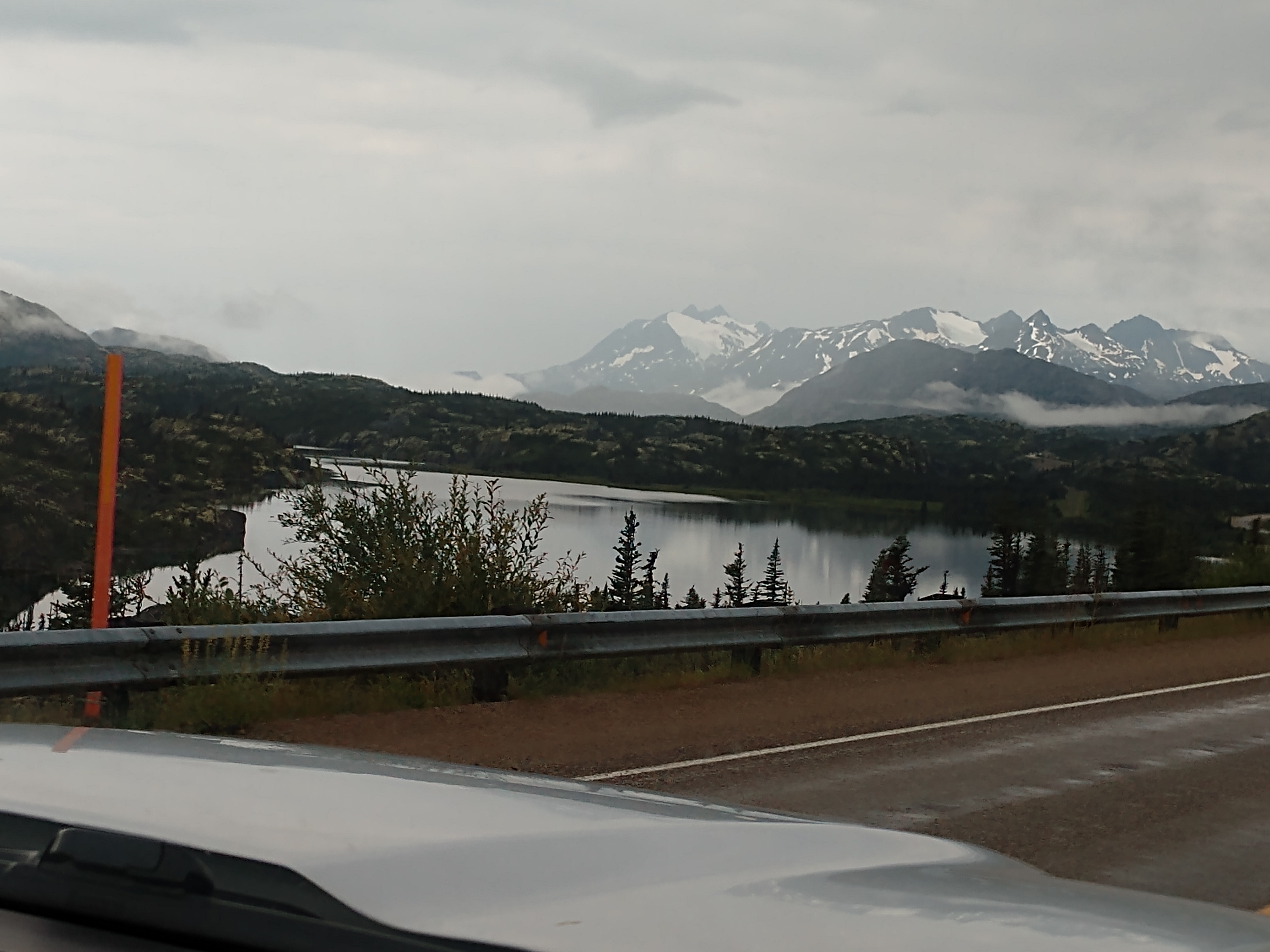
The Skagway Border Crossing is near the summit of White Pass on the Klondike Highway, where the elevatin is 3,292 feet. The border divides Alaska Time Zone from Pacific Time Zone. The highway was completed in 1979 as a seasonal, but has been open year-round since 1986.
For a few months in 1898 during the Klondike Gold Rush, while discussions continued on the Alaska boundary dispute, a North-West Mounted Police detachment and a customs office (collecting duty on goods destined for the Yukon) operated at Skagway. The White Pass and Yukon Route, completed in 1900, included train stations at White Pass, Fraser and Bennett. When the White Pass train station, which housed the customs office, burned to the ground in 1950, customs moved to temporary accommodation before closing the following year. This section of the line closed in 1982, unable to compete with the highway but reopened to Fraser in 1988. The line reopened to Bennett in 1992 and Carcross in 1997.


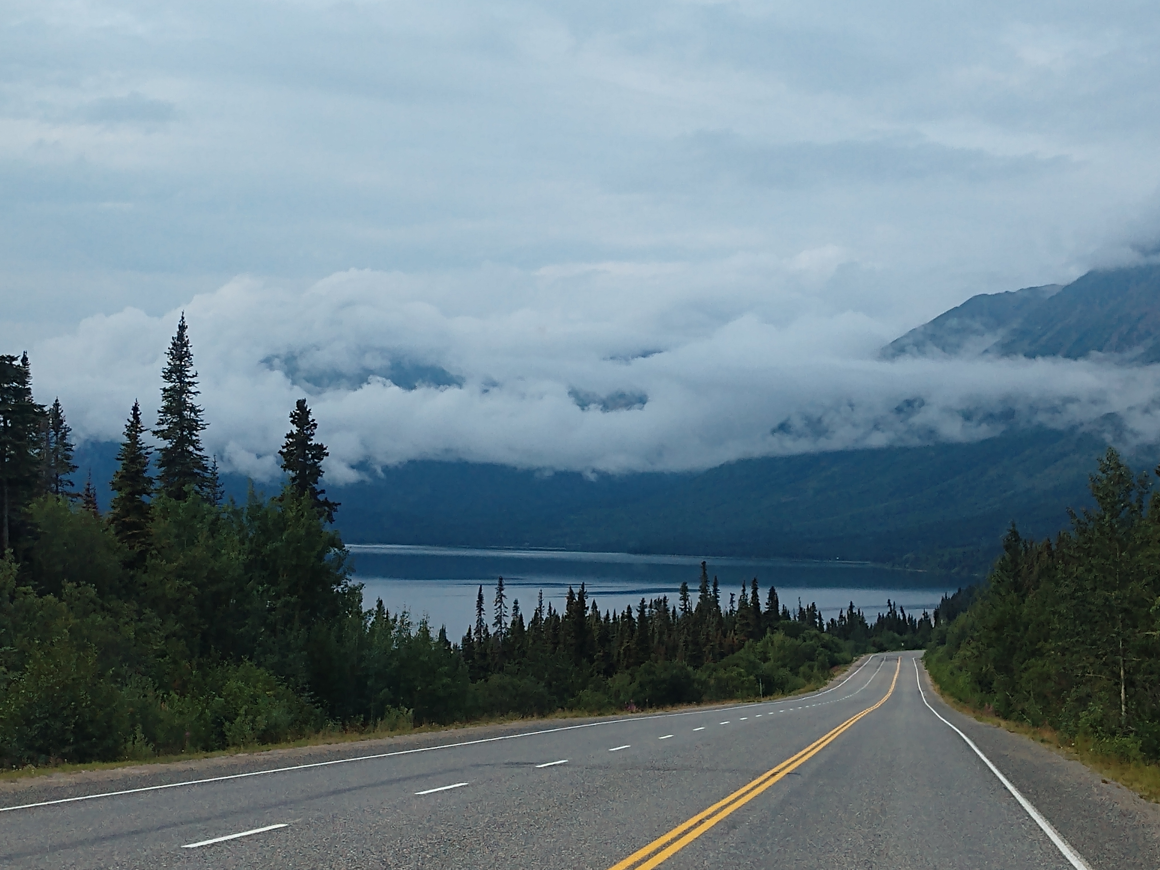
The Customs checkpoint at the Port of Skagway was easy peasy. We handed the customs agent our passports. He then just looked at our license plate on the truck and asked if we had anything to declare. When we said, "No," he said, "Go right ahead. Have a nice day!" We now had six miles to go until we were in Skagway.
We just passed the turnoff for Dyea (pronounced dye-EE). A frenzied boomtown during the Klondike Gold Rush of 1897-98, today Dyea is all but a ghost town. A few people live on individual small homesteads in the valley; however, it is largely abandoned. Dyea is located at the convergence of the Taiya River and Taiya Inlet on the south side of the Chilkoot Pass within the limits of the Municipality of Skagway Borough, Alaska.
During the Klondike Gold Rush prospectors disembarked at its port and used the Chilkoot Trail, a Tlingit trade route over the Coast Mountains, to begin their journey to the gold fields around Dawson City, Yukon, about 500 miles away. Confidence man and crime boss Soapy Smith, famous for his underworld control of the town of Skagway in 1897–1898 may have had control of Dyea as well. The port at Dyea had shallow water, while neighboring Skagway had deep water. Dyea was abandoned when the White Pass and Yukon Route railroad chose the White Pass Trail (instead of the alternative Chilkoot Trail), which began at Skagway, for its route.
We're so excited to see the "Welcome to Skagway" sign below.
Skagway got its big boom in the late 1800s as the largest and easiest entry to Alaska and the Yukon during the Klondike Gold Rush. Prospectors would take steamships from the west coast of the USA and Canada to Skagway before trekking up the Chilkoot Trail to the northern part of the Yukon to reach the gold fields. Some however never made it to the trail as they set up businesses in Skagway and catered to the gold prospectors.
For the most part Skagway of today still looks like it did in the late 1800s. The buildings are kept in period style with shops that are mainly tailored to tourists. Tourism in Skagway is big money. The permanent population of the town is only about 1,000 but during the summer season up to one million tourists pass through. How you ask . . . does a tiny town in southern Alaska see so many tourists? Cruise ships of course, as Skagway is one of the main stops on most Alaskan cruise vacations.
We crossed the Skagway River Bridge on our way into Skagway. On the left just past the bridge is Jewell Gardens, a display garden operating on the historic Clark Farm site. They also offer glass-blowing demonstrations.
Above is the White Pass and Yukon Route maintenance shop.
Skagway, Alaska is the northernmost point in Alaska’s Inside Passage, located on the north end of Taiya Inlet on the far end of Lynn Canal. In its heyday, Skagway was the boomtown gateway to the Trail of ’98 and the Klondike gold fields. The population has dwindled from 20,000 feverish gold seekers to about 1,000 year-round citizens. Streets once choked with gold-crazed stampeders clamoring to get to the Klondike and strike it rich, are now just as busy with thousands of cruise ship passengers arriving every day during the summer! The Klondike Gold Rush in its short-lived heyday, didn't last long and within a couple of years the population of Skagway dwindled from about 20,000 people to only about 500 hardy souls.

Skagway is also the home of the Klondike Gold Rush National Historic Park, which honors the stampeders of the Klondike by protecting the historic buildings and trails of the Gold Rush era. On June 28, 1900, Skagway became the first and oldest incorporated city in Alaska. The stampeders called it Skaguay, but the post office insisted on a spelling change, so it’s been known as Skagway since 1899. (Neither name was very satisfactory to Captain William Moore, the valley’s pioneer; he thought Mooresville was appropriate. But Skagway stuck.)
Skagway's name has many definitions. One author says that, “popularly, the word comes from “Skagua, home of the north wind. But it really comes from ‘Sch-kawai,’ meaning end of salt water.” Recent research from local Tlinglit natives has revealed that the name comes from the word Shgagwéi meaning “bunched up or rough water.”
John G. Brady, who was governor during the gold rush, knew a good story when he heard it. He described how the Skagway River got its name in this way:
“The Natives call this stream Skugua. This name has been in use since the crow made the earth and the Tlingits. A woman was drowned in this river and her name was Skugua. On the banks of the river lived a man named Ken-noogoo, or North Wind. Skugua came to him and became his wife. No doubt those who remain there this winter will find out how close their relationship is to the cold north wind.”
One of the first white residents of Skagway was Billy Moore, a former steamboat captain. He believed that gold would be found in the Yukon and in 1887 built a dock and a trading post in anticipation of the gold rush. He was proven right 2 years later when prospectors began to arrive on steamships and prepared for their overland journey north into the Yukon to Dawson City. The first part of their expedition was certainly the most difficult. Prospectors had to transport more than 2,000 pounds of provisions over the Chilkoot Pass into Canada. The trail passed through British Columbia to Carcross, in the Yukon. This proverbial “ton of goods” was required for each person to prevent starvation in the remote Yukon Territory. In order to transport such large amounts of food and supplies stampeders were required to make many trips over the treacherous Chilkoot Pass. Once in Carcross, they needed to build a boat capable of making the 600-mile journey north to Dawson City, via the Yukon River.
Skagway’s neighboring town of Dyea was at the beginning of the Chilkoot Trail and what began as a tent city in 1897 quickly grew into a town of 3,500 with restaurants, hotels and saloons. However, with the building of the White Pass & Yukon Railroad from Skagway in 1898, Dyea quickly faded away. The old townsite is now recognized as a National Historic Landmark even though there is hardly any evidence that the town ever existed.
In July 1897,
the first ships full of stampeders bound for the Klondike landed at Skagway and
Dyea. By October 1897, according to a North West Mounted Police report, Skagway
had grown “from a concourse of tents to a fair-sized town, with well-laid-out
streets and numerous frame buildings, stores, saloons, gambling houses, dance
houses and a population of about 20,000.” Less than a year later it was
reported that “Skagway was little better than a hell on earth.” Customs office
records for 1898 show that in the month of February alone 5,000 people landed
at Skagway and Dyea.
By the summer of 1899 the
stampede was all but over. The newly built White Pass & Yukon Route railway
reached Lake Bennett, supplanting the Chilkoot Trail from Dyea. Dyea became a
ghost town. Its post office closed in 1902, and by 1903 its population consisted
of one settler. Skagway’s population dwindled to 500. But Skagway persisted, both
as a port and as terminus of the White Pass & Yukon Route railway, which
connected the town to Whitehorse, YT, in 1900.

We drove through the streets of Skagway while trying to locate the campground that we would be staying at for a couple of days.
Above is the Skagway Alaska Streetcar, which looks like an interesting tour if you didn't have your own vehicle.
We have finally arrived at the Garden City RV Park located on 15th Avenue in Skagway.
We checked in and got all set up on site #86 for two nights. The nightly fee was $52.50.
We then went into town for a walking tour of Skagway.
We walked past the Skagway Public Library on our way down state Street. The Skagway Public Library began in 1920 when a group of 55 women met to form a Literary and social Club.
Along our walk, we can see one of the cruise ships in port today.
Above is the First Presbyterian Church, which is Skagway's only remaining gold rush church. It was built in 1901 by the Methodists, but in a denominational realignment, that church body vacated Skagway in 1917. The Presbyterians, who had lost their church building to a fire the previous years, moved in and have remained ever since. During the gold rush, Skagway had but one house of worship, the Union Church. But by 1900, several other religious groups were in evidence.
Above is just a unique looking house. Mel said it reminded him of the "Hocus Pocus" house from the movie of the same name.
The plantation-style
White House (above and below) was built in 1902, and was originally the home of Lee Guthrie,
saloon keeper and civic official. After Guthrie left town, the house was
converted into a small hotel. The Army used it for a small hospital during
World War II.
The building’s name occasionally caused delightful confusion. One
story about it dates back to 1956, when a Republican campaign worker stopped by
to visit. No one responded to the knock, but because the door was ajar, the
worker called out, “Would you be interested in keeping Eisenhower in the White
House?” The owner’s response was, “No! Let him stay downtown!”
A view down one of the streets in Skagway.
The Historic Skagway Inn shown above and below is also known as the Gutfeld Residence. Built using materials from an 1897-1898 false-front building, Max Gutfeld, operator of the Vienna Bakery on Broadway, built this residence in 1918. In the 1920's the rear wing was added by moving the vacant Ross-Higgins warehouse (built in 1901) from 4th Avenue and Main Street to the present site. The Skagway Inn presently operates in the enlarged building. This street was also the site of Skagway's once thriving Red Light District.

As was true in most frontier towns,
prostitution was first a common practice here, then it was regulated, and
finally it was outlawed. During the gold rush, rows of cribs (two-room huts
where the "soiled doves" plied their trade) occupied the alleys
between 4th and 7th, but after the rush, they were moved onto 7th. Some cribs
were moved again before they closed in about 1910; others simply closed where
they were. A local brothel included the red, two-story structure at 8th and
Broadway, known as The Cottage during the Gold Rush.
The storyboard above told us about the "Garden City of Alaska." In 1916, Dr. L.S. Keller, in the Daily Alaskan, began to promote Skagway's gardens in recognition of their importance to the community. Soon after arriving in 1897 stampeders began to plant vegetables. Sunshine, long hours of daylight and areas of rich soil provided a variety of produce and flowers.
Residents wanted to be self-sufficient and were so successful that in 1901 the Skagway Chamber of Commerce sent agricultural products to the Portland Exposition. Flowers went to the Alaska-Yukon Exposition in Seattle in 1909. Henry C. Clark, the "Rhubarb King," and Charles O. Walker, became famous for their produce and flowers.
But it was the visitors who spread the word beyond Alaska of Skagway's gardens. In 1906 White Pass & Yukon Railroad promotional materials described the town as offering "a profusion of flowers, trim lawns, and prolific gardens." Between World War I and World War II, the Blanchard garden was a "must-see" for visitors and a 1929 dahlia cultivated by Blanchard was recorded as the world's largest. Local hotel owners, George and Clara Dedman of the Golden North and Harriet Pullen, of the Pullen House, were known for their flowers. The Pullen Farm in Dyea provided fresh milk and vegetable to hotel guests.
World War II with the occupation of Skagway by thousands of U.S. military servicemen disrupted the town's historic gardening cycle. Quonset huts and tents occupied all available space, much of which had been used for gardens. Fifty years later, the community has returned to its historic roots and Skagway is again the "Garden City of Alaska."
The storyboard above told us of "Before the Gold Rush." Tlingits are an Alaska native people who have lived in Southeast Alaska for generations. Before the Gold Rush, a Tlingit village was in the Dyea area in the Taiya River valley, nine miles west of Skagway. Nearby was the start of the Chilkoot Trail which crossed the mountains to interior Canada.
The Skagway River valley was used by the Tlingits for subsistence hunting, fishing and gathering activities. Archaeological sites known as shell middens have been located in the Skagway and Dyea area and contain evidence of seasonal fish camps. After the Gold Rush Tlingits helped develop early tourism in Skagway by selling their beadwork and carvings on the docks and in the curio shops.

Above is the Skagway Museum and City Hall, which was built in 1899 of native
granite brought from Clifton on the WP & YR railroad. The Methodist school,
named for Bishop McCabe, was Alaska’s first institution of higher education, but after facing financial difficulties, the private McCabe College closed after only three
terms. From 1901 until 1956, the building served as the U.S. Court House with
the U.S. Marshal’s office and jail on the first floor. District Court was held
on the second floor in the former chapel of McCabe College. In 2000, the City
of Skagway completed a new addition to the venerable McCabe building. The
Skagway Museum, open daily in the summer, is a fascinating storehouse of
Skagway history from the gold rush to present.
On display, adjacent to the Skagway Museum and City Hall is the White Pass train.
Shirley poses in front of the White Pass Train.
Mollie Walsh was a resourceful and independent young woman with a wanderlust and love of frontiers. In 1890, she left home at 18 for Butte, Montana where she spent seven years. Mollie Walsh came to Skagway, unaccompanied in the fall of 1897. A rarity in her day, she was young, unmarried and at least sowmewhat respectable. Mollie became popular as a waitress and member of humanitarian activities of the Union Church. When her efforts crossed Jefferson "Soapy" Smith, she feared retaliation and moved north up the White Pass Trail near a Canadian Mountie station where she established a grub tent (restaurant) in Log Cabin. Log Cabin was a tent town located along the White Pass Trail.
She soon received the attentions of many packers along the trail. One who was particularly fond of her was Jack Newman. He professed his love for her and even killed a rival to earn her affections, but alas she soon married Mike Bartlett and left the area.
Over the spring of 1898, thousands of argonauts began carrying stories of her charm and grace. Jack Newman and Mike Bartlett, both hardy and reputable packers, were serious suitors, but Mike finally won Mollie's heart. In 1900, they were married in Dawson City, had a child and rode a wild wave of prosperity until the evil of drink and a bad experience in Nome changed Mike dramatically (the Bartlett's marriage was turbulent at best). Crestfallen, Newman soon married Hannah Barry instead, but he never stopped thinking about Mollie.
Mollie eventually moved to Seattle without Mike, but he pursued her. One dreary October evening in 1902, drunk and quarrelsome, Mike came to the room Mollie shared with their child. After a short argument, Mollie, who was ill, fled to a muddy alley where her husband shot her dead.
Meanwhile, Jack Newman read about the slaying of Mollie and was heartbroken. He revered the memory of the "Angel of the White Pass," and never forgot the diminutive woman who won his heart. In 1930, he unveiled a small bust statue to Mollie that now stands in the Skagway park named for her (Mollie Walsh Park). Newman wrote that Mollie was a woman on whose headstone could be most fittingly inscribed: "Here Lies Drama!"
The above storyboard told us about Harriet Pullen and the Pullen House Hotel.
Harriet Pullen arrived in Skagway aboard the steamer "Rosali" on September 12, 1897. The wife of fur trader Dan Webster Pullen, she left her husband and 4 young children in Washington State to go north to make her fortune. Harriet Matilda Smith had married Pullen in 1878, when she was 18 years old and he was 36.
Harriet could do two things well - cook and handle horses. She arrived in Skagway with $7.00 in her pocket and took the first job that came along - cooking in a tent for $3.00 a day for the 18 men who were building Moore's Wharf. At night, Harriet baked apple pies, hammering pie plates from tin cans, and then sold them to the miners longing for a taste of "home."
Soon she had enough money to send for her family and buy a small cabin. When gold was discovered in Atlin in the fall of 1898, Harriet joined the rush. However, she fell, broke her arm, and returned to Skagway. Harriet then sent for her horses which she had left in Washington, and began hauling freight over the White Pass Trail. When the stampede subsided, she opened a small boarding house. In 1901, Harriet opened the Pullen House in the large home built by Captain William Moore.
During her fifty years in Skagway, Harriet accumulated a large collection of Alaska memorabilia. She kept Skagway's history alive with her colorful talks in the Pullen House. Harriet met every tourist ship in her horse-drawn Pullen House coach. She had a steadfast belief in the future of Alaska and was a courageous woman with an unquenchable spirit. Her motherly ways earned her the title "Mother of the North", and in her later years she was known as "Ma Pullen".
Before World War I, round trip excursions to Alaska could cost as little as $66, but the trip was most popular with society's upper classes, and the amenities offered by the Pullen House were significant in getting cruise ships to stop in Skagway.
With the help of her granddaughter, Mary, and her son, Royal, Harriet kept the Pullen House open until her death on August 8, 1947. At her request, she was buried along the White Pass & Yukon Route rail line near the Pullen House.The hotel was demolished in 1991.
(Above is Harriet Pullen and her children in 1901 - Chester, Dan, Royal, and Mildred.)
Today, 32 years after the Pullen House burned, the property beside City Hall still stands empty with only the chimney above remaining.
The building above is Peniel (pronounced "pen-aisle") Mission. According to newspaper accounts, when Peniel missionaries first arrived in Skagway in 1897 they held street meetings outside saloons. In 1899 a small structure was moved to a lot purchased by the missionaries near the east end of Sixth Avenue where meetings were held until the present Peniel Mission building was erected in 1900 with money contributed by some of the townspeople. The two-story structure was false-fronted with two vertical windows per floor and a central door entry. It appeared to have had an illuminated sign marked "Peniel Mission" on a post in front of the door.
Mrs. Victoria Yorba, who served as missionary in charge, resided with her assistants on the building's second floor until around 1910. Doctor Clayton Polly remodeled the mission into a first-floor residence and second-floor office and apartment in 1937. The National Park Service acquired the building in 1978. It was restored to its original 1900 exterior condition in 1993-1995 at a cost of around $923,000. The Peniel Mission (employee housing) is near its original location on the south side of Sixth Avenue (Block 24, Lot 2). The interior provides modest, contemporary housing for Klondike Gold Rush NHP seasonal employees.


The mural on the side of this building (see above and below) is of the prospectors climbing the "Golden Staircase" on the Chilkoot Trail.
(Closeup of mural.)
Above are a couple of historical photos of the stampeders climbing the "Golden Staircase. While below is the "Trails to the Klondike Gold Fields 1897-1898" map. While many routes existed to the Klondike, most took the Chilkoot or White Pass routes.
* * * * * * * * * * * * * * * * * * * * * * * * * * * * * *
THE HISTORICAL STORY BEHIND THE KLONDIKE GOLD RUSH
Cries of "Gold! Gold! Gold in the Klondike!" started a race. 100,000 hopeful miners sprinted toward Alaska and the Yukon with their eyes on riches. Alaska Native and First Nations communities adapted to hold onto another kind of wealth: their culture, land, and way of life.
In August, 1896, Skookum Jim and his family found gold near the Klondike River in Canada's Yukon Territory. Their discovery sparked one of the most frantic gold rushes in history. Nearby miners immediately flocked to the Klondike to stake the rest of the good claims. Almost a year later, news ignited the outside world. A wave of gold seekers bought supplies and boarded ships in Seattle and other west coast port cities. They headed north thinking they would strike it rich.
Stampeders faced several routes to the Klondike. Some chose the all water or "rich man's route." Sailing around Alaska and up the Yukon river was easy, but expensive. Some stampeders tried walking the entire way with one of the overland routes. These were often tangled messes. Folks taking some of these routes arrived two years after everyone else. Other stampeders tried crossing the glaciers near Yakutat and Valdez. In a sea of icy towers, many of these people got lost or went snow blind.
Most stampeders opted for the cheapest, most direct routes - the White Pass and Chilkoot Trails. A stampeder taking this "poor man's" route sailed up the Inside Passage. They disembarked and then hiked over the Coast Range Mountains to reach the head of the Yukon River. On a homemade boat, stampeders traveled over 500 miles by river to reach the gold fields.
Through the fall and winter of 1897-1898, ships delivered gold seekers to Skagway and nearby Dyea, Alaska. Both mushroomed from tents to towns in a matter of months. Merchants built a two-mile dock on beaches where Tlingit people traditionally fished. Criminal boss Jefferson “Soapy” Smith preyed on naive gold seekers. Prostitutes made more money than laundresses, cooks, dressmakers, or nurses.
Skagway, at the head of the White Pass Trail, was founded by a former steamboat captain named William Moore. His small homestead was inundated with some 10,000 transient residents struggling to get their required year's worth of gear and supplies over the Coast Range and down the Yukon River headwaters at lakes Lindeman and Bennett. Dyea, three miles away at the head of Taiya Inlet, experienced the same frantic boomtown activity as goldseekers poured ashore and picked their way up the Chilkoot Trail into Canada.
WHY A TON OF GOODS?
To prevent mass starvation in the remote and inaccessible Yukon Territory, the Canadian government required every stampeder bring a year's supply of goods (with food and othr supplies would weigh over 2,000 pounds or one ton) before crossing the border.
As people headed to the Klondike, few of them had any idea what they were getting themselves into. Fueled by dreams of gold and pure ambition, they set sail on an adventure most were not properly prepared for. Without modern communication systems, stampeders had to rely on hearsay and advertisements to let them know what they needed in the north.
Within days after the arrival of the first gold ship in San Francisco, observers were expressing concern about what would happen if a hoard of new arrivals got to Dawson City in the fall. With a long supply chain stretching the length of the Yukon River to west coast ports like San Francisco or Seattle, getting extra food to Dawson City before winter was problematic.
The Canadian government determined each person going to Dawson City from Skagway or Dyea needed three pounds of food per day for a whole year. Food alone would weigh in at a minimum of 1,095 pounds or just over half a ton. But for a prospector, adding necessary clothes and equipment to the food could easily double the total load, and thus came to be known as a "ton of goods." If purchased in the U.S., the goods were subject to customs duties payable to the North-West Mounted Police who also enforced the amount of goods required. Just between February and June of 1898, the Mounties collected $174,000 in duties. In today's money, that is about $4.9 million dollars!
Once a stampeder had bought the food and equipment he would need for a year in the Klondike, he was faced with the backbreaking job of packing his outfit up the trail to Lake Bennett. How would he do that?
Stampeders who carried their own goods had the choice of carrying more weight or walking more miles. A light pack of 50 pounds meant more trips. A heavy pack of 80 pounds meant fewer trips, but extra weight and slower pace. Every mile walked with a load meant another mile back empty.
Stampeder Everett Barton wrote home, "We have been working terribly hard packing 50 pounds and 75 pounds over mountains that we would not think of walking over at home."
While stampeder Ed Lung stated in 1897, "Stacey and I viewed our hundreds of pounds of supplies with much concern, especially when we saw the steep, slippery trail leading from the river up the canyon. We knew we would have to make a number of back-breaking relay trips to establish our first cache. Quickly, we began dividing our supplies, making about sixty-five to seventy-pound packs for each. Then we started. The trail immediately crooked up, narrow and slippery. As we climbed, we threw our weight toward the inside of the trail, hugging the precipitous walls. The fact that we must make several trips over this trail for the rest of our supplies was hard to bear."
Some stampeders walked nearly 1,000 miles to carry their supplies the 33 miles from Dyea to Lake Bennett. At first, some stampeders hired local packers to help them transport their gear.
(Stampeders gear up at the Scales before Chilkoot Pass.)
PROSPECTORS OFTEN ASKED "WHAT SHOULD I TAKE TO THE KLONDIKE IN 1897-1898?"
The Northern Pacific Railroad Company published the Chicago Record's Book for Gold Seekers in 1897 and included the following supply list:
FOOD included the following: 150 lbs. bacon; 400 lbs. flour; 25 lbs. rolled oats; 125 lbs. beans; 10 lbs. tea; 10 lbs. coffee; 25 lbs. sugar; 25 lbs. dried potatoes; 2 lbs. dried onions; 15 lbs. salt; 1 lb. pepper; 75 lbs. dried fruits; 8 lbs. baking powder; 2 lbs. soda; 1/2 lb. evaporated vinegar; 12 oz. compressed soup; and 1 can mustard.
SUPPLIES included the following: 1 tin of matches (for four men); 1 stove for four men; 1 gold pan for each; 1 set granite buckets; 1 large bucket; a knife, fork, spoon, cup, and plate for each; 1 frying pan; 1 coffee and teapot; 1 scythe stone; 2 picks and 1 shovel; 1 whipsaw; 1 pack strap; 2 axes for four men and 1 extra handle; six 8-inch files and 2 taper files for the party; 1 draw knife, brace and bits, jack plane, and hammer for party; 200 feet three-eights-inch rope; 8 lbs. of pitch and 5 lbs. of oakum for four men; nails, five lbs. each of 6, 8, 10 and 12 penny for four men; 1 tent (10 x 12 feet) for four men; canvas for wrapping; two oil blankets to each boat; and 5 yards of mosquito netting for each man.
PERSONAL CLOTHING ITEMS included the following: 3 suits of heavy underwear; 1 heavy mackinaw coat; 2 pairs heavy machinaw trousers; 1 heavy rubber-lined coat; 1 dozen heavy wool socks; 1/2 dozen heavy wool mittens; 2 heavy overshirts; 2 pairs heavy snagproof rubber boots; 2 pairs shoes; 4 pairs blankets (for two men); 4 towels; 2 pairs overalls; 1 suit oil clothing; several changes of summer clothing; and small assortment of medicines.

(Stampeders pose with their gear on Dyea waterfront in 1897.)
Stampeders faced their greatest hardships on the Chilkoot Trail out of Dyea and the White Pass Trail out of Skagway. There were murders and suicides, disease and malnutrition, and deaths from hypothermia, avalanche, and possibly even heartbreak. The Chilkoot Trail was the toughest on men because pack animals could not be used easily on the steep slopes leading to the pass. Until tramways were built late in 1897 and early 1898, the stampeders had to carry everything on their backs.
Would-be miners, seeking to go over the White Pass and unwilling to pay steep prices for hay, mercilessly forced animals over the mountains until they dropped, many at a notorious spot called Dead Horse Gulch. More than 3,000 animals died on this trail; many of their bones still lie at the bottom on Dead Horse Gulch.
It is estimated as many as four thousand pack animals died from abuse and starvation. The only people who got rich off the gold rush were the suppliers in Seattle, Portland, San Francisco, Tacoma and Vancouver.
During the first year of the gold rush an estimated 20,000 to 30,000 goldseekers spent an average of three months packing their outfits up the trails and over the passes to the lakes. The distance from tidewater to the lakes was only about 35 miles, but each individual trudged hundreds of miles back and forth along the trails, moving gear from cache to cache. Once the prospectors had hauled their full array of gear to the lakes, they built or bought boats to float the remaining 560 or so miles downriver to Dawson City and the Klondike mining district where an almost limitless supply of gold nuggets was said to lie.
By midsummer of 1898, there were 18,000 people at Dawson City, with more than 5,000 working the diggings. By August many of the stampeders had started for home, most of them broke. The next year saw a still larger exodus of miners when gold was discovered at Nome, Alaska. The great Klondike Gold Rush ended as suddenly as it had begun. Towns such as Dawson City and Skagway began to decline. Others, including Dyea, disappeared altogether, leaving only memories of what many consider to be the last grand "gold rush" adventure of the 19th century.
* * * * * * * * * * * * * * * * * * * * * * * * * * * * * *

The Wells Fargo Bank (shown below) began as the Bank of Alaska in 1916, and became the National Bank of Alaska in 1950 and went on to become a pioneer and leader in branch banking in Alaska. In 2000, National Bank of Alaska merged with Wells Fargo & Company.
The above building is Klondike Electric Bikes, where you can rent an e-bike.
The Portland House (shown above) is a hotel in Skagway. Captain Moore, Skagway's first white settler, built the Moore business block in 1897, a decade after his arrival. Anticipating a gold rush into the interior, he and his partners built a wharf, a sawmill, and several other structures as well as the business block which provided a hotel, store space, a bank, and law offices through 1899. It was the center for all of Captain Moore's Alaska and Northwest Trading Company business.
The hotel also provided office space for the Skagway Chamber of Commerce, for Captain Richardson who was the officer in charge of constructing Fort William Seward (Chilcoot Barracks), and the Alaska Road Commission. The building later became a hotel called the Portland House. This two-story wood frame structure retains its original configuration and false front, although remodelling in the 1930s replaced the ornamental facade with gray asbestos siding. It is presently vacant.

The Kirmse Jewelry Store is shown above. Stampeder Herman Kirmse opened his Pioneer Jewelry Store on Sixth Avenue during the fall of 1897. After several moves he purchased this two-story wood frame store at Fifth and Broadway (built in 1899) in 1903 and remodeled the structure that winter. In February 1904, he opened Kirmse's Jewelry Store and moved his residence to the second floor. In 1906 he expanded into the adjacent structure (formerly A. Laska's Cigar Factory) and remodeled it with a glass front. The Kirmse's curio shop retains this appearance. Jack Kirmse operated the family store until 1977 when he sold the business.

The Eagles Hall (shown above) is composed of two 1898 hotels — the Mondamin Hotel and the Pacific Hotel — with a facade built in 1916. Skagway Aerie No. 25, Fraternal Order of Eagles, was instituted in June 1899. Three years later the Order purchased the Pacific Hotel on Fifth Avenue near Main. In 1916 the Mondamin Hotel had been moved from the northwest corner to the southeast corner of Sixth and Broadway and, around 1920, part of the Pacific Hotel was moved to the rear of the Mondamin Hotel. The false front was added by contractor P. W. Snyder. The bay-windowed front still remains visible. The Eagles acquired the structure, remodelled it as a theater/hall, and now present a "Days of 98" show every summer, Alaska's longest running show.

The Skagway jail was full of persons arrested as Soapy's henchmen, and an angry crowd outside talked of lynching. The City Hall (shown above) also served as a jail. Skagway was an infant town in 1898, and the rough buildings were new. When on July 26, 1897, the site was declared a port of entry it had but one small log cabin owned by Captain Billy Moore.
The Moore Homestead is a calm sanctuary a block over from Skagway's busy business street.

Old barn outbuilding on Moore Homestead (shown above).
The Moore Cabin (shown above) was the first building constructed in Skagway a decade before the gold rush. Captain William Moore (1822-1909) established a homestead on the site of the future town of Skagway in 1887. Captain William Moore and his son J. Bernard "Ben" built their log cabin during November 1887 and May through June 1888. The cabin served as proof of the Moores' homestead rights to the 160 acres they claimed in Skagway Valley. Captain Moore, as an ardent backer of the White Pass Route to Yukon and forseeing that a gold strike would eventually occur there, he built a one-story cabin measuring 16 feet by 16 feet. The saddle-notched cabin had a gable roof covered with shakes. The interior was lined with vertical planks covered with newspapers, but the building was left unfinished and was probably built primarily to hold the claim.
The Moore Cabin and House at one time were incorporated into the same structure. In 1896, Captain Moore and his youngest son, J. Bernard "Ben" Moore (1865-1919), finally installed doors, a window, and flooring, and moved in. The cabin was not a year-round residence until 1897 when Ben Moore and family moved in. They built the Moore house directly in front of the cabin, and during 1900 Ben moved the cabin 50 feet west to make way for additions to the house.
By 1897, the Alaska and Northwest Territories trading Company had built a sawmill in Skagway as part of its support for the White Pass Route. In the summer of that same year, with sawn lumber now available, Ben Moore added a 14 foot by 16 foot one-and-a-half story wood-framed addition to the front of his cabin; he made still other additions in the fall and winter.
In 1900 however, the Moores detached the log cabin and moved it to its present site 50 feet north of the house, placing it on a wood post foundation. Apparently, they already foresaw its tourist potential as the first cabin in Skagway. The wood-framed house continued to grow and was inhabited by Ben Moore until he left Alaska in 1906. Except for the front porch, which dates from 1914, the house looks much as he left it, a one-and-a-half story core surrounded by one-story, shed-and-hip-roofed additions. Although not neat, the house illustrates the random growth typical of early buildings not only in Alaska but also throughout frontier America.
The Moores, and later the Kirmse family, preserved the cabin as a memorial to the pioneers Captain William and Ben Moore. Jack Kirmse sold the cabin to the National Park Service in 1979. The cabin has been restored and placed on a new foundation by the National Park Service, who have also retored the house.
Above is a photo of Captain William Moore, very much in character. Town founder of Skagway and a man who bred legends, he had been in every Pacific coast gold rush since California in 1849. He was one of the first steamboat captains on a half-dozen British Columbia rivers, and among the first few into the Yukon River headwaters. The Captain boasted of his successes and dreamed of new ones. Skagway provided his final success before his retirement to Victoria, B.C.


When Ben Moore arrived with his family in the summer of 1897, the pressing need for housing prompted him to build a story-and-a-half residence directly in front of the Moore cabin (shown above). During 1898 and 1899 the house was expanded and in 1900 the cabin was moved to make way for a rear addition. The Moore family lived in the house until 1906. In 1914 the Kirmses acquired the house and made slight alterations. Jack Kirmse sold the house to the National Park Service in 1977.
The Moore Cabin was restored in 1985-86 in time for its 100th birthday,
and the house was restored in 1995-1997 in time for the City of Skagway's 100th
anniversary.
How did Ben Moore meet his wife?
While making
improvements to the Moore homestead land and working in canneries around southeast
Alaska to earn money, Ben met his future wife, Klinget-sai-yet Shotridge. She
came from a prestigious Tlingit family, and their marriage in 1890 provided the
means for an alliance and friendship with the Native peoples of the area. The
couple moved to Skagway in 1896 and lived in the one-room log cabin for a short
period of time.
Shotridge, whom Ben renamed "Minnie Elizabeth Moore," bore them three
children: Bernard Jr. ("Bennie"), Edith Gertrude, and Frances Flora.
While relations between the Moores and the local Native community were
strengthened by this marriage, relations between Ben and his father were
strained by it. Captain Moore did not approve of the marriage, and this tension
was an early sign of more difficult times ahead.

Pictured above are Minnie Moore with her children, James Bernard, Jr., Frances Flora, and Edith Gertrude.
New Struggle Face Ben Moore's Family
Ben Moore and his family
faced new pressures as a result of the gold rush. New Skagway residents brought
their prejudices with them, and looked down upon the Moores' interracial
marriage. The Moores were rarely invited to social events in town and the
children were sent to boarding schools in Washington State, perhaps to avoid
the racial epithets they likely heard around town. Ties with Ben's father
weakened as Captain Moore filed a lawsuit against Ben to gain title to part of
the land. Meanwhile, relations with Minnie's Tlingit family were dissolving as
Minnie adopted Victorian clothing and attempted to raise her children in the Victorian society.
Ben and his family eventually sold their interests in Skagway and moved to
Washington State, but could not escape the trouble that followed them. Ben and
Minnie divorced in 1909, and Ben died in 1919 after losing most of his fortunes
in poor real estate investments. Minnie remarried but took her own life in
1917. While her life ended in tragedy, she deserves respect for the hurdles she
overcame and empathy for leaving behind family ties and her Tlingit heritage.

Above is one of the bedrooms in the Moore House.
Above is the Moore home's front parlor.
Frye - Bruhn warehouse (shown below) is part of the Frye-Bruhn meat packing empire. It was first used briefly as a slaughter house. It was remodeled in May 1900 and turned into a refrigerated warehouse for meat. In November 1902 it was moved from the north side of 2nd Avenue to the south side of 5th Avenue to be nearer the company's commercial store. The Frye-Bruhn Company sold the warehouse in September 1919 to Anthony Dortero, a Skagway fruit dealer and clothier to men for $450, but continued to operate in Skagway until the mid 1930s. Mr. Dortero died in 1920 but his widow Sabina kept the property until 1945. After that it was owned by several people before being donated to the National Park Service.


The above storyboard told us about the perceptions and misperceptions in Skagway. Performers, dance hall girls, and prostitutes -- all attempted to "mine the miners" in Skagway's nightlife of the late 1800s and early 1900s, but in different ways. Professional actresses, singers, and other entertainers performed in vaudeville shows. Dance hall girls earned commissions in the saloons by waltzing with males and enticing them into buying many glasses -- or bottles -- of liquor. Prostitutes worked in one-room or two-room cribs in alleyways, upstairs in saloons, or in brothels. A few "ladies of the night" made fortunes and enjoyed lavish lives, indulging in diamond necklaces and champagne baths. A couple of enterprising madams became rich and invested in real estate. To straitlaced Victorians, of course, all of these occupations were suspect.


The Brass Pic (shown above) was used as a house of negotiable affection in Skagway during the 1898 gold rush. Skagway attracted more than prospectors. As word of fortunes spread, thieves, con artists and "fancy ladies" flocked there to share the wealth. While some of the working girls were employed in saloons, other worked out of "cribs," small houses fronting the main streets. One of these one-room buildings is now the Brass Pic -- a souvenir shop operated by Marj Newell.
Above is Mel posed by the Brass Pic; while below are some of the prostitutes of the Red Light Distrtict that graced the streets of Skagway. Some worked in brothels (like the Red Onion Saloon), others worked in small shacks or "cribs" (like the Brass Pic), and others simply carried a mattress on their backs.
The above storyboard told us about the harsh reality of prostitution. Prostitutes came to Skagway to seek fortunes, but few succeeded. They lived in tents, boarding houses, and cramped cribs. Some had to share their income with madams and pimps. Others were brought here as "white slaves" from foreign countries and forced to pay their managers for the voyage. Prostitutes also suffered violent attacks in disputes with pimps, clients, or each other. Diseases and suicides took a toll too.

The above storyboard told us of the necessary evil. In the Goldberg Cigar Store, a gold seeker could buy tobacco, cakes, dried fruits, and other goods before heading north to the gold fields. Entrepreneur Annie Leonard, one of the first women in Skagway, purchased land in August 1897 and originally owned this building. She also owned other small buildings, known as cribs, which she rented to women. Whether she was aware or not, these cribs housed prostitutes. Prostitution was tolerated, if not encouraged, in many gold rush towns, which were populated mostly by bachelors and by husbands who had left their families behind. Prostitution was never legal in Skagway, but the women regularly paid fines, which were more of a civic fundraising tax than a penalty.

The Goldberg Cigar Store (shown above and below) is a small, single-story, wood frame structure (12 foot by 30 foot) that was built sometime during the hurried days of the Klondike stampede. Annie Leonard, a Skagway madam and the first woman to stake lots in Skagway in August 1897, staked this lot and had the building constructed.

Early business days at Goldberg's showed that D. Goldberg operated his shop from the fall of 1897 through the fall of 1898 and possibly into the spring of 1899. An advertisement in the Skagway News (September 16, 1898) listed his stock of goods as: "Everything Fresh. Fruits, Confectionery, Cigars, Tobacco, Nuts, Cakes, Candies, and Dried Fruits." Mr. Goldberg left for Haines and the gold rush and set up shop at the outfitting point of Haines.
The Goldberg Cigar Store has changed very little since Mr. Goldberg left for Haines. Annie Leonard sold the lot where the Cigar Store stood to the Kaufman Brothers, dry goods merchants in December 1898. The local press announced that the property was to be cleared and a new large store was to be erected on the site. The Kaufman Brothers store was located about a half a block away up Broadway and north of Fifth Avenue. The firm never initiated this plan. In 1926, it passed to the city in lieu of unpaid taxes. In 1944, grocer Herbert Riewe acquired the vacant building and used it for storage. In 1978, Mr. Riewe sold the building without the lot to the National Park Service. The Goldberg Cigar Store is currently located on Broadway next to the Trail Center.

The Trail Center is an information center for the Chilkoot Trail.
The Skagway U.S. Customs building is shown above and below. The customs office played a secondary role until the Dyea subport proved too isolated. In 1899, the staff at Skagway was increased and a single-story wood-framed false-fronted structure was erected adjacent to the railroad depot. The customs building was built by the railroad and leased to the government. In 1969, with the construction of the new depot, the customs staff was moved to the present site. The United Transportation Union Local 1787 acquired the building for use as its meeting hall.


Mr. Brooks came to Skagway in 1897 from Vancouver. He was a merchant and wrangler. His company “J.H. Brooks, Packer and Freight” was headquartered in the St. James Hotel (shown above and below). He is famous for taking 15 mules over the Chilkoot Pass and later took 335 mules over. He claimed that he and a Mr. Turner had first blazed the trail.
The St. James Hotel was completed in January 1898. The St. James advertised itself as the only fireproof hotel in Alaska — its sides were covered with corrugated metal. The hotel was moved in 1909 from its original site on the northwest corner of Fourth and State to its present location on Fourth Avenue east of Broadway.
J.H. Brooks returned to Skagway in 1934 to collect information for his book and died on this day, July 13, 1934 on the Chilkoot Trail. He was born about 1867 and was about 67 years old when he died and was buried in the Pioneer Cemetery. Pictured above is the St. James Hotel where it now sits behind the Hardware Store on 4th Avenue. The Skagway Hardware Store uses the building for storage.


Skagway Brewing Company (shown above and below) opened its doors to thirst stampeders in 1897 and the rest is history. They serve hand-crafted beer to weary travelers and hard-working locals.
Above is a historical picture of what Skagway Brewing Company looked like.
The Trail Inn and Pack Train Building above, at three-stories is the tallest historic building in
Skagway. The three buildings that make up this block date from 1900, but like
many others on Broadway, they were first located elsewhere. These were originally
barracks that once comprised part of Camp Skagway, located two blocks up
Broadway on 6th Ave. The military abandoned them when it moved to the Haines
area in 1904, and four years later, they were moved here. The corner business,
run by the mayor and his partner, was a saloon called The Trail.

The Trail Inn symbolized the new Skagway that businessmen desired to create during the brief period of prosperity in 1908. Fred Patten and Chris Shea, owners of the Pack Train Saloon, led the drive to move businesses to Broadway and to erect new structures or new facades. Contractor Patten saw to the inn's design and the moving of an old army barracks, built around 1904 as part of Camp Skagway on Sixth Avenue, to a new location at the southeast corner of Fourth and Broadway. The wood frame two-and-a-half-story barracks was sawed in half; the two pieces were placed perpendicular to Broadway and a new three-story false front was placed on the north and west walls; a tower adorned the corner. In June 1908 Mayor Chris Shea opened the Trail Inn and Saloon with a grand feast.
On the 4th Avenue side of the building, there is a large sign proclaiming “U-AU-TO-NO-THE-TRAIL,” which dates from this period. Prosperity was short lived, however, and the complex passed through the hands of several owners. Soon afterwards, the Lynch and Kennedy clothing store opened just south of the saloon. After prohibition, the building was reopened as the Pack Train bar, the name it retains today. The Brenna Family is restoring the landmark structure.
The Golden North Hotel, now home to several retail stores, started operating during the Gold Rush. The Klondike Trading Company built the two-story, wood, business block with an onion-domed corner tower at Third Avenue and State early in 1898. After the Klondike stampede, the building was rented by the army as barracks until 1904. George Dedman and Edward Foreman, proprietors of the Golden North Hotel, purchased the Klondike Trading Company building and in 1908 had it moved one block to the southwest corner of Third and Broadway.
At this time the
third story and dome were added and the building began operating as a hotel.
The dome, which appears to be of Russian or Slavic origin, was constructed by a
carpenter from Montana. The tower helped show visitors, some of whom were
illiterate in early days, the building’s location.
The Mascot Saloon is on the corner of the Mascot Block (a row of three separate buildings), built by the San Francisco-based Northern Trading and Transportation Company. Located on the corner of 3rd and Broadway, The Mascot Saloon dates back to 1898.
In 1899 saloon owner Albert Rienert bought the building and began expanding the Mascot Saloon to its present configuration. It was one of more than 80 saloons in a town once described as “the roughest place in the world.” The saloon operated until August 1916, when Prohibition closed it down. Perry Hern acquired the complex for his Skagway Drug Store which operated into the 1940s. In 1974 the National Park Service acquired the building. Restoration is now in progress and it has been repainted in its original colors.


The Arctic Brotherhood Hall was the first hall built for the fraternal order of the Arctic Brotherhood, formed during the Klondike Gold Rush in February of 1899. The hall was erected between June and August of 1899, and in 1900 the brothers added a facade of driftwood and sticks shaped into a mosaic of letters, gold pan, and square patterns -- a unique example of Vicrtorian rustic architecture. The facade, which dates from 1900, has been called a prime example of Victorian
Rustic Architecture. Charley Walker and his fellow lodge members collected over
8,800 driftwood sticks on the shores of Skagway Bay and nailed them to the
front wall.
The Brotherhood, which remained active into the 1920s, once
entertained President Warren G. Harding. The Brotherhood's membership declined as Skagway's economy waned. In July 1923 President Warren Gamaliel Harding became the last initiated member of Camp Skagway Number 1, Arctic Brotherhood. The building is currently the home of
the Visitor Information Center operated by the Skagway Convention &
Visitors Bureau. The outside façade of the Arctic Brotherhood Hall underwent a
restoration during the winter of 2004-2005. All of the 8,883 pieces of
driftwood on the front of the building were removed. Forty percent (3,533) had
rotted and were replaced, while sixty percent (5,300) were still able to be
preserved over one hundred years later.
The Arctic Brotherhood Hall is perhaps the most photographed building in Alaska. In times past, it was a fraternal hall; the local chapter of the Brotherhood first met here in August 1899. Notice the letters “A.B.” and the “1899” above the door, and “Camp Skagway No. 1” on the overhang. The organization’s symbol -- a gold pan and nuggets -- is up near the roof line.
Peter Lawson, a Seattle saloon man built the Red Onion Saloon during the fall of 1898 and opened it as Skagway's largest dance hall and saloon. The two-story building had a saloon and dance hall on the first floor and the brothel up the "Stairway to Heaven" on the second floor.
Men would come into the saloon, head over to the bar, and find ten dolls on display, each representing a woman working at the time. If the doll was lying down, the woman was busy with another customer. If the doll was standing up, then $5 in gold would buy 15-minutes of her time. Today, there are oil paintings of madams over the bar and are a references to the “dolls” of earlier times as the brothel ran on what was known as the “doll system”.
After the gold rush era, the two-story, wood frame structure was moved from the southeast corner of Sixth Avenue and State to Second Avenue and Broadway. This move in 1914 required that the facade be placed onto the building's rear which then became the front of the saloon. After local prohibition in 1916, the saloon closed. The exterior has remained unchanged.
Buxom Red Onion madams in come-hither costumes call out from their perches, while waitresses in corsets
and petticoats serve food and drinks. The atmosphere is lively and the tours are bawdy, fun, and
flirtatious—how else to run a tour of a brothel museum? Plus, their bar and
restaurant is one of the most happening places in Skagway . . . just like it was in
1898! The popular Red Onion Saloon is known for its nachos and pizza.
Above & below are several of the "cribs" bedrooms in the Brothel -- at the Red Onion Saloon in Skagway.
The lives of
the “goodtime girls” during the Klondike Gold Rush are told to visitors on a guided tour
accompanied by one of the madams. A tour of the historic brothel includes: a couple of the 10 foot by 10 foot crib rooms, the
madam’s room and what is now called the wallpaper room -- all containing period
artifacts with most notable being a stunning original silver dress found in the
floorboards. All the madam-guides are raucously entertaining with stories to match, and you might even get a glimpse of one of the brothel’s resident ghosts,
Lydia.
(Original dolls used at Red Onion Saloon.)
Each girl had a doll carved in her likeness, which rested above the bar. If the doll was on its back, the girl was with a customer. Interested buyers would select a doll and head upstairs to meet the woman in one of the "crib rooms." He'd pay the woman, and she'd drop the gold down a copper tube system into a safety deposit box at the bar. The bartender would then place her doll upright, signaling she was once again ready for business. The whole business was overseen by a madam and a crew of bouncers.

The Red Onion Saloon's Story of the Resident Ghost - Lydia
Red Onion Saloon is said to be haunted by a resident ghost, Lydia. She is believed to be one of the former prostitutes that worked at Red Onion Saloon during the gold rush. Sounds of footsteps and a strong scent of perfume often preludes Lydia’s manifestation, where she appears in full form in her long dark dress by the staircase. She is particularly known to be hostile towards male visitors. Many men have reported being pushed and scratched while touring the second floor of the saloon where the cribs are.
Unfortunately, little is more is known about the Lydia. Although it is believed that she took her own life in her crib at the Red Onion Saloon after contracting a sexual disease. Once, there was a great disturbance on the upper floor. The police were even called to check on it. When they approached the stairs they saw a female figure running down the hall in the direction of the room which once belonged to Diamond Lil. Lydia was most likely seeking protection with her madam.

Above and below are pictures of the inside of the Red Onion Saloon.
We stopped in briefly at the Klondike Brewing Company for Mel to try a few craft beers (see above).
I made a quick stop at the Rushin' Tailors quilt shop to get a 2023 row by row pattern for the quilt I am planning to make after our Alaska journey.
The above storyboard told us about the Jeff Smith Parlor Museum.
Jeff Smith's Parlor (shown above) was initially constructed as the office of the short-lived First Bank of Skagway. This false-fronted, single-story, wood frame building became the saloon of the infamous con man Jefferson Randolph "Soapy" Smith. Smith, the last of the big-time western bad men, was a con man who took over Skagway during the winter of 1897-1898. He landed here with only a few confederates, but through a combination of skill and guile he soon controlled an underworld of more than 200 gamblers, swindlers and thugs.
His power seemed almost limitless until July 8, 1898. On that fateful day, he and surveyor Frank Reid shot it out on one of the town's docks. "Soapy" was killed instantly. After the gunfight, for the next two years other businesses tried their luck in the building including the Mirror Saloon, Clancy's, the Clancy Cafe, and the San Souci Restaurant. All of them failed.
In 1935 Martin Itjen, a tour guide, moved the building across Sixth Avenue onto the south side and re-opened it as Jeff Smith's Parlor Museum. Itjen retained the integrity of the parlor's interior and exterior design; only the illuminated exterior sign and the cornice board are missing today. In 1964 the museum was moved again, this time by George Rapuzzi who moved it to the south side of Second Avenue near Broadway. Although two additions have been attached to the rear, this landmark structure still retains its 1898 appearance.

Shown above is the interior of Jeff Smith's Parlor from a photo taken in January of 1898. Soapy stands beside the bar with his hat in his hand.
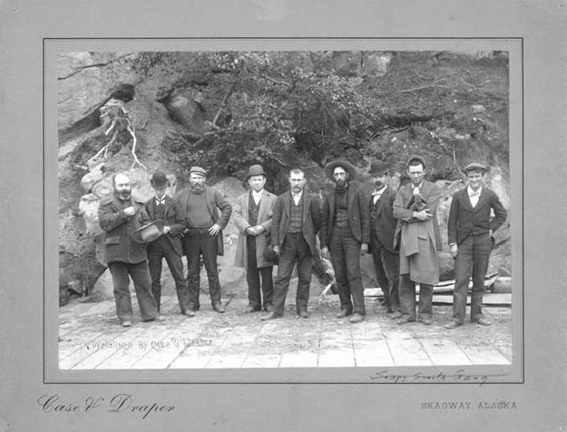
The above photo shows a group of men standing in front of Jeff Smith's Parlor in 1898.
The above storyboard told us about Soapy Smith's troubles, while the storyboard below told us about Martin Itjen's use of the building as a museum.


The White Pass & Yukon Route Railroad depot is now the Klondike Gold Rush National Historical Park Visitor Center. We watched the film "Gold Fever: Race to the Klondike," inside the visitor center. The depot is basically a five-sided building, rectangular in shape except that the southwest corner of the building has been "clipped' because the main track of the railroad curved up past the depot in that location. The bay windows on the second floor of the Broadway side of the building were intended to be used for the dispatcher so that he could keep an eye on the approaching and departing trains.
Construction of the White Pass & Yukon Route railroad began on May 27, 1898. Exactly when the new depot building was begun is unknown but it was probably staked out if not actually under construction soon after the Skagway City Council granted a right-of-way to the railroad company for tracks on Broadway, June 14, 1898. By the fall, lumber arrived for the construction of the two-story wood frame depot. By December 1898 the railroad offices opened on the second floor and the ticket office, waiting room, and baggage room opened on the first. After the completion of the adjacent railroad general offices, the depot was remodeled, with additions connecting the building's front and rear with the general offices. The depot was acquired by the National Park Service.


Above the White Pass and Yukon Depot stands behind the train that is moving up Broadway in Skagway. Inside the visitor center was information about Jack London (stampeder and writer); Mollie brackett (Skagway resident and amateur photographer); and Chief Isaac (leader and entrepreneur).
Jack London was an American novelist, journalist and activist. He was one of the first American authors to become an international celebrity and earn a large fortune from writing.
Mollie Brackett was the daughter-in-law of George Brackett who built the Brackett Toll Road up the White Pass Trail. Mollie Brackett took many photos of everyday life in Skagway from 1898 to 1900. Her non-professional but informative photos were labeled and included many well-known aspects of the Klondike Gold Rush -- the internment of Soapy Smith's gang, the building of the Brackett Road, and traversing the White Pass Trail in the snow.
Chief Isaac was the well-known chief during the Klondike Gold Rush in 1896.
Above the Glacier Bay Trading Company specializes in great souvenirs.
One of the most popular attractions in Alaska is the White Pass & Yukon Route Railroad. The White Pass & Yukon Route Railway, “The Scenic Railway of the World” was built in 1898 during the Klondike Gold Rush. This narrow gauge railroad is an International Historic Civil Engineering Landmark. On the train, you can experience the breathtaking panorama of mountains, glaciers, trestles & tunnels from the comfort of vintage rail cars.


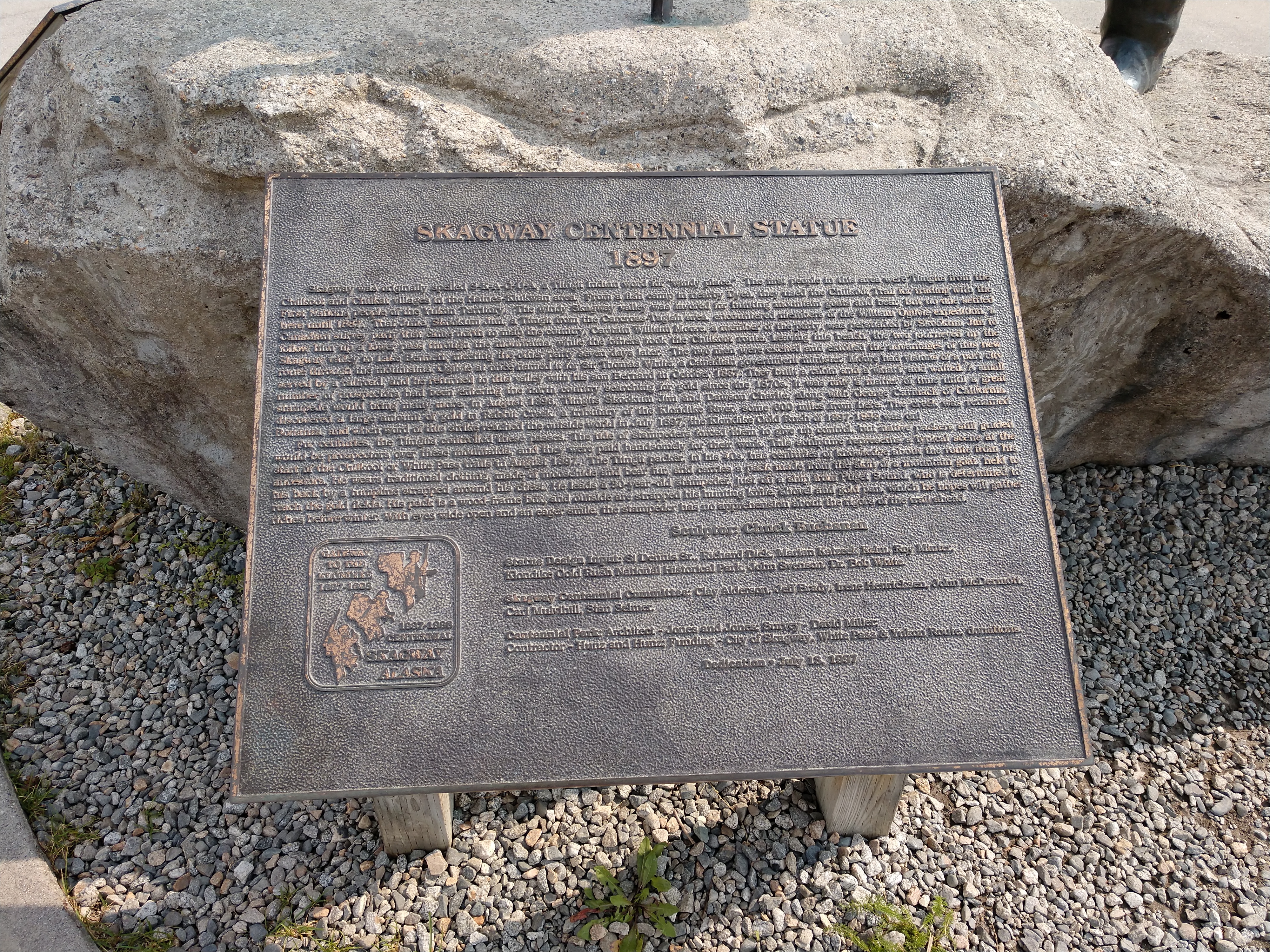
The Centennial statue (shown below) that is in the the middle of a park near the White Pass train depot was erected in 1997 to celebrate the 100-year anniversary of discovering gold in the region. It shows a scene that was typical of the start of a prospector’s journey through the small city of Skagway up to White Pass: a Tlingit packer showing the way.
The inscription on the monument (shown above) gives you a little history about how Skagway got its name; it was originally called “Skagua,” which is a Tlingit word for “windy place.” The plaque also provides some information about the first people in the area, the Tlingits from the Chilkoot and Chilkat villages, and how they worked with the stampeders that flocked to the area to make some of the first discoveries of gold during the Klondike Gold Rush.


The above storyboard told us about the sinking of the ship SS Princess Sophia on October 23, 1918. Approximately 6 years after the sinking of the Titanic, the SS Princess Sophia, also named the “unknown Titanic of the West Coast,” remains one of the worst shipwrecks on the west coast of North America. The tragic sinking of the SS Princess Sophia, a Canadian Pacific Steamer occurred in late October 1918.
At least 353 passengers and crew lost their lives in the wintery waters near Vanderbilt Reef. The shipwreck occurred days before the end of the First World War. Newspapers were highlighting the Armistice that ended the war and headlines focused on the increasing fear of Spanish influenza rather than the news of a tragic shipwreck in Alaskan waters.
On Wednesday October 23rd, 1918 the Daily Alaskan announced, “Steamer SS Princess Sophia leaves Skagway P.M. -- Tickets Take Same Rate to: Vancouver, Victoria, Seattle, Tacoma, Olympia, Everett, Bellingham, Anacortes and Port Townsend.”
At 10:10 pm on October 23rd, 1918, the SS Princess Sophia departed from Skagway on her last run of the season to Vancouver and Victoria, 3 hours behind schedule. The 353 aboard the Sophia included miners, territory and city government officials, businessmen, civil servants, their wives and children, and crew members. It was a diverse group representing individuals from the Yukon and Alaska. Four hours into the journey out of Skagway, the SS Princess Sophia had shifted course.
(Above is the SS Princess Sophia underway with passengers on deck.)
At 2:00 a.m. on October 24th, the Sophia crashed into Vanderbilt Reef at a speed of about 11 knots. Distance from the shore was most likely miscalculated with heavy snow, fog, and zero visibility. How the ship came to hit the Vanderbilt Reef there is no definite answer -- Sophia's log was never found and all of the ship's officers perished. Upon striking Vanderbilt Reef, the ship's operator sent out a distress call to Juneau. But after grounding on Vanderbilt Reef in Lynn Canal near Juneau, all 364 people aboard the ship died, making the wreck of Sophia the worst maritime accident in the history of British Columbia and Alaska.
The above storyboard told us about the rotary blade snowplow.
A rotary snowplow is a piece of railroad snow removal equipment with a large circular set of blades on its front end that rotate to cut through the snow on the track ahead of it. As the plow spins its huge blades it throws snow to the side. It was built in 1898 and cleared the tracks until 1964. It was restored in 1995 to be displayed here.
Mel stands in front of the enormous rotary blade snowplow.
Above is the monument to the fatal duel and death of Soapy Smith and Frank Reid at Skagway -- who fought this duel in the latter part of the summer of 1898.
The inscription reads: "Frank Reid, guarding the approach to Sylvester's Wharf, where the vigilantes were meeting to restore law and order, shot 'Soapy Smith' who failed to stop when challenged, July 8, 1898."
Smith operated confidence schemes across the Western United States and had a large hand in organized criminal operations in both Colorado and the District of Alaska. Smith gained notoriety through his "prize soap racket," in which he would sell bars of soap with prize money hidden in some of the bar's packaging in order to increase sales. However, through sleight of hand, he would ensure that only members of his gang purchased "prize" soap.
Soapy Smith died in one hour and Frank Reid lived for 9 days. Smith was a gambler, saloon keeper and had a bad gang around him.
(Jefferson "Soapy" Smith standing at the bar in a saloon in Skagway -- July 1898.)
The site of Soapy's final duel was near First Avenue and State Street. On the evening of July 8, Soapy rallied six of his men with plans to break up another vigilante meeting. Armed with a Model 86 Winchester and a pair of revolvers, Soapy strode forward until he was confronted by city engineer, Frank Reid who challenged him, "Halt, Smith! Where are you going?"
According to an eye witness, Soapy shouted, "Out of my way, you son of a bitch!" and brought down his rifle butt on Reid's head just as Reid drew his revolver which misfired. Soapy cried out, "My God, don't shoot!" A man named Murphy came to Reid's assistance and grabbed Soapy's gun which fired into Reid's groin. Almost simultaneously Reid fired a shot into Soapy's heart, followed by another into his stomach. Soapy died on the spot; Reid was hospitalized until his death on July 20.
Leaderless, Soapy's men scattered, but were rounded up by members of the vigilante committee. Some were shipped out of town, while others including Deputy Taylor were jailed pending trial. Upon arrival of federal Marshal James M. Shoup on July 13, the vigilantes turned their prisoners over to the authorities.
The Port of Skagway is the northernmost ice-free, deep-water port in North America that offers intermodal access to Pacific shipping lanes through its existing port infrastructure. Due to its strategic location, the Port of Skagway has and continues to provide key, year-round transportation access and capacity between the contiguous United States, the Yukon Territory, Northern British Columbia, the Northwest Territories, Nothern Alaska, Asia and Europe while also accommodating a robust seasonal cruise industry for the area.
Above and below are cruise ships in port today in Skagway.
Happy Endings Saloon, sometimes rowdy and always fun is the only real Skagway saloon that is open year round with a full-service bar, a dozen beers on tap, and the only Corn Hole Arena in the great state of Alaska.
The above screenshots show how my Garmin tracked our walking tours of Skagway today. It was a total of 6.89 miles in a little over three and one-half hours.


.jpg)


.png)
.png)


No comments:
Post a Comment