Saturday, August 12, 2023
Today started out as another cloudy, rainy day and it was 55 degrees.

.jpg)
.jpg)

With raindrops on our windshield, we drove out of Hyder and to our first stop at the Canada Border Services Agency (CBSA) border crossing at Stewart, British Columbia.


The Hyder - Stewart Border Crossing connects the communities of Hyder, Alaska and Stewart, British Columbia on the Canada–US border. This border crossing was so easy -- very few questions asked. They sent us quickly on our way.


We are now back in British Columbia and we once again have to think metric when converting speed limits (50 km/hour equals about 30 mph).


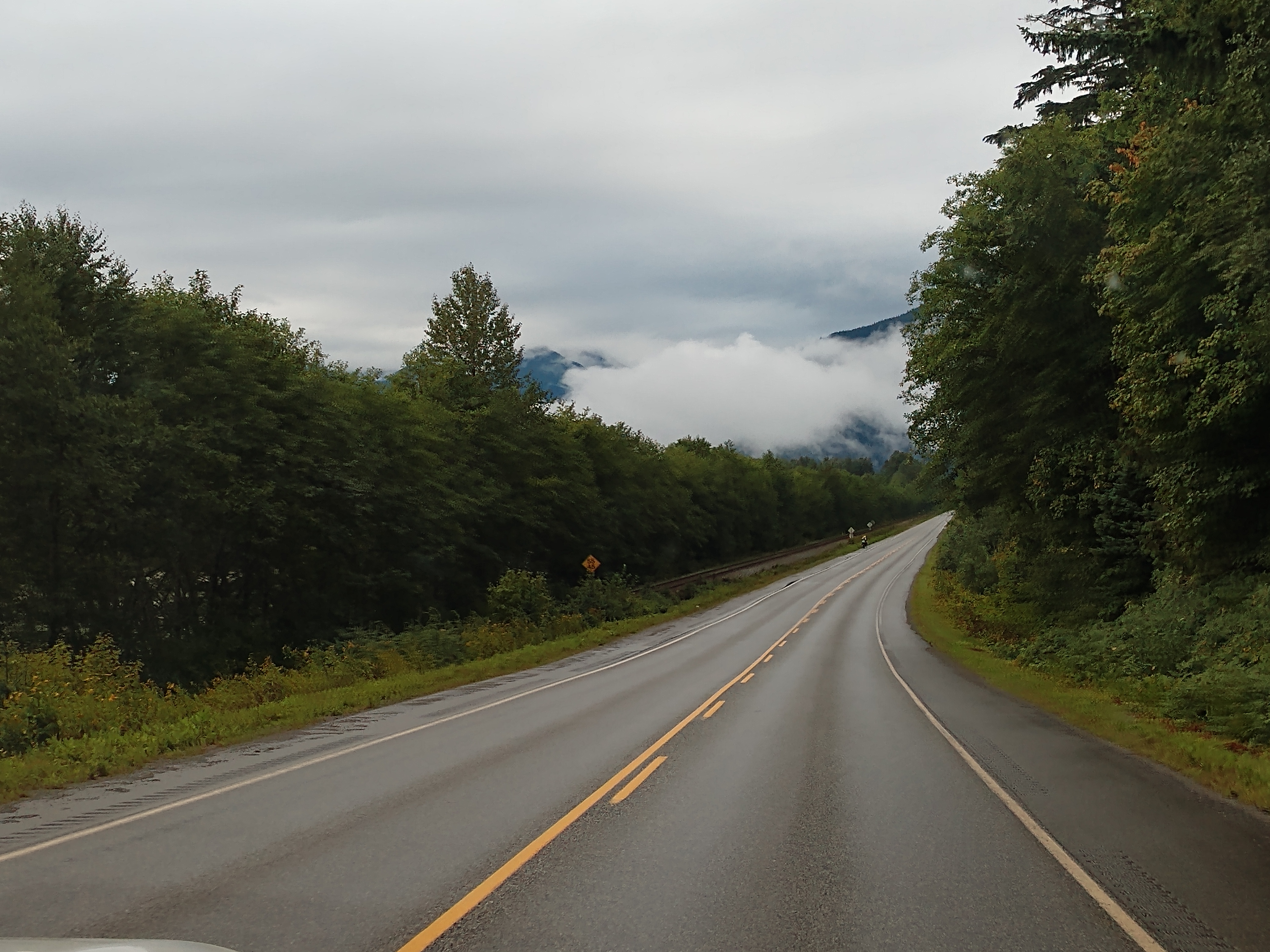
Looking among the raindrops, we caught a view of a waterfall (see below).


As we are going to Terrace and Prince George, we followed the sign and turn right.


It is 218 km (or about 135 miles) to Terrace, British Columbia.

Now it is 167 km (or about 104 miles) to Terrace, British Columbia.

We just passed the turnoff for Gitanyow, which has a population of 434. It is a small First Nation village with one of the largest concentrations of standing totem poles in northwestern British Columbia.

And soon we go past Kitwanga -- which is at the crossroads of the old upper Skeena “grease trail” trade. The “grease” was eulachon (candlefish) oil, which was a trading staple among tribes of the Coast and Interior. The grease trails were believed to have extended north to the Bering Sea.

We are now at the junction for the Yellowhead Highway South (Hwy 16).

And after we crossed the bridge, we took a turn right to continue on to Terrace (Hwy 16 West).


We are now 92 km (or about 57 miles) to Terrace, British Columbia.


As we continue down the highway, we are now 48 km (or about 30 miles) to Terrace, British Columbia. Prince Rupert, British Columbia is 192 km (or 119 miles) away.

We have once again ran into some road construction and up ahead was the stop light controlling traffic through the area.


The road construction appears to be another bridge that they are working on (see below).


The community of Thornhill is an unincorporated settlement on the east side of the Skeena River immediately across from the city of Terrace, British Columbia. Terrace is connected to Thornhill by the Old Skeena Bridge and the Dudley Little Bridge, also known as the "New Bridge." Because of its contiguousness with Terrace along the Highway 16 corridor, many visitors and newcomers to the area consider Thornhill a part of Terrace. However, that is now changing now that signs are going up identifying Thornhill as a vibrant community with more than 5,000 residents.

The ‘Welcome to Thornhill’ sign on Hwy 16 above is at the eastern approach to the community. It’s a creation of local wood artist J.J. Jung. This sign reflects more about the community of Thornhill and its depiction of a horse logger harkens back to the earlier settlement days.

And then again -- as we look ahead -- we see the orange flagger sign with more road construction. Ugh!


Terrace and Prince Rupert are now located straight ahead.


We have now entered Terrace. Terrace has a population of 11,320 and an elevation of 220 feet. Logging was the major industry in Terrace for decades. For a time, the community was known as the “cedar pole capital of the world,” and the world’s largest cedar pole was cut here at 162 feet.
While we are in Terrace, we stopped at the Subway and shared a foot-long sweet onion chicken teriyaki sub and sun chips. While we were in Terrace, we also got gas for the truck at a Petro Canada gas station and then stopped at Walmart for some groceries.

As we had planned to stay for the night in Terrace, we drove into the Ferry Island Campground and Nature Park to check it out and see if they had any available camping spots. But to our dismay, nothing was available for the night.

Ferry island, at one time, got its name because it was a major hub for two riverboat ferries during the early 1900s. A ferryman lived on the island, a First Nation riverboat captain, who operated the ferries. In 1936, the island was 8 feet underwater because of the great Skeena River Flood which took out the bridge built in 1925 and was the last time someone lived on the island. One of the major highlights are the carvings found along the Ferry Island Trail carved into the bark of the trees. There is said to be over 55 carvings hidden in the forest. Carved by a local artist, Rick Goyette, you can discover faces and birds, carved discretely into the bark of the trees along the trail.

As I was hoping that we would be able to look for these carved faces in the trees while staying at Ferry Island -- I had my eyes open when Mel stopped to see if they had any sites open. I was able to catch a glimpse of one of the carvings in the tree (see above).

So we had no choice, we continued on toward Port Edward 127 km (or 79 miles) away and Prince Rupert 139 km (or 84 miles) away.


Next we drove by the Shames Mountain ski area. Shames Mountain is located west of Terrace in the spectacular Shames Valley amidst the majestic Coast Mountain Range of British Columbia. Established in the early 1990s, Shames Mountain has 28 cut runs and an abundance of natural glades.


The railroad track followed along the highway with us, switching back and forth from one side of the road to the other.


We drove by Exchamsiks River Provincial Park, located in the Range 5 Coast Land District, on the north side of the Skeena River between Terrace and Prince Rupert. The park's chief conservation role focuses on protecting one of the last known unlogged old-growth maritime coastal Sitka spruce-salmonberry ecosystems.

Prince Rupert is now 95 km (or 59 miles) away.


At around 4:00 p.m., we see a sign for Kasiks Lodge & Campground, and decide to drive in and see what they have available. But they didn't have any sites with hookups available as they were just redoing the whole campground. So off we go again.


As we are getting closer to Prince Rupert and the coast, heavy clouds are beginning to settle in.


Port Edward is now 60 km (or 37 miles) and Prince Rupert is now 72 km (or 45 miles) away.


We came upon a double bridge (with the one on the right being a railroad bridge).


The road curved all around the coastline.

We are now at the Rainbow Pass chain up area.
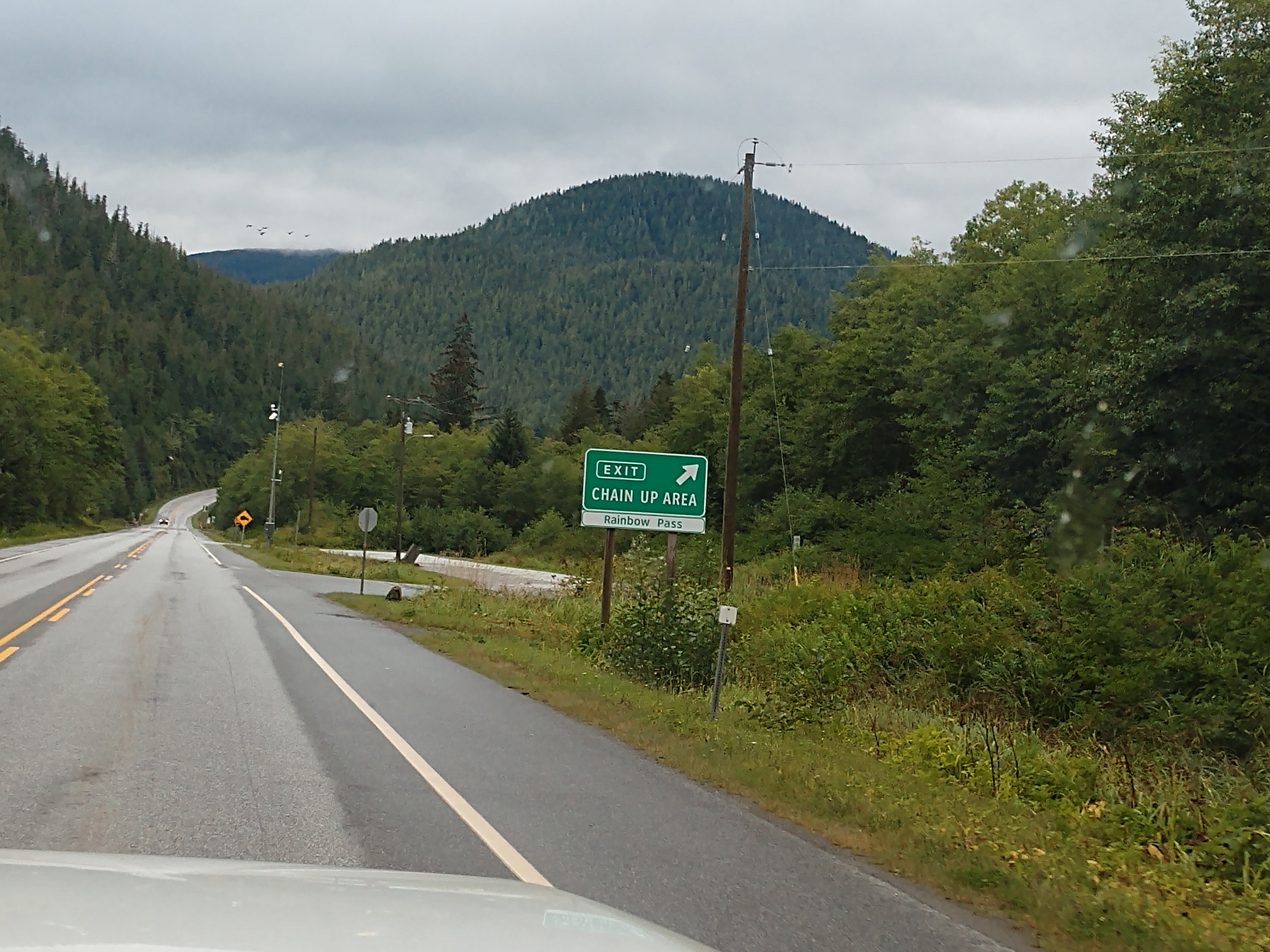
Rainbow Pass is a pass in British Columbia, that has an elevation of 160 meters (or 525 feet) at its summit.


We passed by Rainbow Lake Road and we see the sign for North Pacific Cannery at the Port Edward exit.


Port Edward is now 4 km (or about 2-1/2 miles) away.


We followed the sign for Port Edward, which is now 3 km (or less than 2 miles) away.

And then we saw the sign to Kinnikinnick Campground, so we pulled in to check on availability. Lucky for us, we got the very last site that was available for three nights.

Nestled between mountain and ocean, Kinnikinnick Campground featured uniquely designed and beautiful private sites. (It would have been more difficult if we had our big truck and fifth-wheel as the sites were a little tight, but his was perfect for us.) With eagles soaring above and deer browsing about, the true flavor of the North Coast was right at our door step.


Above is the campground map of Kinnikinnick Campground & RV Park in Port Edward, British Columbia. We're staying on site #A for three nights for $148 CA total (or $35.75 US per day).


Sunday, August 13, 2023
This morning, we left the campground and headed to Prince Rupert. It was cloudy and raining again with a temperature of 60 degrees, but that didn't stop us.


We spotted several "Welcome to Prince Rupert" signs.


Prince Rupert has a population of 13,392 and an elevation of sea level. Prince Rupert is the terminus for ferry traffic to Southeast Alaska, Haida Gwaii and Vancouver Island. It is one of the deepest, natural ice-free harbors in the world. Prince Rupert is located in the heart of Tsimshian territory, and for 10,000 years many villages flourished in the harbor. European explorers first arrived off the northern coast in the 18th century and quickly established a maritime fur trade with the Tsimshian and the neighboring Nisga’a, Haida and Heiltsuk nations.
Fishing and trading were ancient businesses on the Northwest Coast, and the village of Port Essington sprang up at the mouth of the Skeena to capitalize on this. Prince Rupert, the “Gateway to Alaska” was surveyed prior to 1905 by the Grand Trunk Pacific Railway (later changing its name to Canadian National Railways) as it terminus for Canada’s second transcontinental railroad. After the railroad focused its attention on Kaien Island, the city developed quickly—the first surveyors arrived in 1906, a “tent city” sprang up almost immediately, and by 1910 the City of Prince Rupert was incorporated. Charles M. Hays, president of the CNR was an enthusiastic promoter of the new terminus, which was called “Prince Rupert.”
Settlers responded to the enthusiasm of Hays and his dreams of a population of 50,000 with world markets supplied by his railroad. However, both the railroad and city suffered a great loss when Charles M. Hays went down with the Titantic in April 1912. Even so, work went ahead on the Grand Trunk Pacific, and two years later the first train arrived at Prince Rupert, linking the western port with the rest of Canada. Following two world wars, a pulp mill and other major industries were added to Prince Rupert’s economy, helping to build the vibrant seaport community and transportation hub of today.


Hmmm. . . what do cows, totem poles and salmon all have in common?
They are all part of Prince Rupert’s fascinating heritage. Stay tuned as I will later tell you about Cow Bay and show you some of the totem poles in Prince Rupert. Also, Prince Rupert's long history of fishing has earned it the title of “The Halibut Capital of the World.” Numerous charter fishing companies draw sportfishermen searching for massive halibut, trophy-sized Chinook salmon, Coho salmon, red snapper, ling cod, rock cod and Dungeness crab. (And tomorrow we will be visiting the North Pacific Cannery National Historic Site in Port Edward, which showcases the history of the fishing industry and the role of canneries in the area.)
Our first stop today was at the Prince Rupert Visitor Center. After that we drove around town looking for the totem poles in Totem Pole Park, and other areas in Prince Rupert.
Totem poles are wonderful examples of aboriginal art – the ancient practice of totem carving has been handed down through generations as a way of preserving the history of local native heritage as well as honoring tribal rituals and sacred spirits of people. The totem poles – created by Ts’msyen and other First Nations – punctuate the city. Indigenous artists depict their family lineage and cultural heritage by carving family crests, humans, animals, birds and fish into the stately trunks of western red cedar trees. We viewed totem poles in Cow Bay, at the Sunken Gardens Park, and in the Totem Park.


Below is the Prince Rupert Cruise Terminal that can accommodate vessels of up to 960 feet in length and 50 feet in draft. A 4,000 square-foot terminal building provides customs and immigration services. The terminal was constructed in 2004. The terminal has a unique self-adjusting ramp that maintains a gentle incline, regardless of tide levels, for ease of use by all cruise passengers. The newly constructed Atlin Promenade serves as a dedicated pedestrian walkway to the Atlin Terminal, which connects visitors and residents alike to amenities like the Cow Bay Marina.


Below is the Atlin Terminal. Formerly the Atlin Fish Plant, the conversion of Atlin Terminal into a trendy community centerpiece marks the beginning of the area’s transition from industry to tourism. Fishing boats once lined the waterfront, with Cow Bay businesses catering to ships and processing plants in the area. Though many of the old processing plants are gone, the area retains its authentic feel. Atlin Terminal houses a market area, retail space and public washrooms, with office space on the upper floor.

Cow Bay, a trendy bovine-inspired district – with its black-and-white Holstein-colored fire hydrants, trash cans and signs – was a pleasant surprise.
The sign below told us about historic Cow Bay. Cow Bay acquired its name in 1908, when the first herd of dairy cows arrived by ship. No suitable dock was available to unload the cattle, so they had to swim ashore in Prince Rupert’s bay. Today, a steady stream of cruise ship passengers come ashore at the Northland Terminal, opened in 2004 at Cow Bay, not far from downtown Prince Rupert.
Whether fact or fiction, one thing remains true – these legen-dairy cows have left a long-lasting influence on Prince Rupert . . . even a hundred years later. Today Cow Bay is a waterfront area of historic buildings, many of them built on pilings over the water. Though visitors will still find working marine shops providing services for the commercial fleet, Cow Bay is a trendy shopping district where visitors can book area tours, visit a variety of boutiques, including souvenir and gift shops, or relax in one of several restaurants and coffee shops.


(Above is a photo of some of the first cattle in Prince Rupert.)
* * * * *
HISTORY OF COW BAY
Before European settlers came to Kaien Island and the shores lined with fishing boats, canneries, and marine supply shops, Cow Bay district was once a Ts’msyen village called Wil lun oo, a home to the Gispaxloats laxsgyiik tribe. Since time immemorial, Ts’msyen people have lived in villages along the harbor where they wintered, traded, hunted deer and porcupine, and harvested shellfish, salmon, halibut, herring, and seaweed. And yet, as you walk the boardwalk in Cow Bay today, you may wonder how cows became the namesake and prevailing theme.
The dairy itself didn’t succeed. The cows were fed entirely on imported feed, rendering a steep price for milk, and you can imagine how Prince Rupert’s wet climate and saturated muskeg also led to poor conditions for the cows used to feeding in drier pastures.
In the early days, the Cow Bay district grew fast meet to the demands of the rising fishing industry and arriving settlers. Railway contractors built a new hospital, and a group of pioneer businessmen established the Prince Rupert Rowing and Yacht Club in 1912, one of the oldest running yacht clubs in Canada.

(Above is a photo of boats and waterfront businesses at Cow Bay in 1935.)
Post-World War I, Cow Bay became the centre for the “mosquito fleet” — small vessels took on jobs from towing, ferrying, to fishing. Small fish plants decorated the wharf, and fish were brought in and shipped out immediately on railroad refrigeration carts. From the wharf, a fleet of gillnetters and tall-poled trollers could be seen waiting in anticipation for the salmon season to open. Black cod, halibut, herring, and salmon were all caught and brought here to the docks, where people worked in processing, shipping, and supplying the industry.
Cow Bay was the one-stop spot for fish harvesters, who could tie up at the docks, and walk to any of the shops, cafes, or pubs, without needing to take a taxi. There was Love Electric, a marine electric shop, started by W.R. (Ray) Love in 1919 after he returned to the coast from serving in World War I. Japanese boat builders, Suchiro, Suga, Matsumoto, and Tsumara had shops based in the district until 1941 when they were forced into internment camps during World War II. In 1922, an ice cream and hot dog stand, later known as Smile’s Cafe (after the owner, Dolly Nelson’s kind expression) began serving locals. The Prince Rupert’s Fishermen’s Co-operative Association formed in 1939 to supply fishermen with gear from fishhooks to diesel engines.
Today, you may still see vestiges of the area’s once thriving marine past. Formerly an active fish plant, Atlin Fisheries, remains in the heart of Cow Bay, and within its preserved, blue-painted exterior you’ll find the Prince Rupert Port Interpretive Centre, retail shops, artisans, and a sushi restaurant and marketplace. In 1985, the Fishermen’s Co-op building was renovated to become what is now Breaker’s Pub. Smile’s Seafood Cafe still serves locals today and is the oldest restaurant in the city.
Cow Bay is a blend of its industrial and commercial past mixed with recreation, retail, cafes, and restaurants. In more recent history, the Northland Cruise terminal was built in 2004 allowing cruise ship passengers to spill right into Cow Bay for their day excursion. In 2016, the Cow Bay Marina and public breakwater opened offering waterfront access, sea-level views of marine life, and close-ups of the luxury yachts, sailboats, and fishing boats that tie up here. Beyond the hokey cow-inspired theme, there are layers of history as rich and diverse as the intertidal shoreline where cows once stood within the salty puddles of the slough like the proverbial fish out of water.

A couple more totem poles in Prince Rupert. The totem pole below is in front of the Prince Rupert Carving Shed.


A memorial totem pole (see above) was carved and raised in Prince Rupert on August 11, 2020. It was the first in the city in more than 30 years. Lyle Campbell was the lead carver and the totem pole was erected at Campbell’s family residence on Second Avenue West. Campbell started the project in memory of his mother Alice Campbell, who was a Haida Gwaii matriarch and had passed away six years to the day prior to the raising. The pole is standing tall in the front yard of the family residence just as his mother had wanted.


A couple more totem poles.

One of Prince Rupert's older buildings, the Besner Block (see below) is located in the heart of the downtown area. Dating back to 1928, it's been part of the city's landscape for over 77 years. Presently home to the Scotia Bank, it's a dominant site on the corner of 3rd Avenue and 3rd Street. Adjacent to it is the Federal Block, which was built in 1912 and later became a business block.


We found another couple totem poles outside the Civic Center in Prince Rupert.


We marveled at the numerous colorful murals we found in Prince Rupert. The murals dotted throughout Prince Rupert depicted some of the wildlife that you might see while exploring the area. Many of these murals were painted by wildlife artist Jeff King from Nanaimo, like the whale tail on Johnny's Machine Shop (pictured below), which was the first mural he painted in town.

As you drive around town, be sure to take time to spot more of these delightful artworks like we did -- including a white whale on the side of the Moby Dick Inn or orcas swimming around the Rona Tyee Building Supplies building and on the Pacific Inn (see below).


The other murals we saw in Prince Rupert were of bears and wolves. The bear mural shown above was awesome -- especially when you look at the detail of the mural shown below! This particular mural was located on the Inn on the Harbor in Prince Rupert.


Above is the "Howling Wolf" wall art along one of the roads in Prince Rupert. Below is the beautified McBride Street Gateway at McClymont Park (sponsored by the Rotary Club) with Prince Rupert and British Columbia flag painted on the lawn and flags flying to welcome visitors to the city.

Next we stopped at Wheelhouse Brewing, which opened its doors on the night before Christmas Eve 2013. The original location was a former construction shop playfully known as “the bunker” due to its lack of windows. This small brewery became a big hit with locals who embraced its rustic, cozy charm and fell in love with its creative and well-made craft beers.
Flash forward nearly a decade to when the Wheelhouse’s three founders were presented with an opportunity to take over the former waterfront railway station -- which was built in 1922 using Tyndall stone imported from the Prairies. It served the community until the early 1990s and had been sitting empty ever since. How could they say no? It was another diamond in the rough beckoning to have its walls filled with the yeasty scent of beer and the chatter of customers. The move into the new space occurred in the spring of 2023.
The new location is much larger, which allows the brewers to make more craft beer than they could given space limitations in the original location. It also has windows — lots of them! The second level boasts a sunroom with 270 degrees of glass facing southwest toward the ocean. Another improvement is the addition of a kitchen, including a pizza oven imported from Italy.


Mel enjoyed a flight of craft beer at the Wheelhouse Brewery.

Below is a drawing of a sailor that was on one of the walls in the Wheelhouse Brewery. (I think it looks a lot like Mel with his beard, lol!)

And then as we were hungry, we stopped at Bob's on the Rocks -- a fish and chips stand at the start of the Rushbrook Trail in Prince Rupert. Originally started in 2004 to cater to the local fish charter industry, Bob's has grown into an iconic destination for locals and visitors alike because of our world famous fish and chips. They were the humble recipients of the 2021 Northern View Reader's Choice Award for Best Food Place in Prince Rupert, so we had to give them a try.

We both decided to get the two-piece halibut and chips (as shown on the partial menu below). It cost us a total of $55 CA (which is $40.14 US).

The fish and chips were prepared fresh as we ordered. Besides the two pieces of fried halibut fish and chips (french fries), it also came with a small container of both tarter sauce and cole slaw. The fish was a little bit greasy, but delicious just the same!

After eating our fish dinner, we stopped back at the Wheelhouse Brewery so Mel could get a growler filled with his favorite craft beer. We then headed back to the camper.
Lots of "moo"-ving beauty for our eyes today in Cow Bay and Prince Rupert!
Shirley & Mel


No comments:
Post a Comment