We were up and rolling down the road at 9:00 a.m. It was sunny and 66 degrees, and hit 81 degrees in the afternoon.

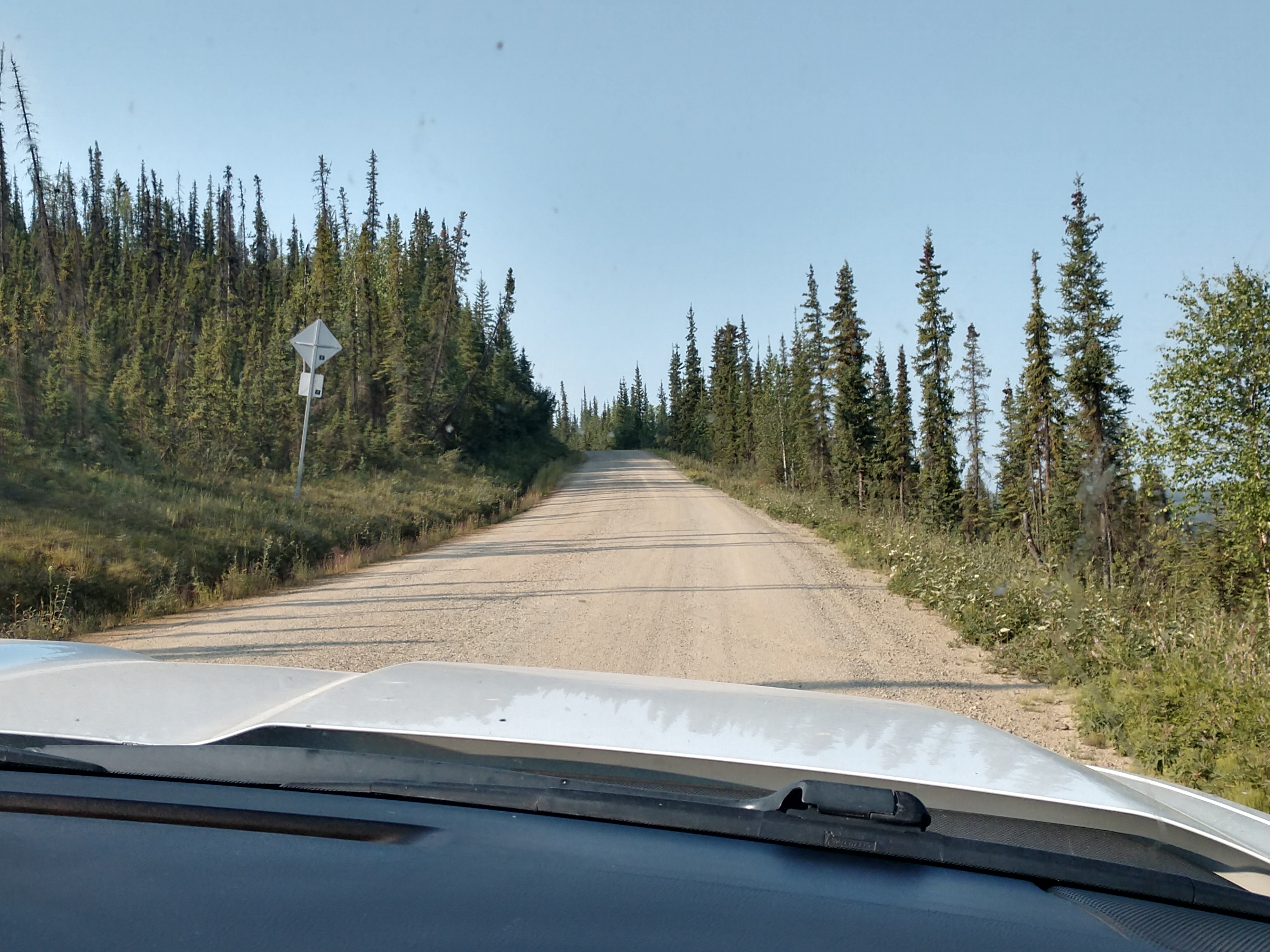
Once again there is lots of gravel road ahead of us today.

As we left Chicken in the dust climbing a hill, we could see the Chicken Gold Camp and Pedro Dredge down in the valley from the side of the road.


After about two miles along our journey tody, we went by Mosquito Fork Dredge Trail. This was an overlook above the remains of the Mosquito Fork Dredge. The dredge was shut down in 1938 after operating for less than 2 seasons.


Continuing on, shortly we came to the Lost Chicken Hill Mine area. The Lost Chicken Hill Mine is a gold mine located at an elevation of 1,699 feet.


The gravel road continued on with many ups and downs, then many sharp hairpin curves to the right and then to the left.


And then we came to some washboard areas in the gravel and lots of snakey road ahead.


We drove by the South Fork River Wayside at mile 75 on the Taylor Road.


The dust really begins to roll as we run into a caravan of trailers going in the opposite direction.


The road continues with more curves and ups and downs.


We then pass by Walker Fork Campground.


Next we drove past the Walker Fork River, which is a tributary to the South Fork Fortymile River at an elevation of 1,509 feet.


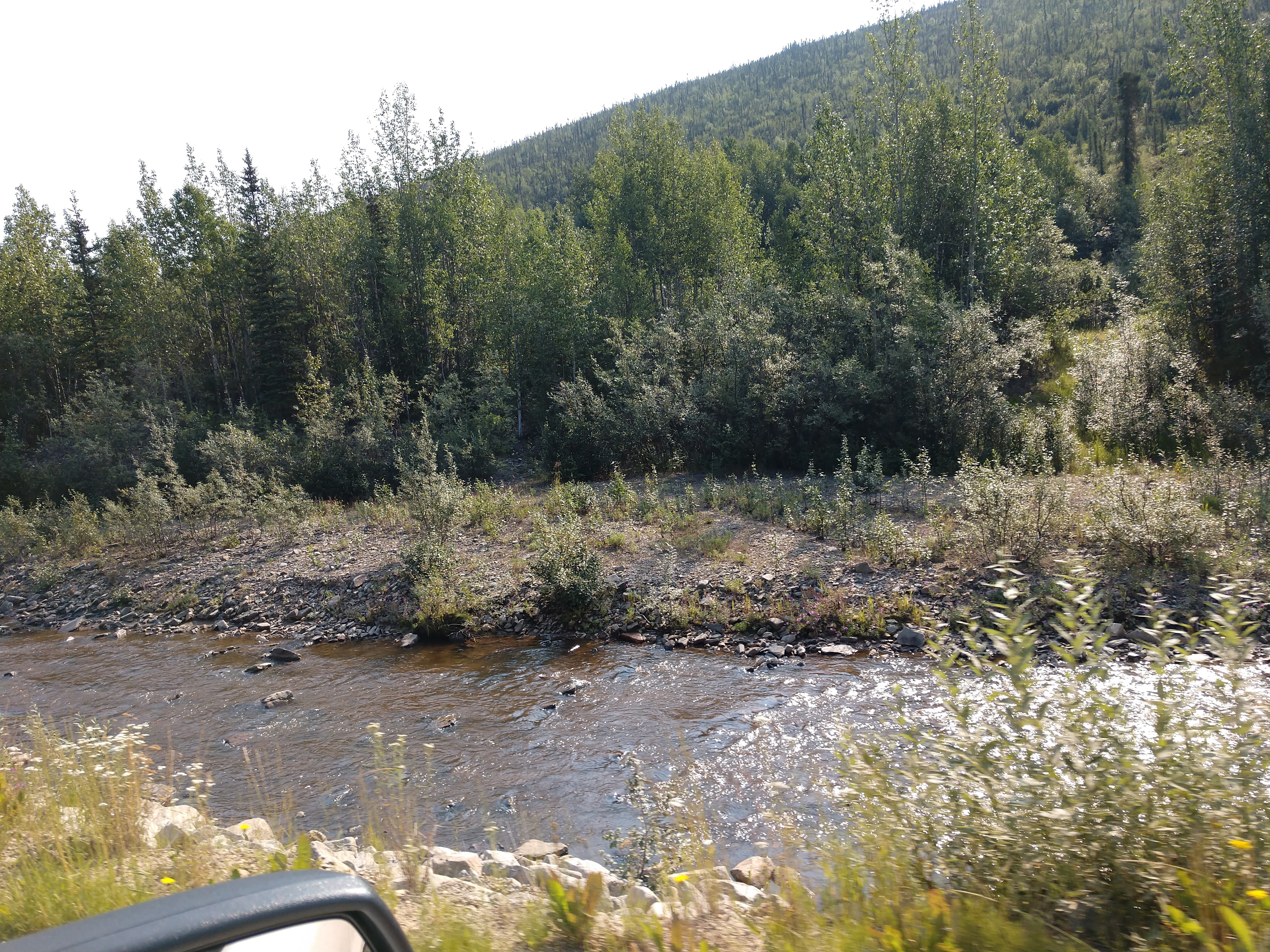
We follow a creek along portions of the gravel road.


The gravel road continues to wind around sharp curves and follow the creek.


We come to the turnoff for Eagle (which we are not taking), which was incorporated during the Klondike Gold Rush and is now home to 89 people. It sits on the bank of the famous Yukon River at an elevatin of 820 feet. Eagle is like no other small town in the state of Alaska, as it is tuly at the end of the road. Eagle was founded in 1880 as Belle Isle, with a population of only 30 or so in 1897, but after the big influx of miners to Dawson City in 1898, the population grew to 1,700. Eagle became an American trading center for the gold seekers. Fort Egbert was established in 1899, adjacent to Eagle and became a key communications center for Alaska when the 1,506-mile-long Washington-Alaska Military Cable and Telegraph System was completed in June 1903.


We are now nine miles from the border inspection station going into Canada.

We have come upon a stretch of paved highway. Yeah!


It appears the paved-section of the highway is going to continue until we almost reach the border. There are some areas of frost heaves that we have to be aware of though.


The sign for the Davis Dome Wayside is above, while the Davis Dome (at an elevation of 4,124 feet) is shown below.

We have just now entered the Pacific Time Zone (which caused us to lose an hour).


The U.S. Poker Creek-Little Gold Creek Customs is just ahead. This crossing is located on the 'Top of the World Highway," which connects the communities of Chicken, Alaska and Dawson, Yukon on the Canada-United States border. This crossing is notable for being the northernmost international border crossing in North America. Located at a remote spot known as Little Gold Creek, there is just one building that serves both U.S. and Canadian customs. Because the border passes right through the middle of the small building, it literally straddles two different time zones.


Customs was fairly easy again -- as we were asked the following questions: 1) where are you from; 2) how long do you plan to be in Canada; 3) do you have any firearms; and 4) do you have any firewood. Easy peasy and then we were on our way again.

.JPG)
The 'Top of the World Highway' snakes through breathtaking North American scenery. Rolling hills flank a path sparsely studded with clusters of scraggly trees. On this boreal route sits Poker Creek, the United States' northernmost terrestrial border crossing. At an elevations of 4,1247 fee, Poker Creek is the second highest border crossing along the U.S.-Canada border.

We have now arrived in the Yukon Territory of Canada once again.

The road has turned to all gravel again. It is like this all the way to the George Black Ferry crossing into Dawson City, Yukon which is about 65 miles away.


As we again meet a caravan, the road becomes very dusty.


As we continue, the road goes up and down and curves along.


It is very slow going and dusty!


There were beautiful views along the way.


We were able to find a pulloff that was a little way off the dusty gravel road so we could fix a lunch meat sandwich for lunch before arriving at the George Black Ferry.


With just about 18 miles until the George Black Ferry -- we hit the dusty road again.


We came upon this billboard that welcomed us to Dawson City.


We then come to an area on the gravel road where they are watering it and doing some road work.


We are now a little over a mile to Dawson City.


We slow down now as the George Black Ferry crossing is just ahead.


And we get into a line as directed for the crossing.


And then the ferry arrives from the other side, but we don't make it on this trip across the Yukon River. We have to wait for the next one.

The George Black Feffy Service crosses the Yukon River and provides access to the 'Top of the World Highway' from the North Klondike Highway for motorists passing through Dawson City. It is a free service that runs 24 hours per day.

The George Black steel ferry has been transporting people and vehicles across the Yukon River at Dawson City since 1967. Built by Allied Shipbuilders of Vancouver, it was cut into sections and shipped to Whitehorse. The 10 sections arrived on White Pass & Yukon Route flatcars in late April 1967, and 5 weeks later it was launched at Whitehorse.

The ferry left Whitehorse for Dawson City on Thursday, June 8, 1967, but it grounded on sandbars at least twice. The first time was near the Marwell area just downstream from Whitehorse , where they were able to ge assistance from the Department of Public Works crew with winches and cables, and then 9 miles before reaching Dawson City -- the old ferry McQuestien helped them get off that one. They arrived at Dawson City on Wednesday, June 14, 1967.

The George Black can carry substantial loads -- vehicles up to 83 feet long and/or 17 feet wide, with weights of up to 143,000 pounds. When the ice floating down the river gets too thick to operate safely in the fall, the ferry is slid up wooden ways onto the top of the dyke, where it sits until spring. When the ferry isn't operating, the 'Top of the World Highway' closes and snow isn't plowed past the road to West Dawson City. When the ice on the river gets thick enough, an ice road is created to access West Dawson City.

It is now our turn to get on the ferry to cross over to the other side (Dawson City).


And across the Yukon River we go . . .


And we are now in Dawson City, Yukon. Dawson City has a population of 1,879 and an elevation of 1,050 feet. Dawson City was the site of the famous Klondike Gold Rush in 1898. This fascinating gold rush history makes it one of the most interesting towns to visit. The Klondike Gold Rush only lasted a few short years, but its legacy live on. More than a century later, gold mining remains an economic mainstay and has produced close to 14 million ounces of gold in the past 120 years.

It all began with Robert Henderson, a fur trapper and part-time prospector who in 1894 found gold in Rabbit Creek (later renamed Bonanza Creek) near the confluence of the Yukon River and the Kondike River. When he had finished prospecting this clear, shallow creek, he was certain he was close to a major find. Two years passed, however before he could persuade his friend, George Carmack to go back to the area. Carmack and his native companions, Dawson Charlie and Skookum Jim, explored the area around the river the First Nations people call "Tr'ondek" -- or Klondike to English tongues. The three lucky prospectors discovered gold on Bonanza Creek on August 16, 1896 marking the beginning of the Klondike Gold Rush!
A short time later, at the nearby mining camp of Fortymile, Carmack registered the claim. Within days, Bonanza and Eldorado Creeks had been staked from end to end. Carmack did not tell Henderson, who ended up missing out on the richest claims. Thirty thousand prospectors and miners, entrepreneurs, bankers, gamblers, prostitutes and con artists from every corner of the continent came across snow-covered mountain passes and down the Yukon River to claim their fortune in the Klondike. Most who made the journey found no gold at all. But the hope of striking it rich was not all that mattered. For many of those who made the incredible expedition, the Klondike represented an escape from everyday life and adventure in a new frontier.

In its heyday, Dawson City was full of miners and businesses. The ciy was full of first-class entertainment and services for those who participated in the gold rush. It is one of the best-preserved and most beautiful towns from the time of the gold rush as you can see as you stroll around the city along the wooden sidewalks and admire the wooden facades of shops, hotels, and entertainment centers.
Dawson City grew up in the shadow of a scar-faced mountain called Midnight Dome. Here on the flats of two Klondike rivers -- the Klondike and the Yukon was a city of mud streets, churches, saloons, casinos and theatres. White Pass & Yukon steamers were typically berthed at riverside docks bringing a steady stream of people and supplies. These beautiful boats were part of a fleet of 250 paddlewheelers on the Yukon River.
The Klondike Gold Rush had a major impact on the local First Nations, The Han. They inhabited the land around the Yukon, Stewart and Klondike Rivers for several thousand years and were one of the few Yukon tribes to develop permanent villages in the Yukon. Today, they are concentrated in Dawson City where they operate the Dänojà Zho Cultural Center.

We are now heading to Bonanza Gold Motel & RV Park where we will be staying for three nights.


We stayed in this campground for three nights for $140.18 Canadian ($103.62 US total or $34.54/day).

After we got set up on site# 33, we realized it had extremely low power, so we had to move to site #35.


Since it had been a pretty long travel day on a dusty, pretty rough highway, we decided to just hang around the RV and relax. For dinner tonight, we had steak and foil packets with potatoes, carrots, onions, and green peppers.
Hoping to have gold dust dreams tonight!
Shirley & Mel


Wow what a trip. So interesting. The gravel roads and ferry. I just love reading it. Every curve and the rivers and streams are so beautiful. Thabks for blogging. What a great trip. 👍 ❤️
ReplyDelete