Today we left our boondock site at Destruction Bay around 8 a.m. to a sun-filled sky and a temperature of 49 degrees that would reach 67 degrees before the end of the day.
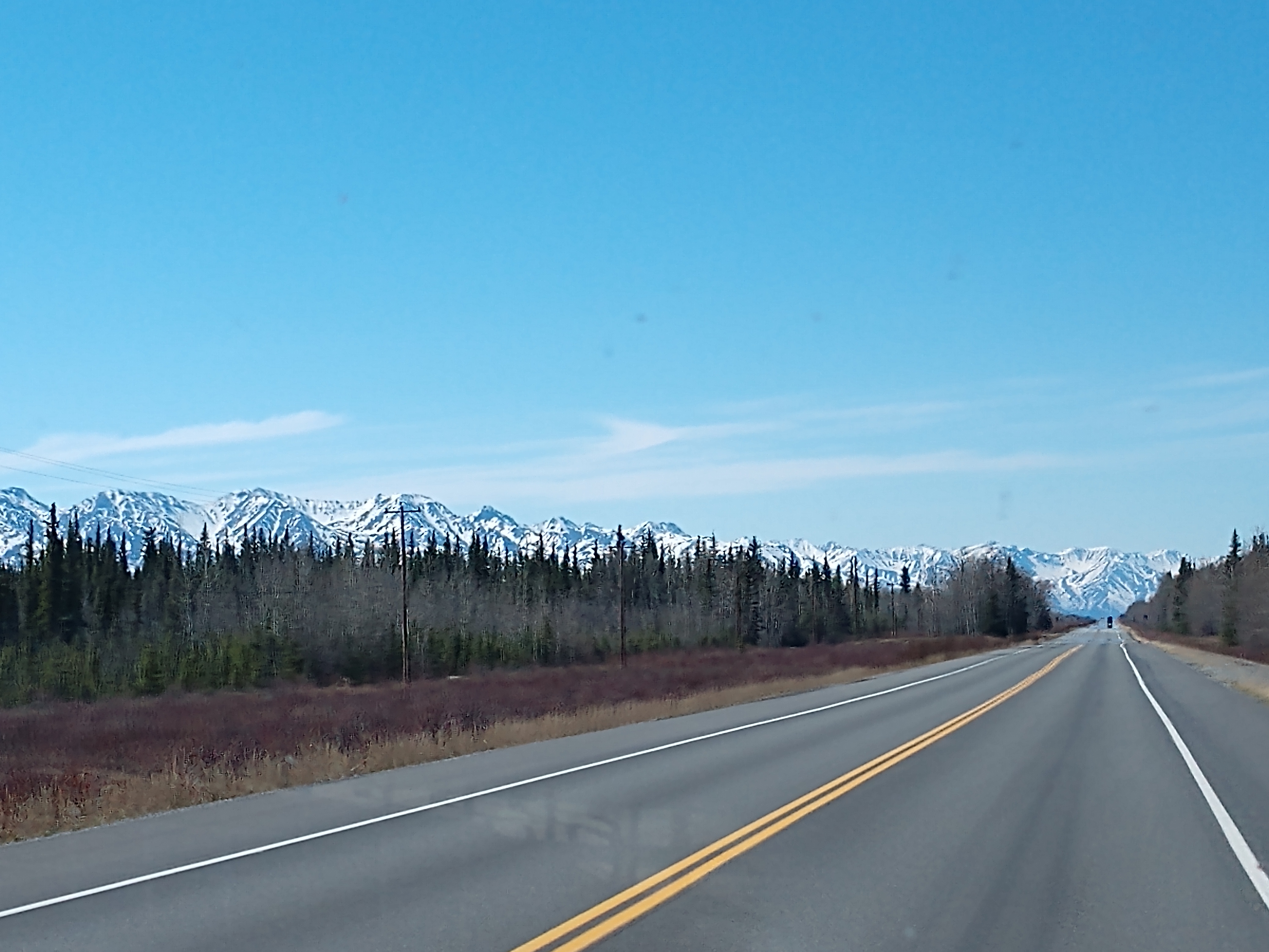
We got to experience the worst part of the Alaskan Highway from Destruction Bay to the Alaska border, with this section of the highway always "under construction" since it was first built hastily in 1942. Frost heaves have made the road full of rough spots and pot holes. We encountered many sections of road construction.
Heading out on our way to Tok, we first stopped at Burwash Landing to do a walking tour (which took us 1-1/4 hours to complete).
Burwash Landing has a population of
84 and is located on the shore of
Kluane Lake. Burwash Landing is one of the oldest settlements in the Yukon. The
original trading post was established in 1904 by the Jacquot brothers, Louis
and Eugene, as a supply center for local miners. A lodge was built here in
1944-45 to serve highway travelers.
1. The walking tour in Burwash Landing started at the Kluane Museum of Natural History. Konrad Domes and his class at Yukon College originally designed this
building as a Catholic Church and the First Nation congregation built it in
1974. The church was considered too large for the community but the design was
so unique that Father Huijbers asked the museum society if they would be
interested in using it for their planned museum structure.
The biggest gold pan in the world is in front of the museum. Fred O’Brien, a Roman Catholic missionary, painted the mural on the gold pan.
On June 12, 1999, as garbage was being burned at the Burwash Landing garbage dump, embers were carried by the wind into the nearby forest and started a blaze. The strong winds drove the fire out of control and into the community. Most of the Burwash Landing inhabitants had to be evacuated and it left over 7,900 acres of burned land.
This is some of the remains from that fire.
2. Our Lady of the Holy
Rosary Church is the next site on the tour. Father Eusebe Morisset traveled north in 1943 to serve as
an auxiliary chaplain with the American Army. He was responsible for the area
from Whitehorse to the Alaska border. Father Morisset built the main church at
Burwash Landing in 1944 with the help of the Jacquot brothers and the First
Nation congregation. It was the first church northwest of Whitehorse on the new
Alcan Highway. The materials for the building came from an abandoned army mess
hall at Duke Meadows and the Jacquots donated the land.
The church door was open, so we stepped inside to take a look.
We couldn't find the Burlbilly Hill Cabin that was supposed to be #3 on the map.
4. Jimmy Johnson House, a log house that was built by Jimmy
Johnson for his very large family in 1929. It was
originally located on the shore of Kluane Lake by the small dock. The Jacquots
purchased the house from Jimmy in 1946 and used it as living quarters for the
lodge staff.
5. Moose Horn Cabin was built by Louis Jacquot around 1939. During the early 1950s, Jack
Saunders and his wife and seven children lived cozily in this little log home.
Jack was a surveyor on the Canol Road and Alaska Highway. Originally from
Alabama, the Saunders were the first African-American family to live in the
area. From 1955 to 1957, Pieter and Margaret Van der Veen lived in the Moose
Horn Cabin with their children, Gary and Karen. Pieter was a grader and heavy
equipment operator on the Alaska Highway.

6. Burwash Landing Resort. Soon after they arrived in the area, the Jacquot brothers started to work in the
guiding business with Tom Dickson whom they had met at Dyea, Alaska on the way
to the Klondike goldfields. Guiding turned into a family business when Gene
Jacquot married Tom Dickson’s eldest daughter, Ruth. Their business was small
until the American army established a base camp at Burwash Landing during the
construction of the Alaska Highway. The original two-story lodge was built in
1948 and can be identified in the modern building by the low hip roof, small
windows and oak flooring. The lodge was identical to a now demolished lodge at
Johnsons Crossing. Logs for the lodge were milled by Mickey Blackmore at Bear
Creek and were carted and barged to Burwash Landing. A large barn that also
served as a dance hall spanned the creek near the current parking lot. Eugene
Jacquot owned and operated the Burwash lodge until his death in 1950.


7. Kluane Lake Boats -- there are several boats on the beach behind the Burwash Landing Resort. The
“Josephine” was built in 1931 by the Jacquots and named for one of Louis’
daughters, Josie Sias. It had an inboard motor and was rigged for sail. The
“Josephine” replaced the Jacquot’s old unnamed 1920s freighting boat, beached
to the right. The “Kluane” was originally named the “Rosalie”, for Louis’ other
daughter, and was used in the 1940s. Archie Lampman built the blunt-ended boat
around 1944 for Ruth Jacquot. As a child, Ruth delivered messages and mail in
the area. By age 15, Ruth was traveling alone by dog team to pick up supplies
in Whitehorse. A walk along the shore revealed many other remnants of Kluane
Lake’s fishing and freighting history.


8. Boat House -- the Jacquots
built several structures of this type along Kluane Lake for their barges and
boats. Bad weather on Kluane Lake is something to be feared as the lake is deep
and extremely dangerous at times. In the spring and fall, the Jacquots brought
their goods from Whitehorse along the old Kluane Wagon Road and stored them in
warehouses on the south-east shore of the lake. Supplies and stores would have
to wait there until good weather allowed passage by boat to Burwash Landing on
the north-west shore.

9. Gas House Dugout - the Jacquots brought in perishable meat and vegetables and distributed them to the
area miners and First Nations hunters and fishers. This dugout is typical of
many caches built around the lake to keep the goods refrigerated. The Jacquots favored
underground storage dugouts because they could keep block ice, cut from Kluane
Lake in the winter, frozen for several months. The Gas House Dugout at Burwash
Landing was built in 1904 and may have first been used for storing vegetables.
More recently it served as gas storage for the freighting boats.
10. Ice House – this dugout
was built by the Jacquots around 1915 and was used to store ice for the whole
community. Storage for perishable goods was a problem before refrigerators
became common. The householders would use horses to drag big blocks of ice from
the lake and pack them in sawdust. Ice stored in this fashion would last
through the short summer.

11. Mary's House – Mary Copper
Joe and Louis Jacquot were married in 1920. Mary Jacquot learned fine pastry
baking and cooking from her husband. She was fond of horses and an excellent
marksman. The couple rode in the valleys around Kluane Lake. Louis Jacquot
built this house for his wife and their children, Louis Jr., Rosalie, and
Josephine. Over the years, the Jacquot brothers worked as chefs and bakers,
miners, traders, farmers, outfitters and guides, blacksmiths, veterinarians,
road and bridge builders and carpenters. Although both brothers had a number of
talents, Louis was more skilled as a miner and Eugene was better at business.
Louis built the small cabin first to live in while constructing the main house.
All of the logs were cut in the surrounding area.
Leaving Burwash Landing, we continued on our way toward the Alaska border and the 141st Meridan.
We drove by Burwash Creek and then Quill Creek.
Shortly thereafter we saw a black bear strolling along the side of the highway.
And then a little ways down the highway, we came upon a couple more black bear along the side of the highway.
Continuing on toward Beaver Creek.
After about 45 minutes we hit another section of road construction with extreme dusty conditions and loose gravel.
The last
little town in the Yukon going northbound on the Alaska Highway is Beaver Creek.
It has a population of 112 and is located at Historic Milepost 1202 on the
Alaska Highway, 20 miles southeast of the Canada–U.S. border. Alaska Highway
construction crews working from opposite directions connected the highway at
Beaver Creek in October 1942, thus making it possible for the first time for
vehicles to travel the entire length of the highway. Beaver Creek was the site
of the old Canadian customs station.
We passed by the Canadian border customs station for those traveling southbound into Canada.
US Customs and border crossing is still 30 km or 19 miles ahead.
More road construction and a time zone change ahead (gaining back the hour we lost yesterday).
Welcome
to Alaska sign and the US/Canada International Border on northbound side.
We finally made it to mainland Alaska. Woohoo!
The 141st meridian international boundary line was determined and marked to separate the two counties (United States and Canada). In 1906, a Convention was signed by Canada and the U.S. requiring this be done.
Closeup of memorial about boundary line between Canada and the United States.
Stickers all over the back of the "Welcome to Alaska" sign.
Entering Alaska time zone and customs 1,000 feet ahead.
United States Border Inspection & Customs Station.
Customs into mainland Alaska went a little differently this time. Along with the usual questions: 1) where are you from; 2) what is the reason for your trip; any citrus, green peppers, tomatoes (that we knew from last time to not have any; and then he asked a question that we hadn't been asked yet: 3) any eggs and where did you get them -- since we had bought them in from Canada, the agent told Mel to pull over and go get the eggs -- so we had to surrender them, but if they had been hard-boiled we could have kept them.
Even with having to stop and give up the eggs, customs was pretty easy and we still got through in seven minutes.
Back on the road again, we seemed to be moving along pretty well until . . . we came upon another section of road construction. We had to follow a pilot car through it for a few miles.
And then we were off and rolling again toward Tok Junction.
After we rolled into Tok, we checked out the RV parks, but every single one of they did not have their water on yet -- and wanted to charge a lot for no services. We got gas at the Vitus gas station and a few groceries at the Three Bears Alaska grocery store. We then stopped briefly at the Visitor Center before we decided to move on down the road and look for a boondocking site.
Mel in front of a big adirondack chair in Tok.
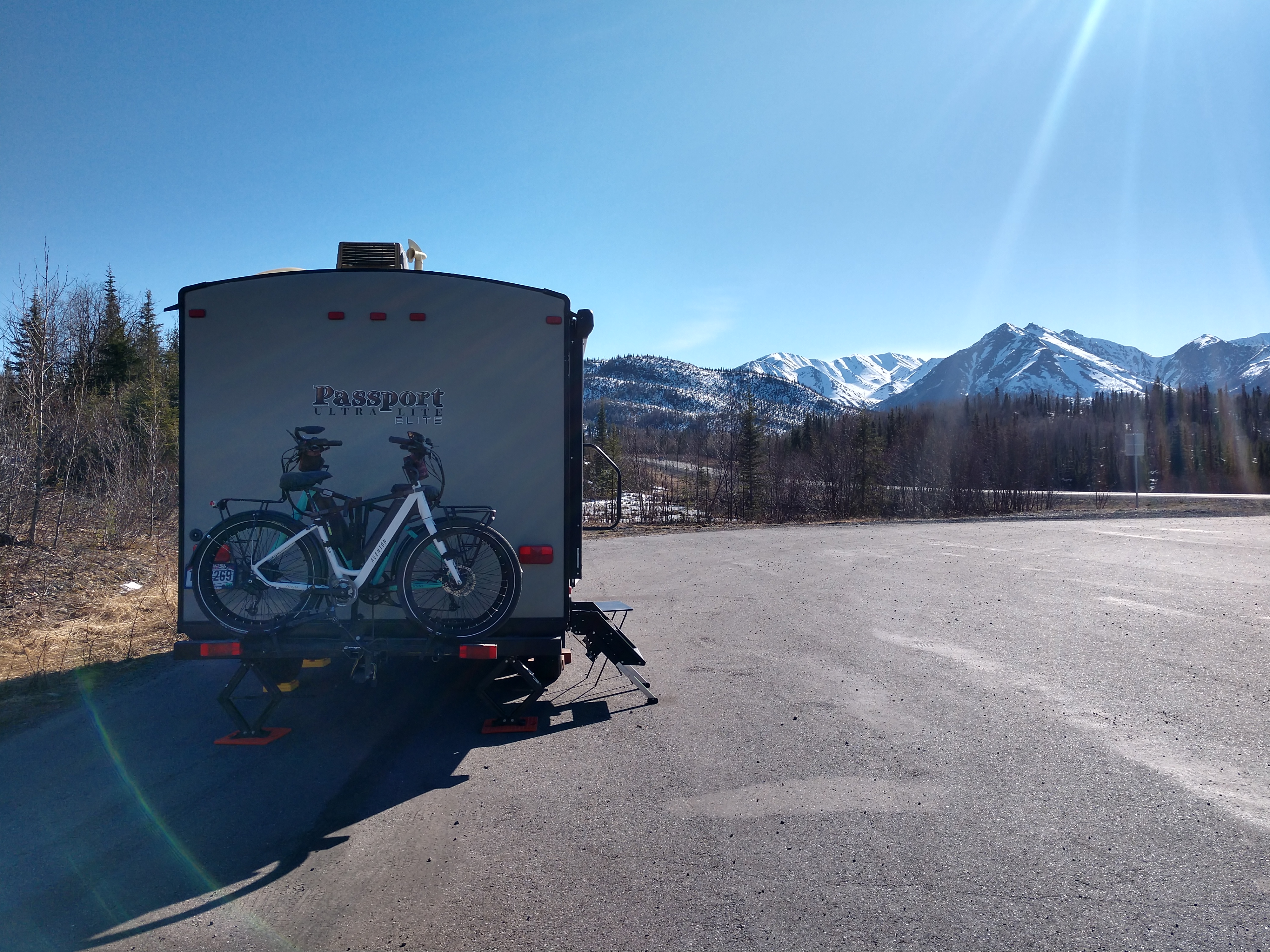
We turned onto the Tok Cutoff and drove until we found a pulloff on the highway that we liked.
We found a large pulloff with a great view of the frozen lake and mountains, but before we started setting up, I noticed a posted sign. We decided to move on even though it sure was pretty!
We drove on until we came to the rest area shown below which was just past the Slana River. (This was a picture of the info from The Milepost for this turnout.)
Slana River and bridge just before this rest stop. The Slana River flows from its source glaciers some 55 miles to the Copper River.
We had hamburgers over charcoal and sweet potato fries for dinner. We drifted to sleep to the soothing sounds of the river.
Shirley & Mel


No comments:
Post a Comment