Today we decided to drive over to Redstone and Marble and explore those areas. We left the campground around 8:45 a.m.

We followed the West Elk Loop (see map above). We first went to Crested Butte and crossed over via Kebler Pass. Then we drove north up HWY 133 all the way to Carbondale, and then went back to Redstone to see the Redstone Coke Ovens. We then journeyed over to Marble, where we went on a rocky jeep jaunt to see the marble statues, and the beautiful Maroon Belles Snowmass Wilderness area and mountains. From there we drove back to HWY 133 and went south past McClure Pass, and the towns of Somerset, Bowie, Paonia, and Hotchkiss. At Hotchkiss, we turned on to HWY 92 and followed it to Crawford and until we came to HWY 50. We then crossed the bridge over the Blue Mesa Reservior that they had been working on (it was open to one-lane car traffic now from 7:00 a.m. to 7:00 p.m.)
We followed Hwy 135 toward Crested Butte.
Kebler Pass is a terrific high-mountain pass connecting Crested Butte with Paonia to the west. It’s a gorgeous seasonal shortcut to Aspen in the Roaring Fork Valley.
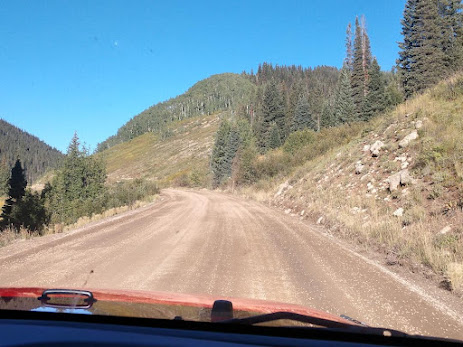
We followed the dusty, gravel road until we came to a sign indicating we were approaching Kebler Pass.
The Kebler Pass summit is at an elevation of 10,007 feet, passing through the Gunnison National Forest. It’s best known as one of the premiere spots to be blown away by the fall aspens, and we're hoping to see some beauties today. This area is home to one of the largest aspen groves in the United States, situated in the West Elk Mountains.
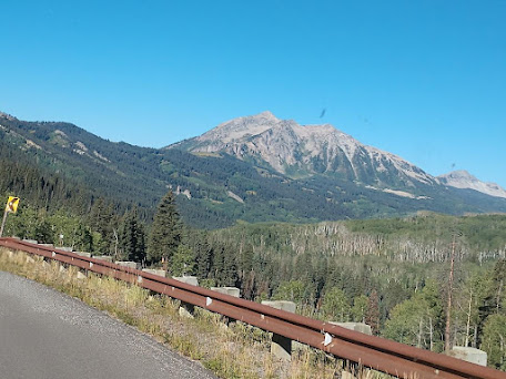
We continued straight ahead on Kebler Pass. We could now see a little snow in the distance.
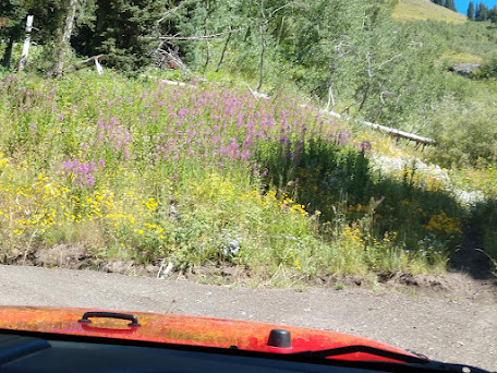
The gravel road is pretty smooth, and we are seeing a lot of Aspen trees -- but it is too early for them to be changing colors.
We come upon more and more Aspen trees standing tall with their leaves whispering as we drive by.
The drive over Kebler Pass takes nearly two hours. It’s a fairly high pass at 10,007 feet that leads through a spectacular alpine terrain. Peaks tower in the distance as we pass through aspen and evergreen forests. The 33-mile long winding dirt road is really pretty smooth most of the way.
We have now turned off Kebler Pass Road onto Hwy 133 North to Carbondale.
We are now 27 miles from Redstone and 44 miles from Carbondale.
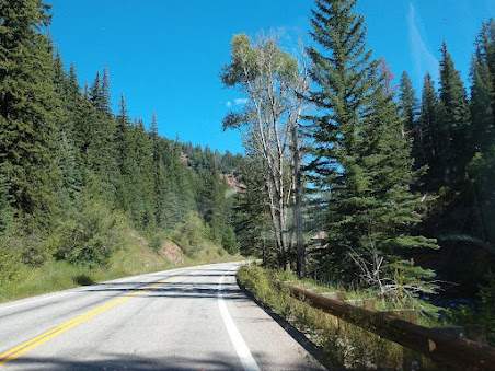
The highway follows along Crystal River. Crystal River is a tributary of the Roaring Fork River and is approximately 40 miles long and is located in Gunnison, Pitkin and Garfield counties in Colorado.
The Crystal River remains one of the few rivers in Colorado that is undammed along its length, making the segments that are upstream of large ranching irrigation diversions outside of Carbondale eligible for federal Wild and Scenic River protection. The Crystal Valley historically was a seasonal home and hunting ground of the Parianuche and Yampa bands of the Ute people.


We are now six miles from the McClure Pass summit. McClure Pass is a mountain pass in the Rocky Mountains of western Colorado located along the boundary between Pitkin and Gunnison counties, in a gap at the western side of the Elk Mountains. The pass is at an elevation of 8,755 feet and separates the headwaters of the Crystal River (a tributary of the Roaring Fork River) to the east with the headwaters of the North Fork Gunnison River to the west. The pass is named in honor of Thomas "Mack" McClure who in the late 19th Century owned a large house at the eastern base of the pass. The house served as a stage stop where McClure fed and lodged travelers.
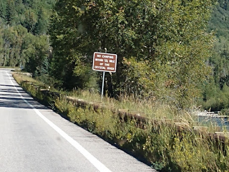
You are not allowed to camp within a 1/4 mile of Crystal River.
We are now 1 mile from Redstone and 17 miles from Carbondale.
The town of Redstone is off to our right. We drive by the Coke Ovens on our left (we plan to stop at them on our way back) and continue on until Carbondale.
We have just made it to Carbondale, located at the base of majestic Mt. Sopris, resting in a broad valley defined by the confluence of the Crystal and Roaring Fork Rivers. Carbondale is located 170 miles west of Denver and 30 miles from Aspen in the heart of Colorado’s central Rocky Mountains. The picturesque town of Carbondale was first occupied by the Ute Indians, then by silver prospectors, cattle ranchers, and potato farmers. The town is known for its arts and music community.


When gold and silver were discovered near Aspen in 1879, droves of prospectors poured into the upper Roaring Fork Valley to settle and establish mining claims, and the rich and fertile river-bottom land in Carbondale was coveted by hunters and farmers wishing to supply food to the mining boom towns.
By 1881, twenty families had moved to the valley. These early settlers started cattle and sheep ranches and began growing potatoes, which for over 50 years was the mainstay crop of the Carbondale economy. The town was incorporated on January 31, 1888 and was named in honor of Carbondale, Pennsylvania, the original home of some of these early settlers. During this period, Richard Sopris led an expedition into the valley to explore the potential for precious metals and minerals in the region. His legacy remains in the geographical dominance of the mountain bearing his name.
When mining and railroading suffered a setback from the silver panic of 1893, the growth of Carbondale slowed to a near halt. The turn of the century saw a surge in potato farming, and the community stabilized and prospered. Potato Day, the longest-standing annual community event, began with a celebration of the potato harvest in 1909.


After we left Carbondale, we headed back to Redstone.
We are now 1 mile from Redstone and 12 miles from Marble.
Just 18 miles south of Carbondale on Hwy 133 is the town of Redstone, where mining has left its indelible mark. Redstone’s historic coke ovens are located on the west shoulder of Hwy 133. During the heydey of mining in Redstone, 200 coke ovens were built as a way of refining coal into coke. Although they haven’t been used since the beginning of the 20th century, many of the ovens remain and are a fascinating look into American history.
Also in Redstone as you drive through the quaint town you will see the famous Redstone Castle, a mansion built by John Osgood, the founder of the Colorado Fuel and Iron Company. Built in a Stick style with a European-styled interior design and furnishings, the Redstone Castle is on the National Register of Historic Places.
Shown above is part of the 90 coke ovens remaining. Most of the structures are freestanding beehive ovens made of stone, their rounded tops covered with hardened brown earth. Some retain their original integrity; many have decayed visibly over the years. Four have been restored to their original appearance.
A set in the middle, just north of the parking area and entrance, is within a stone retaining wall added in the mid-20th century (due to this, neither it nor the ovens it protects are considered to be contributing to the historic district).
(Workers building the ovens, 1902)
Redstone’s coke ovens are the foundation of the community. Over a century ago, the men who worked them and their families lived in the village’s houses and walked on Redstone Boulevard, its lone street. The Redstone community has always had a deep connection to them and Redstone’s history.
Originally, two hundred coke ovens were built because the coal in the surrounding mountains was ideal for refining into coke. At their peak, they were producing almost 6 million tons a year. The development was the beginning of the modern settlement of Redstone. There are very few coke ovens of their type remaining in the West; the ovens are themselves the only remnant of the sizable coking operation in the area, the largest at the time in Colorado.
Redstone is located in Pitkin County, Colorado and has a population of 127. The village is listed on the National Register of Historic Places as a historic district. Redstone was established in the late 19th century by industrialist John Cleveland Osgood (see photo below) as part of a coal mining enterprise.
Osgood's coal empire also spurred construction of the Crystal River Railroad and Redstone's historic dwellings. As an experiment in "enlightened industrial paternalism," Osgood constructed 84 cottages and a 40-room inn, all with indoor plumbing and electricity, for his coal miners and cokers, as well as modern bathhouse facilities, a club house with a library and a theatre, and a school. Most of these Craftsman-era Swiss-style cottages are still used as homes.
A dominant feature of Redstone is Cleveholm Manor (shown above), which was commonly called "Redstone Castle," an opulent 42-room Tudor-style mansion that Osgood built for his second wife, Swedish Countess Alma Regina Shelgrem.
Construction of Cleveholm Manor, which was designed by New York architects Boal and Harnois, began in 1897 and was completed in 1901. The Castle was part of a 72-acre estate that also included servants' quarters, a gamekeeper's lodge, a carriage house, and a greenhouse. Cleveholm Manor and the gamekeeper's cottage are both independently listed on the National Register as Osgood Castle and Osgood Gamekeeper's Lodge, respectively. As of 2004, the Castle still contained 75 percent of its original furnishings.
We're now heading to Marble via CR 3.
Marble has an elevation of 7,950 feet. Marble has a population of 133. Marble was first incorporated in 1899. The town is the location of a historic Yule Marble quarry along the mountains that began operations in the late 19th century, and from which the town draws its name. It has been used for the Tomb of the Unknowns, as well as for parts of the Lincoln Memorial in Washington, D.C., and civic buildings in San Francisco. It was also used for the construction of the Equitable Building, a historically important early skyscraper in New York City.
The marble of the quarry is considered to be of exceptional quality, praised as one of the purest marbles ever quarried and a rival to classical Italian and Greek marble. It is nearly pure calcite marble with minor inclusions of mica, quartz, and feldspar, and has irregularly shaped calcite grains ranging from 100 to 600 micrometers in diameter. According to physical tests of the marble, its strength is comparable to marble typically used in building construction.

Shown above and below is the Marble Community Church. Formerly called St. Paul's Church, it is a historic Episcopal church located at 123 State Street in Marble, Colorado. The church's main building was originally the building of the St. John's Episcopal Chapel, which was built in Aspen, Colorado in 1886.
By the beginning of the 20th century, Marble was home to an active children's sunday school, though the town lacked a church building for which to hold the school. In 1908, the one-room St. John's Episcopal Chapel in Aspen was no longer required and the diocese made it available for relocation to Marble. The chapel, originally constructed in 1886, was dismantled and moved by railroad car to Marble where it was reassembled on two lots of land at 123 State Street that had been purchased with a $2,500 donation from the Episcopal Women's Guild. The new church was renamed and dedicated as St. Paul's. Shortly after the establishment, an extension was carried out to enlarge the church through the addition of two side rooms. Further enlargement of the church was carried out in 1911, with the addition of a belfry containing a 500-pound bell.
We decided to drive the narrow shelf road that followed the Crystal River to go see the Crystal Mill.
Leaving the town of Marble, Colorado, we passed by Beaver Lake, with its placid waters that surely will beckon us to come back again.
Beaver Lake is a small lake located on the road that leads to Crystal Mill. It's often considered a stopping point before tackling the more challenging terrain to reach Crystal Mill itself.
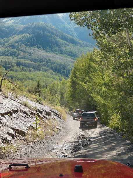
The road quickly changed from mostly paved to an unpaved road and as we went along. It then became more and more rocky. At one point, we came to a fork in the road where we had to decide if we wanted to go on toward Lead King Basin or turn to our right and then take a sharp left past a mountainside house toward the mill.
At this point, the yellow warning sign said, "Four Wheel Drive High Clearance Vehicles Only." We knew we were ok because we were following our trail maps to Lead King Basin and to the one of Colorado's most famous landmarks,the Crystal Mill (see below).
We climbed switchbacks up the steep dusty road. The road along the river was fairly easy, but very rocky and bumpy.
We proceeded right toward the town of Crystal (note the light yellow sign above indicated a choice between a road that was "spicy" or "very spicy"). Of course, we opted for the "spicy" road option. Along the way there were mountain views, natural spring waterfalls, and signs that indicated that this was once a thriving mining community.
The trail was narrow and rocky as it wound along, much of the time beside the Crystal River.
There were some areas where we had to drive over a few water crossings.
There were lots of big rocks and ups and downs along the trail.
After a long descent down narrow switchbacks, we crossed a stream and then the trail weaved through trees.
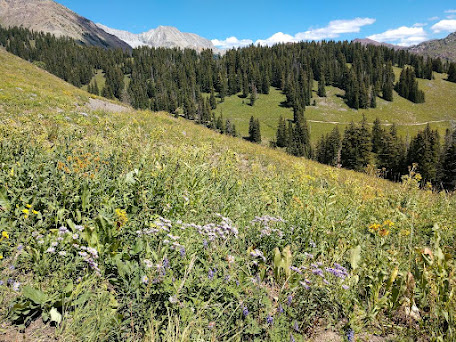
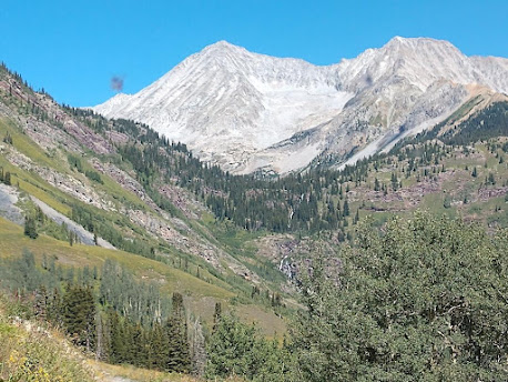
Let me tell you -- there is nothing like the majestic Maroon Bells Wilderness with its towering Rocky Mountain peaks covered in shades of green and the beginning of amazingly fall colors. It takes your breath away, and it almost feels as though you're looking through the lens of a fairy tale.
More curves and ups and down as we continued . . .
And spectacular views!
Then the trail descended.
And we continued our downward descent.
That was when we saw lots of snow on the mountains in front of us!
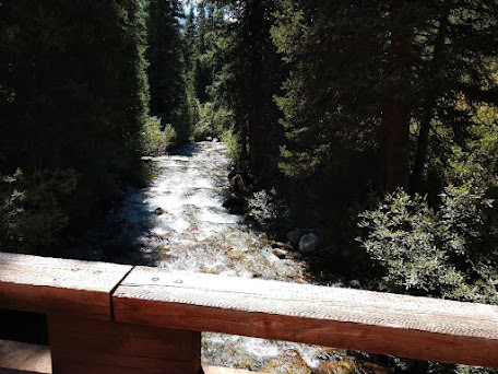
Next, we crossed a bridge and turned to our right. We then followed a high rocky shelf road above North Fork of the Crystal River as we head back towards Marble along the Crystal River.
The road is narrow and passes close to rocky ledges before emerging us in heavy tree cover.
We follow the sign that points us back to Marble.
We pass through more groves of Aspens.
And we splash through some mud puddles.
And finally, as we round a corner we are in the town of Crystal. It was almost like a dream -- however it wasn't too long before we got our first glimpse of the beautiful Crystal Mill.
At one time, Crystal, Colorado was a ghost town with 400 residents, most of whom were miners and their families.
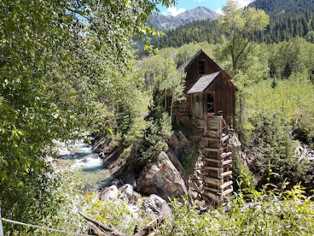
The Crystal Mill is an 1892 wooden powerhouse located on an outcrop above the Crystal River. Although called a mill, it is more correctly denoted as a compressor station, which used a water turbine to drive an air compressor. The compressed air was then used to power other machinery or tools.
Crystal Mill is a historic landmark and one of the most photogenic places we've ever seen with its rugged appearance that gives it a ghostly haunted feel.
Crystal Mill once operated as a powerhouse or power plant for mining operations and was known as the Sheep Mountain Power House, or Lost Horse Mill. Now the mill sits mysteriously quiet, framed by the Crystal River and the aspen covered mountains of the Maroon Bells Wilderness.
The river swirls and flows along the side and around the front of the mill. Between both the blue of the sky and the clarity of the water, it boasts a beautiful blue green tint.
As maybe you can tell, I just couldn't get enough pictures of the beautiful Crystal Mill!
Crystal Mill is truly a Colorado treasure and one place that everyone should experience in their lifetime. Add it to your bucket list -- we're sure that you'll agree that it's truly unforgettable.
From Crystal Mill, we headed back to the town of Marble.
Soon on our right, we could see a lake.
And it was a really pretty lake.
We find out that the lake is called Lizard Lake. The lake is located within the boundaries of the White River National Forest, between Marble and the ghost town of Crystal, along Crystal City Road (FSR #314).
The lake has views of Whitehouse Mountain (to the southeast), and is near Sheep Mountain (to the northeast) and Hat Mountain (to the southwest). The name Lizard Lake is a misnomer for the salamanders (not lizards) with feather-like gills inhabiting the lake, seen along the mud lake bottom and floating above the aquatic vegetation.
Lizard Lake, at an elevation of 8,705 feet, is a 5-acre lake with an unknown depth.
The above sign reads: "Lizard Lake - Motor Boats Prohibited."
Lizard Lake is a photographer's dream come true and a true definition of a hidden gem. It's a perfect place for us to stop and have some ntoo! We didn’t mind taking on the rugged terrain, as this secret mountain lake in Colorado could definitely become our new little hideaway.
Mel is getting the grill set up to prepare lunch.
Mel seasons the steaks and gets them on the sizzling grill.
Wow my steak sure looks good -- and for me the perfect complement to a well grilled juicy steak is a lettuce salad.
Shown above and below is Mel enjoying his steak with his lettuce salad by Lizard Lake.
After eating, we put things away and continue our journey back to Marble.
We have now run into some traffic -- which wasn't the case on most of the trail today.
Once again we drive by Beaver Lake.
And soon we are back into Marble.
The Marble Mill Site is a national historic site.
The mill took giant hunks of marble quarried high above, cleaned and refined them for shipment to customers, including wealthy homeowners looking to add classical touches to their estates and government entities, seeking fine-quality marble for public buildings. (Marble from this operation was used to create the Lincoln Memorial in Washington, D.C., and the Tomb of the Unknown Soldier in Arlington, Virginia.) The marble veins slowly played out, and the company stopped and started production several times before closing in 1941. In recent years, however, a new and richer lode of marble was uncovered, and production under the ownership of an Italian marble company resumed.
Shown above is an old ladder wagon at the Marble Fire Station.
While Mel parked the jeep at the Marble Fire Station to air up the tire, I went walking around the town. Shown above and below are some of the many art pieces carved from the marble.
There were many beautiful and intricately carved pieces.
We left Marble at about 4:30 p.m.
We were soon back to McClure Pass Summit.
On our way back, we drove by the towns of Somerset, Bowie, Paonia, Hotchkiss, and Crawford. We turned left off HWY 133 to HWY 92 towared Crested Butte and Gunnison.
Soon we were at the Blue Mesa Dam. Blue Mesa Dam is a 390-foot-tall zoned earthfill dam on the Gunnison River in Colorado. It creates Blue Mesa Reservoir, and is within Curecanti National Recreation Area just before the river enters the Black Canyon of the Gunnison. The dam is upstream of the Morrow Point Dam.
Blue Mesa Dam and reservoir are part of the Bureau of Reclamation's Wayne N. Aspinall Unit of the Colorado River Storage Project, which retains the waters of the Colorado River and its tributaries for agricultural and municipal use in the American Southwest. Although the dam does produce hydroelectric power, its primary purpose is water storage. State Highway 92 passes over the top of the dam. Blue Mesa Dam houses two turbine generators and produces an average of 264,329,000 kilowatt-hours each year.
Here we turned left on to HWY 50 to go to Gunnison.
Gunnison is now 26 miles away.
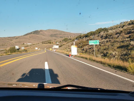
We are now stopped and waiting for the pilot vehicle to take us over the bridge that they are working on.
This was the end of our journey on the West Elk Loop.
It was a long and adventuresome day along the West Elk Loop! We arrived back at our campsite in Blue Mesa Thousand Trails at 7:20 p.m.
Shirley & Mel




















.jpg)






No comments:
Post a Comment