Tuesday, December 5, 2023
Today was a "campground move day" as we moved from Wilderness Lakes Thousand Trails in Menifee, California to Oakzanita Springs Thousand Trails in Descanso, California. The day started off nice and sunny at 50 degrees and reached 70 degrees in the afternoon.

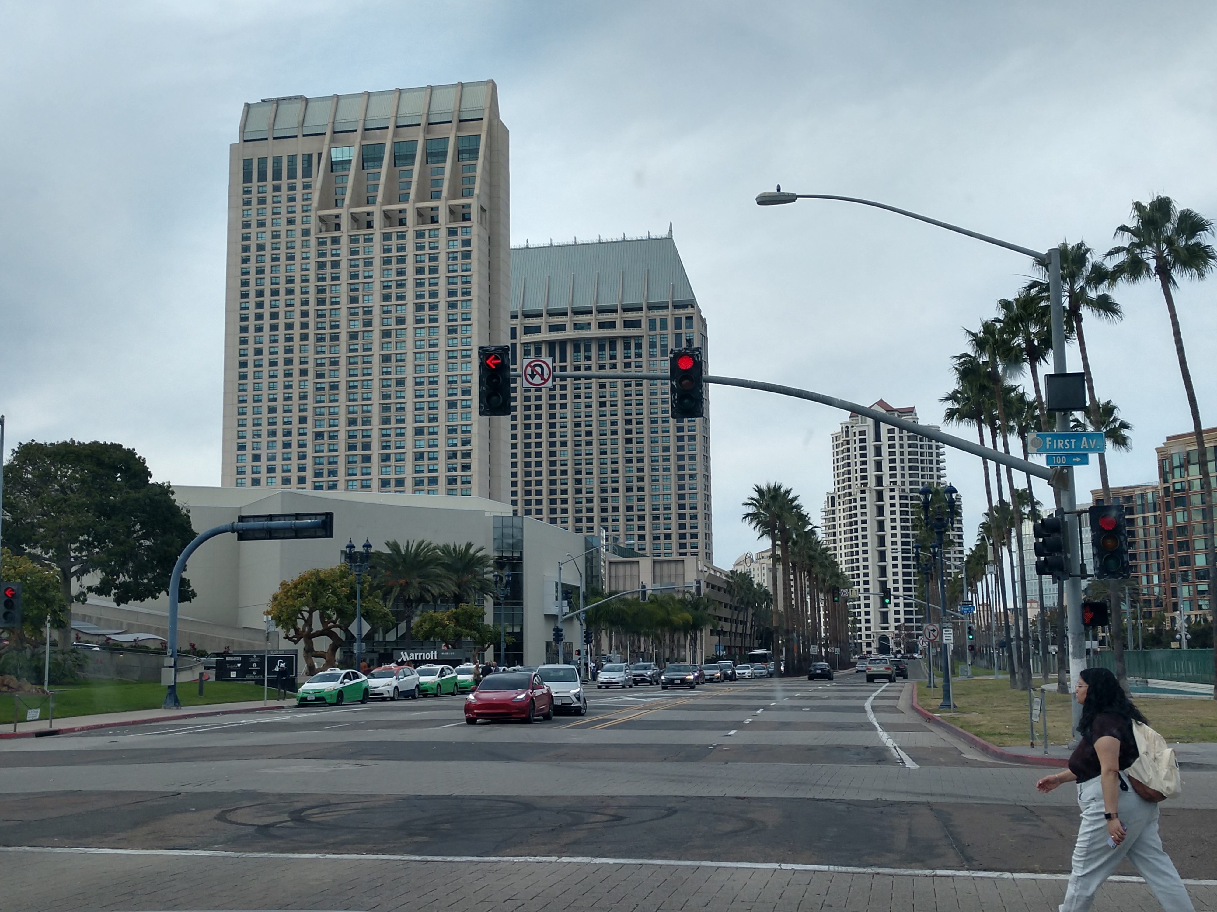
We left at 8:20 a.m. and headed out on I-215 South toward San Diego, California.

Murrieta is now 4 miles away, Temecula is 11 miles away, and San Diego is 67 miles away.


We are now in Murrieta, a city in southwestern Riverside County, California, with a population of Murrieta was 113,795. Murrieta is one of the fastest-growing cities in the state. Murrieta is bordered by the city of Temecula to the south, the cities of Menifee and Wildomar to the north, and the unincorporated community of French Valley to the east. Murrieta is named for Juan Murrieta, a Californio ranchero who founded the town.

For most of its history, Murrieta was not heavily populated. On June 9, 1873, Domingo Pujol, Francisco Sanjurjo, and Juan and Ezequiel Murrieta purchased the Rancho Pauba and Rancho Temecula Mexican land grants, comprising 52,000 acres in the area. Ezequiel returned to Spain and turned the land over to his younger brother, Juan Murrieta, who brought 7,000 sheep to the valley in 1873, using the meadows to feed his sheep. The partnership dissolved in 1876 and Ezequiel and Juan Murrieta retained 15,000 acres of the northern half of the Temecula Rancho. Ezequiel and Juan Murrieta granted a right-of-way, one hundred feet wide to the California Southern Railroad through the Temecula Rancho on April 28, 1882 so that the railroad could be constructed through the valley.
.jpg)
(Shown above is Murrieta, ca 1915.)
In 1884, the Temecula Land and Water Company purchased about 14,500 acres from Juan Murrieta and mapped a townsite along the California Southern Railroad. Others discovered the valley after the construction of a depot in 1887 that connected Murrieta to the Southern California Railroad's transcontinental route. By 1890, some 800 people lived in Murrieta. When the trains stopped in 1935, tourists—the lifeblood of the town—were much harder to come by. The boom that Murrieta had experienced due to the train and the hot springs gradually died, leaving Murrieta as a small country town.

The Murrieta Hot Springs (thermal springs) were called Cherukanukna Hakiwuna by the Luiseño. They bathed in the warm waters and believed the springs had healing powers. Fritz Guenther, a German emigrant, bought the Murrieta Hot Springs tract in 1902 and developed a world-class health spa resort. The Guenther family sold the property in 1970 to Irvin Kahn, a San Diego attorney and real estate developer.

We drove by the exit for the Murietta Hot Springs.

We just drove by Temecula, a city in southwestern Riverside County, California, with a population of 110,003. It was incorporated on December 1, 1989. The city is a tourist and resort destination, with the Temecula Valley Wine Country, Old Town Temecula, the Temecula Valley Balloon & Wine Festival, and the Temecula Valley International Film Festival contributing to the city's economic profile.

The area was inhabited by the Temecula Indians for hundreds of years before their contact with the Spanish missionaries (the people are now generally known as the Luiseños, after the nearby Mission San Luis Rey de Francia). Seven bands of Luiseño Indians inhabited the Temecula valley pre-contact: the Pechanga, La Jolla, Soboba, Pala, Rincon, Pauma, and San Luis Rey bands (presently, all of the bands except the San Luis Rey are federally recognized tribes). In Pechanga history, life on Earth began in the Temecula Valley. They call it "Éxva Temeéku", the place of the union of Sky-father, and Earth-mother. The Temecula Indians lived at "Temeekunga", or "the place of the sun," or "Where the sun breaks through the mist".


We drove under the bridge going to Old Highway 395.


We followed I-15 South toward San Diego, California.


We have slowed down now and traffic is starting to back up.


There are now six lanes of traffic including the Express Lane.

We continued to follow I-15 South.


Junction CA Hwy 52 is coming up soon. We are now to Exit 11 where we will exit to the right.


We continued to follow CA Hwy 52 East.


We are now to Junction CA Hwy 67 South. We followed Exit 18B, CA Hwy 67 South toward El Cajon.


We will be turning off on I-8 East soon.


We are in an area where they have shut us down to one lane of traffic while they work on the other lane.

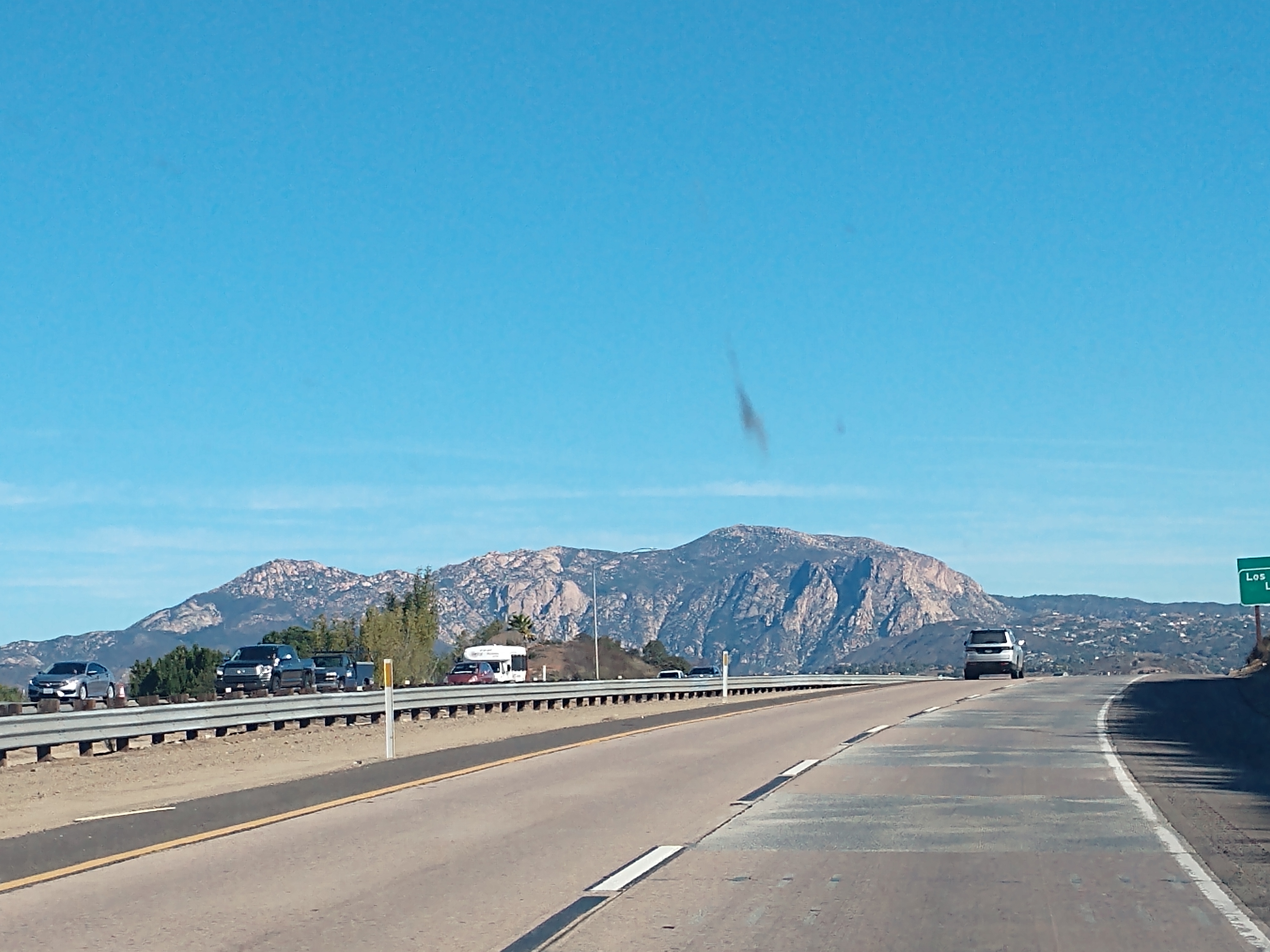
We take Exit 40 to CA Hwy 79 toward Descanso, California.

.jpeg)
.jpeg)
California Highway 79 winds through the mountains, providing panoramic views. Descanso is a small unincorporated community in the Cuyamaca Mountains, within the Mountain Empire area of southeastern San Diego County, California. The community's name is a Spanish word meaning "rest from labor". The population was 1,423 at the 2010 census.

Descanso is located east of Alpine and west of Pine Valley. At a 3,450 feet elevation, it is located at the south entrance to Cuyamaca Rancho State Park and also borders Cleveland National Forest to the west and east. The area was heavily threatened by the 2003 Cedar Fire. The community consists of many small ranches and newer homes of San Diego commuters.
In 1884, a group of Spiritualists started Hulburd Grove. In 1898, the residents of the area started the Descanso school and the Descanso Town Hall. Peter Jacobs started the Descanso Park Addition in 1926.


As we drove into Descanso Junction, we drove by the Descanso Junction Restaurant, which appears to be quite busy today.


We continued along the winding and curvy mountain road toward the Oakzanita Springs Thousand Trails campground.


.jpeg)
A "shelf" was cut from the mountainside for this road for sure and the view is amazing!

The sign for Oakzanita Springs Thousand Trails warns of a tight turn to enter the campground from the south. For those with bigger rigs and towing another vehicle (like if we come back another year with our big fifth wheel and jeep), there is a large turn off about a mile and a half to the north, where we could unhook the tow vehicle and then come in from the north.
.jpeg)

.jpeg)
We turned into the drive for the Oakzanita Springs Thousand Trails campground. This campground sits at 4,100 feet above sea level, and it gets quite chilly at night. The roads in the park were narrow too.

.jpeg)
After getting checked in, we made our way to the top of a hill to a pull-through site that also had sewer. In this campground, the sewer sites are few and far between.

We got all set up on site #39 for the next 4 weeks through Christmas and New Year's Day. We bought one of our additional weeks of camping for $29 so we could stay the next 4 weeks in a row.


For dinner tonight, we had leftover chicken broccoli and cheese soup.
Wednesday, December 6, 2023
Today was a beautiful day, so I decided to walk down to the clubhouse to check out what books they might have available to read. The walk down the hill was ok, but the walk back up was not for the light-hearted.


I found a couple of books in the lodge to take back with me. I then headed back up the hill to our campsite. My walk today was only 1.47 miles in about 31 minutes, but it was strenuous (see the Garmin GPS screenshots below).


Saturday, December 9, 2023
Today began as a spectacular sunny day with a temperature of 52 degrees. We decided to drive over to the Pio Pico Thousand Trails in Jamul, California because that is where we were planning to stay next -- but Mel had gotten a couple text messages saying that they were having some closures at the park. Therefore, we thought it would be wise of us to check it out.

We left around 10:00 a.m. for the mountain drive toward Jamul, California.


The scenery along the way was simply beautiful!


.jpeg)
We finally arrived at the Pio Pico Thousand Trails in Jamul, California. Jamul, meaning "sweet water" is a census-designated place in San Diego County, California with a population of 6,163.


We talked to the rangers in the entrance station about the possible closure, and then decided we had better make a "Plan B," so we went in and worked with the lady that does campground reservations. She was very helpful, and we were able to get a couple weeks back in Wilderness Lakes Thousand Trails, with a week out at Cherry Valley Lakes RV Resort in Beaumont, California. So now we will be able to return to Wilderness Lakes Thousand Trails on January 23 - February 12, 2024 for three week stay as we had originally planned. Our RV will be in storage at Wilderness Lakes during a portion of that stay while we are on the 7-day Mexican Riviera cruise, that leaves on February 2nd out of Los Angeles.

Above and below are Christmas decorations that were at the Pio Pico Thousand Trails.


We walked around the campground while we were there.

The pictures shown above and below are aerial view of Pio Pico Thousand Trails in Jamul, California.

After leaving Pio Pico Thousand Trails, we drove toward Jamul Casino, which was to be our next stop of the day. Jamul Indian Village is one of 12 federally recognized tribes that are part of the Kumeyaay Nation, with roots in the area going back 12,000 years. They are the owners and operators of Jamul Casino.

.jpg)
However, traffic was backed up for miles going in and out of Jamul Casino -- so we chose not to go (see picture of traffic below).


Our next stop was at Sycuan Casino Resort located just 30 minutes outside of downtown San Diego in El Cajon, California. We signed up for new player cards and each got $10 in free play. Needless to say, that $10 in free play was soon gone.


The Sycuan Tribal Government operates one of the region's premier Indian gaming and resort facilities, Sycuan Casino Resort. The Sycuan Tribe demonstrates its strong commitment to the San Diego region through the support of hundreds of civic and charitable organizations.

Sycuan Casino celebrated its 40th Anniversary on November 18, 2023. That's why they had the 40th Anniversary banner shown below.


Then we stopped to get gas at the Sycuan Square. Also while we were there, we got a jalapeno corn dog.

Our next stop was at the Viejas Casino & Resort, a hotel casino and outlet center owned by the Viejas Band of Kumeyaay Indians, located in Alpine, California. In 1932, The Viejas Band of Kumeyaay Indians purchased the reservation with their share of proceeds from a forced eviction from the area now containing El Capitan Reservoir. The Viejas tribe is one of seven California tribes that signed a modified compact with Governor Arnold Schwarzenegger granting unlimited slot machines in return for higher payments to the state.

At the Viejas Casino & Resort, we signed up for new players cards. We found out that we got no free play for signing up, so we just walked around the casino for a little while and then left.


The above mural was in the Viejas Casino & Resort. It told us about the Viejas Band of Kumeyaay Indians. This rendering is a depiction of the Kumeyaay hand game known as "Peon" and is played by many tribes throughout the southwest region. It is called Uumarrp or Uumarr in their language and is referenced in their creation story. It is also referenced in early Spanish writings during the Spanish period of early San Diego, as being played near the San Diego de Acala Mission in the 1700's.

(Shown above is a group of Native American Indians playing the game Peon.)
The great nation of Viejas has always been a nation of gaming for amusement. The oldest and most popular game the Kumeyaay play is Peon. Betting is a vital part of Peon with a purse at stake and side bets on single players as a part of the game. Peon is a guessing game in which two teams face each other and take turns hiding behind a blanket. The black and white bones are what is being hidden and the sticks are the points of the game. The hiding team conceals their black and white game pieces, often made of coyote or rabbit bones, then the other team must guess how the pieces are hidden. The sticks are made of Arrowweed. Counting sticks are used to keep track of the score. The object of the game is to win all 15 sticks while hiding.

(Shown above is peon counting sticks also known as Eselkwak.)
When an incorrect guess is given, the hiding team receives a stick and when a correct guess is given, the bones go to the opposing side. When all hidings are eliminated, it is the other teams turn to hide. The game survives to this day and the skills of dedication, strategy, and savvy are still celebrated in song throughout the hours-long game until a victor is chosen and rewarded with a prize of great value. Gaming has been a presence throughout Kumeyaay as a form of community amusement, family cohesion and strength of culture. The game carries pride and rivalry when played between villages. This game is often played at large gatherings and accompanied by song. It is not unique to the Kumeyaay – in fact, Peon is played by many tribes throughout the Southwest.

Shown above is the street view of Descanso, California as we came back through on our way back to the campground. The Santa Ana winds blew pretty hard today and into tomorrow.
Wednesday, December 13, 2023
Today started out sunny at 40 degrees and reached 70 degrees in the afternoon. We left the campground at 9:00 a.m. and headed to Lakeside, California.
Our first stop of the day was at the Barona Resort and Casino, an Indian casino on the Barona Indian Reservation located in Lakeside, California. It is owned and operated by the Barona Group of Capitan Grande Band of Mission Indians.


The drive into the casino was decorated with Christmas decorations.


We walked into the casino and got signed up for new player cards. Once again, this casino had no free play perks for new players, so we just walked around the casino for awhile.

We then drove to El Cajon, California and went to the Aldi's to get some groceries. We also went to Walmart and picked up two suitcases (for our upcoming cruise out of Los Angeles on February 2, 2024), and got some groceries, while I got my flu shot.
After that, we went to Taco Bell and each got cravings boxes for a late lunch. Our last stop was at Tractor Supply for propane. We then headed back to the campground arriving there at 2:30 p.m.
Thursday, December 14 - Saturday, December 16, 2023

The Santa Ana winds were back and blew hard from Thursday through Saturday.
.jpg)
Sunday, December 17, 2023
Today we traveled to Imperial Beach, California. It was sunny and 72 degrees when we left at 9:45 a.m. The temperature reached an awesome 78 degrees by the end of the day.

We drove by the Tijuana River Estuary, which is literally a stones throw from Imperial Beach and has preserved a large habitat for many different birds. It is also just a few miles north of the US-Mexico border, the estuary is one of the few remaining salt marshes in California and is home to nearly 400 species of birds. It’s a National Wildlife Refuge, packed with easy-to-traverse trails for enjoying the scenery.

Our plan was to first stop at the Coronado Brewing Company in Imperial Beach, California. However, we found out that Coronado Brewing Company closed the door to its most southerly bar & restaurant at the end of 2023, after nearly 10 years in San Diego's South County city of Imperial Beach.


Brothers Ron and Rick Chapman opened Coronado Brewing as a brewpub in the heart of their home town of San Diego's picturesque Coronado in 1996. Coronado Brewing eventually moved the majority of their brewing operations from Coronado to their Bay Park facility, which was first opened in 2013. In 2014, Coronado Brewing took over a restaurant space at 875 Seacoast Drive in Imperial Beach to open their second San Diego area brewpub.

Next, we walked down to Imperial Beach. Imperial Beach is a residential beach city in San Diego County, California, with a population of 26,137. The city is the southernmost city in California and the West Coast of the United States. It is in the South Bay area of San Diego County, 14.1 miles south of downtown San Diego and 5 miles northwest of downtown Tijuana, Mexico.

(Shown above, Rancho Melijo -- which encompassed all of modern-day Imperial Beach was granted to Californio ranchero, Santiago E. Argüello in 1833.)
Imperial Beach sits on the traditional territory of the Kumeyaay people, who had established the village of Alyshuwii. Founded in June 1887, the city takes its name from Imperial County, California, a desert climate 100 miles east. Farmers and land owners from the Imperial Valley came to the area in the late 1880s seeking cooler weather during summer months. In March 1887, over 2,000 laborers descended upon nearby Coronado, California to construct the Hotel del Coronado, the largest resort in the world at the time. A large number of the workers stayed in Imperial Beach and some would later make it their permanent homestead. The city was incorporated in 1956.

A colorful sculpture known as Surfhenge serves as the gateway to Portwood Pier Plaza at Imperial Beach. Surfhenge consists of four 16 to 20 foot high surfboard shaped arches, weighing up to three-quarters of a ton each, which are believed to be the largest colored acrylic moldings ever cast. Alluding to giant surfboards stuck in the sand, the huge colored shapes of Surfhenge pay homage to the proud surfing heritage of Imperial Beach.


Shown above and below is Mel writing Imperial Beach in the sand -- as has become one of our traditions that we always do when we come to a sandy beach.


Above is the sign on the Imperial Beach Fishing Pier that was dedicated March 10, 1989.

We walked out onto the Imperial Beach pier and were rewarded with incredible panoramic views. We also had an opportunity to watch the surfers catching endless waves and the fisherman casting their poles as we strolled past.

(Shown above is a map showing the wooden Imperial Beach Pier.)


Shown above is some of the surfers at Imperial Beach waiting to catch a wave.

Shown above is one of the inspirational signs along the pier at Imperial Beach. This one says, "Hanging with my gull friends."

Shown above is the Imperial Beach Lifeguard Station.


Mel continues his walk along the pier at Imperial Beach.


Shown above is a saying on the side of the bathroom on the pier at Imperial Breach. It says, "As long as there's been surfing, there's always been the quest for the perfect wave."

At the end of the 1,500-foot pier is the Tin Fish Restaurant with a wrap-around view of the ocean.


Shown above and below are pictures from the end of the pier at Imperial Beach.


The sign above and below was on the Tin Fish Restaurant at the end of the pier at Imperial Beach. It said that we have reached the most southwesterly point in the Continental United States -- Imperial Beach California.


Shown above are more surfers waiting to catch a wave.

As we walked along the Imperial Beach Pier, we found humorous signs at intervals on either railing. Many of the signs, placed by the Port of San Diego and City of Imperial Beach, featured witty sayings and puns that related to activities on and under the pier. I photographed many of the clever sayings, but not all (see below).


Shown above is "The Spirit of Imperial Beach," an 18-foot-tall statue that honors the surfing and sandcastle history at Imperial Beach. At the foot of the statue are two children building sandcastles (see below).

After walking the pier at Imperial Beach, and enjoying the weather, we decided to stop at Mike Hess Brewing of San Diego.

Mel give his thumbs up before we go in to the Mike Hess Brewery. Combining a tap room and kitchen with a 6,500 square foot yard, this location is the largest beachfront biergarten in San Diego. It highlights 17 Mike Hess beers on draught, community seating and fun games and features local favorite City Tacos providing the in-house food. The family and pet-friendly Imperial Beach location marks the fifth location in California for family-owned Mike Hess Brewing.


Shown above is a Christmas tree sand sculpture at Mike Hess Brewing in Imperial Beach.


Shown above, Mel enjoys a blood orange craft beer (one of his favorites) in an aluminum cup at Mike Hess Brewing in Imperial Beach.

Shown above, Mel is eating 2 salmon tacos at Mike Hess Brewery. Mel said they were delicious!

Shown above is the MHB Steel Beach Fish & Chips plate I had at the Mike Hess Brewery. It consisted of house brewed fresh herb tempura battered white fish, over crispy truffle fries, sprinkled with cotija cheese and green onions. It was yummy!


.jpg)
Then as we drove out of Imperial Beach, we saw this pretty sign (see above).


We are now driving toward Coronado, California.


Driving along we saw these orange desert-type plants blooming along the side of the highway (don't know what they are called).


Soon we could see the skyline of Coronado, California, a resort city located in San Diego County, across the San Diego Bay from downtown San Diego. It was founded in the 1880s and incorporated in 1890. It has a population of 20,192. Coronado is a tied island which is connected to the mainland by a tombolo (a sandy isthmus) called the Silver Strand.

The explorer Sebastian Vizcaino gave Coronado its name and drew its first map in 1602. Coronado is Spanish term for "crowned" and thus it is nicknamed -- The Crown City. Its name is derived from the Coronado Islands, an offshore Mexican archipelago. Three ships of the United States Navy have been named after the city, including USS Coronado.

Prior to European settlement, Coronado was inhabited by the Kumeyaay, who sustained fishing villages on the peninsula in North Island and on the Coronado Cays. As American settlers moved into the area, the Kumeyaay were pushed out of Coronado, with the last six Kumeyaay families deported to Mesa Grande Reservation in 1902. Coronado was incorporated as a town on December 11, 1890. The community's first post office predates Coronado's incorporation, established on February 8, 1887, with Norbert Moser assigned as the first postmaster.

We are now in downtown Coronado.


We are now driving by the Hotel del Coronado. Coronado is home to the famous Hotel del Coronado, built in 1888 and long considered one of the world's top resorts. It has been designated as a National Historic Landmark and has hosted many notable guests, including American presidents George H. W. Bush, Jimmy Carter, Bill Clinton, Gerald Ford, Lyndon B. Johnson, Richard Nixon, Ronald Reagan, Franklin D. Roosevelt, and William Howard Taft, as well as sports, entertainment, and noted public figures -- Muhammad Ali, Jack Dempsey, Thomas Edison, Magic Johnson, Charles Lindbergh, Willie Mays, Babe Ruth, Oprah Winfrey, and Robert Downey. Notable actresses Mary Pickford and Marilyn Monroe also stayed here.

"The Del" has appeared in numerous works of popular culture and was said to have inspired the Emerald City in The Wonderful Wizard of Oz. It is rumored that the city's main street, Orange Avenue, was Baum's inspiration for the yellow brick road. Because of the reported association with Oz, Coronado is often associated with the color green and is sometimes referred to as "The Emerald City". The colors of Coronado High are green and white; the Coronado city flag is a tricolor of green-white-green, with a crown in the middle.

(Shown above is the Hotel del Coronado, ca 1885.)


The Hotel del Coronado is an architectural gem. Numerous world leaders, dignitaries and celebrities have stayed at the resort over the years.

Sign by the beach. Hotel del Coronado continues to safeguard this magnificent stretch of Southern California coastline.

Shown above is the Hotel del Coronado’s old boathouse on Glorietta Bay, built in 1887. It’s now home to the Bluewater Boathouse Seafood Grill.

This life-size Marilyn Monroe by an Orange Avenue shop is in her iconic pose. The famous actress starred in the movie 'Some Like It Hot', which was filmed at the nearby Hotel del Coronado.

Shown above is a cool sand sculpture built near the Hotel del Coronado by The Sandcastle Man!

Bird-of-paradise (shown above) is the official flower of Los Angeles, California and one of the world’s best-known plants. Native to the subtropical coastal areas of southern Africa, it has been cultivated worldwide, and it has been naturalized in North, Central, and South America, as well as in Portugal, where it is the national flower. Its exotic appearance, with unique and brightly colored flowers that look like the head of a bird, has made it a favorite with horticulturists, designers, florists, and gardeners. In full flower, a bird-of-paradise looks a bit like several birds hidden in a clump of foliage, craning their necks up and turning their plumed heads and pointed beaks in different directions.

The bird-of-paradise Latin name Strelitzia reginae was chosen in honor of Queen Charlotte, wife of King George III of England, who was Duchess of Mecklenburg-Strelitz in Germany. Bird-of-paradise belong to the same taxonomic group as ginger and banana plants. A healthy, mature bird-of-paradise can produce up to 36 flower spikes a year. In the right conditions, it can bloom year round.

We are now approaching the San Diego - Coronado Bay Bridge, locally referred to as the Coronado Bridge, is a prestressed concrete/steel girder bridge fixed-link, crossing over San Diego Bay, linking San Diego with Coronado, California.
In 1926, John D. Spreckels recommended that a bridge be built between San Diego and Coronado, but voters dismissed the plan. The U.S. Navy initially did not support a bridge that would span San Diego Bay to connect San Diego to Coronado. They feared a bridge could be collapsed by attack or an earthquake and trap the ships stationed at Naval Base San Diego. In 1935, an officer at the naval air station at North Island argued that if a bridge was built to cross the bay then the Navy would leave San Diego.

(Shown above is John Diedrich Spreckels, ca 1901.)
In 1951–52, the Coronado City Council initiated plans for bridge feasibility studies. By 1964 the Navy supported a bridge if there was at least 200 feet of clearance for ships which operate out of the nearby Naval Base San Diego to pass underneath it. To achieve this clearance with a reasonable grade, the bridge length was increased by taking a curved path, rather than a more direct path to Coronado. The clearance would allow an empty oil-fired aircraft carrier to pass beneath it.

The principal architect was Robert Mosher. Mosher's job was to build a bridge that would provide transportation, allow ships access to the bay, and serve as an iconic landmark for San Diego. Mosher proposed a basic box and girder style bridge for the framework, with a prestressed concrete and steel deck sitting atop steel girders and supported by towers. Construction on the San Diego–Coronado Bay Bridge started in February 1967. The bridge required 20,000 tons of steel (13,000 tons in structural steel and 7,000 in reinforcing steel) and 94,000 cubic yards of concrete. To add the concrete girders, 900,000 cubic yards of fill was dredged and the caissons for the towers were drilled and blasted 100 feet into the bed of the bay.

The bridge opened to traffic on August 3, 1969, during the celebration of the 200th anniversary of the founding of San Diego. The 11,179-foot-long or 2.1 mile bridge ascends from Coronado at a 4.67 percent grade before curving 80 degrees toward San Diego. It is supported by 27 concrete girders, the longest ever made at the time of construction.


We have now entered into San Diego, a city in the U.S. state of California located alongside the Pacific Ocean in Southern California. With a population of over 1.3 million residents, the city is the eighth-most populous in the United States and the second-most populous in California after Los Angeles. The city is located immediately adjacent to the Mexico–United States border and is the seat of San Diego County, which has a population of nearly 3.3 million people as of 2021. San Diego is known for its mild year-round Mediterranean climate.
.jpg)
(Shown above, the Kumeyaay, who were referred to by the Spanish as Diegueños, have inhabited the area for thousands of years.)
Historically home to the Kumeyaay Native Americans, San Diego has been referred to as the Birthplace of California, since it was the first site visited and settled by Europeans on what is now the West Coast of the United States.

(Shown above is Juan Rodríguez Cabrillo.)
Upon landing in San Diego Bay in 1542, Juan Rodríguez Cabrillo claimed the area for Spain, forming the basis for the settlement of Alta California 200 years later.
.tif.jpg)
(Shown above is Portuguese explorer Juan Rodríguez Cabrillo landing in San Diego Bay in 1542, claiming California for the Spanish Empire.)
The Presidio and Mission San Diego de Alcalá, founded in 1769, formed the first European settlement in what is now California. In 1821, San Diego became part of the newly declared Mexican Empire, which reformed as the First Mexican Republic two years later. California was conquered by the U.S. in 1848 following the Mexican–American War and was admitted to the union as a state in 1850.


We are now at Cesar Chavez Parkway in San Diego, California.

We are now in the Barrio Logan -- an artistic, industrial area with Mexican roots. One of San Diego’s oldest communities, Barrio Logan’s transformation began in 1910 with the influx of refugees from the Mexican Revolution who soon became the majority ethnic group in San Diego and at one point had the highest concentration of Mexican Americans than in any community in California.


At its heart is Chicano Park, with dozens of murals depicting the community’s past activism, alongside images of notable figures like Frida Kahlo. Former warehouses on Logan Avenue now house galleries, taco shops and craft breweries, all of which are popular with students from the nearby Woodbury School of Architecture.


We then turned on Harbor Drive in San Diego.


And we soon were going by Petco Park -- a baseball stadium in Downtown San Diego, California. It is the ballpark home of Major League Baseball's San Diego Padres. The ballpark is located between Seventh and 10th Avenues south of J Street.


We have been to several baseball games in this stadium in years past.

Shown above and below is the Harbor Drive Pedestrian Bridge in San Diego, California. Harbor Drive Pedestrian Bridge is a pedestrian and bicycle crossing over the San Diego Trolley and San Diego & Arizona Eastern Railroad tracks in downtown San Diego, California. The bridge connects otherwise disconnected segments of Park Boulevard, allowing pedestrians easier access between Petco Park/East Village and the waterfront. The Park Blvd Pedestrian Bridge is 550 feet long which makes it one of the longest self-anchored pedestrian bridges in the world. The span measures 350 feet while the remainder is approaches.

Completed in March 2011, the bridge was built to allow pedestrian traffic on Park Boulevard to safely cross 6 sets of railroad tracks and Harbor Drive. The bridge also completes the "Park to Bay Link" a long term vision of City planners to develop a public parkway or greenbelt along Park Blvd in order to connect Balboa Park with San Diego Bay. The bridge crosses over six lanes of traffic on Harbor Drive, a rail yard and trolley tracks, and connects the convention center with the Gaslamp Quarter and East Village. It is accessible by stairs and elevators.


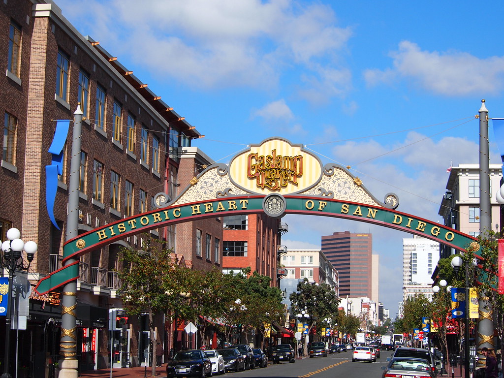
The Gaslamp Quarter is not only the Historic Heart of San Diego, as the iconic sign proclaims, but it has become the center of entertainment and dining for downtown’s burgeoning nightlife. The popular Hard Rock Hotel, seen in the photograph below, is but one of scores of cool attractions lining bustling Fourth, Fifth and Sixth Avenues between Broadway and Harbor Drive. Pouring even more life into the Gaslamp is nearby Petco Park, the San Diego Convention Center and Horton Plaza.


Star of India or the Maritime Museum of San Diego (shown above) is an iron-hulled sailing ship, built in 1863 in Ramsey, Isle of Man as the full-rigged ship Euterpe. After a career sailing from Great Britain to India and New Zealand, she was renamed, re-rigged as a barque, and became a salmon hauler on the Alaska to California route. Retired in 1926, she was restored as a seaworthy museum ship in 1962–1963 and home-ported at the Maritime Museum of San Diego in San Diego, California. She is the oldest ship still sailing regularly and also the oldest iron-hulled merchant ship still afloat.


The above marker told us about the “Star of India,” a three masted bark, is the oldest iron-hulled merchant ship afloat. Built on the Isle of Man, Great Britain, she was launched in 1863 and christened “Euterpe”, the trans-Pacific trade from 1871-1898 resulted in the “Euterpe” circumnavigating the earth twenty-one times, stopping in San Francisco in 1873 and 1883, she was purchased by the Alaska Packers Association to service the salmon canneries in Alaska, leaving each season from Alameda during 1902-1923, “Euterpe” was renamed “Star of India”. “Star of India” continues to sail the Pacific ocean as an active reminder of early California’s maritime commerce.

Our last stop on our road trip today was at Little Italy in San Diego. When Italian immigrants moved to this Manhattan neighborhood in the late 1800s, they brought their customs, food and language. That heritage remains evident today—Little Italy's streets are lined with restaurants serving Italian staples on red-and-white checkered tablecloths.

The above sign told us about the Little Italy Landmark Sign in San Diego, California. The Little Italy Landmark Sign was dedicated and lit at the 7th Annual Little Italy Festa on the evening of October 8, 2000. The landmark sign was constructed as a tribute to this immigrant neighborhood which, until the late 1960s, was the hub of the world's tuna fishing and canning industry. The nautical theme can be seen in the portholes at the top of the pillars, the blue neon of the lettering and the cable span which holds up the sign. The mosaic tile work on each side of the street tells how this immigrant community is historically tied to the bay, the church and the Italian homeland. This sign is a testament to the preservation of Little Italy's cultural heritage and to the ongoing revitalization of this dynamic urban ethnic neighborhood in Downtown San Diego.


We stopped at Ballast Point Brewing Company in Little Italy in San Diego. Mel gives a thumbs up (see above)!
Ballast Point Brewing Company is an American brewery founded in 1996 by Jack White in San Diego, California. Ballast Point Brewing Co. started in the back of Home Brew Mart, a homebrew supply store White founded in 1992. As of 2015, it was the second largest brewer in San Diego County and the 17th largest brewery in the country based on sales volume. The company's main production facility is in Miramar. It also has brewery locations in San Diego's Little Italy and Scripps Ranch neighborhoods, as well as its original Home Brew Mart location in San Diego's Linda Vista neighborhood.


We purchased a $25 gift card at the brewery and got a 64 ounce growler free.

Shown above is Mel enjoying one of the craft beers at Ballast Point Brewing Company. You can also see the free growler he took home.


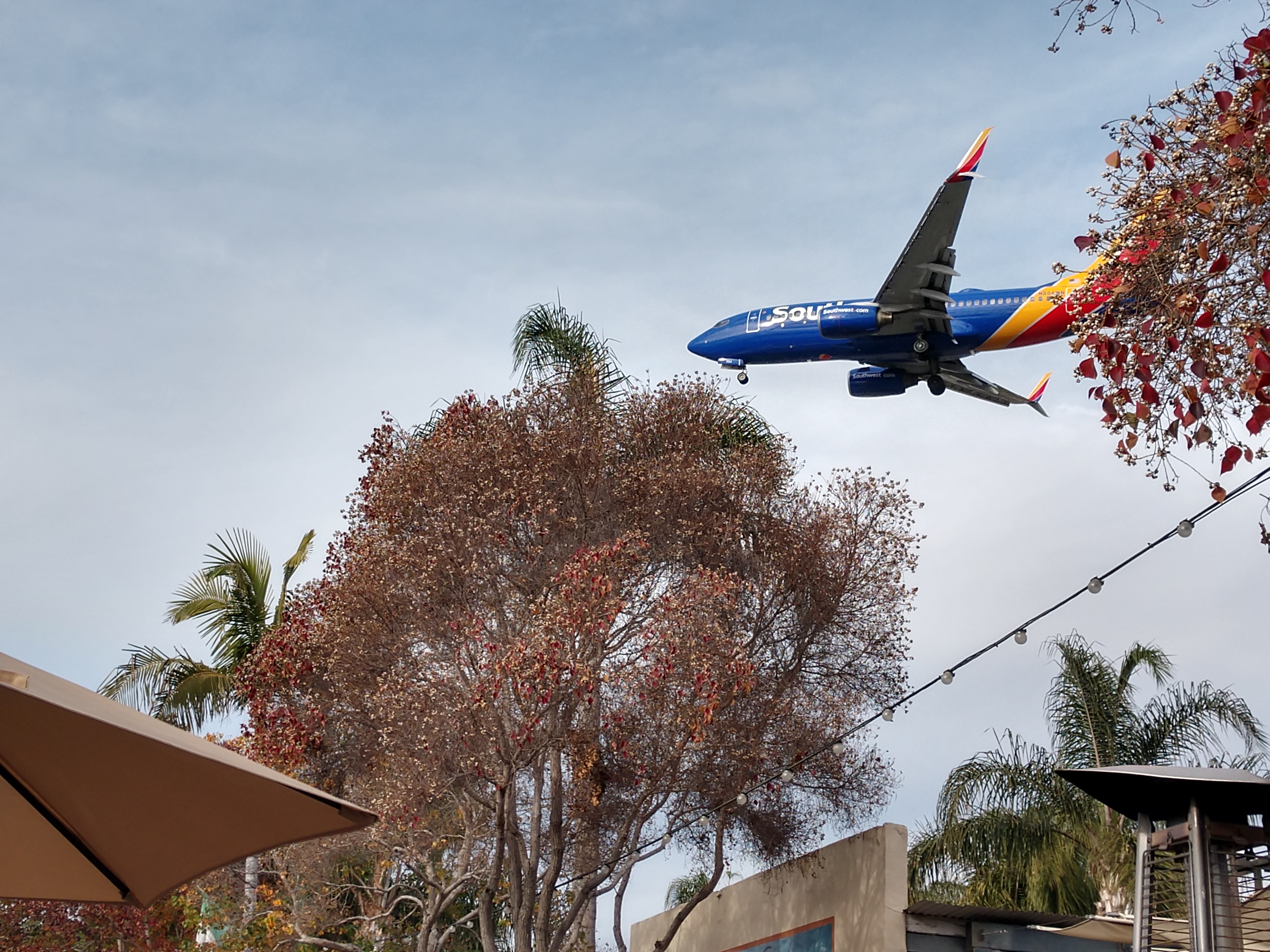
While we were sitting outside in the patio area of the brewery, we had the chance to watch many airplanes fly over close to us.


And the limo shown below drove by while we were there.

We got home from our 114 mile road trip at 3:40 p.m. We had an enjoyable day of sand, breezes, beaches and sights galore!
Shirley & Mel


No comments:
Post a Comment