Today was a travel day and would be the first time we had entered California this trip. It was sunny and 53 degrees when we left Whalers Rest Thousand Trails campground in South Beach, Oregon at 7:50 a.m.

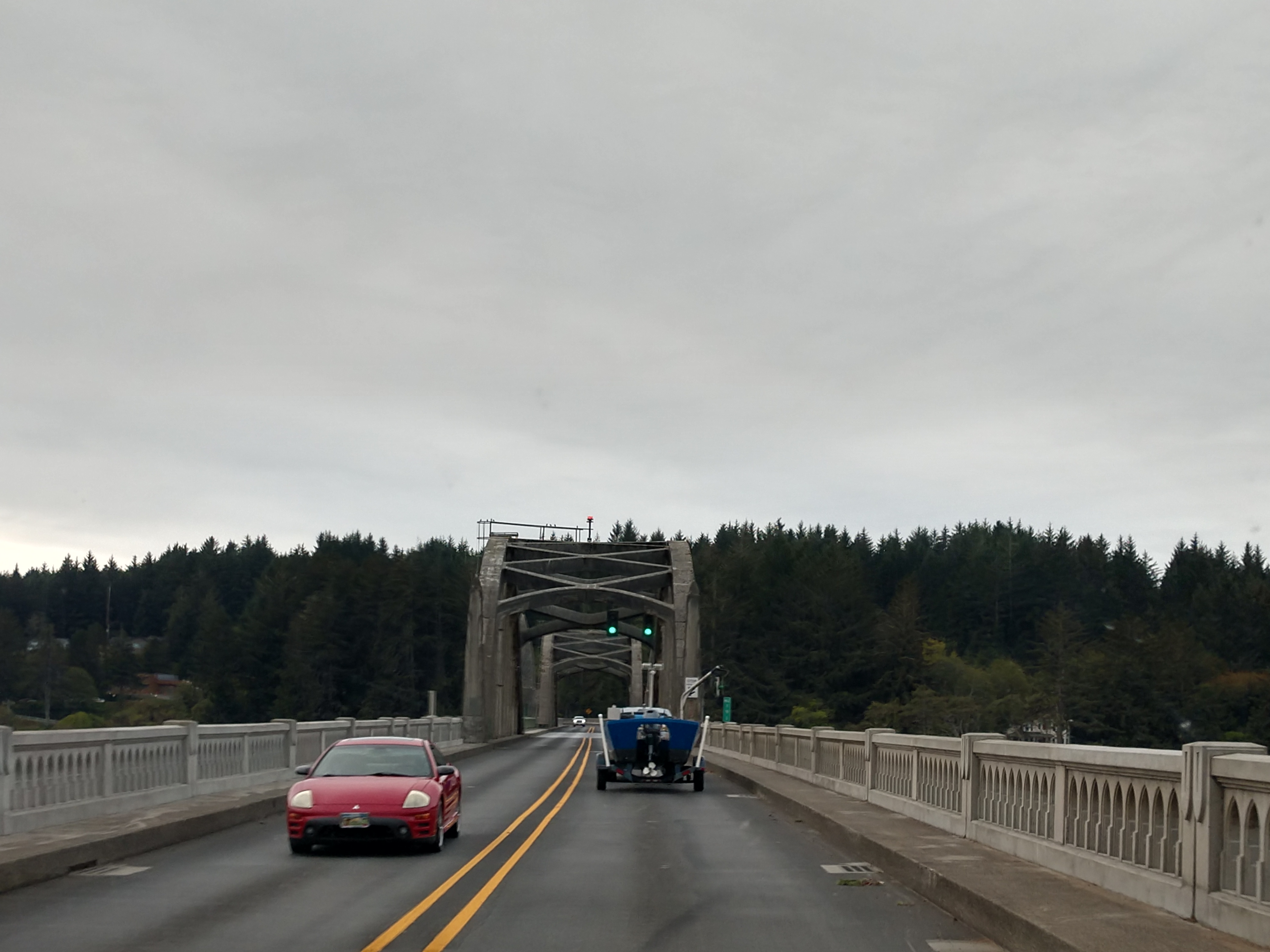
We once again set out driving along US Hwy 101. During the day, we crossed many bridges.

We drove by Cape Perpetua that is a large forested area on a high steep bluff above the Pacific Ocean on the central Oregon Coast in Lincoln County, Oregon. The land is managed by the United States Forest Service as part of the Siuslaw National Forest. Cape Perpetua is located about 2 miles south of Yachats, Oregon along US Hwy 101. At its highest point, Cape Perpetua rises to over 800 feet above sea level. From its crest, an observer can see 70 miles of the Oregon coastline and as far as 37 miles out to sea on a clear day.
For at least 6,000 years, Native Americans hunted for mussels, crabs, sea urchins, and clams along the coast near Cape Perpetua. Cape Perpetua was part of the southern territory of the Alsea people. In their language the Cape was named Halqaik, which might mean something like 'exposed place'. Evidence of their lives can still be found in the huge piles of discarded mussel shells that lie along the shore near the Cape Perpetua Visitor Center.
The cape was named by Captain James Cook on March 7, 1778, as he searched for the Pacific entrance to a Northwest Passage. Cook named the cape Perpetua because it was discovered on St. Perpetua's Day. The area became part of the Siuslaw National Forest in 1908. In 1914, the United States Forest Service cut a narrow road into the cliff around Cape Perpetua and constructed a wooden bridge across the Yachats River, opening travel between the small community of Yachats and Florence to the south. The wooden bridge was replaced in 1926 with a steel structure. The Cape Perpetua section of the Roosevelt Memorial Highway (which is now US Hwy 101) was built in the 1930s.
In 1933, a Civilian Conservation Corps camp was built at the foot of the cape just north of Cape Creek, near where the Cape Perpetua Visitor Center is located today. During World War II, the West Shelter observation point was used as a coastal watch station, and a large coastal defense gun was temporarily installed.


We then drove past the Cummins Ridge Trailhead.

We then crossed another bridge -- this time over Tenmile Creek. Tenmile Creek is the outlet for a chain of lakes ending at Tenmile Lake near Lakeside in Coos County in the U.S. state of Oregon. The creek flows generally west for about 3 miles from the lake to the Pacific Ocean. The stream's name stems from its approximate distance from Winchester Bay, the earliest pioneer village along this part of the coast.
Tenmile Creek meanders generally west from its source at Lakeside, which is on the creek's right bank. Slightly west of town, the creek enters the Siuslaw National Forest, then passes under US Hwy 101. Just beyond the highway, Eel Creek, the outlet from Eel Lake, enters from the right. Turning south parallel to the highway, which is on its left, Tenmile Creek arrives at Spinreel Campground, where Saunders Creek enters from the left. Turning northwest, Tenmile Creek enters Oregon Dunes National Recreation Area, through which it meanders until reaching the ocean.
Tenmile Lake is the largest and southernmost of a chain of lakes that formed behind a ridge of dunes along the Oregon Coast south of the Umpqua River. The lakes developed after rising sea levels, driven by post-glacial warming, drowned the lower reaches of ancestral Tenmile Creek and its tributaries. Sand dunes later blocked the streams and helped produce lakes at varied elevations within the Tenmile drainage basin. Other large lakes in the chain are, from north to south, Clear, Eel, and North Tenmile. All drain toward Lakeside, about 8 miles south of Reedsport and 0.5 miles east of US Hwy 101.

US Hwy 101 continued to wind its way around the coast -- sometimes really close to the Pacific Ocean.


We drove over another bridge -- this time over Big Creek. The Big Creek Bridge is a bowstring arch bridge that spans Big Creek on U.S. Route 101 in Lane County, Oregon. It was designed by Conde McCullough and opened in 1931. The bridge has a total length of 180 ft and contains one 120 ft reinforced concrete tied arch, identical in design to Ten Mile Creek Bridge and Wilson River Bridge. The locations for all three bridges were similar in that the sandy foundations were not secure enough for the abutment piers required to relieve the lateral pressure of traditional arches. The flood levels of the rivers approached the road grade and ruled out the use of reinforced concrete girders. The corrosive salt air eliminated the practicality of steel truss bridges. The design of the bridge was similar to the rainbow arch design patented by James Barney Marsh.


Muriel O. Ponsler Memorial Wayside is located about 15 miles north of Florence. The State of Oregon received this two-acre, ocean-front property from Jack Ponsler in 1939 to be made into a public park in memory of his wife Muriel O. Ponsler.


We next drove through the Cape Creek Tunnel that is outside of Florence, Oregon.


We then drove by the Sea Lion Caves that we had drove by the last time we were here. Sea Lion Caves is a connected system of sea caves and caverns open to the Pacific Ocean in Oregon. They are located 11 miles north of Florence on US Hwy 101, about midpoint on the 400 miles of the Oregon Coast. In this area US Hwy 101 follows a steep and undeveloped seascape 300 feet above sea level.
The cave system is at sea level and the ocean continually washes into the main cavern which has a floor area of about 2 acres and a vaulted rock dome about 125 feet high. Southward from the main chamber, a low passage runs 1,000 feet to a sea level opening. This corridor is flooded at high tide and free of water at low tide. The western entrance is a short, high passage through which the ocean washes at all tide levels. At the north, a third entrance is 50 feet above the ocean which serves as an elevated observation area where the entire cave system and its wildlife are visible.

Lichens, algae, and mineral stains cover the cavern walls with greens, pinks, purples, buffs, and reds on the rough surfaces, some of which are named Lincoln's Head, the Indian Maiden, and The Goddess of Liberty. The sea level portion of this cave and the sea cliff rocks just outside the cave have become over the centuries, the only known mainland rookery and hauling area of the Steller's sea lion and — to a lesser extent, the California sea lion.
Sea Lion Caves is one of the great sea caves of the world, and currently ranks 10th among the world's longest sea caves. With a measured length of 1,315 feet, it is the longest in the United States. A comparable cave is the undeveloped Painted Cave on Santa Cruz Island, California, which is 1,227 feet long.

The Sea Lion Caves were discovered in 1880 by a local seaman, Captain William Cox, who entered the grotto through the western channel in a small boat on a calm day. He reportedly returned to explore the caves a number of times and on one occasion was marooned for several days because of stormy weather and rough ocean. He reportedly sustained himself by shooting a young sea lion and eating the meat of its flippers.


We continued on the curvy, winding US Hwy 101.


We crossed another bridge.

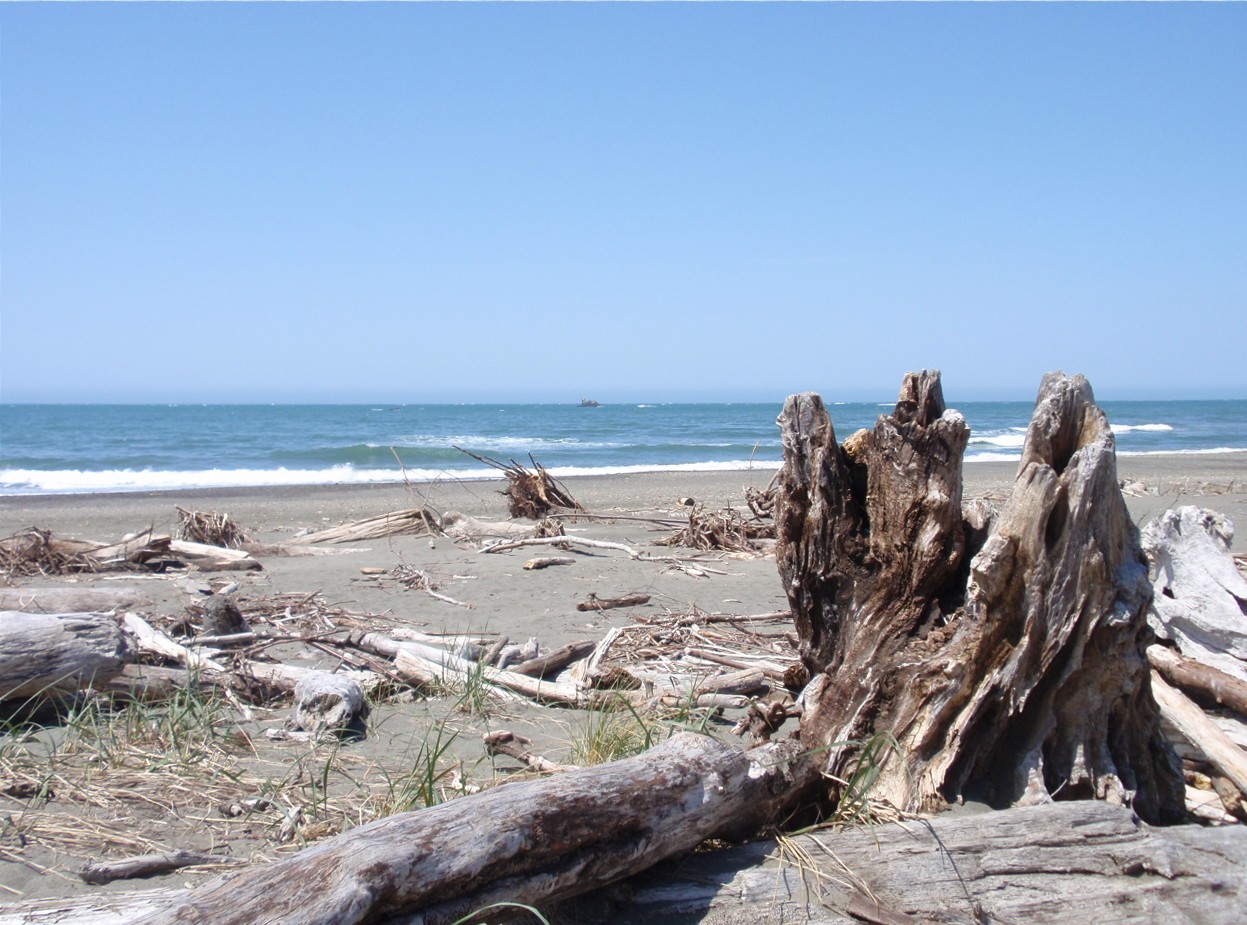
We then drove by the South Jetty Dunes and Beach area. We are beginning to see evidence of the drifting of sand.

We drove by the Honeyman State Park and Woahink Lake. Honeyman State Park, a versatile coastal park is tucked in the dunes three miles south of the city of Florence and two miles from the ocean. Woahink Lake extends further below sea level than any other lake dammed by sand dunes along the coast of Oregon. The lake fills a depression in the Siltcoos River watershed about 3 miles from the Pacific Ocean south of Florence along US Hwy 101. The lowest point of the lake, which is up to 74 feet deep, is about 36 feet below sea level. The lake drains south to Siltcoos Lake via Woahink Creek. The lake's name may have derived from the Siuslaw language.

We have now entered Dunes City, which has a population of 1,303, and is located in the heart of Oregon’s National Dunes Recreation Area.


We then passed Siltcoos Lake North Beach area.

We then passed the West Lake area.

We have now entered Douglas County.


Next we passed the Oregon Dunes Day Use Area.

We then entered the tsunami hazard zone by the Tahkenitch Creek Trailhead.

(Shown above is the beautiful bridge that leads into Reedsport.)

We then crossed the long bridge into Reedsport.


We have now entered Reedsport, Oregon, which is known as the "Gateway to the Dunes". Reedsport has a population of 4,310. Reedsport was established on the estuary of the Umpqua River on January 7, 1852. It was named for a local settler, Alfred W. Reed, who founded the city in 1912. The post office was established July 17, 1912.
The building of Southern Pacific Railroad lines extending south to Coos Bay led to the development of Reedsport. Before the post office was established in 1912, Reedsport was a camp for railroad construction workers. Built on marshy ground, for much of its history Reedsport has struggled with frequent flooding; most of its early buildings were elevated 3 to 8 feet above ground. After a devastating flood in 1964, a dike was constructed to protect the lower town. During this flood, the waters reached the fish hatchery and overflowed the fish troughs allowing hundreds of thousands of smallmouth bass to be introduced into the Umpqua River.

We then drove by the Umpqua Discovery Center and Dean Creek Elk Viewing Area.


A neat mural depicting a lighthouse and the sand dunes is on the side of the Sand Bucket building.

We are now 22 miles away from North Bend and 25 miles from Coos Bay.

Next, we drove by the Salmon Harbor Recreation Area.

We then entered Winchester Bay. Winchester Bay, formerly known as Umpqua City, is an unincorporated community in Douglas County, Oregon, with a population of 382. The community of Umpqua City was established in 1850.


Next, we drove by the exit to the Umpqua Lighthouse State Park. Umpqua Lighthouse State Park is located less than a mile from the famous Salmon Harbor Marina on Winchester Bay, known for some of the best crabbing and sports fishing along the Oregon coast. The park is located in the stretch of towering sand dunes protected by the Oregon Dunes National Recreation Area.
The Umpqua River Lighthouse is operated by Umpqua Valley Museums. The lighthouse is located adjacent to Umpqua Lighthouse State Park and is managed by Douglas County, whose Umpqua River Lighthouse Museum is located 100 yards north of the lighthouse in the historic former U.S. Coast Guard Station Umpqua River. The 65-foot tower contains a distinctive lens that emits a red and white flash.


Next, we drove by Tugman State Park. Despite its close proximity to US Hwy 101, Tugman State Park is relatively unknown — a private hideaway on the wondrous south coast, situated on Eel Lake near the community of Lakeside.


The John Dellenback Dunes Trail is located in the heart of the Oregon Dunes National Recreation Area, 11 miles south of Reedsport along US Hwy 101.


Above and below are views of the Oregon Dunes. The Oregon Dunes National Recreation Area is located on the Oregon Coast, stretching approximately 40 miles north of the Coos River in North Bend to the Siuslaw River in Florence, and adjoining Honeyman State Park on the west. It is part of Siuslaw National Forest and is administered by the United States Forest Service.

The Oregon Dunes are a unique area of windswept sand. They are the largest expanse of coastal sand dunes in North America and one of the largest expanses of temperate coastal sand dunes in the world, with some dunes reaching 500 feet above sea level. They are the product of millions of years of erosion by wind and rain on the Oregon Coast. There are about 7,000 acres of sand dunes, about a fifth of the total area of the national recreation area.

The Oregon Dunes are over 100,000 years old and stretch approximately 40 miles. The youngest dunes, which are the closest to the ocean, began forming about 7,000 years ago. Studies of individual sand grains show that these sands were carried down from the mountains by the Umpqua, Siuslaw, and other smaller rivers.

We could now start to see the Conde McCullough Memorial Bridge in the distance (see below).


We drove past the Trans Pacific Parkway.

The Conde B. McCullough Memorial Bridge (shown above and below) is a cantilever bridge that spans the Coos Bay on US Hwy 101 near North Bend, Oregon. When completed in 1936, it was named the North Bend Bridge. In 1947, it was renamed in honor of Conde B. McCullough who died May 5, 1946. This and 10 other major bridges on the Oregon Coast Highway were designed under his supervision.

The Conde B. McCullough Memorial Bridge replaced ferries that had formerly crossed the bay. The bridge is outstanding for its attention to form and detail, and has been placed on the National Register of Historic Places in recognition of its design and cultural and economic importance.

Work started on what was then called the North Bend Bridge on July 10, 1934. Glenn S. Paxson, Acting State Bridge Engineer while McCullough took a leave of absence to work on projects in Central America, was the supervising engineer during construction. The resident engineer was Raymond Archibald until 1935, when he joined McCullough, then Dexter R. Smith. The Northwest Roads Company of Portland, Oregon built the piers and the concrete structure. The steel sections of the bridge were built by the Virginia Bridge and Iron Company. The main piers are supported on piles driven into the bay's bed. The main towers of the cantilever section were fabricated off-site and moved to the bridge site in four sections. Work on the cantilever arms moved out in both directions from the tower, with the shoreward arm keeping slightly ahead of the center arm so that it would rest on a temporary support structure to stabilize the bridge. The concrete arch sections were erected using timber falsework. The bridge opened in June 1936.

When the bridge was completed in 1936, it was the longest bridge in Oregon and it was the costliest of the Oregon Coast bridges at $2.14 million. The North Bend Bridge was dedicated to its designer, Conde McCullough, in 1947.


(Shown above is the Conde McCullough Memorial Bridge in North Bend, Oregon as seen from the east.)

We have now entered North Bend, Oregon. The welcome sign is made of neon lights. North Bend is a city in Coos County, Oregon, with a population of 9,695. North Bend is surrounded on three sides by Coos Bay, an S-shaped water inlet and estuary where the Coos River enters Coos Bay and borders the city of Coos Bay to the south. North Bend became an incorporated city in 1903.

Before Europeans visited the Oregon coast, Native American tribes claimed the Coos Bay region as their homeland for thousands of years. Members of the Coos, Lower Umpqua, Siuslaw and Coquille tribes lived, fished, hunted and gathered along Coos Bay and its estuaries, along rivers, and in meadows and forests.

We followed US Hwy 101 South to the left toward Coos Bay and Bandon.


The earliest settlement of European Americans in the area was in January 1852 when survivors of the Captain Lincoln shipwreck established Camp Castaway until they and their cargo could be fully rescued. There has been a permanent settlement on Coos Bay since 1853, when the town of Marshfield was founded there and named after the Massachusetts hometown of its founder, J. C. Tolman. The first Methodist church in the area was established in 1857. By 1866 the inhabitants, who were reliant on the sea for their income, had built the Cape Arago Light. The setting up of a post office in 1871 and the arrival of the Coos Bay Wagon Road in the town a year later connected Coos County with the Umpqua River valley in neighboring Douglas County, on the other side of the Coast Range of mountains. This wagon road, although long gone in its original form, is still partially in existence since the route of Oregon Route 42 roughly follows the original right of way.

We continued to follow US Hwy 101 south toward Bandon and Brookings.

Next, we drove by Bullards Beach State Park located at the mouth of the Coquille River, two miles north of Bandon.

Shown above is Bullards Beach.

We then crossed the Bullards Bridge. The Bullards Bridge is a vertical-lift bridge that spans the Coquille River near where the river empties into the Pacific Ocean, just north of Bandon, Oregon. One of only two vertical-lift bridges on the Oregon Coast Highway (US Hwy 101), it was completed in 1954. The lift span is flanked by two camelback truss spans. It is located immediately east of Bullards Beach State Park.

(Shown above is a view of the lift span, looking towards the northern truss span.)

The bridge was built to replace Bullards Ferry, a ferry service whose slip was located about 80 feet upstream from the bridge that replaced it. The name originates with the Bullard family, who were among the early settlers in the area. The Oregon Highway Commission awarded a contract for construction of the bridge and a 0.49-mile new section of highway in October 1952. The completed bridge was dedicated on September 20, 1954.
The overhead clearance for vehicles on the bridge deck originally was between 14 feet 10 inches and 15 feet 2 inches, but after multiple instances of tall trucks striking the bridge, work was undertaken in 2006–2007 to move certain cross pieces in order to increase the vertical clearance on the roadway by about 2 feet. Average daily traffic on the bridge was about 6,000 vehicles in 2004, but had grown to about 8,300 by 2007.

(Shown above is Bullards Bridge, on US Hwy 101 just north of Bandon, Oregon. The 1952-built vertical-lift bridge crosses the Coquille River.)

We are now in Bandon, Oregon, a city in Coos County, Oregon on the south side of the mouth of the Coquille River. It was named by George Bennet, an Irish peer, who settled nearby in 1873 and named the town after Bandon in Ireland, his hometown. Bandon has a population of 3,321.

Before 1850, the Coquille Indians lived in the area. Then in 1851, gold was discovered at nearby Whiskey Run Beach by French Canadian trappers, though the gold rush did not have much of an impact on the area. In 1852, Henry Baldwin, from County Cork, Ireland, was shipwrecked on the Coos Bay bar and walked into this area. The first permanent European settlers came in 1853 and established the present town site. In 1856, the first conflicts with Indigenous Americans in the area arose and those were sent to the Siletz Reservation. In 1859, the boat Twin Sisters sailed into the Coquille River and opened the outlet for all inland produce and resources.

Bandon was founded by the Irish peer George Bennett in 1873. George Bennett, his sons Joseph and George, and George Sealey came from Bandon, Ireland. The following year the town's previous name of Averille was changed to Bandon after the town of the same name in Ireland. The next year, Joseph Williams and his three sons arrived, also from Bandon, Ireland. In 1877, the post office was established. In 1880, cheese making began. That same year, Congress appropriated money to build the jetty. In 1883, the first sawmill, school house, and Catholic church were built. In 1884, the U.S. Army Corps of Engineers began construction on the jetty.

Cranberries have been grown in Bandon since 1885, when Charles McFarlin planted vines he brought from Massachusetts. McFarlin had originally come to pan for gold in California. He did not make his fortune, or even a living, so he turned to what he knew best. He brought vines from Cape Cod and planted them in the state's first cranberry bog near Hauser. This bog produced cranberries for eight decades. His variety adapted to growing conditions on the west coast. The variety was named McFarlin in his honor and was the principal variety grown on the west coast until overtaken by the Stevens variety. Bandon is also the location of the first cranberry bogs to be wet harvested, which is done by building dikes around the bogs then flooding them.
.jpg)
(Shown above is the Bandon Historic District.)

We met a logging truck just as we approached the turnoff for New River Nature Center.

We then drove by Cape Blanco State Park. Located at the state's westernmost tip, and perched over the Pacific Ocean, Cape Blanco features a 19th-century lighthouse and an early Irish settler's home.


We are now at Port Orford, located on US Hwy 101 between the Pacific Ocean and the Siskiyou National Forest, 28 miles north of Gold Beach and 27 miles south of Bandon. Port Orford has a population of 1,133. The city takes its name from George Vancouver's original name for nearby Cape Blanco, which he named for George, Earl of Orford, "a much-respected friend." Port Orford is the westernmost settlement in the state of Oregon, and the westernmost incorporated place in the 48 contiguous states. Before the arrival of European settlers, the Port Orford area was inhabited by Tututni peoples. The Tututni languages were a part of the Pacific Coast Athabaskan language family.


In Port Orford, we drove close to the coast of the Pacific Ocean.


We then crossed another bridge and then we were at Gold Beach.

Gold Beach is a city in and the county seat of Curry County, Oregon on the Oregon Coast. Gold Beach has a population of 2,241. The community was originally named Ellensburg in the 1850s, but later took the name Gold Beach after a beach near the mouth of the Rogue River where hundreds of placer mines extracted gold. An Ellensburg post office was established in 1853, changed to Ellensburg in 1877, and changed to Gold Beach in 1890.


Shown above and below is Kissing Rock, which is the biggest landmark of South Beach. Kissing Rock itself is a tall structure with a slightly curved shape at the top, looking a bit like a dollop of chocolate. It is a huge sea stack towering over the beach and highway with a few smaller rocks sitting around it. There are multiple stories of how the name was given to this rock, but the most common one is that it was simply a place for lovers to meet.

The next few pictures below are coastal driving along US Hwy 101.


Next, we passed Arch Rock, which is a massive natural rock arch standing alone in the Pacific Ocean. Arch Rock is found within the Samuel H. Boardman State Scenic Corridor, one of the most rugged sections of the Oregon coast. The particular geology of this coastline creates plenty of sheer cliffs, sea stacks, and natural arches. Eons of erosion from winds and waves grinds down the rocks and forms these beautiful features. The natural arches form from cracks and crevices that weaken and fracture into notches. These notches grow into sea caves in the cliffs and sometimes collapse to form blowholes. After thousands of years, only the strongest parts of the rock remain even after the shoreline has receded hundreds of feet. Arch Rock is the strong piece of rock that remains from many many years of erosion. Over several thousand more years this natural arch will likely collapse during a violent storm when pummeled by massive waves.


Next, we came to the Thomas Creek Bridge Viewpoint.

The Thomas Creek Bridge crosses Thomas Creek in Curry County in Oregon. It is on US Hwy 101 and lies within the boundaries of Samuel H. Boardman State Scenic Corridor. The Thomas Creek Bridge is a triple span deck truss that crosses a deep valley overlooking the Pacific Ocean. It was designed by Ivan D. Merchant. Built in 1961, it has a length of 956 feet in total, and a deck width of 30 feet. The longest span is 371 feet. The bridge is the highest bridge in Oregon at 345 feet.


.jpg)

We then drove by Whaleshead Beach and Viewpoint. Whaleshead Beach is one of the most gorgeous locations along the Oregon Coast. Offshore there is a sea stack that looks like the head of a Whale. The sea stack is cut with a rock channel and when a wave hits it, it spurts a spray that actually looks like a whale spouting, hence the name Whaleshead Beach. Whaleshead is located about 7 miles north of Brookings. First you will come to the Whaleshead Trail Viewpoint parking area on the ocean side of the road.


(Shown above is the rock formation called "Whaleshead".)

We then passed House Rock and Cape Ferrelo. At House Rock Viewpoint, a memorial commemorates Samuel H. Boardman, the first Oregon State Parks superintendent and the park's namesake. The 4-mile trail between Cape Ferrelo and House Rock offers many side trails to secluded beaches. At the Cape Ferrelo Viewpoint, a mile-long hike leads to breathtaking views of the rugged coastline and photoworthy Oregon sunsets. The Cape is also an excellent spot for whale watching in fall and spring.


We then stopped in Brookings, Oregon. Brookings is a city in Curry County, Oregon that was named after John E. Brookings, president of the Brookings Lumber and Box Company, which founded the city in 1908. Brookings has a population of 6,744.
.jpg)
(Shown above is the coastline of Brookings as seen from US Hwy 101.)
In 1906, the Brookings Timber Company hired William James Ward, a graduate in civil engineering and forestry, to come to the southern Oregon Coast and survey its lumbering potential. After timber cruising the Chetco and Pistol River areas for several years, he recommended that the Brookings people begin extensive lumbering operations here and secure a townsite for a mill and shipping center.

(Shown above is the Brookings harbor.)
While John E. Brookings was responsible for the founding of Brookings as a company town, it was his cousin, Robert S. Brookings, who was responsible for its actual design. The latter Brookings hired Bernard Maybeck, an architect based in San Francisco who was later involved in the Panama–Pacific International Exposition, to lay out the plat of the townsite.
We stopped to get gas at Fred Meyer in Brookings, and then went to Taco Bell to get lunch (2 chicken chipolte grilled burritos and 1 crunchy taco each), before we headed into California.

We then drove by Harris Beach State Park. Located on Oregon’s rugged south coast, Harris Beach offers a splendid seascape for sightseers, several trails, and miles of sandy beaches and rocky outcroppings to explore.

(Shown above is Harris Beach State Park beach.)

Next, we drove by Crissey Field State Park. Perched between the California border and the Winchuck River, this 40-acre park features a sandy beach, wetlands, and a small stand of mature trees.
(Shown above is the Crissey Field State Park beach.)

Next, we crossed into California at around 1:00 p.m. Yeah! The Golden State of California was officially founded in 1850. California is a state in the Western United States with over 38.9 million residents across a total area of approximately 163,696 square miles. It is the most populous state, the third-largest state by area, and the most populated subnational entity in North America. California borders Oregon to the north, Nevada and Arizona to the east, and the Mexican state of Baja California to the south; it has a coastline along the Pacific Ocean to the west.

We are now in Del Norte County in California. As we approached Smith River, California, we came upon an agriculture inspection station that we are asked to stop at and were asked simple questions (like do we have any produce). California Border Protection Stations are located in 16 areas maintained by the California Department of Food and Agriculture along the state's land borders with Oregon, Nevada, and Arizona. Officials staffing CBPS checkpoints inspect vehicle traffic entering California for the presence of pests carried in fruits and other produce.


The Agriculture Inspection Station is just ahead.


Shown above is the sign we saw next "Welcome to Del Norte County -- The Redwood Gate to the Golden State."

We have seen many of these bright "Click-It-Or-Ticket" signs now that we are in California.

We are now at Smith River, a town and census-designated place in Del Norte County, California, located near the Oregon border. Smith River is the headquarters of the Tolowa Dee-ni' Nation, a federally recognized tribe of Tolowa people. Smith River has a population of 906. It is bordered by the Smith River National Recreation Area. A post office was opened in 1863. One early settler of Smith River was William Dows Rexford, who moved there with his sons in the early 1870s. The town has formerly been known as Smith River Corners.

There was a little bit of road construction on this bridge shown below.


Crescent City, California is now 8 miles away (see above).

We are now in Crescent City. Crescent City is the only incorporated city in Del Norte County, California; it is also the county seat. Named for the crescent-shaped stretch of sandy beach south of the city, Crescent City has a population of 6,673. The city is also the site of the Redwood National Park headquarters, as well as the historic Battery Point Light. Due to the richness of the local Pacific Ocean waters and the related catch, and ease of access, Crescent City Harbor serves as home port for numerous commercial fishing vessels.
The city is on the Pacific coast in the upper northwestern part of California, about 20 miles south of the Oregon border. Crescent City's offshore geography makes it unusually susceptible to tsunamis. Much of the city was destroyed by four tsunami waves generated by the Great Alaskan earthquake off Anchorage, Alaska in 1964. More recently, the city's harbor suffered extensive damage and destruction from tsunamis generated by the March 11, 2011 earthquake off Sendai, Japan. Several dozen vessels and many of the docks they were moored to were destroyed as wave cycles related to the tsunamis exceeded 8 feet. The climate of Crescent City is moderate, with cool summers for its latitude as a result of intense maritime moderation. Nearby inland areas behind the mountains have significantly warmer summer temperatures.
The area that is now known as Del Norte County was and still is inhabited by the Yurok (Klamath River Indians) and Tolowa Nations of indigenous peoples. The first European American to explore this land was pioneer Jedediah Smith in the early 19th century. He was the first European American to reach the area overland on foot in a time before the European Americans knew anything about such a distant territory. For him it was literally "Land's End" — where the American continent ended at the Pacific Ocean. In 1855, the U.S. Congress authorized the building of a lighthouse at "the battery point" (a high tide island on the coast of Crescent City) which is still functioning as a historical landmark. European explorers first visited the area by ship in the late 1820s. Europeans began moving to the area in the 1850s. Crescent City was incorporated as a city in 1854.

We decided to follow US Hwy 101 along California's Redwood Highway at Crescent City.


We drove past the turnoff for Battery Point Lighthouse, which is a lighthouse in Crescent City, California. It is registered as a California Historical Landmark, and is listed on the National Register of Historic Places as "Crescent City Lighthouse".
Even though we didn't drive out to get a glimpse of it, it is a beautiful lighthouse as seen below.

(Battery Point Lighthouse in Crescent City, California.)
Battery Point Light was one of the first lighthouses on the California coast. Rugged mountains and unbridged rivers meant coastal travel was essential for the economic survival of this region. In 1855, Congress appropriated $15,000 for the construction of a lighthouse on the tiny islet, which is connected to Battery Point by an isthmus which is visible and can be traversed on foot at low tide. Although not included in the 1852 contract by the United States Lighthouse Service for the first eight west coast lighthouses, the Battery Point Lighthouse was actually lit ten days before the Humboldt Harbor Lighthouse, the last of the original eight to become operational. The fourth-order Fresnel lens was lit in 1856. The lighthouse was automated in 1953, and a modern 14.8-inch lens replaced the fourth-order Fresnel lens. Theophilis Magruder was the station's first keeper; Wayne Piland was its last before automation in 1953.
.jpg)
(Battery Point Lighthouse from shore.)
The 1964 Alaska earthquake, the strongest earthquake ever recorded in the northern hemisphere, caused a tsunami. The lighthouse survived. In the following year, the modern beacon that replaced the Fresnel lens in the tower was switched off, and a flashing light at the end of the nearby breakwater served as the harbor's navigational aid. In 1982, the light in the lighthouse tower was lit again, and the Battery Point Lighthouse was listed as a private aid to navigation.

(Front door entrance and surrounding yard of Battery Point Lighthouse.)

(Shown above is one of the biggest and most beautiful murals in Crescent City that features the area's many light houses. It covers the Renner Building on US Hwy 101.)


(Close-up of a portion of the above mural in Crescent City.)

We then drove by the Crescent City Harbor. Crescent City’s C-shaped harbor is known for its chilly sea breezes and breathtaking mountain vistas, and the region nearby is famous for its Easter lily farms, which produce the vast majority of the nation’s bulbs. The Inner Boat Basin at the Crescent City Harbor District was damaged by a 2006 tsunami, but was totally destroyed by the tsunami that struck the harbor on March 11, 2011. The damage from both events required three years to rebuild. (The word tsunami in Japanese translates literally as “harbor wave.”) The new Inner Boat Basin was designed to resist a 50 year tsunami event.

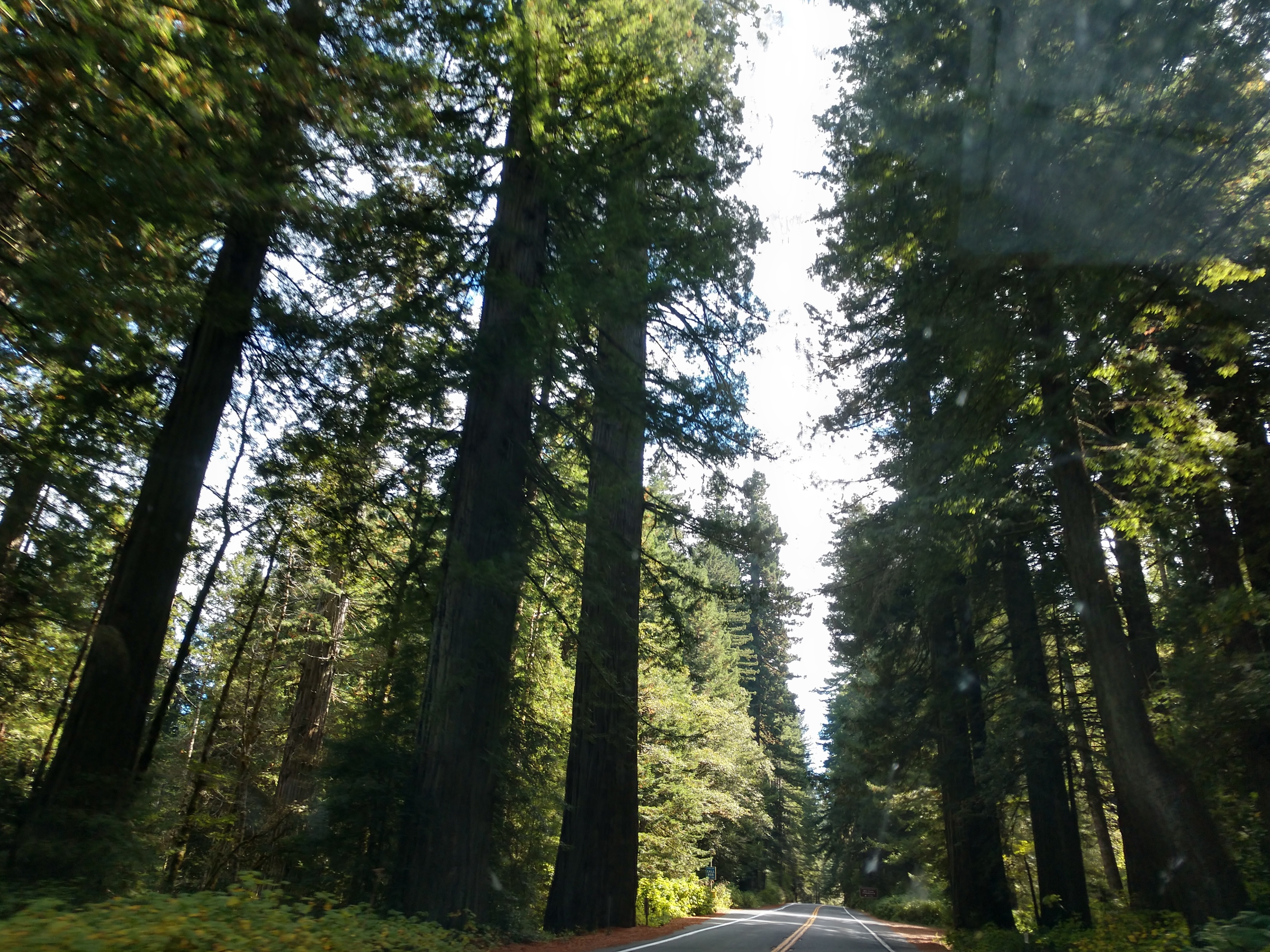
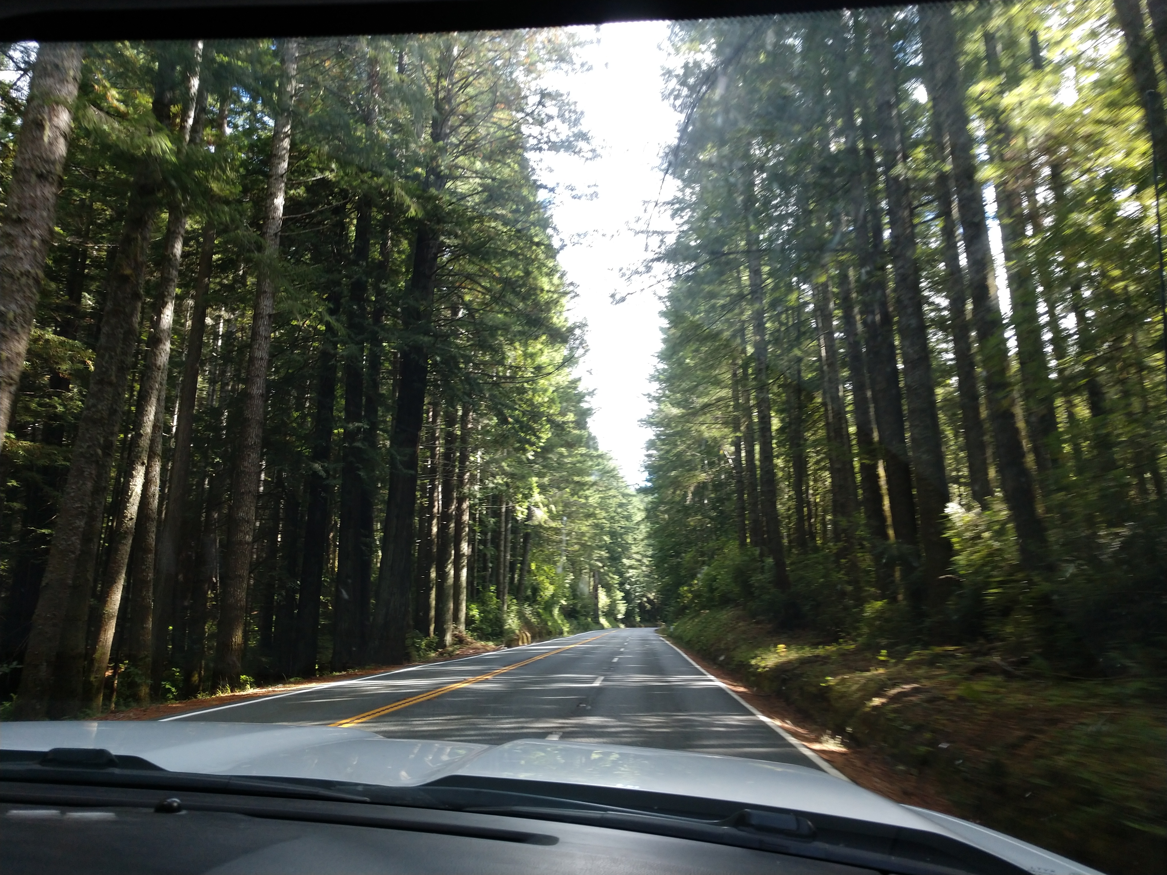
We then followed California's Redwood Highway from just outside of Crescent City. The highway gently took us past thousands of acres of old-growth redwood forests, through clusters of redwood tree groves. The trees that grow along the Redwood Highway were Coastal redwoods. They're the tallest living things on our planet, reaching 300 to 350 feet high and 16 to 18 feet across, which actually makes them look sort of skinny.

We didn't drive the Avenue of the Giants, but instead continued along the Redwoods Highway.

The Newton B. Drury Parkway was a 10-mile drive through Prairie Creek Redwood State Park. It followed a north-south route that connected with US Hwy 101, making it an easy choice for us to “take the scenic route!” In the most southern area was the Visitor’s Center, Big Tree, meadow, and the largest trees.

The Redwood Highway in California is widely considered one of the most scenic drives in all of California, if not in America. The Redwood Highway in California takes its name from the massive coastal redwoods that can be found along much of its route. The highway passes through most of the Redwood National and State Parks that cover much of Northern California. These colossal trees gained protection during the early 20th century.

Even though the Redwood Highway seemed like a misnomer at the beginning of the drive, within the first 20 miles the redwood giants made their grand appearance and kept us watching for bigger and larger trees along the drive.


The giant redwood monsters were everywhere.


We continued on and soon we were only 10 miles from Klamath, which is where we planned to spend the night.


We took numerous sweeping views of the Del Norte County coastline and the vast Pacific Ocean.


(False Klamath Rock from US Hwy 101.)
Soon we drove by the Trees of Mystery tourist attraction with a giant Paul Bunyan and Babe the Blue Ox. This was just before we got to Klamath, California.


Trees of Mystery is a park and tourist attraction along U.S. Route 101 (US 101) near the coastal town of Klamath, California. It features interpretive trails through Giant Redwoods and a number of unusual tree formations, many of which can be seen from its Trail of Mysterious Trees. Its Trail of Tall Tales displays some 50 chainsaw sculptures and carvings illustrating stories of legendary logger Paul Bunyan and his crew.

Trees of Mystery is best known for its 49-foot statue of Paul Bunyan and 35-foot statue of Bunyan's companion, Babe the Blue Ox. Paul Bunyan stands proud at 49’2′ high and weighs in at a petite 30,000 lbs. His waist is a firm 52 feet around. His chest is a robust 66 feet in circumference. His strong arms measure 27 feet each. Even his boots are 10 feet high! His pal Babe is also similarly humongous. The big blue ox measures 35 feet at the horn tips, and weighs just as much as Paul does – tilting the scales at a trim, powder blue, 30,000 lbs.
Constructed largely of wooden beams, chicken wire and stucco, the current Babe was built in 1950 and the current Bunyan in 1961. The original Bunyan was built in 1946, but was destroyed by rain that winter. In late 2007, the half-ton, 9-foot-wide head of Babe fell to the ground as the result of rain damage; it has since been replaced. Paul is not the least bit camera shy, and, with a great big smile and a waving hand Paul greets all visitors to Trees of Mystery.


We have just entered Klamath, California, which is an unincorporated community in Del Norte County, California, situated on US Route 101 inland from the mouth of the Klamath River. The population of Klamath is 632 and Klamath is at an elevation of 30 feet. Klamath is located within the Yurok Indian Reservation. The original town center was destroyed by the 1964 Flood. Streets and sidewalks of this original site, west of US Hwy 101 and the current site of the town's core, remain visible.

We crossed the Klamath River Bridge that is famous for the golden bears on both ends. A pair of golden bears located at each end of the G. H. Douglas Memorial Bridge near Klamath on Route 101 in Del Norte County were cast to replace the original ones that formerly stood on the Klamath River Bridge—a bridge which was washed out during the heavy floods of December 1964.


The bridge crosses the Klamath River on US Hwy 101 near Klamath, California. The bear statues represent grizzly bears, California's official state animal. The golden bears also represent the Grizzly Bear that is on the official California state flag.
,_Redwood_NP.jpg)

.jpg)
Although the reservation comprises some 56,000 acres of contiguous land along the Klamath River, only about 5,000 acres of scattered plots are under partial tribal ownership. Most Yurok land is owned by timber corporations or is part of national parks and forests. This forest management has significantly disempowered the Yurok people and disrupted their ability to access natural resources, land, and practice Indigenous lifeways.


On our way to the Chinook RV Resort in Klamath, California we ran into a little bit of road construction.

Chinook RV Resort is right on the Klamath River and less than a mile from the Pacific Coast.


(Shown above is the RV Site Map for Chinook RV Resort. We were on site #22.)

We stayed for one night at the Chinook RV Resort in Klamath, California on site #22. It was a Passport park so we got it for half price ($31).


For dinner, we had leftover BBQ ribs and potato soup.
We have now driven all of the coastal US Hwy 101 south through the state of Washington, through the state of Oregon and now into California!
Shirley & Mel


No comments:
Post a Comment