Thursday, June 8, 2023
Today was cloudy most of the day with rain pretty constant and temperature between 53 degrees topping out at 60 degrees. We began our journey at 9:45 a.m. in Soldotna and by 10:30 a.m. we had arrived in Ninilchik, Alaska.


We drove by Kasilof (pronounced Ka-SEE-lof) that is a small fishing village with a population of 532, located fifteen miles south of Soldotna along the Sterling Highway and the Cook Inlet. Originally the settlement was established as St. George by the Russians in 1786.


We then passed the Kasilof River on our way to Clam Gulch.


Clam Gulch is a recreation area and small settlement established in 1950. It is famous for beaches and salt water charters.


Then about 15 miles down the road, we came to Ninilchik, Alaska. Leaving Sterling Highway, we turned on Oil Well Road going east, and then turned on Brody Road before arriving at All Seasons Campground where we planned to stay a week. This was a Passport Park (that only cost us $126/week for full hookups or $18/night). Quite the deal for Alaska.
Ninilchik is an oceanside town located on the Kenai Peninsula. Two major rivers, Deep Creek and the Ninilchik River pass through Ninilchik. The original village, known as Old Ninilchik Village was colonized by Russian fur traders in 1820. Ninilchik offers an old-world setting with quaint fishermen's cottages and a green and white Russian Orthodox Church on the hill.

When we pulled into the campground, we were the only one there besides the host camper.


After we got all set up in the campground, we decided to drive into Anchor Point and then on to Homer Spit and Homer.

The first thing we saw on Brody Road, not too far from our campsite was a mama moose and her twins! What an awesome sight!


It started to rain again as we passed by the Deep Creek State Recreation Site.

We were now five miles from Anchor Point.


Anchor Point is the westernmost town on the highway system that is located on the Kenai Peninsula. With a population of 2,043, it was originally named "Laida" by Captain James Cook in the summer of 1778, when the Resolution and Discovery sailed into Cook Inlet looking for the Northwest Passage. It was later renamed Anchor Point by early homesteaders to commemorate the loss of an anchor off the point by Captain Cook.

We then followed the sign to the Anchor River State Recreation Site.


The Anchor Boat Launch building told us the times for the high and low tides. Since it is around 1:00 p.m., it is obviously low tide now.

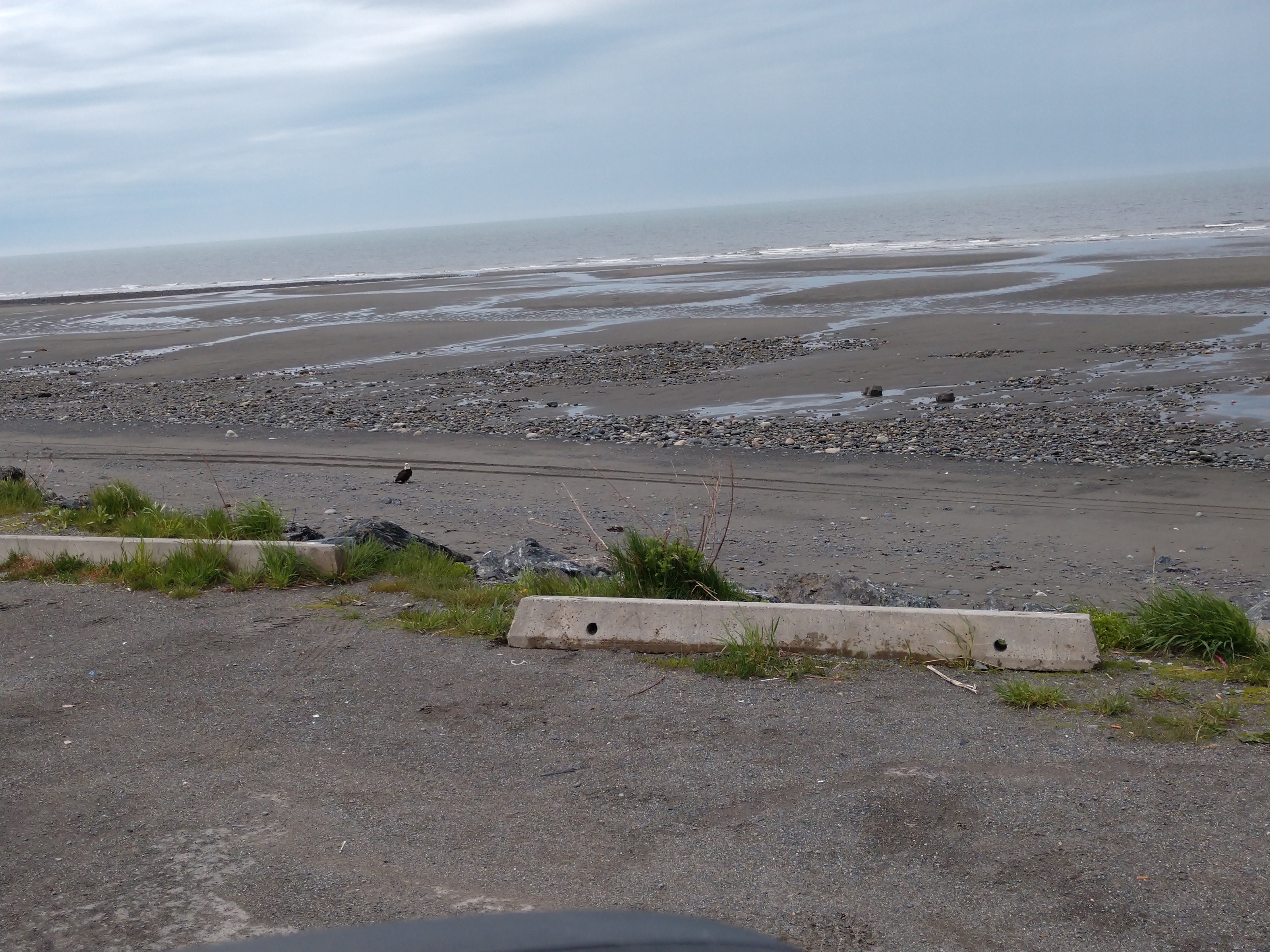
And then we were surprised with a beautiful bald eagle on the beach.


As we made our way toward the beach we came upon the following sign. We decided to park the truck and walk down.


As it was definitely low tide, we decided to walk carefully out to where the water was now residing.

Before I started walking on the beach, I stopped to read the interesting sign below that told about the first mining of gold on a commercial scale in Southcentral Alaska that occurred along this beach.

Mel had gone ahead of me, so I stopped to take one more picture before he performs our tradition -- writing in the sand of the beach where we are.


We walked on the beach for a little while, than headed back to the truck.

As we left town I took a picture of the signs above pertaining to Anchor Point.

We decided to then drive to Homer and Homer Spit since we still had a lot of daylight hours left.
As we passed the Anchor River, we came upon a truck with a "Wet Paint" sign, and we had to follow that convoy for quite a ways, until they pulled over and let all the traffic backed up behind them pass.


The scenery was beautiful mountains and lakes along the way to Homer.


Then we came to the "Homer Alaska - Halibut Fishing Capital of the World" sign. Sure, Homer is known for it's halibut, but non-anglers revel in the charming, end-of-the-road Alaska town.


The drive into Homer on the highway was spectacular with many beautiful snow-covered mountains.


As we drove into town, we passed the Islands Ocean Visitor Center -- hopefully we will stop there on another day.

Homer has a population of 5,252 and an elevation of sea level to 800 feet in some parts of the town. Homer is known as the town at the "End of the Road" which is the Sterling Highway that leads to the beautiful coastal waters of Kachemak Bay, that is surrounded by glaciers and mountains. Homer was named for a local prospector, Homer Pennock and was established in 1895.


Homer has an area for float planes (aka sea planes) to take off and land.


We continued along our coastal drive to the Homer Spit which is where the highway ended at milepost 179. Homer Spit is a natural geographic landform that is a long, narrow finger of land jutting 4-1/2 miles into Kachemak Bay. It is the second longest of its kind in the world.


Homer Spit ends at Land's End. The end of the road is shown below.

The picture below is the Homer Ferry Terminal.

Once we were on Homer Spit, we found a place to park so we could walk along the spit and see the shops.


The Salty Dawg Saloon is a well-known landmark on the Homer Spit. The Salty Dawg originally was one of the first cabins built in Homer in 1897, soon after the establishment of the town site. In April 1957, it was officially opened as the Salty Dawg Saloon.


We stop and take a look inside the Salty Dawg Saloon. It's filled with dollar bills that tourists have signed and fastened to the wall.


We then went to stroll along Kachemak Bay, which was at low tide.


We found this interesting board with information about the history of Kachemak Bay.

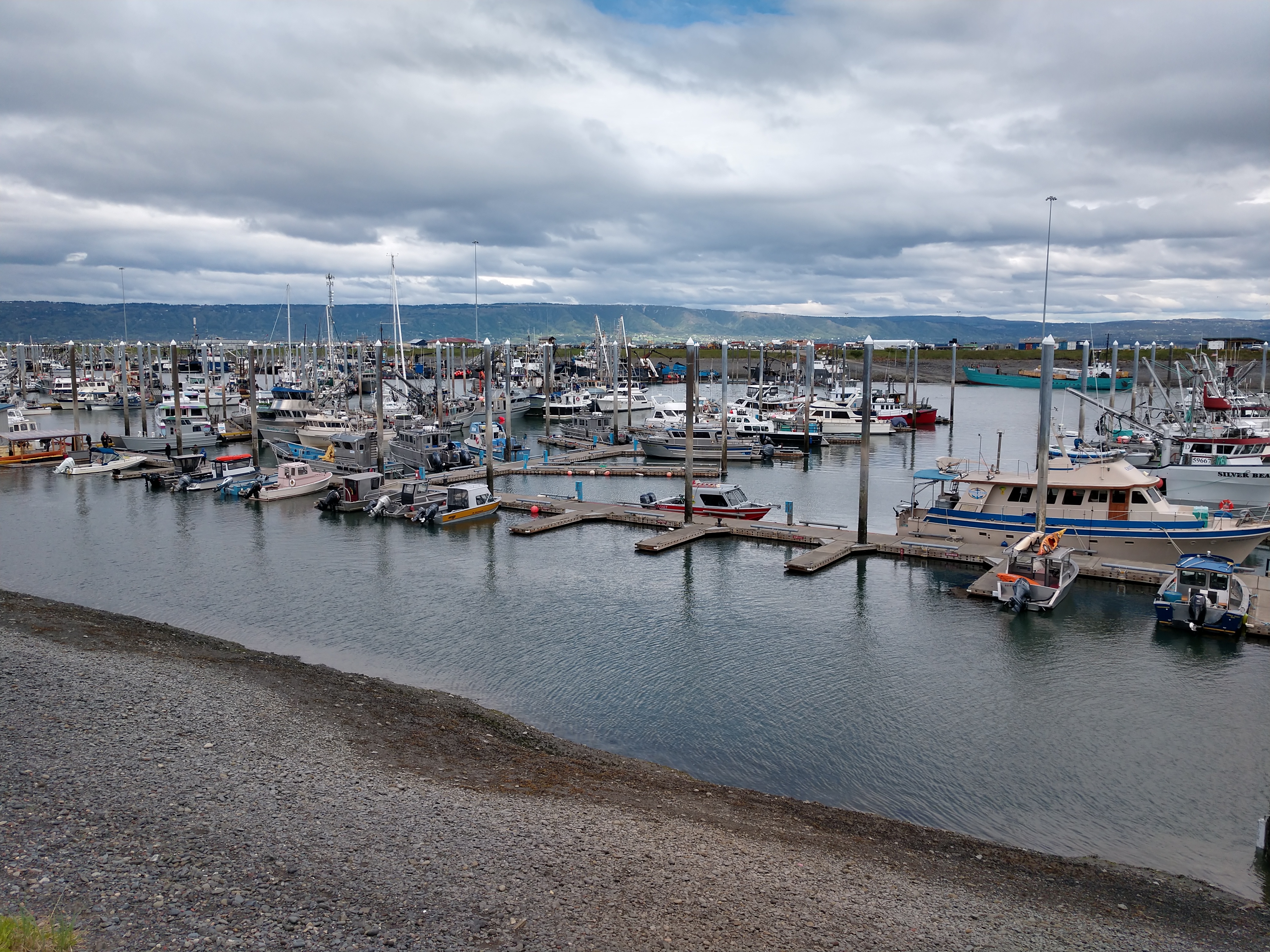
We then went down and walked along the harbor.


More shops along the Homer Spit (see above and below).

Below is an information board talking about the bounty of the bay.

More pictures of the beautiful harbor.


We were going to eat at Swell Taco, but their tacos were $7 or $8 a piece, so we decided not to eat there.

Can you see Mel's reflection in the window of Swell Taco?

Above and below is an interesting wooden remake on a motorhome that is parked by the Homer harbor.


Above is another picture of the harbor which we continued along. Below in the next three pictures you can see the otter we saw swimming in the harbor.


The Kona Kai fishing boat in the Homer small boat harbor (see above and below).


Above is the map of the Homer Small Boat Harbor. While below is an information board on the different purpose-built vessels in the Homer Small Boat Harbor.

Information board on the commercial fishing in the Homer Small Boat Harbor.

Below is the Fish Factory in Homer where fish processing is performed.


Above is the Seafarer's Memorial located on Homer Spit. It serves as the final resting place for those lost at sea and is dedicated to all those who go to sea.


Plaque at the Seafarer's Memorial.

Above is the "Bell that Tolls for All."

Another look at Kachemak Bay (above and below).


Mel poises behind Lula's mermaid along Homer Spit.

Mel in front of some of the stores along Homer Spit. When we had seen enough of Homer Spit for the day, we stopped by the Homer Brewing Company so Mel could try their craft beer.

But first Mel had his picture taken with the Homer Brewing bear.


When we left the brewery and were heading back to the campground in Ninilchik, we went by the float planes again.


And then once again in the same spot where we had seen a mama moose and her twins earlier in the day, she was there again. Again I was really thrilled to see them so close by the road.


We called it a great day and had pot roast with veggies for dinner.
Friday, June 9, 2023
This was another cloudy, rainy day that started out at 50 degrees and only reached 56 degrees by the afternoon. Because it was raining pretty hard off and on all morning, we didn't decide to adventure out until around 11:50 a.m. We decided to drive back into Ninilchik to tour the village and go see the Russian church.

Shortly after we turned left off of Sterling Highway onto Orthodox Avenue, we arrived at the beautiful Holy Transfiguration of Our Lord Russian Orthodox Church. It occupied a spectacular setting on top of a high bluff overlooking a quaint little village of Ninilchik settled alongside the Cook Inlet. It makes you feel as though you just stepped into a 19th-century novel! (See the view in the next three pictures.)


The Holy Transfiguration of Our Lord Russian Orthodox Church is one of only four Alaskan Russian Orthodox churches built in a cruciform plan. Elaborate by Alaskan standards, such a grand church as this is unexpected. When this church was built in 1901, the village only had a population of 100.


The log church with carefully dovetailed corners is covered with beveled siding. At the crossing of the gable roofs of the nave and transept, there is an octagonal cupola topped by an onion dome, one of five onion domes on the church. The square bell tower on the west end is two stories high, and its pyramidal roof supports a square belfry, which is also topped by an onion dome.

On the interior, the low ceilings of the nave and transepts rise to an octagonal dome in the center, crowned by the cupola that sheds light into the nave.

The church itself has a surprisingly intimate feel on the inside; the nave is only 24 feet long, and the transepts are only 10 feet wide. The nine-bay iconostas is ornamented with four large oil-on-canvas icons. (The next four pictures show the beautiful interior of the church.)


The beveled siding was applied some time after 1916. A wider bell tower replaced the original, which had round-arch openings in the belfry; the ends of the original are visible in the interior of the vestibule. The churchyard and cemetery are neatly fenced.


After our viewpoint on top of the hill of the Russian church, we decided to drive down to the quaint little village of Ninilchik. It was again raining as we descended to the village below.

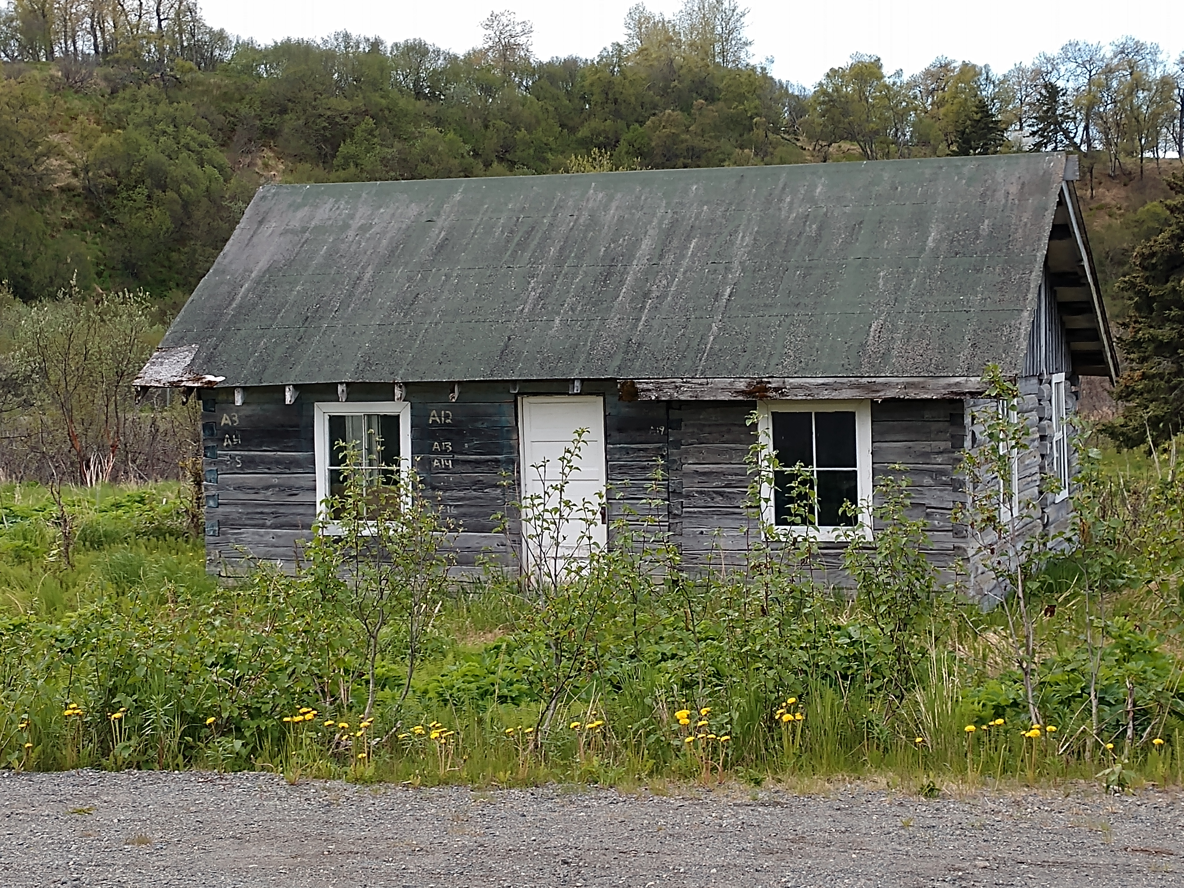
The pictures below are some of the older structures in the village of Ninilchik.


We drove over the bridge that crossed the Ninilchik River as it ran through the village.


When we were on our way back to the campground, we stopped briefly at the Ninilchik State Recreation Area at the River Campground. There we got a couple of good views of the mountain range.


After stopping for gas at Tesoro in Ninilchik, we arrived back at the campground at 12:50 p.m. Mel did a load of laundry, while I worked on my blog. I then fixed taco salad for dinner.
Saturday, June 10, 2023
Another cloudy, rainy day in Alaska. It started out at a chilly 48 degrees and then only got to 54 degrees by the afternoon. We spent most of the day in our camper. Mel did go the grocery store for a few things, while I worked on my blog. Mel made pizza for dinner (we really love using our air fryer to make personal pizzas with pita bread as the crust).
Sunday, June 11, 2023
Well today was a better day weather-wise with partly cloudy skies turning to mostly sunny with temperatures ranging from 53 degrees to 57 degrees throughout the day.

This morning around 10:30 a.m., we took off and headed to Nikolaevsk, another Russian village.

Turning left on Nikolaevsk Road we were soon at the village of Nikolaevsk.

BRIEF HISTORY OF THE VILLAGE OF NIKOLAEVSK
Nikolaevsk is a 17th-century Russian community living in 21st-century Alaska. The clan that developed the village of Nikolaevsk traveled from Russia through China, Brazil, and Oregon before making their home in the remote north, while struggling hard to avoid modernization.
The Yakunin clan was much smaller in 1968 when they started building a Russian Orthodox village called Nikolaevsk in an isolated corner of Alaska's Kenai Peninsula. Members of the Old Believers -- a Russian Orthodox sect that left the church in 1666, in the face of state-issued church reforms -- traveled more than 20,000 miles over five centuries in the search of the perfect place to protect their traditions from outside influences.
The women often wore teal, pink, red and purple satin dresses, all made with the same basic design that covered their bodies down to their ankles. Married women covered their hair with scarves that matched their colorful gowns. The village of Nikolaevsk instated their first priest in 1983 after centuries of living without a clergy.
However, before starting on their 20,000-mile journey across the globe, the Old Believers lived peacefully in a remote part of Siberia for nearly 200 years. And then the turmoil started around 1666 -- when Patriach Nikon, the head of the church, altered the Russian Orthodox prayer books and traditions, forcing it on the people to accept. If they questioned it at all, they were beaten and their fingers and other apertures (such as their tongue) was cut off.
Many Old Believers were forced to leave after a communist revolution in the beginning of the century. And they left in a hurry -- walking only at night and following a compass they coul only see by striking a match every so often. And to make maters worse, this journey took place in the middle of winter.
Of all their stops around the globe, China was the place Old Believers called home the longest. They quickly adapted to their new environment in China and made a living hunting elk for their antlers, capturing baby tigers for zoos, and killing man-eating tigers. However once the Japanese left China in 1949, the Chinese government told all foreigners to leave the country. And since the Old Believers didn't have documentation to defend their residency, they had to leave.
So when China gave all foreigners five years to leave the country, the Old Believers had two choices: 1) go back to Russia, where they would be punished as deserters from communist Russia, or 2) try their luck in another country. Those who returned to Russia were immediately arrested and sent to jail.
With the Cold War setting in, many countries wouldn't take in religious refugees. At this time, the Old Believers scattered across the globe into Turkey, Argentina, and Australia, while the Yakunins went to Brazil. In Brazil, they lived as subsistence farmers while living in three makeshift Russian Orthodox villages in a rural community. While Brazil was the first place they lived where they could practice their faith freely, it was hard to make a living in South America. In the tropical climate, they found it was difficult to adapt to the new calendar which dictated when their holy days were (with Christmas being held in the middle of the summer).
This time when the Yakunins decided to move, it wasn't to escape religious persecution, but for better economic opportunities. In the middle of the Cold War, the acting Attorney General, Robert F. Kennedy offered them asylum. Some of the Old Believers decided to settle in New Jersey, but many ended up in Woodburn, Oregon. But after only a few years, the elders began to fear that the younger generation was becoming too Americanized -- drinking too much and hanging out with the wrong crowd.
With the help from the Tolstoy Foundation, five families continued their migration up to a small piece of land just outside of Anchor Point, Alaska on the Kenai Peninsula. They lived in tents the first few months, while everyone pitched in to build the first few homes and buildings. In the beginning, the community tried a subsistence lifestyle and harvested their own vegetables. There was also a gate to the community that reinforced the self-isolation they were seeking. These five Russian families that moved to the Kenai Peninsula lived in tents while they built their geographically-isolated community of Nikolaevsk between 1968 and 1970. Today, Nikolaevsk remains a small village in Alaska of about 350 people.
* * * * * * * * * * * * * * * * * * * *
When we got to the Russian church, we saw the old church and also saw they were building a new church. I will first show you pictures of the old Church of Saint Nicholas in Nikolaevsk.


This is the Russian Orthodox Old-Rite Church of St. Nicholas The Wonderworker (the church and community was established in 1968).


The picture below tells all about the church (if you can read Russian that is).

Below is the new Church of Saint Nicholas that they are building.

Below is one of the gold domes that they still need to add to the new church.

The grave below is one of their founding members of the community of Nikolaevsk, the Rev. Kondraty Sozontovich Fefelov who died in 2008.


Leaving the Russian village of Nikolaevsk, we drove on until we found a spot to hopefully get close to Kachemak Bay. We followed the road, but it ended up at a dead end and a private residence with no view of the bay.

Later down the road, we did find a turnout to get a view of the Kachemak Bay and the mountains.

The Welcome Sign to Homer is shown below.


The Driftwood Inn pictured below is a charming historic inn located in the old-town area of Homer near the beach.

The pictures below of are Bishop's Beach in Homer, Alaska along a 1-1/4 mile-long peninsula that juts into Kachemak Bay. This bay is the most popular beachfront destination for locals and tourists alike. The Kachemak Bay skyline boasts views of striking blue water, flourishing trees and greenery, as well as mountain ranges.


We drove along the Spit again today taking in the views.

We went by the Homer Ferry Terminal.

And by the Salty Dawg Saloon.


And past the Port of Homer Deep Water Dock.


We then decided to drive up Skyline Drive and take in the views.

From Skyline Drive we could see the entire length of Homer Spit. It was the most spectacular 180 degree panoramic view of the Kachemak Bay with sea, mountains and sky.


Before getting all the way down Skyline Drive, we saw a couple of sandhill cranes standing in the front yard of a residence. Sandhill cranes are large birds that live in open habitats and they mate for life, so you will usually see two together.


We drove back down into Homer and went to find someplace to eat an early dinner. We ended up eating at the Duncan House Dinner, located at 128 E. Pioneer Avenue.


Mel had a Duncan Burger with all the toppings and fries, while I had a chicken strip basket with fries.

After that we stopped at Grace Ridge Brewing so Mel could sample their craft beer.


After that we headed back to the campground in Ninilchik and relaxed for the rest of the evening.
We have seen wildlife galore and how to continue seeing a lot!
Shirley & Mel


Wow. Seeing the bears churches mountains etc has been so interesting. Which part did I enjoy most so far? ALL OF IT!! WOW it had been so enjoyable going on this journey. Take care. Can't wait to read next.
ReplyDelete