Tuesday, May 9, 2023
We left Watson Lake this morning at 8:15 a.m. to sunny
skies, but with a chilly temperature of 30 degrees, which would only reach 52
degrees in the afternoon. We traveled almost 300 miles today and arrived at 2
p.m. at Hi Country RV Park in Whitehorse, YT. We only saw three caribou on our
journey today.

We crossed over numerous bridges and rivers and then continued west toward Whitehorse. We saw lots of frozen lakes and snow-covered mountains.


We also came upon a stretch of a bad road where they were
grating up the highway and it was gravel and rocks for a while as we were led through the
construction site by a pilot car.


It wasn’t too long after the construction site that we crossed another bridge and came to the Continental Divide pullout.

This
Continental Divide separates two of the largest river drainages in North
America with the Alaska Highway crossing the divide at one of the lowest
points. Only lumps of sand and gravel separate the west-flowing Swift River
from the east-flowing Rancheria River. If you dropped a leaf into the Rancheria
River to the east, it would float to the Liard River near Watson Lake, continue
to the Mackenzie River in the Northwest Territories and eventually reach the
Beaufort Sea (Arctic Ocean), a long journey of 2,650 miles. Likewise, if you
dropped a leaf into the Swift River to the west and the current would take it
to the Teslin Lake and the Teslin River. The Teslin flows northwest to the
Yukon River which cuts across northern Alaska enroute to the Bering Sea
(Pacific Ocean); a journey of 2,300 miles.


Shortly after that we crossed back into British Columbia,
Canada for a while.


And then we left British Columbia and went back into Yukon
Territory, crossing more bridges as we made our way to Teslin.


Teslin has a population of 450 and an elevation of 2,239 feet.
Situated at the confluence of the Nisutlin River and Teslin Lake, Teslin began
as a trading post in 1903. Teslin has one of the largest Native populations in
Yukon and much of the community’s livelihood revolves around traditional
hunting, trapping and fishing.
As we came through Teslin, our first stop was at Nisutlin River Bridge (a seven-arch bridge spanning the Nisutlin River). They are currently in the process of doing some repair work to this bridge.

In 1942, the United States Public Road Administration constructed this 1,917 foot long trestle bridge across Nisutlin Bay. The piles were driven 99 feet into the glacial silt, but the bridge was affected by ice jams and deteriorated quickly. In 1946, a truck carrying a caterpillar tractor broke through the deck and fell into the bay, effectively closing the bridge for two weeks while the bridge was being repaired. A new bridge was built in 1956 with a concrete deck, heavy piers, and adequate clearance to eliminate ice and driftwood jams. The concrete deck was replaced by a steel grid in 1971. The Nisutlin Bay Bridge is the longest water span on the Alaska Highway.


After Teslin, we went by the communities of Tagish and Jake’s Corner along our mountainous drive.
The U.S.
Army Corps of Engineers set up a construction camp at Jake's Corner in 1942, under the
command of Captain Jacobson, thus giving Jake’s Corner its name. However, the
name is also attributed to Jake Jackson, a Teslin Indian who camped in this
area on his way to Carcross.


We passed Marsh Lake Campground, but it appeared that Marsh Lake was frozen over. Marsh Lake (aka Mud Lake) is a widening of the Yukon River southeast of Whitehorse. The lake forms part of a chain of finger lakes, sometimes referred to as "The Southern Lakes." During World War II, the Alaska Highway Project was routed along Marsh Lake, and the military engineers were headquartered in Whitehorse. During a nice summer day the daughters of one of the officers decided to explore the swampy area off the northwest end of Marsh Lake, during their hike they discovered a large shallow sandy and warm bay, with a huge crescent of clean sand beach. It became cottage lots first for the military, then some local residents, and is still called Army Beach, Yukon.


We arrived in Whitehorse, the capital of the Yukon at around 1:30 p.m. It has a population of 26,418 and an elevation of 2,316 feet.

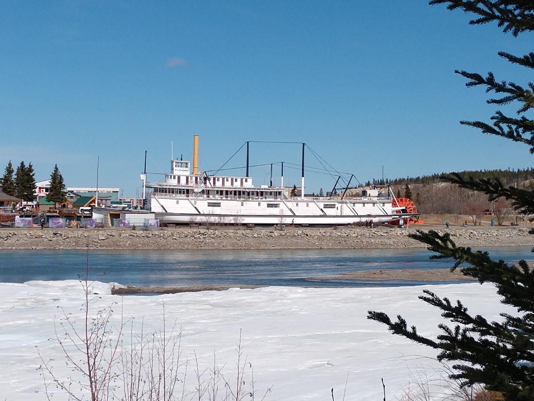
Whitehorse is the largest city in the Yukon. Whitehorse began as the northern terminus of the White Pass & Yukon Route railway from Skagway, AK, which was completed in July 1900.
Klondike stampeders landed at Whitehorse to dry out and repack their supplies after running the Whitehorse Rapids. The community grew as a transportation center and trans-shipment point for freight from the WP&YR railroad and the sternwheelers plying the Yukon River to Dawson City. Whitehorse was one of the largest construction camps on the Alaska Highway in 1942. When the Alaska Highway opened to civilian travel after WWII, mining and tourism had a profound effect on the economy of the region. On March 31, 1953, Whitehorse became capital of Yukon (replacing Dawson City).


The plaque beside the horse explains that the horse is made of pieces of metal donated by Yukoners to depict life in the territory in the early days and now. It's like one of those "I Spy" books where every time you look at the sculpture, you see something else!

Since we continued to have issues with the water pump, we decided that before going to the campground, we would stop at Wal-Mart to see if we could buy a water pump there. (We had also read that you could boon dock at Wal-Mart in Whitehorse overnight – so we thought we would give that a try. However, that option is no longer available.)
Mel was successful at getting a water pump, and having it as a security factor made us feel a lot better. Even though a few nights down the road, the water pump would again act up, so Mel decided to put in the new one.
After leaving Wal-Mart, we found out that none of the RV parks in Whitehorse had their water on yet due to the cold temperatures, so we decided to go to Hi Country RV Park – where friends we had met earlier, Brian and Karen Burk were staying. We checked in for two nights on sight #68 for a total of $118.12 CA (and before the second night they had the water turned on).


Later that
evening, we went out to get drinks and eat dinner with our friends, Brian and
Karen Burk at Miner’s Daughter/Dirty Northern Bar.


After dinner, I took a few pictures of downtown Whitehorse, some of the buildings were built in the early 1900s.


Wednesday, May 10, 2023
This morning after breakfast we left our camper at around 9 a.m. It was sunny and 41 degrees out, reaching 61 degrees in the afternoon.

Our first stop was to get gas at the Kiki Convenience Store/Petro Canada gas station in Whitehorse. Next, we stopped at the Whitehorse Visitors Center as I had read that we could get a “free visitor parking pass.” The visitor center was a wealth of information, and we walked out with a bag full.

After putting the newly collected information into the truck, we walked around downtown
Whitehorse doing a little walking tour.

We first saw the Logscraper site and its glorious height.


Our next stop was at the White Pass & Yukon Route Railway Depot.


Since we
were walking by the White Pass & Yukon Route Railway Depot, we decided to
stop in. We have been thinking about maybe taking the train to Skagway instead
of driving there, so we wanted to find out what was available. With that
information in hand, we will have to make a decision later.

Outside the depot was the "Healing Totem Pole."


Also across from the totem pole was the "Whitehorse Aboriginal Women's Circle."


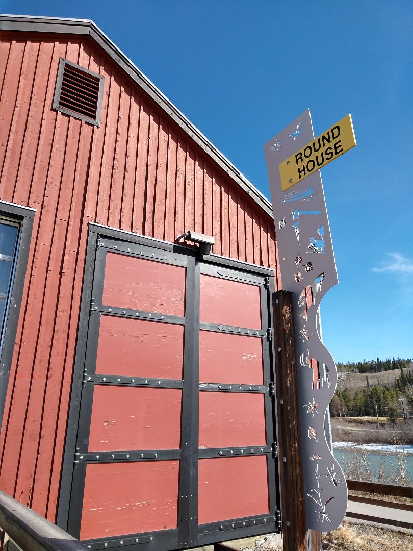
And then we got to see the Yukon River that ran along the train depot, as well as the original Roundhouse.


We continued our walk and came to the Old Fire Hall – saw the fireman statue.


After our
downtown walking tour, we stopped in at Tim Hortons for lunch (just to say we
did it).


No comments:
Post a Comment